Louisville, KY
Weather Forecast Office
May 10, 1969
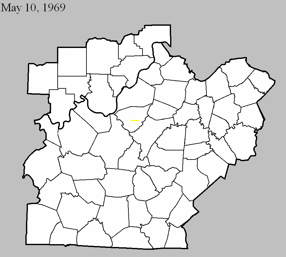
Counties: Bullitt
F-scale: F3
Deaths: 0
Injuries: 14
Path width: 300 yards
Path length: 4 miles
Time: 4:00pm EDT
Notes: (From internal Weather Bureau memo and from newspaper clippings) Eight homes destroyed, 29 damaged. Much of the tornado path was at tree top, and several residents within 1/2 mile of the storm were unaware of it due to lack of excessive winds or roar. The tornado touched down just west of the KY 480/I-65 junction, and moved east along Cedar Grove Road. The tornado did its worst damage at the beginning of its path where it demolished three homes on Dawson Drive. One lane of Interstate 65 was blocked by debris, and cars were damaged. Just east of I-65 a house trailer was lifted and deposited 100 feet away. Pieces of clothing, blankets, sheets, metal siding, and roofing were wrapped around uprooted trees and hanging from power lines. The path ended at the W.D. Miller farm. The Millers saw the vortex recede upward into the main cloud. Mr. Miller reported that a small whirlwind passed within a few hundred feet of his house, sucking out a storm window, uprooting a cedar tree, and depositing debris. Of the injured, 3 were serious enough to be hospitalized. Four-year-old Terry Harding, on Dawson Drive, suffered a fractured skull and severe head lacerations that required surgery. Timothy Dawson, 10, experienced a fractured leg. One man was sitting in his trailer when the tornado hit, and subsequently found himself sitting in a field after his trailer was carried away.
Grazulis narrative: Moved east from two miles south of Shepherdsville. Eight homes were destroyed, but some walls were left standing on all of them. Twenty-nine more homes were damaged, as were trailers, barns, and fences. One victim said that his "picture window looked as if it were breathing in and out." A car was moved from one side of a building to another.
Noted discrepancies: SPC and NCDC give a path width of 200 yards...Grazulis and Storm Data 100 yards.
Current Hazards
Hazardous Weather Outlook
Storm Prediction Center
Submit a Storm Report
Advisory/Warning Criteria
Radar
Fort Knox
Evansville
Fort Campbell
Nashville
Jackson
Wilmington
Latest Forecasts
El Nino and La Nina
Climate Prediction
Central U.S. Weather Stories
1-Stop Winter Forecast
Aviation
Spot Request
Air Quality
Fire Weather
Recreation Forecasts
1-Stop Drought
Event Ready
1-Stop Severe Forecast
Past Weather
Climate Graphs
1-Stop Climate
CoCoRaHS
Local Climate Pages
Tornado History
Past Derby/Oaks/Thunder Weather
Football Weather
Local Information
About the NWS
Forecast Discussion
Items of Interest
Spotter Training
Regional Weather Map
Decision Support Page
Text Products
Science and Technology
Outreach
LMK Warning Area
About Our Office
Station History
Hazardous Weather Outlook
Local Climate Page
Tornado Machine Plans
Weather Enterprise Resources
US Dept of Commerce
National Oceanic and Atmospheric Administration
National Weather Service
Louisville, KY
6201 Theiler Lane
Louisville, KY 40229-1476
502-969-8842
Comments? Questions? Please Contact Us.


 Weather Story
 Weather Map
 Local Radar