Louisville, KY
Weather Forecast Office

June 25, 2018
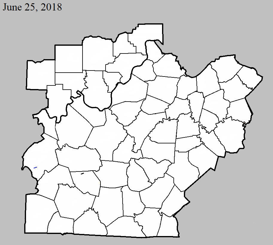
County: Ohio
EF-Scale: EF1
Deaths: 0
Injuries: 0
Path width: 100 yards
Path length: 0.6 mile
Time: 10:50am - 10:51am CDT
Notes: This brief tornado did most of its damage at treetop level, snapping the trunks of or uprooting at least two dozen large, mature oaks and cedars and causing limb damage to many others. In one case, it snapped the 2-foot diameter trunk of a large cedar less than 5 feet above the ground, but lofted the tree over nearby utility poles -- which remained intact -- and deposited the tree 200 feet to the east. The tornado did occasionally reach closer to the ground, causing significant damage to two structures. The first was a large brick ranch home which had most of the north half of its roof torn off, and insulation spread eastward in a narrow path. One piece of roofing lumber was found 500 feet ENE of the home. A second building, a large two-story brick industrial building 1/2 mile east, had about 20 percent of its metal roof peeled off. Immediately after hitting this building and downing trees in a nearby cemetery, it crossed US 62 and did additional tree damage as it moved through a wooded area.
June 25, 2018
County: Edmonson
EF-Scale: EF0
Deaths: 0
Injuries: 0
Path width: 50 yards
Path length: 1.6 mile
Time: 12:04pm - 12:06pm CDT
Notes: This weak tornado skipped along mainly at treetop level near the Moutardier Recreation Area and 1/2 mile south of the Edmonson-Grayson county line. The tornado snapped the upper reaches of several tree trunks near its initial point near several homes -- leaving debris in a circular pattern -- then skipped eastward, causing other minor tree damage before crossing Nolin Lake northeast of the Moutardier Marina. The tornado was captured on video and shared on social media, confirming the existence of the rotation and funnel. The tornado dissipated as it approached the east shore of the channel.
Current Hazards
Hazardous Weather Outlook
Storm Prediction Center
Submit a Storm Report
Advisory/Warning Criteria
Radar
Fort Knox
Evansville
Fort Campbell
Nashville
Jackson
Wilmington
Latest Forecasts
El Nino and La Nina
Climate Prediction
Central U.S. Weather Stories
1-Stop Winter Forecast
Aviation
Spot Request
Air Quality
Fire Weather
Recreation Forecasts
1-Stop Drought
Event Ready
1-Stop Severe Forecast
Past Weather
Climate Graphs
1-Stop Climate
CoCoRaHS
Local Climate Pages
Tornado History
Past Derby/Oaks/Thunder Weather
Football Weather
Local Information
About the NWS
Forecast Discussion
Items of Interest
Spotter Training
Regional Weather Map
Decision Support Page
Text Products
Science and Technology
Outreach
LMK Warning Area
About Our Office
Station History
Hazardous Weather Outlook
Local Climate Page
Tornado Machine Plans
Weather Enterprise Resources
US Dept of Commerce
National Oceanic and Atmospheric Administration
National Weather Service
Louisville, KY
6201 Theiler Lane
Louisville, KY 40229-1476
502-969-8842
Comments? Questions? Please Contact Us.


 Weather Story
 Weather Map
 Local Radar