Louisville, KY
Weather Forecast Office
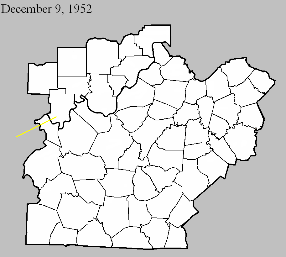
December 9, 1952
Counties: Hancock, Perry (from Daviess)
F-scale: F3
Deaths: 0
Injuries: 3
Path width: 880 yards
Path length: 32 miles
Time: 3:00pm
Grazulis Narrative: Moved northeast, striking the northern part of Tell City. There were three homes destroyed in Kentucky, and $200,000 damage. Many barns were destroyed in Indiana, where there was $300,000 damage. Most of the Indiana damage was from wind-driven hail.
Noted discrepancies: SPC and NCDC call this an F3, Grazulis an F2. SPC and NCDC give a time of 3:00pm, Grazulis 2:30pm. SPC gives a path length of 70 miles, NCDC gives 35 miles, Grazulis gives 32 miles. SPC gives a path width of 880 yards, NCDC gives 30 yards, Grazulis says 400 yards. Grazulis mentions this was probably a family of tornadoes. NCDC or Grazulis must have the better path length...SPC entry looks to be an entry error. Storm Data says the tornado crossed from Kentucky into Indiana at Tell City with a "total path length in both states" of 32 miles.
Current Hazards
Hazardous Weather Outlook
Storm Prediction Center
Submit a Storm Report
Advisory/Warning Criteria
Radar
Fort Knox
Evansville
Fort Campbell
Nashville
Jackson
Wilmington
Latest Forecasts
El Nino and La Nina
Climate Prediction
Central U.S. Weather Stories
1-Stop Winter Forecast
Aviation
Spot Request
Air Quality
Fire Weather
Recreation Forecasts
1-Stop Drought
Event Ready
1-Stop Severe Forecast
Past Weather
Climate Graphs
1-Stop Climate
CoCoRaHS
Local Climate Pages
Tornado History
Past Derby/Oaks/Thunder Weather
Football Weather
Local Information
About the NWS
Forecast Discussion
Items of Interest
Spotter Training
Regional Weather Map
Decision Support Page
Text Products
Science and Technology
Outreach
LMK Warning Area
About Our Office
Station History
Hazardous Weather Outlook
Local Climate Page
Tornado Machine Plans
Weather Enterprise Resources
US Dept of Commerce
National Oceanic and Atmospheric Administration
National Weather Service
Louisville, KY
6201 Theiler Lane
Louisville, KY 40229-1476
502-969-8842
Comments? Questions? Please Contact Us.


 Weather Story
 Weather Map
 Local Radar