Louisville, KY
Weather Forecast Office

April 8, 2020
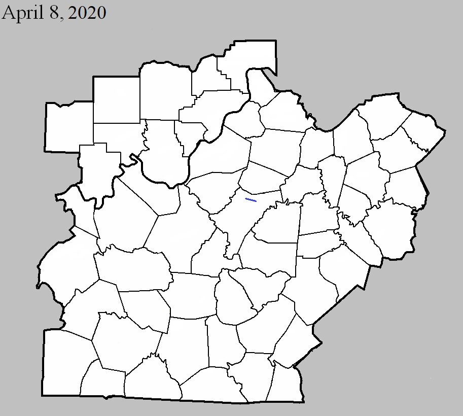
County: Nelson
EF-Scale: EF1
Deaths: 0
Injuries: 0
Path width: 45 yards
Path length: 4 miles
Time: 11:20-11:25pm EDT
Notes: The tornado initially touched down on the northwest side of a large family home and farm on Fairfield Road. The upper part of the roof of a two story home was lifted off and thrown in various directions. Several large 2x10s and 2x8s were impaled in the ground about 50 yards from the barn. Two trees on the property sustained extensive damage. The tornado at this point was only 35 yards wide with wind speeds of 95 mph. The owner of the house was upstairs sleeping when he felt his ears popping, then a large roar of wind on top of the house and bricks fell on his bed. The tornado then moved across a mixture of open farm fields and scattered forest. There was a significant swath of tree damage between Fairfield Road and Murrays Run Road with trees uprooted and snapped. Drone footage clearly showed trees lying in multiple directions. The tornado hit a property on Murrays Run Road ripping off the sides of a large well-built barn. The back part of the barn was thrown to the west while a wagon in the trailer was pushed out through the barn. A 72'x12' shed next to the barn was destroyed. Parts of that barn were impaled into the ground 75 yards from the damage path. Across the street the tornado did extensive roof damage to a family house and barn. Debris from the barn was thrown up to 300 yards downwind and in many different directions. The family said that they heard all the doors in the house shut tightly and heard a distinct roar. The tornado produced sporadic damage across farmland mainly in terms of trees, with more concentrated damage along Plum Run Road. Cedar tree damage was rather extensive with many cedars snapped. Winds here were around 90 mph with a width of 40 yards. The tornado destroyed an old barn on Chester Hahn Road but then weakened to an EF0 of 80 mph and ended with a few snapped trees before Dugan Lane.
Current Hazards
Hazardous Weather Outlook
Storm Prediction Center
Submit a Storm Report
Advisory/Warning Criteria
Radar
Fort Knox
Evansville
Fort Campbell
Nashville
Jackson
Wilmington
Latest Forecasts
El Nino and La Nina
Climate Prediction
Central U.S. Weather Stories
1-Stop Winter Forecast
Aviation
Spot Request
Air Quality
Fire Weather
Recreation Forecasts
1-Stop Drought
Event Ready
1-Stop Severe Forecast
Past Weather
Climate Graphs
1-Stop Climate
CoCoRaHS
Local Climate Pages
Tornado History
Past Derby/Oaks/Thunder Weather
Football Weather
Local Information
About the NWS
Forecast Discussion
Items of Interest
Spotter Training
Regional Weather Map
Decision Support Page
Text Products
Science and Technology
Outreach
LMK Warning Area
About Our Office
Station History
Hazardous Weather Outlook
Local Climate Page
Tornado Machine Plans
Weather Enterprise Resources
US Dept of Commerce
National Oceanic and Atmospheric Administration
National Weather Service
Louisville, KY
6201 Theiler Lane
Louisville, KY 40229-1476
502-969-8842
Comments? Questions? Please Contact Us.


 Weather Story
 Weather Map
 Local Radar