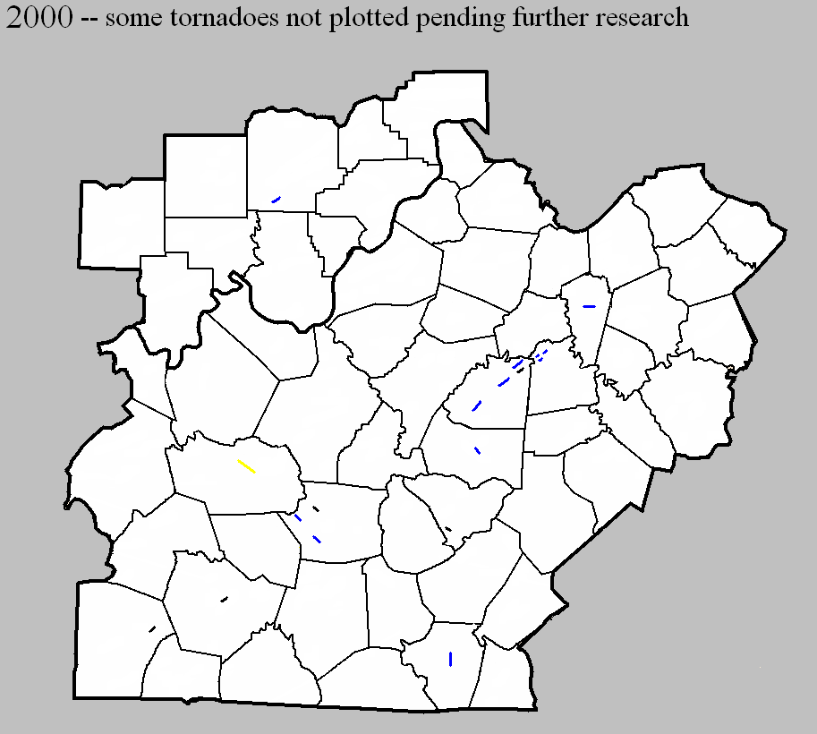
January 3, 2000
Counties: Washington IN
F-scale: F1
Deaths:
Injuries:
Path width:
Path length:
Time: 1:05pm
Noted discrepancies: Storm Data puts this tornado two and a half miles north of Fredericksburg.
April 20, 2000
Counties: Washington KY
F-scale: F1
Deaths:
Injuries: 4
Path width:
Path length:
Time: 4:55pm
Noted discrepancies: SPC lists a path width of 70 yards, NCDC 73 yards, Storm Data 50 yards.
Notes: Storm Data takes this tornado from half a mile north of Willisburg to two miles northeast of Willisburg.
April 20, 2000
Counties: Washington KY
F-scale: F0
Deaths: 0
Injuries: 0
Path width: 40 yards
Path length: 1/3 of a mile
Time: 5:00pm
Noted discrepancies: This tornado is not listed at SPC or NCDC, but is in Storm Data. Storm Data lists this tornado in Mercer County, but it takes this storm from 4.3 miles southwest of Dugansville to 4 miles southwest of Dugansville near Tablow. This distance from Dugansville would put it in Washington County. Tablow is directly on the county line. Will plot it in Washington County.
April 20, 2000
Counties: Mercer
F-scale: F1
Deaths:
Injuries:
Path width:
Path length:
Time: 5:05pm
Notes: Storm Data takes this tornado from 1.7 miles southwest of Dugansville to 1.6 miles southwest of Dugansville, or half a mile east of Tablow.
April 20, 2000
Counties: Mercer
F-scale: F1
Deaths: 0
Injuries: 0
Path width: 40 yards
Path length: 1/10 of a mile
Time: 5:07pm
Noted discrepancies: SPC and NCDC do not list this tornado.
Notes: Storm Data takes this tornado from one mile west of Dugansville to 9/10 of a mile west of Dugansville.
April 20, 2000
Counties: Mercer
F-scale: F1
Deaths: 0
Injuries: 0
Path width: 40 yards
Path length: 1/10 of a mile
Time: 5:10pm
Noted discrepancies: This tornado is not listed at SPC or NCDC.
Notes: Storm Data takes this tornado from Dugansville to 1/10 of a mile east of Dugansville.
April 20, 2000
Counties: Clinton
F-scale: F0
Deaths:
Injuries:
Path width:
Path length:
Time: 6:00pm
Noted discrepancies: SPC gives a path width of 20 yards, NCDC says 27 yards, Storm Data says 25 yards. The lat/lon for this tornado at SPC is in Tennessee. The NCDC begin location and end location (8 miles southwest of Albany) also places this tornado in Tennessee, or, depending on the degree of "southwest", in the middle of Dale Hollow Lake. Narrative at NCDC gives no additional location information. Storm Data also plots this tornado "8 miles southwest of Albany" and mere mentions that "a piece of scaffolding and a cement mixer pan were moved 50 yards at Ootens Store." Further research is necessary.
May 23, 2000
Counties: Grayson
F-scale: F3
Deaths:
Injuries: 16
Path width:
Path length:
Time: 1:00pm
Notes: Storm Data takes this from four miles north of Leitchfield, across northeastern Leitchfield, to four miles east of Leitchfield.
May 23, 2000
Counties: Hart
F-scale: F0
Deaths:
Injuries:
Path width:
Path length:
Time: 1:25pm
Notes: SPC lists a path width of 20 yards, NCDC 27 yards, Storm Data 25 yards.
Notes: Storm Data puts this on the northwest side of Priceville.
May 23, 2000
Counties: Taylor
F-scale: F0
Deaths:
Injuries:
Path width:
Path length:
Time: 3:20pm
Noted discrepancies: SPC lists a path width of 20 yards, NCDC 27 yards, Storm Data 25 yards.
May 24, 2000
Counties: Logan
F-scale: F0
Deaths:
Injuries:
Path width:
Path length:
Time: 4:24pm
Notes: Storm Data says this tornado touched down on Liberty Church Road in Auburn.
May 24, 2000
Counties: Warren
F-scale: F0
Deaths:
Injuries:
Path width:
Path length:
Time: 6:45pm
Noted discrepancies: SPC lists a path width of 20 yards, NCDC 27 yards, Storm Data 25 yards.
November 9, 2000
Counties: Hart
F-scale: F1
Deaths:
Injuries:
Path width:
Path length:
Time: 1:06pm
Notes: Storm Data takes this tornado from one mile southwest of Blowing Springs to one mile northwest of Blowing Springs.
November 9, 2000
Counties: Hart
F-scale: F1
Deaths:
Injuries:
Path width:
Path length:
Time: 1:15pm
Noted discrepancies: SPC lists a path width of 70 yards, NCDC 73 yards, Storm Data 75 yards. The lat/lon for this tornado shows it moving northwest, though no mention of that is made in the NCDC narrative. Storm Data moved this tornado from three miles northwest of Horse Cave to five miles northwest of Horse Cave.
November 9, 2000
Counties: Cumberland
F-scale: F1
Deaths:
Injuries:
Path width:
Path length:
Time: 1:40pm
Noted discrepancies: SPC lists a path width of 70 yards, NCDC 73 yards, Storm Data 75 yards.
Notes: Storm Data takes this tornado from one mile southwest of Burkesville to one mile northwest of Burkesville.
November 9, 2000
Counties: Marion
F-scale: F1
Deaths:
Injuries:
Path width:
Path length:
Time: 1:53pm
Notes: Storm Data places this tornado two miles southeast of Lebanon.
November 9, 2000
Counties: Washington, KY
F-scale: F1
Deaths:
Injuries:
Path width:
Path length:
Time: 1:55pm
Noted discrepancies: SPC lists a path width of 70 yards, NCDC 73 yards, Storm Data 75 yards.
Notes: Storm Data takes this tornado from half a mile south of Saint Catherine to one and a half miles northeast of Saint Catherine.
November 9, 2000
Counties: Washington KY
F-scale: F1
Deaths:
Injuries: 1
Path width:
Path length:
Time: 2:10pm
Noted discrepancies: SPC lists a path width of 70 yards, NCDC 73 yards, Storm Data 75 yards.
Notes: Storm Data takes this tornado from half a mile northeast of Sharpsville to two miles northeast of Sharpsville.
November 9, 2000
Counties: Woodford
F-scale: F1
Deaths:
Injuries:
Path width:
Path length:
Time: 2:34pm
Noted discrepancies: SPC lists a path width of 70 yards, NCDC 73 yards, Storm Data 75 yards.
Notes: Storm Data takes this tornado from one mile northwest of Versailles to one mile north of Versailles.


 Weather Story
 Weather Map
 Local Radar