Louisville, KY
Weather Forecast Office
January 19, 1928
Counties: Jefferson KY
F-scale: F2
Deaths: 0
Injuries: 17
Path width: 50 yards
Path length: 16 miles
Time: 7:20am
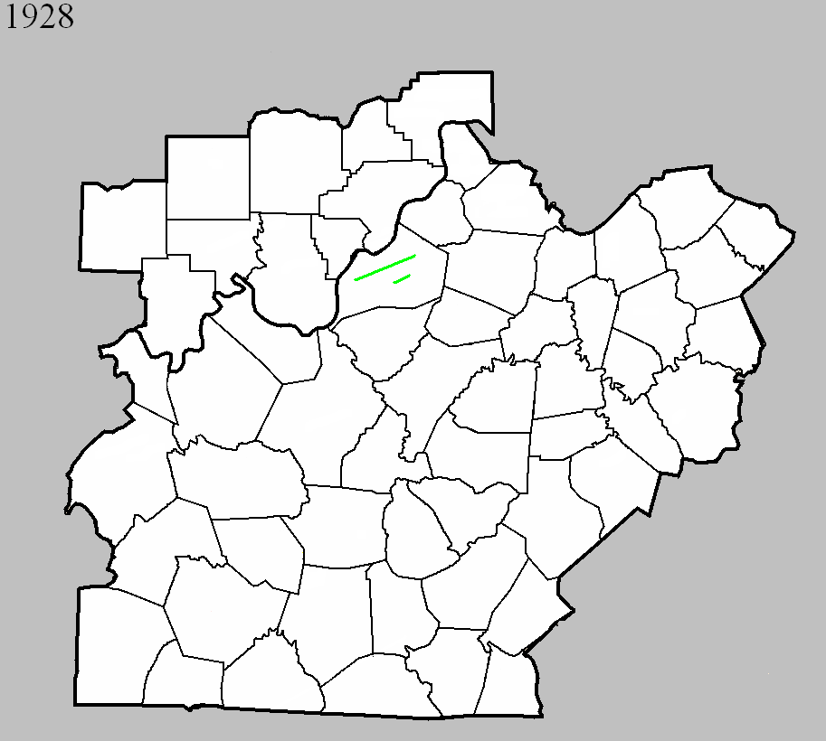
Narrative: This unusual January tornado touched down southwest of Shively and moved east-northeast. The tornado lifted near Anchorage after cutting a narrow path through the south suburbs of Louisville. About a hundred homes were unroofed or damaged. The first damage was to a farm on Lower Hunters Trace Road. The tornado quickly strengthened and caused quite a bit of damage in Saint Helens, just southwest of Shively. Damage was reported at Rockford Station (Rockford Lane and 18th Street Road -- now Dixie Highway). On Stewart Avenue a house lost its roof. The tornado then weakened or possibly lifted as it passed through or over Jacobs, where little damage occurred. The tornado then touched back down or strengthened as it entered Wyandotte-Oakdale. Damage was widespread along Dresden and Longfield Avenues, with damage on Longfield reported at the addresses of 812, 713, 716, and at 715 the house was "twisted." A house lost its roof at 570 Dresden Avenue, with additional damage at 550 and 552 Dresden. The tornado proceeded to the northeast across the southeastern section of Churchill Downs -- click here to see a map of how close the tornado came to the twin spires (the path of the tornado is outlined by the thick white lines). The tornado's worst damage then occurred in the 3800 block of Southern Parkway, with walls blown out of homes at the addresses of 3833, 3831, 3855, 3844, 3848, and 3850. Three brick houses were completely wrecked. The last significant damage occurred on High Street near Boxley Avenue where a house was unroofed and several cottages were damaged. Damage between this location (just east of Cardinal Stadium) and Anchorage was very light and spotty. J. L. Kendall and Grady Norton, meteorologists with the Weather Bureau, surveyed that damage and called the event, "a true tornado."
January 19, 1928
Counties: Jefferson KY
F-scale: F2
Deaths: 0
Injuries: 0
Path width: 50 yards
Path length: 4 miles
Time: 7:20am
Narrative: This tornado moved east-northeast from one mile northwest of Fern Creek, traveling parallel to the previously mentioned tornado. One barn was destroyed, and others were damaged.
Current Hazards
Hazardous Weather Outlook
Storm Prediction Center
Submit a Storm Report
Advisory/Warning Criteria
Radar
Fort Knox
Evansville
Fort Campbell
Nashville
Jackson
Wilmington
Latest Forecasts
El Nino and La Nina
Climate Prediction
Central U.S. Weather Stories
1-Stop Winter Forecast
Aviation
Spot Request
Air Quality
Fire Weather
Recreation Forecasts
1-Stop Drought
Event Ready
1-Stop Severe Forecast
Past Weather
Climate Graphs
1-Stop Climate
CoCoRaHS
Local Climate Pages
Tornado History
Past Derby/Oaks/Thunder Weather
Football Weather
Local Information
About the NWS
Forecast Discussion
Items of Interest
Spotter Training
Regional Weather Map
Decision Support Page
Text Products
Science and Technology
Outreach
LMK Warning Area
About Our Office
Station History
Hazardous Weather Outlook
Local Climate Page
Tornado Machine Plans
Weather Enterprise Resources
US Dept of Commerce
National Oceanic and Atmospheric Administration
National Weather Service
Louisville, KY
6201 Theiler Lane
Louisville, KY 40229-1476
502-969-8842
Comments? Questions? Please Contact Us.


 Weather Story
 Weather Map
 Local Radar