|
As part of a continuing effort to remember, celebrate and learn from our amazing weather, the National Weather Service in Louisville has compiled a list of several "Top 10" events for the County Warning Area (CWA). Here we present the list of the top 10 heat events that have occurred in central Kentucky and southern Indiana. While many drought or heat wave events have occurred in the CWA we tried to pin point the top ten most memorable. |
| 1. The Summer of '36 | |
| July - August 1936 | |
 |
|
| The summer of 1936 is legendary for intense heat coupled with an extreme lack of rainfall. While the entire first half of the year was unusually dry, true drought conditions developed with a vengeance in June. Bowling Green suffered through the month with only twelve hundredths of an inch of precipitation, which still stands today as the 7th driest month on record and the driest June and driest summer month. Similarly, Louisville received only 0.35" of rain (driest June on record) and Lexington got 1.18" of rain, 1.06" of which fell on one day (2nd driest June on record). Then came the searing heat. The last few days of June saw afternoon temperatures reach around 100 degrees, followed by a brief break in the heat for the first three days of July. However, the hot weather had only just begun. Every day from July 8 through 15 all major reporting stations in Kentucky reported 100 degree temperatures. Louisville peaked at 107 on the 14th (their all-time high), Lexington hit 108 on the 10th and 15th (their all-time high), and Bowling Green struck 106 on the 10th and 11th. At night temperatures dropped often only into the upper 70s and lower 80s. Hot summer weather continued for the rest of July, though not at record levels. Then in August another heat wave swept the region from the 16th to the 28th. Bowling Green recorded another ten 100 degree days during that stretch, peaking at 106 on the 28th. Louisville topped out at 101 on the 19th and 22nd, and Lexington made it to 105 on the 19th (their all-time high for August). The summer of '36 turned out to be the 2nd hottest summer ever recorded at Louisville, and the hottest on record at Lexington, and Bowling Green. It was also the 2nd driest at Lexington, third driest at Louisville, and eighth driest at Bowling Green. Modern air conditioning had been invented in 1902, but didn't become commonplace in residential homes until the 1950s. |
|
| 2. Kentucky's Hottest Day? | |
| July 28, 1930 | |
  |
|
| While the summer of 1936 was known for its prolonged heat and drought, arguably the hottest single day in Kentucky history occurred several years earlier. The map above (click on the image for a larger version) shows high temperatures from July 28, 1930. Nearly everyone saw readings above 100 degrees. The red values indicate all-time high temperature records set that day. July and August of 1930 were extremely hot and dry. Louisville recorded it's all-time driest July with only a quarter inch of rainfall. July 28 was one of a lengthy string of extremely hot days, with some weather stations reporting temperatures well over 100 degrees for several days before the 28th and a couple of weeks after. As a matter of fact, some of the stations that did not set all-time record highs on July 28 did set them in early August! |
|
3. 1901 Heat Wave
|
|
July
|
| At Bowling Green 30 of the month's 31 days had temperatures of at least 90 degrees, and 16 days saw at least 100 degrees. Every day from the 20th to the 29th had a high of at least 102! To add insult to injury, Bowling Green received a paltry 0.17" of rain, and all measurable rain during the month fell within 26 hours! Louisville experienced twenty-seven 90 degree days and eight 100 degree days (7 of them consecutive) including 107 degrees on the 24th, which is the all-time record high for the city. Four of the record warm temperatures set during the month still stand today, over a century later, including the warm low temperature of 83 degrees on the 25th. Fortunately, Louisville benefited from heavy thunderstorms on the 3rd that brought 2.19" of rain, though the rest of the month was quite dry. Conditions weren't quite as bad at Lexington, which recorded only two 100 degree days and over two and a half inches of rain. The July 1901 heat wave was widespread and deadly across much of the eastern United States, with over 9500 heat-related casualties nationwide -- 724 of them in New York City alone. |
|
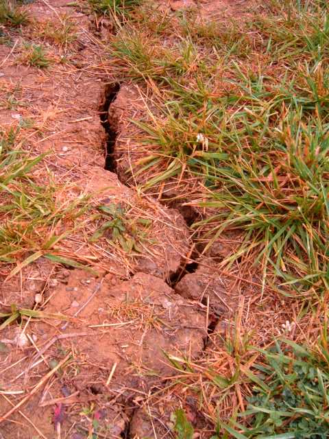
4. August of 2007
|
|
|
August 2007
|
|
|
Harrodsburg, KY on 6/14/07 |
|
| Louisville set 12 record warm temperatures in August 2007. The normal for August is 78.9 degrees but this year the average was 85 degrees. Over the whole 2007 year, there were 67 days of 90 degrees or warmer and 5 of over 100 degrees.
At Louisville International Airport, there were 26 days of 90 degree or more temperatures in August. In Bowling Green there were 30 days, and 23 days in Lexington. These high temperatures and lack of rain lead to a deficit in the early fall. The United States Drought Monitor rated much of Kentucky in extreme conditions from August to October. A federal disaster declaration was granted for the state of Kentucky where farmers were hit hard by the drought. All types of crops were affected from hay to corn to soybeans. Photo by: Jordan Wirth |
|
| 5. 1954 Extreme Drought |
| 1954 |
|
The drought in 1954 was one of the worst droughts in Kentucky. The Central Region, Bluegrass, and Western Region of Kentucky were in the extreme drought category from January through September (and severe/extreme October through December) while the Eastern Region was in severe or extreme drought through November. It stands as the 8th hottest June-September and July-September period for the state of Kentucky. |
|
6. Kentucky's Hottest Year
|
| 1921 |
|
In 1921 the summer and fall months were particularly difficult. The June-July period still stands as the 3rd hottest and 9th driest on record for the state of Kentucky. July was the 3rd hottest and 6th driest at Lexington. It's also the 3rd hottest July at Bowling Green. At Bowling Green all but four of the days from June 1 to July 31 had a high temperature of at least 90, and ten days hit 100. Only about five inches of rain fell during that time. |
| 7. 2012 |
|
January - August
|
|
2012 was extremely warm from the start of the year right through summertime. It is the 2nd warmest year on record for the state of Kentucky...#1 for the period January through August. Louisville: Lexington: Bowling Green: At least some part of Kentucky was in drought from April to August, with western Kentucky suffering extreme drought in July and August. An impressive early season heat wave swept the region June 28-July 8. During that time Louisville hit 100 degrees or more on 9 different days, peaking at 106 degrees, just one degree away from the all time record, on July 7. Lexington had seven 100+ degree days (peaking at 105) and Bowling Green had ten, peaking at 110 degrees on June 29. |
| 8. 1991 Heat and Drought |
|
1991
|
|
The 1991 Heat Wave was just as impressive as the 1990 but the only difference and the reason why 1991 made our top ten list is the fact that a drought was associated with it. As summer approached, very little rain fell, with June through August only producing about half of the normal rainfall in western Kentucky. The temperatures with the 1991 heat wave made the record books with 1991 both the 10th warmest year (57.4 degrees Fahrenheit) for Kentucky. It is also the 3rd warmest spring (Mar-May) on record with an average of 59 degrees. |
| 9. Water Shortage and Drought |
| 1983 |
|
1983 was known as one of the worst droughts of the 20th Century. It was so dry that many trees and shrubs were forced into dormancy as well as many towns having water shortages. In Louisville alone, the July precipitation was only 0.99 inches which is well under the average of 4.05 inches. In August the city received 2.39 inches of rain but that was still 1.02 under the average. Even in September there was a shortage of rainfall with Louisville only receiving 1.13 inches where the average is 3.05 inches. August of 1983 ranked as the 7th warmest August with an average of 81.6 degrees in Louisville. Most of July and most of August were over 90 degrees with July having 23 days and August having 27 days. Lexington sweltered in the heat with the 5th hottest July and 3rd hottest August on record. Sixth driest August at Bowling Green. |
| 10. Autumn Heat and Flash Drought |
|
September - October 2019
|
|
September was a very hot month overall, with an initial heat wave in the region from the 10th to the 22nd, with many daily highs in the 90s. After a brief respite, a record-breaking late season heat wave baked the Ohio Valley from September 27 to October 3. Every day during this stretch was in the 90s at Louisville, Lexington, and Bowling Green. The hottest day of the stretch was September 30, on which Lexington's average daily temperature was a full twenty degrees above normal. Highs that afternoon at Lexington, Louisville, and Bowling Green were 97, 98, and 97, respectfully. Lexington set an all-time record high for the month of September. All-time record highs were then set for the month of October at all three sites in early October: Lexington 97 on the 1st, Louisville 97 on the 1st and 2nd, and Bowling Green 98 on the 2nd. It was the hottest September 27-October 3 period on record at all three sites by 3-5 degrees. September was also astoundingly dry, and was the driest September on record at Lexington and Louisville (#4 at Bowling Green). For the very first time, Lexington experienced a calendar month with no measurable precipitation: just a trace fell! It was also Louisville's driest month of all-time with a mere 0.04" of rain, all of which fell in a space of less than two hours on the 23rd. |
Last updated: June 21, 2022


 Weather Story
 Weather Map
 Local Radar