Louisville, KY
Weather Forecast Office
The month started out on a very warm note with many locations seeing temperatures in the 90s from the 2nd to the 6th. Then over the weekend of the 8th former Tropical Storm Gordon brought repeated deluges to the region, along with a couple of tornadoes. The heavy rains caused small streams to go into flood. Louisville International Airport recorded it's 5th wettest September day on record when 3.84" of rain soaked the city.
After about a week and a half of quiet weather, the rains returned. Rain fell on every day from the 21st to the 27th as a wavy surface boundary remained over the area.
| Average Temperature | Departure from Normal | Rain | Departure from Normal | |
| Bowling Green | 75.2° | +5.1° | 5.61" | +1.68" |
| Frankfort | 73.2° | +5.6° | 7.58" | +4.25" |
| Lexington | 73.2° | +5.1° | 10.42" | +7.51" |
| Louisville Bowman | 74.9° | +5.3° | 10.10" | +6.94" |
| Louisville International | 74.9° | +3.9° | 10.91" | +7.86" |
Records
3rd: Warm low of 72° at Frankfort
8th: Rainfall of 1.46" at Lexington, rainfall of 3.84" at Louisville
9th: Cold high of 67° at Frankfort
16th: Warm low of 72° at Frankfort
17th: Warm low of 72° at Bowling Green, warm low of 71° at Frankfort
20th: Warm low of 74° at Louisville
21st: Warm low of 74° at Bowling Green
24th: Rainfall of 1.70" at Frankfort, rainfall of 1.25" at Lexington, rainfall of 2.49" at Louisville
7th warmest September on record at Frankfort
6th wettest September on record at Frankfort
7th warmest September on record at Lexington
Wettest September on record at Lexington
10th warmest September on record at Louisville
Wettest September on record at Louisville

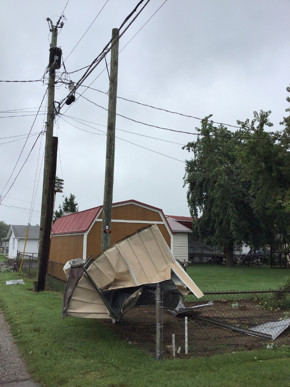
An EF0 tornado ruined this shed in Tell City on the 8th. NWS Louisville
Current Hazards
Hazardous Weather Outlook
Storm Prediction Center
Submit a Storm Report
Advisory/Warning Criteria
Radar
Fort Knox
Evansville
Fort Campbell
Nashville
Jackson
Wilmington
Latest Forecasts
El Nino and La Nina
Climate Prediction
Central U.S. Weather Stories
1-Stop Winter Forecast
Aviation
Spot Request
Air Quality
Fire Weather
Recreation Forecasts
1-Stop Drought
Event Ready
1-Stop Severe Forecast
Past Weather
Climate Graphs
1-Stop Climate
CoCoRaHS
Local Climate Pages
Tornado History
Past Derby/Oaks/Thunder Weather
Football Weather
Local Information
About the NWS
Forecast Discussion
Items of Interest
Spotter Training
Regional Weather Map
Decision Support Page
Text Products
Science and Technology
Outreach
LMK Warning Area
About Our Office
Station History
Hazardous Weather Outlook
Local Climate Page
Tornado Machine Plans
Weather Enterprise Resources
US Dept of Commerce
National Oceanic and Atmospheric Administration
National Weather Service
Louisville, KY
6201 Theiler Lane
Louisville, KY 40229-1476
502-969-8842
Comments? Questions? Please Contact Us.


 Weather Story
 Weather Map
 Local Radar