November 29, 2024 marks the 30th anniversary of when the WSR 88-D (Doppler) radar officially went into service at Fort Knox. This is the radar we still use today to track weather across southern Indiana and central Kentucky, though numerous changes and upgrades have been made to it over the years.
Here's a very brief look at radars that the Louisville National Weather Service office has used:
 |
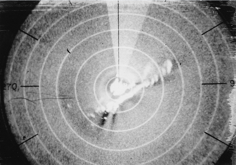 |
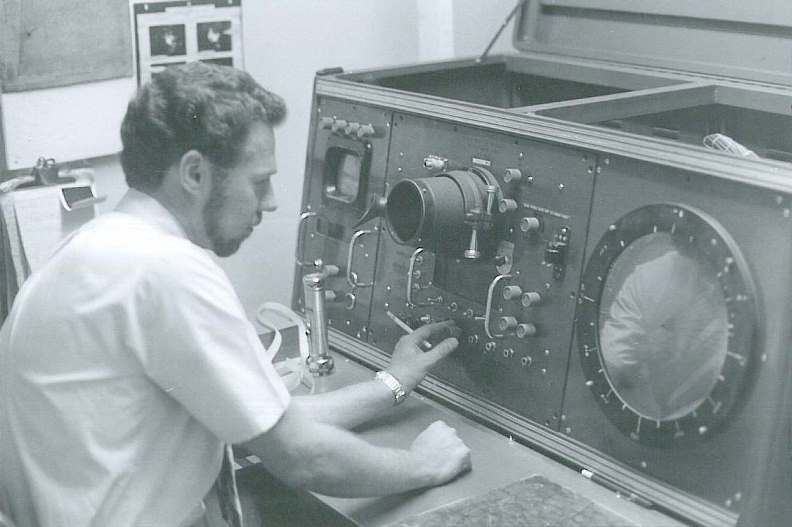
| This was our first radar, called a WSR-3, which went into service on February 20, 1962. The radar was normally used in a completely dark room -- the lights are on here for the sake of the photograph. The photo shows meteorologist Paul Hunt at the controls in 1972. | See the fuzzy southwest-northeast line near the center of the scope? That is what a line of thunderstorms looked like on the WSR-3's display. Compare it to the radar pictures from the 88-D shown at the bottom of this page! |
 |
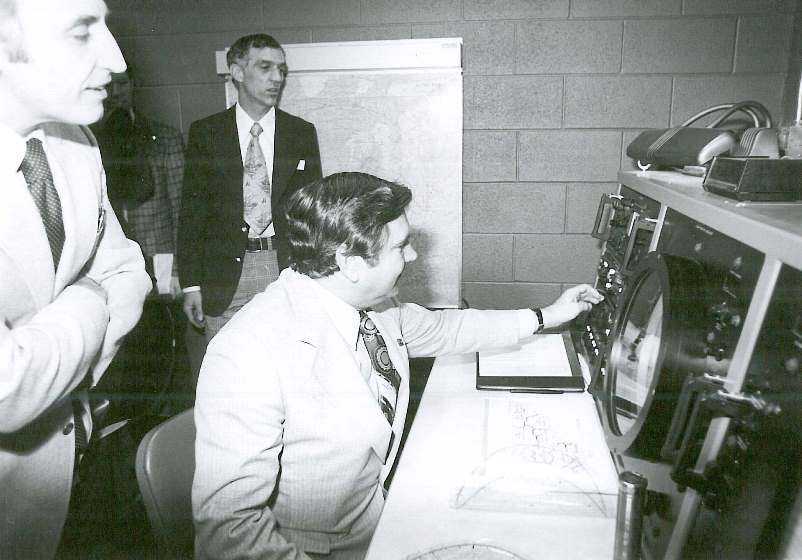 |
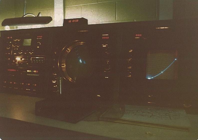
| This is the console of the radar that replaced the WSR-3, called the WSR 74-C. This radar arrived in Louisville in the spring of 1978. Like the WSR-3, this radar was normally viewed in a completely dark room. The circular center screen showed where precipitation was occurring across the region. The square screen on the right showed a vertical profile of precipitation echoes, which was especially useful in thunderstorms. The radar operator was able to stop the rotation of the antenna and focus on one storm, looking up and down to see the internal structure of the storm. | Senator Walter "Dee" Huddleston (D-KY), seated, is shown here at the dedication ceremony for the brand new WSR 74-C radar. Mr. Huddleston was a driving force in the effort to bring the radar to Louisville. Representative Ron Mazzoli (D-KY) is at left, and the weather office's Electronics Technician, Jim McFarland, is in the background. |
 |
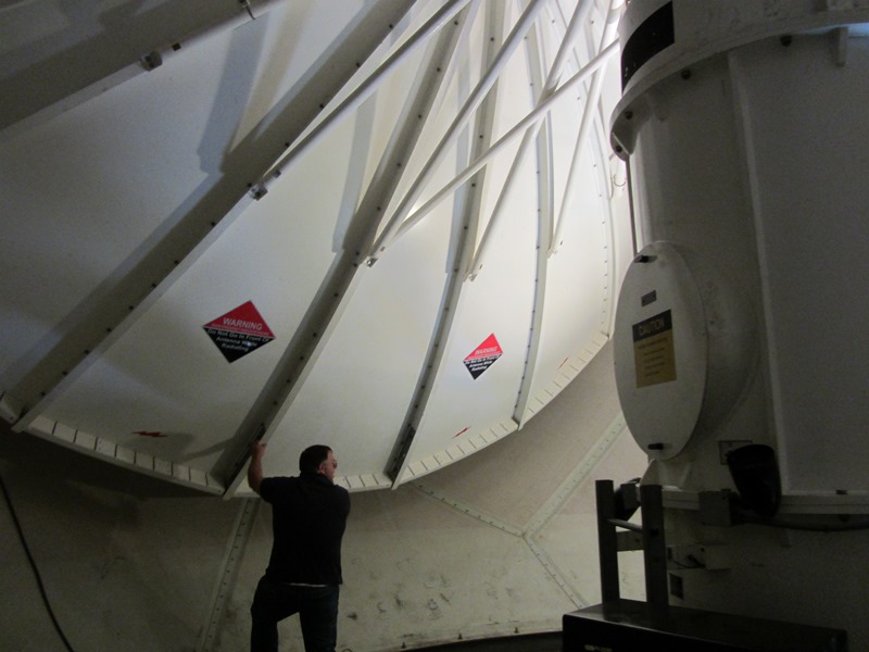 |
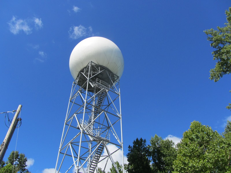
| The WSR 88-D came on-line in 1994. Shown here is the radar tower at Fort Knox. | The WSR 88-D's antenna apparatus, from inside the "golf ball" at the top of the tower, dwarfs the technician shown here at the base of the dish. |
 |
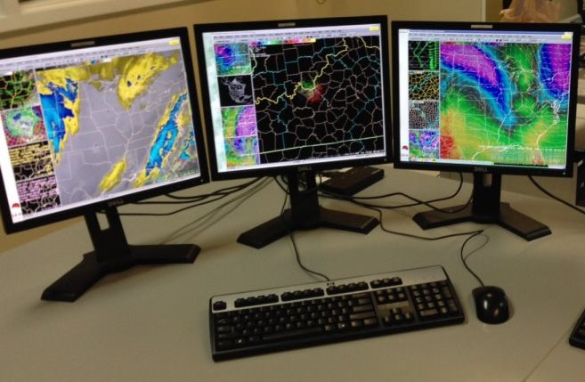 |
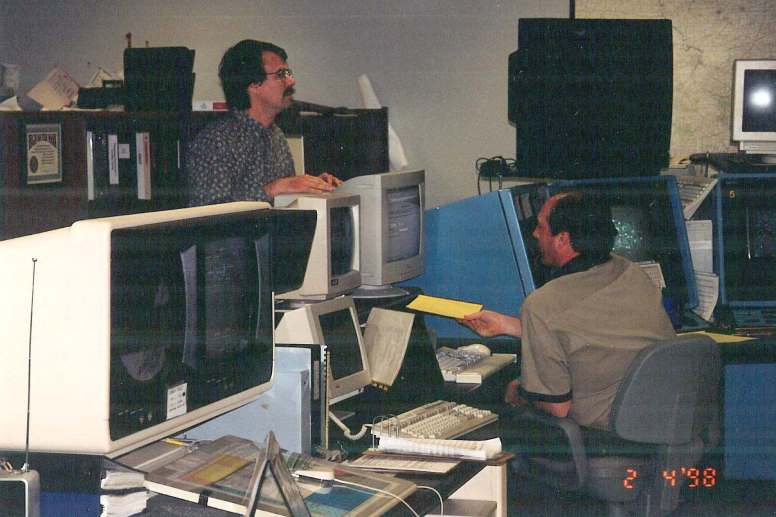
| The large screens on the left of this photo were used to display 88-D radar data from the time of its installation until around the turn of the century. | Today we view radar data on flat screen computer monitors, rather than a radar scope or the large screens in the picture to the left. |
 |
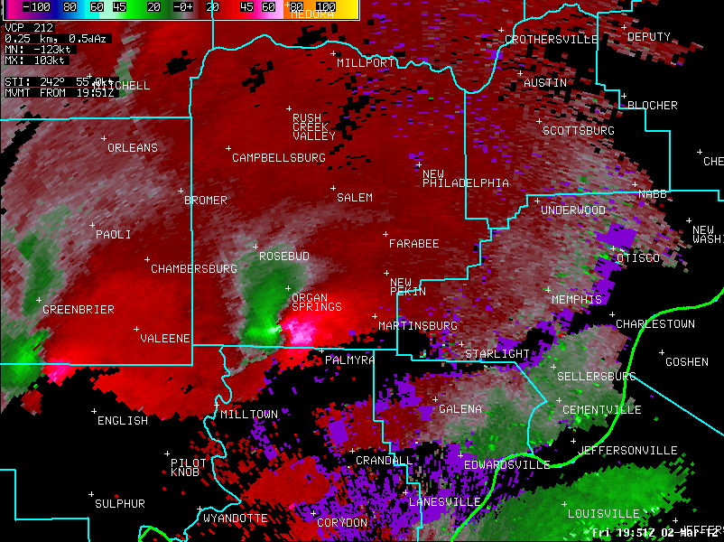 |
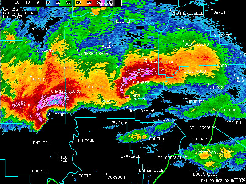
| Modern-day WSR 88-D display. Compare this to the WSR-3 data at the top of this page! We've come quite a long way. This picture shows the March 2, 2012 Henryville, Indiana tornado as it approached New Pekin (center of image). | The genesis of the Henryville tornado. The green and red/pink colors right next to each other indicate powerful rotation within the storm. |
For information on how Doppler radar works, see our Science and Technology page.


 Weather Story
 Weather Map
 Local Radar