...A MONTH OF EXTREMES...
The month started off with a severe drought and historic heat wave that had begun in September. The first three days of the month were 20 degrees hotter than normal with high temperatures in the middle and upper 90s. Bowling Green (98°), Lexington (97°), and Louisville (97°) set new all-time record highs for the month of October. Mercifully, a cold front came through on the 6th and brought much cooler air with it. By the 7th high temperatures were only in the 60s. Then on the 13th, just a week and a half after the heat wave, we had our first frost of the fall season.
The weather was quiet through the middle of the month, however that meant little relief to the drought. As the area dried up, many counties instituted burn bans.
Tropical Storm Olga came ashore on the Louisiana coast early on the 26th. Over the course of the day the circulation shot northward up the Mississippi Valley. By afternoon temperatures in western Kentucky had warmed to near 70 degrees, with just enough instability to generate gusty showers. Very gusty showers. Trees and power lines were damaged or blown down from Logan County northward to Dubois County. A couple of Mesonet sites reported winds over 60 mph.
Over the last couple of weeks the tap turned back on and cold fronts brought waves of rain to the region. Several inches of rain, split up among three main systems, brought enough precipitation to eliminate the severe drought just before month's end.
A cold front Halloween morning caused temperatures to crash from the 50s to the 30s during the day, in addition to widespread rain and gusty winds. In the afternoon and evening flurries were spotted in many locations.
| Average Temperature | Departure from Normal | Precipitation | Departure from Normal | Snow | Departure from Normal | |
| Bowling Green | 61.3° | +2.5° | 7.04" | +3.66" | 0 | 0 |
| Frankfort | 59.5° | +3.1° | 8.26" | +5.02" | ||
| Lexington | 61.4° | +4.4° | 7.83" | +4.70" | 0 | 0 |
| Louisville Bowman | 60.4° | +2.2° | 5.48" | +2.26" | ||
| Louisville Muhammad Ali | 62.0° | +2.5° | 5.62" | +2.40" | T | -0.1" |
Records
1st: High of 97° at Bowling Green, high of 97° at Lexington, high of 97° at Louisville, warm low of 72° at Louisville
2nd: High of 98° at Bowling Green, high of 96° at Frankfort, high of 96° at Lexington, warm low of 70° at Lexington, high of 97° at Louisville
3rd: High of 97° at Bowling Green, high of 95° at Frankfort, high of 96° at Lexington, high of 96° at Louisville
6th: Rainfall of 2.18" at Frankfort
26th: Rainfall of 1.29" at Louisville
30th: Rainfall of 1.30" at Bowling Green, rainfall of 1.00" at Lexington
31st: Snowfall of a trace at Louisville
8th wettest October on record at Bowling Green
2nd wettest October on record at Frankfort and Lexington
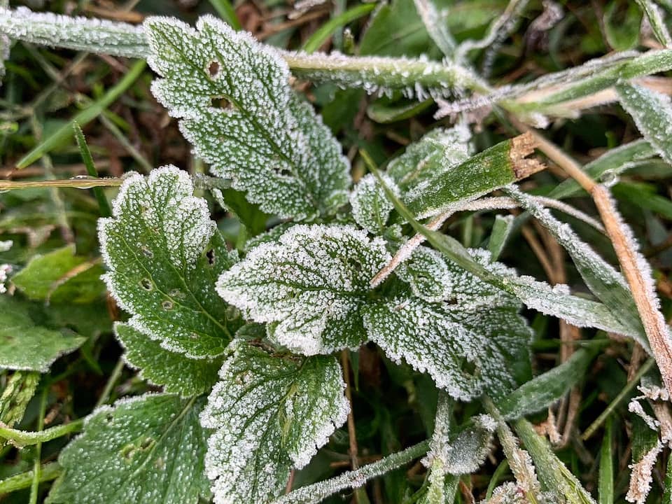
Frost in Shepherdsville on the morning of the 13th. Photo: Tyler Voelker


 Weather Story
 Weather Map
 Local Radar