Louisville, KY
Weather Forecast Office
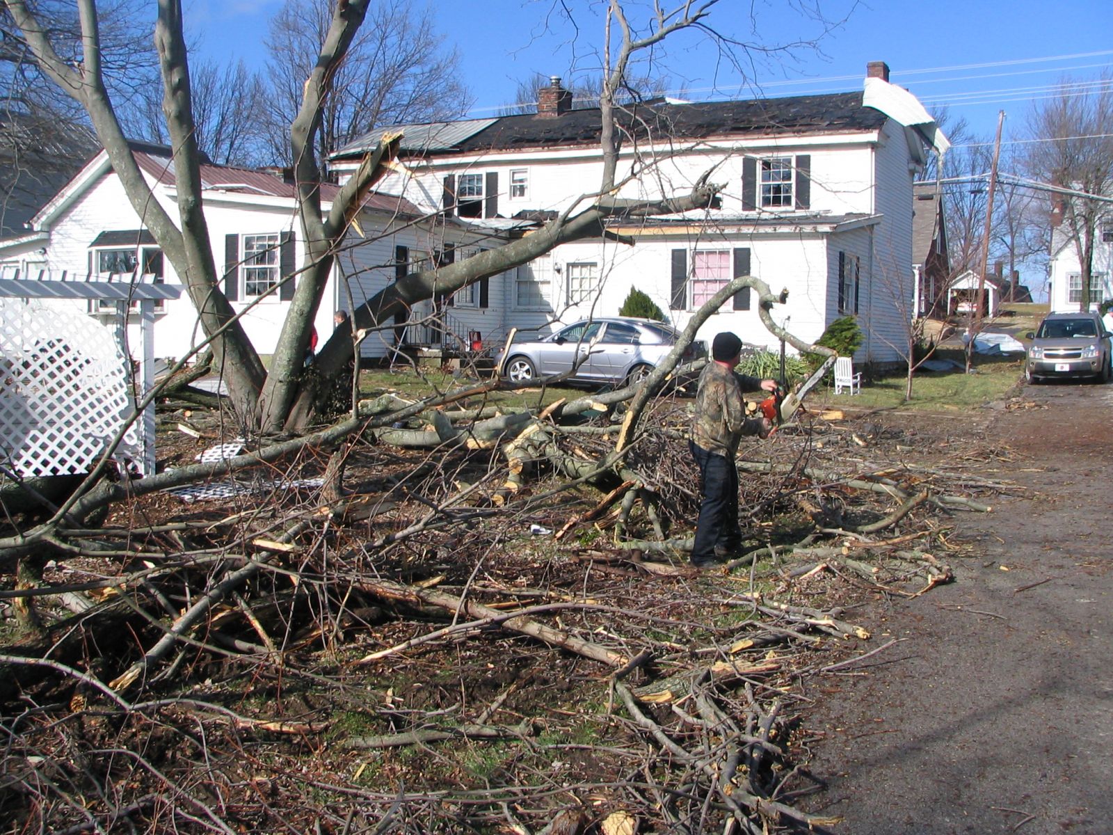
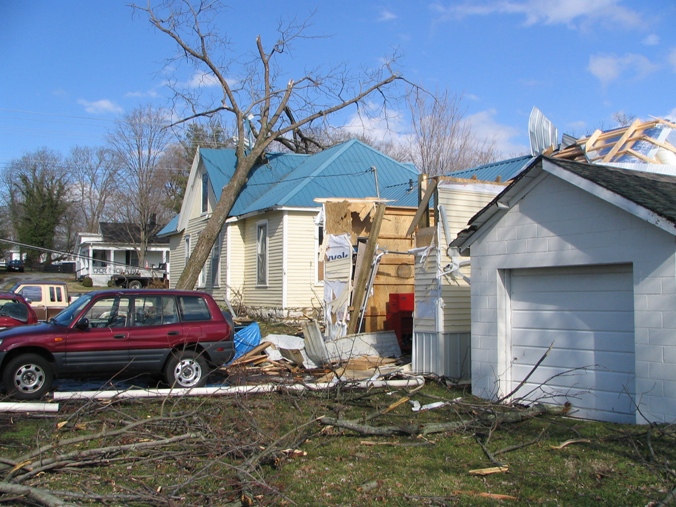
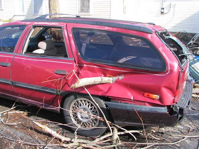
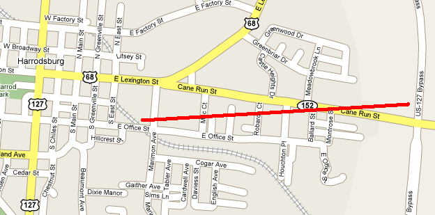
As the tornado touched down on the east side of Harrodsburg it collapsed three walls of a warehouse. Near the intersection of KY 152 and Mac Court extensive tree damage occurred. Metal sheeting was found in trees. A large tree fell on a house and power lines, and that same house had its garage destroyed. A small branch was driven into the side of a car and a chimney was knocked down from a house. Near KY 152 and Montrose Street the roof of a factory was blown in and extensive tree damage occurred.
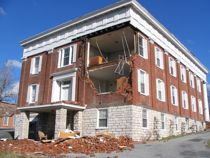
In addition to the tornado, there was also widespread straight-line wind damage across Mercer County. The north side of the roof of the county fairgrounds building collapsed. Extensive structural damage happened at the James B. Haggin Memorial Hospital where roofing material was peeled off and a chimney was knocked down. Numerous trees were uprooted and shingles were peeled off a church with wind speeds of 75 mph. Near the intersection of Childs Street and Mooreland Street an old two-story apartment building had part of its west-facing wall blown out by 85 mph winds (see picture below).
 |
 |
 |
 |
 |
Click here for radar imagery of this event.
Page Updated: 4/8/2008 9:15 AM EDT
Current Hazards
Hazardous Weather Outlook
Storm Prediction Center
Submit a Storm Report
Advisory/Warning Criteria
Radar
Fort Knox
Evansville
Fort Campbell
Nashville
Jackson
Wilmington
Latest Forecasts
El Nino and La Nina
Climate Prediction
Central U.S. Weather Stories
1-Stop Winter Forecast
Aviation
IDSS Forecast Points
Air Quality
Fire Weather
Recreation Forecasts
1-Stop Drought
Event Ready
1-Stop Severe Forecast
Past Weather
Climate Graphs
1-Stop Climate
CoCoRaHS
Local Climate Pages
Tornado History
Past Derby/Oaks/Thunder Weather
Football Weather
Local Information
About the NWS
Forecast Discussion
Items of Interest
Spotter Training
Regional Weather Map
Decision Support Page
Text Products
Science and Technology
Outreach
LMK Warning Area
About Our Office
Station History
Hazardous Weather Outlook
Local Climate Page
Tornado Machine Plans
Weather Enterprise Resources
US Dept of Commerce
National Oceanic and Atmospheric Administration
National Weather Service
Louisville, KY
6201 Theiler Lane
Louisville, KY 40229-1476
502-969-8842
Comments? Questions? Please Contact Us.


 Weather Story
 Weather Map
 Local Radar