The first week of the month was cooler than normal with generally pleasant conditions leading up to the Kentucky Oaks and Derby. On Derby Day itself the weather cooperated for the most part, with thunderstorms waiting until just after the Derby itself that evening. Storms continued to develop to our north overnight, and slid southward into southern Indiana and north central Kentucky. On the morning of the 7th half a dozen small tornadoes touched down around the Louisville region. The twisters were all of EF-0 or EF-1 strength. Most of the twisters were very brief, with the total path length of 5 of the 6 tornadoes adding up to a sum of less than two miles. The most significant twister was an EF-1 that touched down in southern Floyd County, crossed the Ohio River into Lake Dreamland in Louisville, then lifted at the end of its 4.8 mile long path northwest of Iroquois Park.
That night another severe storm hit Louisville. Between 3:30 and 4 in the morning on the 8th a lone storm brought golf ball sized hail to Shively and Louisville International Airport. When this storm initially developed over Harrison County, Indiana, hail to the size of baseballs was observed!
The final severe weather event of the month took place on the 16th when a warm front advanced from the Tennessee Valley north into Kentucky. Severe thunderstorms produced strong wind gusts east of Interstate 65, especially in the Lake Cumberland and southern Blue Grass regions. Several trees were blown down. Some of the storms exhibited impressive rotation aloft, but no tornadoes touched down.
The remainder of May was generally quiet with temperatures slightly cooler than normal until the last few days of the month.
| Average Temperature | Departure from Normal | Precipitation | Departure from Normal | |
| Bowling Green | 67.7° | -0.3° | 3.86" | -1.17" |
| Frankfort | 63.8° | -1.7° | 3.20" | -1.90" |
| Lexington | 65.0° | -0.4° | 2.53" | -2.91" |
| Louisville Ali | 67.5° | -0.8° | 4.06" | -1.12" |
| Louisville Bowman | 64.6° | -2.6° | 2.40" | -2.76" |
Records
No records were set this month.
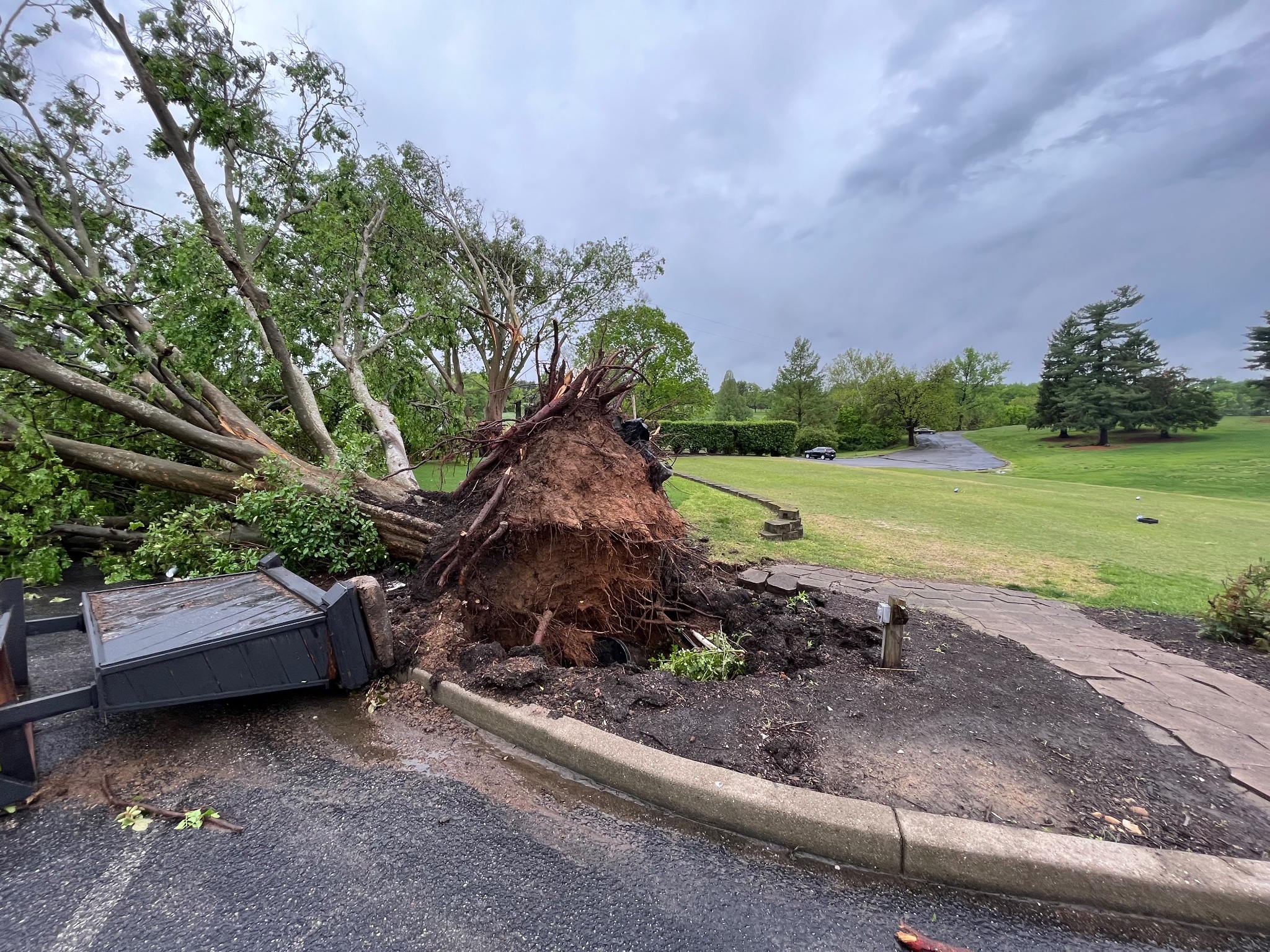
Straight-line winds blew this tree down at Wildwood Country Club in Louisville the morning after Derby. NWS Storm Survey


 Weather Story
 Weather Map
 Local Radar