Louisville, KY
Weather Forecast Office
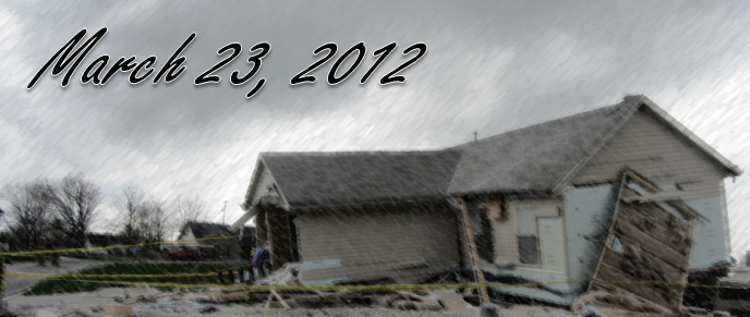
On March 23, 2012 low pressure spinning over Missouri sent waves of showers and thunderstorms eastward through the Ohio Valley for much of the day. By early afternoon a pocket of strong winds aloft rotated around the low and entered Kentucky just as a small line of convection developed roughly along Interstate 65. As the line of showers moved to the northeast, it may have crossed a subtle boundary that helped add just enough spin to the atmosphere to allow a couple of very narrow, brief tornadoes to form. The cells that spawned the tornadoes were very small, reaching only about 20,000 feet into the atmosphere (summertime supercells can grow to more than 50,000 feet tall). There wasn't even any lightning, as evidenced by lightning detection networks as well as storm witnesses who reported no thunder before the tornadoes struck.
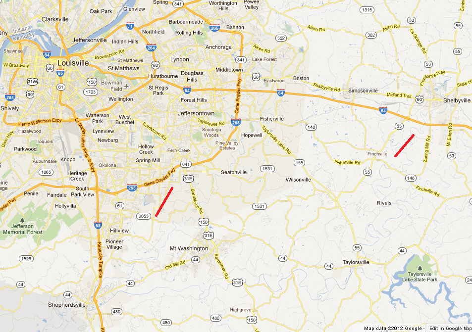
On the map below, click on a track (thick red line) to see detailed information about each tornado in Jefferson and Shelby Counties.
Current Hazards
Hazardous Weather Outlook
Storm Prediction Center
Submit a Storm Report
Advisory/Warning Criteria
Radar
Fort Knox
Evansville
Fort Campbell
Nashville
Jackson
Wilmington
Latest Forecasts
El Nino and La Nina
Climate Prediction
Central U.S. Weather Stories
1-Stop Winter Forecast
Aviation
IDSS Forecast Points
Air Quality
Fire Weather
Recreation Forecasts
1-Stop Drought
Event Ready
1-Stop Severe Forecast
Past Weather
Climate Graphs
1-Stop Climate
CoCoRaHS
Local Climate Pages
Tornado History
Past Derby/Oaks/Thunder Weather
Football Weather
Local Information
About the NWS
Forecast Discussion
Items of Interest
Spotter Training
Regional Weather Map
Decision Support Page
Text Products
Science and Technology
Outreach
LMK Warning Area
About Our Office
Station History
Hazardous Weather Outlook
Local Climate Page
Tornado Machine Plans
Weather Enterprise Resources
US Dept of Commerce
National Oceanic and Atmospheric Administration
National Weather Service
Louisville, KY
6201 Theiler Lane
Louisville, KY 40229-1476
502-969-8842
Comments? Questions? Please Contact Us.


 Weather Story
 Weather Map
 Local Radar