Louisville, KY
Weather Forecast Office
A NWS storm survey team surveyed Barren, Metcalfe, Green, Adair, and Russell counties. Several pine trees were down within the hail path, but likely due to straight-line winds. Several people reported seeing a funnel cloud, including Russell County Emergency Management personnel, who chased the funnel cloud to Highway 80 toward Pulaski County. No tornado damage was found, but that area did suffer extensive large hail damage. The most significant hail damage was found in and near Columbia in Adair County. Along one stretch of roadway from the Metcalfe/Adair county line to the city of Columbia, not one vehicle was found that did not have its windshield damaged. In the city of Columbia, one house had hail break through the roof and a Wal-Mart store had 160 skylights damaged.
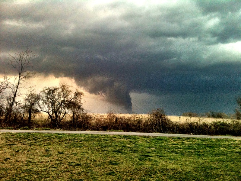
Russell County had been struck by an EF2 tornado just two days prior to the storms of March 2. When this storm rolled through the county on the 2nd, it had some low hanging clouds that looked very much like tornadoes, but were not.
First two photos courtesy Brittany Meece.
Click on an image for a larger version:
 |
|
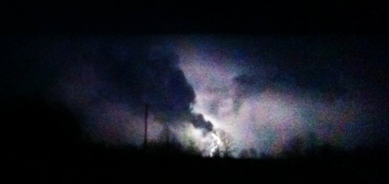
Here is another photo of the suspicious-looking storm (no larger version available):

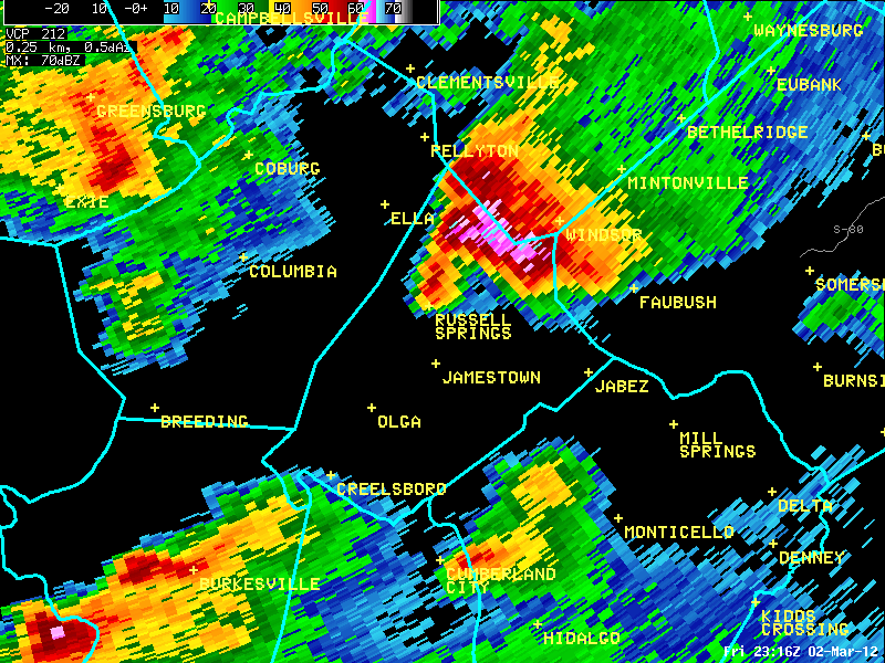
The radar image below shows a cell that dropped golf ball size hail on northern Russell County around a quarter after five. This is actually the same storm that dropped big hail on Edmonton and Columbia as well.
Current Hazards
Hazardous Weather Outlook
Storm Prediction Center
Submit a Storm Report
Advisory/Warning Criteria
Radar
Fort Knox
Evansville
Fort Campbell
Nashville
Jackson
Wilmington
Latest Forecasts
El Nino and La Nina
Climate Prediction
Central U.S. Weather Stories
1-Stop Winter Forecast
Aviation
Spot Request
Air Quality
Fire Weather
Recreation Forecasts
1-Stop Drought
Event Ready
1-Stop Severe Forecast
Past Weather
Climate Graphs
1-Stop Climate
CoCoRaHS
Local Climate Pages
Tornado History
Past Derby/Oaks/Thunder Weather
Football Weather
Local Information
About the NWS
Forecast Discussion
Items of Interest
Spotter Training
Regional Weather Map
Decision Support Page
Text Products
Science and Technology
Outreach
LMK Warning Area
About Our Office
Station History
Hazardous Weather Outlook
Local Climate Page
Tornado Machine Plans
Weather Enterprise Resources
US Dept of Commerce
National Oceanic and Atmospheric Administration
National Weather Service
Louisville, KY
6201 Theiler Lane
Louisville, KY 40229-1476
502-969-8842
Comments? Questions? Please Contact Us.
Thank you for visiting a National Oceanic and Atmospheric Administration (NOAA) website. The link you have selected will take you to a non-U.S. Government website for additional information.
NOAA is not responsible for the content of any linked website not operated by NOAA. This link is provided solely for your information and convenience, and does not imply any endorsement by NOAA or the U.S. Department of Commerce of the linked website or any information, products, or services contained therein.
You will be redirected to:


 Weather Map
 Local Radar