Louisville, KY
Weather Forecast Office
The EF4 that tore across southern Indiana on the afternoon of March 2, 2012 was similar in placement, timing, and strength to the April 3, 1974 F5 tornado that also devastated the region.
| March 2, 2012 | April 3, 1974 | |
| Scale | EF4 | F5 |
| Path length | 49 miles | 68 miles |
| Counties struck | Washington, Clark, Scott, Jefferson, Trimble | Perry, Crawford, Harrison, Washington, Clark, Scott |
| Time of day | 2:50pm | 1:20pm |
| Fatalities | 11 | 6 |
Click here for a zoomed out map of the region, showing a portion of the 1974 F5 track in red and the 2012 EF4 track in orange.
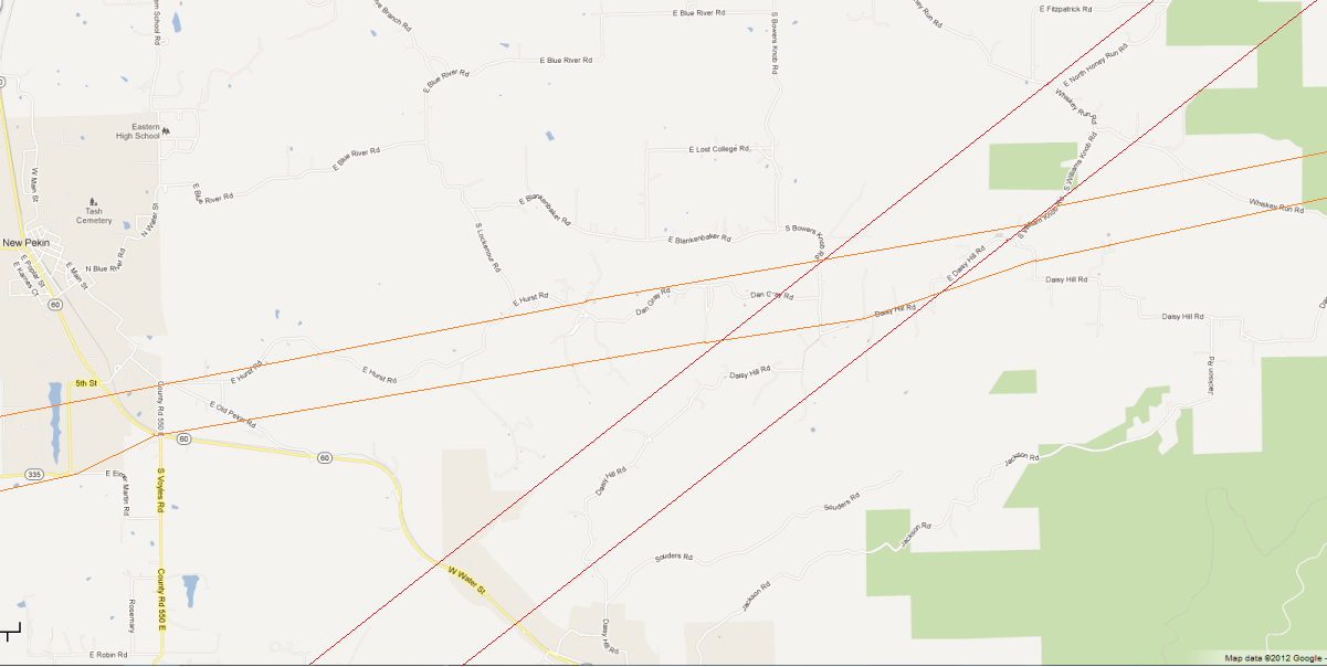
Click here for a map that zooms in to the approximate intersection of the two tornado paths, with the 1974 F5 track outlined in red and the 2012 EF4 track outlined in orange:
And click here to zoom in tighter still to where the intersection of the two tracks appears to be in Daisy Hill, as shown by the white parallelogram. If you experienced the 1974 tornado or have detailed information that shows these maps may be incorrect, please let us know.
Current Hazards
Hazardous Weather Outlook
Storm Prediction Center
Submit a Storm Report
Advisory/Warning Criteria
Radar
Fort Knox
Evansville
Fort Campbell
Nashville
Jackson
Wilmington
Latest Forecasts
El Nino and La Nina
Climate Prediction
Central U.S. Weather Stories
1-Stop Winter Forecast
Aviation
Spot Request
Air Quality
Fire Weather
Recreation Forecasts
1-Stop Drought
Event Ready
1-Stop Severe Forecast
Past Weather
Climate Graphs
1-Stop Climate
CoCoRaHS
Local Climate Pages
Tornado History
Past Derby/Oaks/Thunder Weather
Football Weather
Local Information
About the NWS
Forecast Discussion
Items of Interest
Spotter Training
Regional Weather Map
Decision Support Page
Text Products
Science and Technology
Outreach
LMK Warning Area
About Our Office
Station History
Hazardous Weather Outlook
Local Climate Page
Tornado Machine Plans
Weather Enterprise Resources
US Dept of Commerce
National Oceanic and Atmospheric Administration
National Weather Service
Louisville, KY
6201 Theiler Lane
Louisville, KY 40229-1476
502-969-8842
Comments? Questions? Please Contact Us.


 Weather Story
 Weather Map
 Local Radar
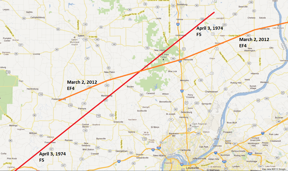