Overview
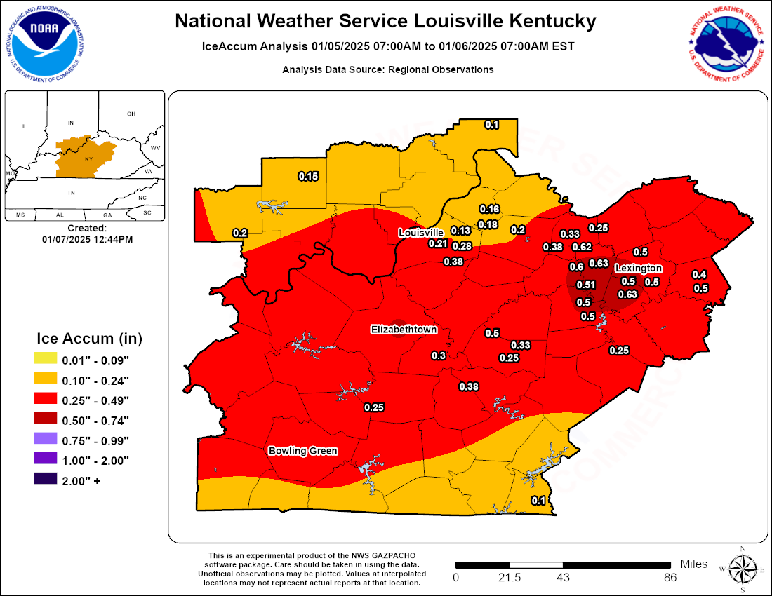
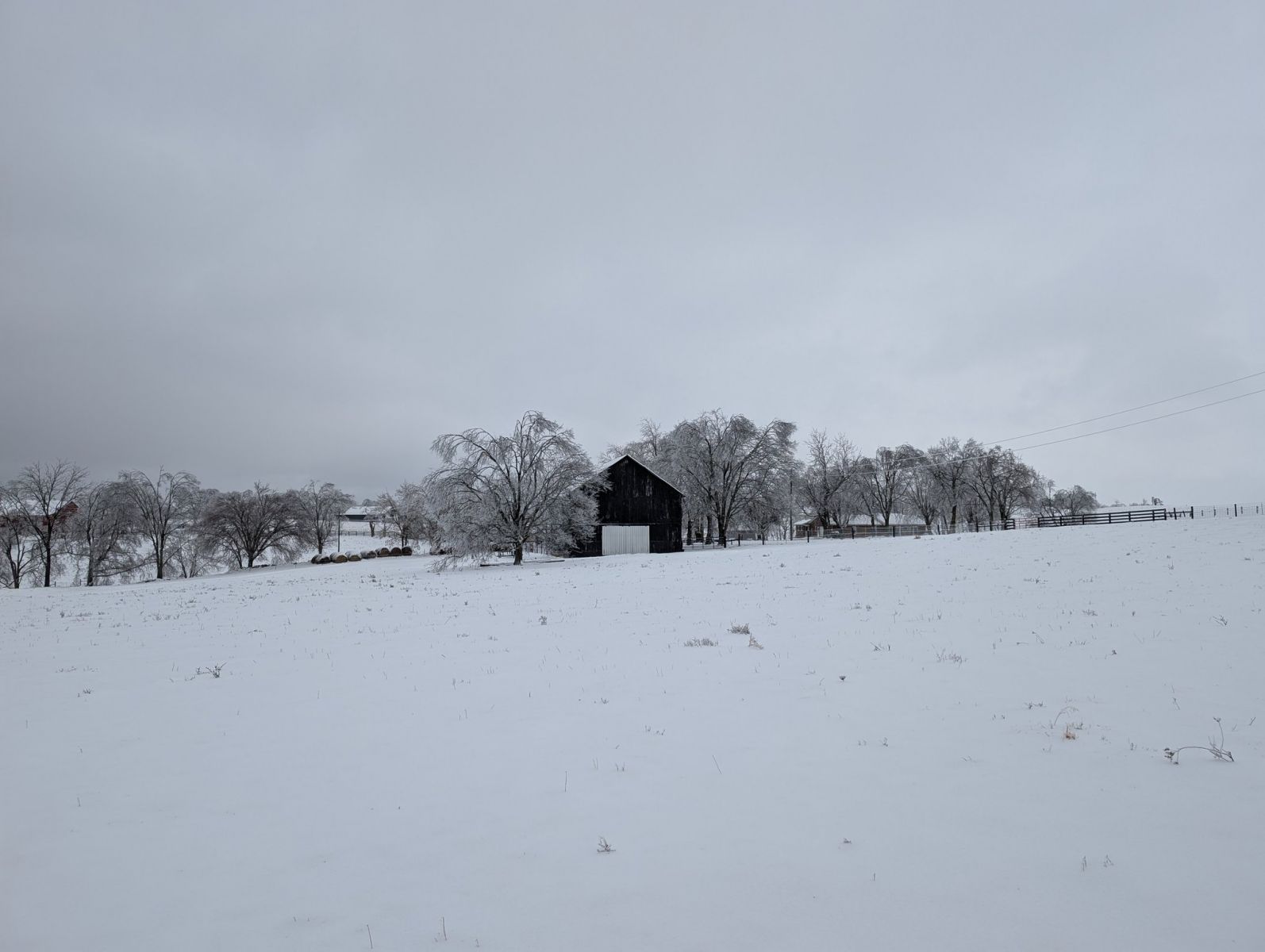
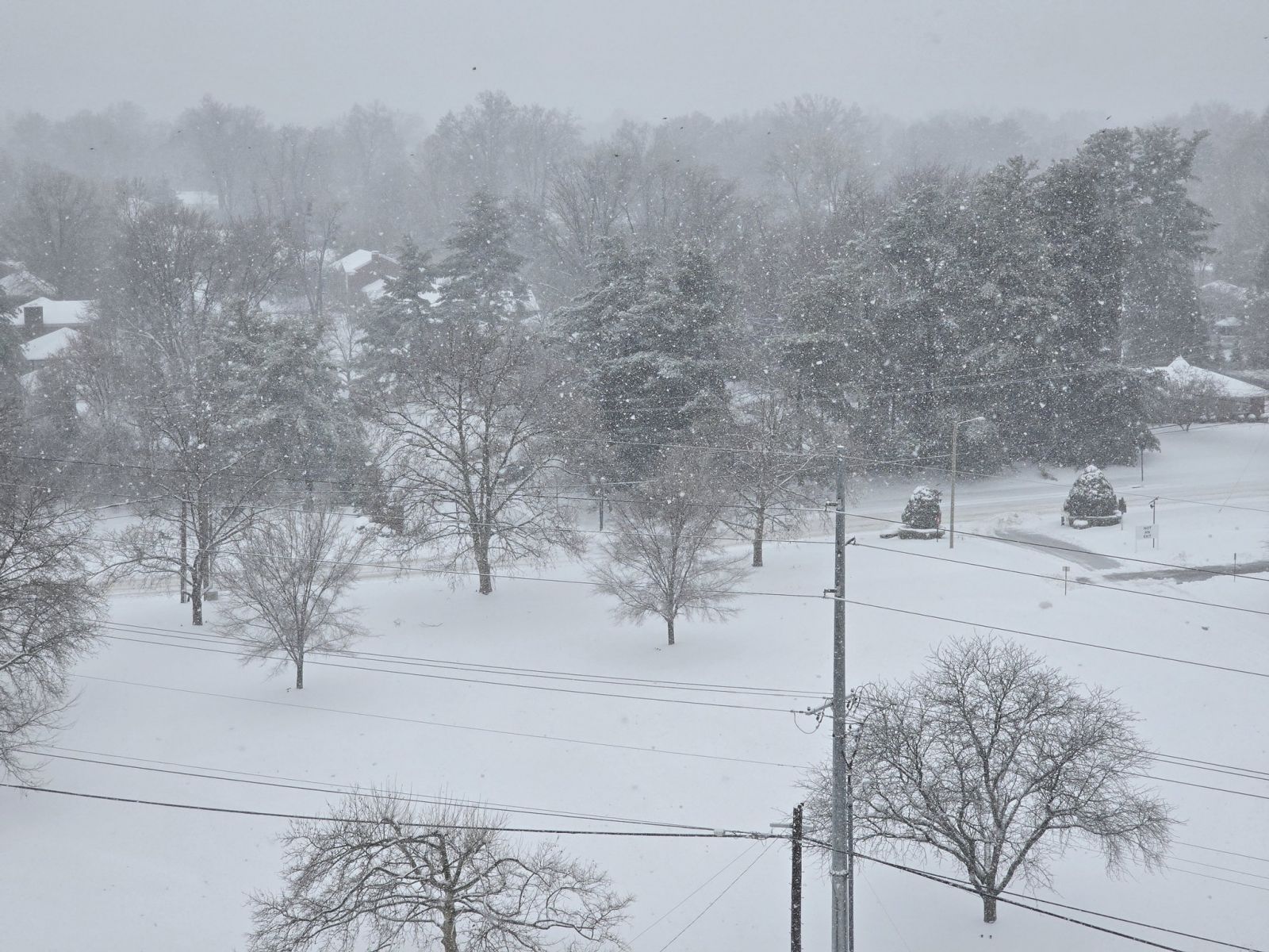
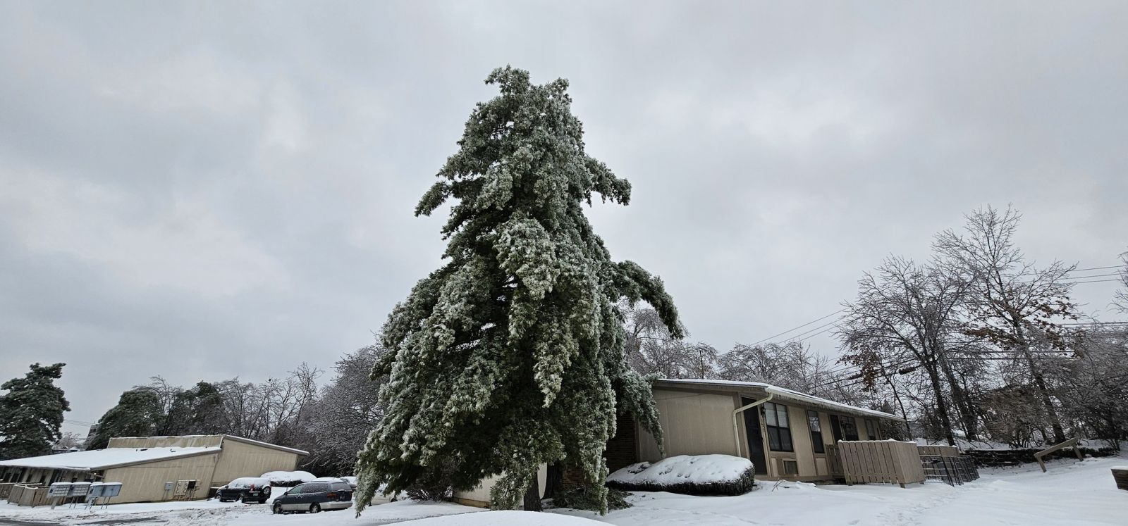
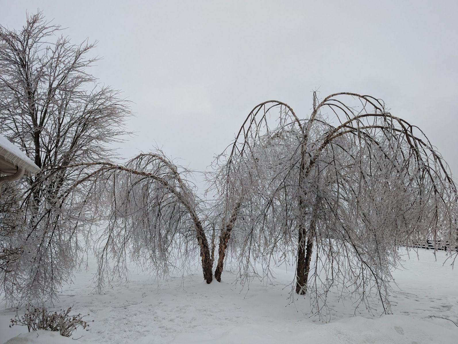
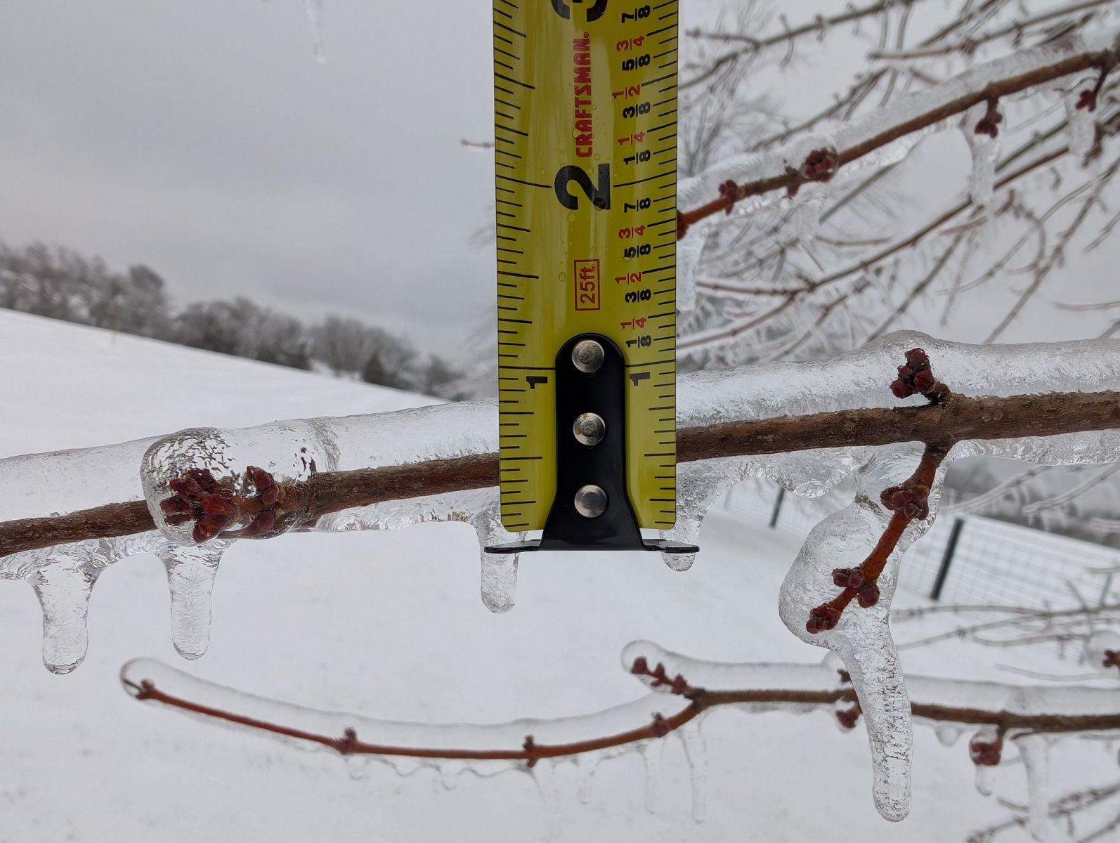
A major winter storm impacted the Ohio Valley on January 5-6, 2025. When all was said and done, the storm had dropped a swath of heavy snow and sleet ranging between 6 and 12 inches across southern Indiana and northern Kentucky. In addition, damaging amounts of ice from .25" to .75" were noted across much of Kentucky. Nearly 100,000 people were without power by Monday morning. The storm then ended Monday afternoon with one last round of snow ranging between 1 to 3 inches. By Monday night, many area roads and streets were still snow and ice covered, with close to 50,000 people still without power. A several day stretch of intense cold then followed the storm, adding to the impacts from the storm.
Snow/Ice
-SnowfallAnalysisPublic.png)
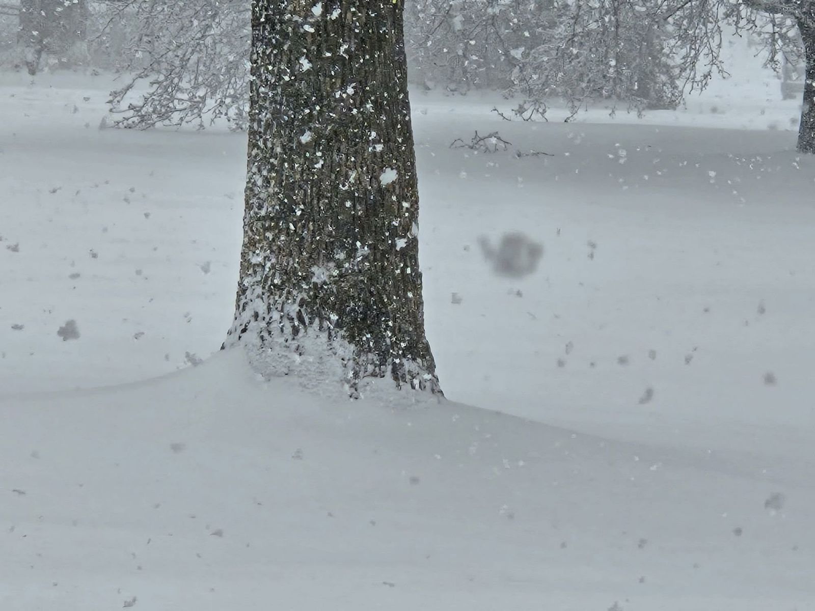
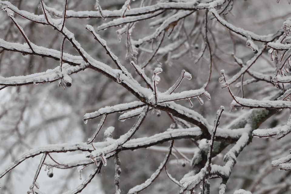
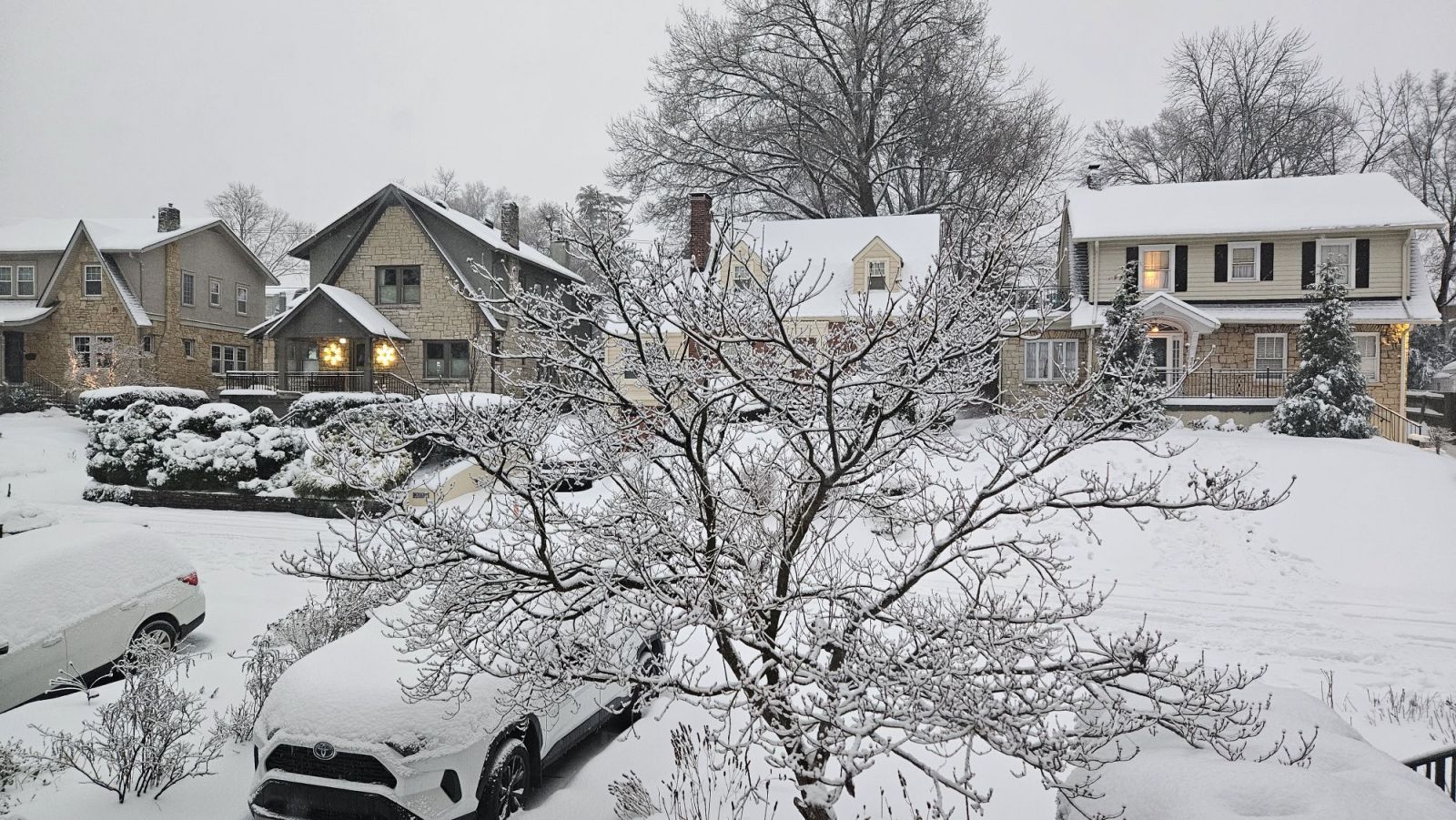
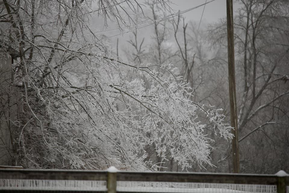
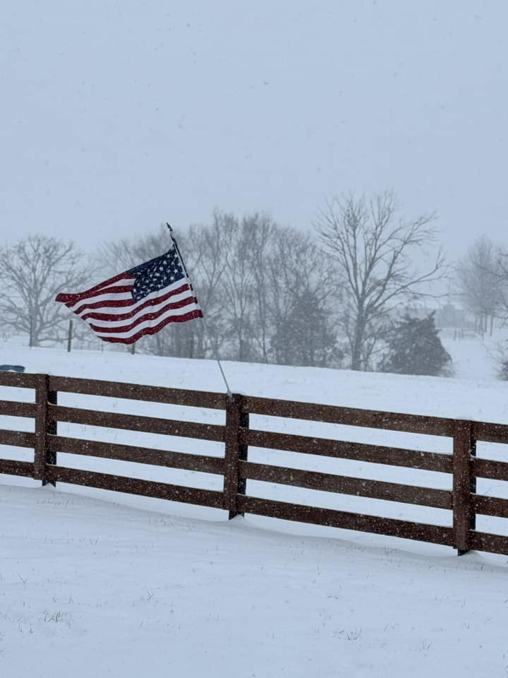
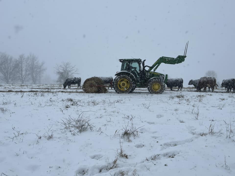
Photos
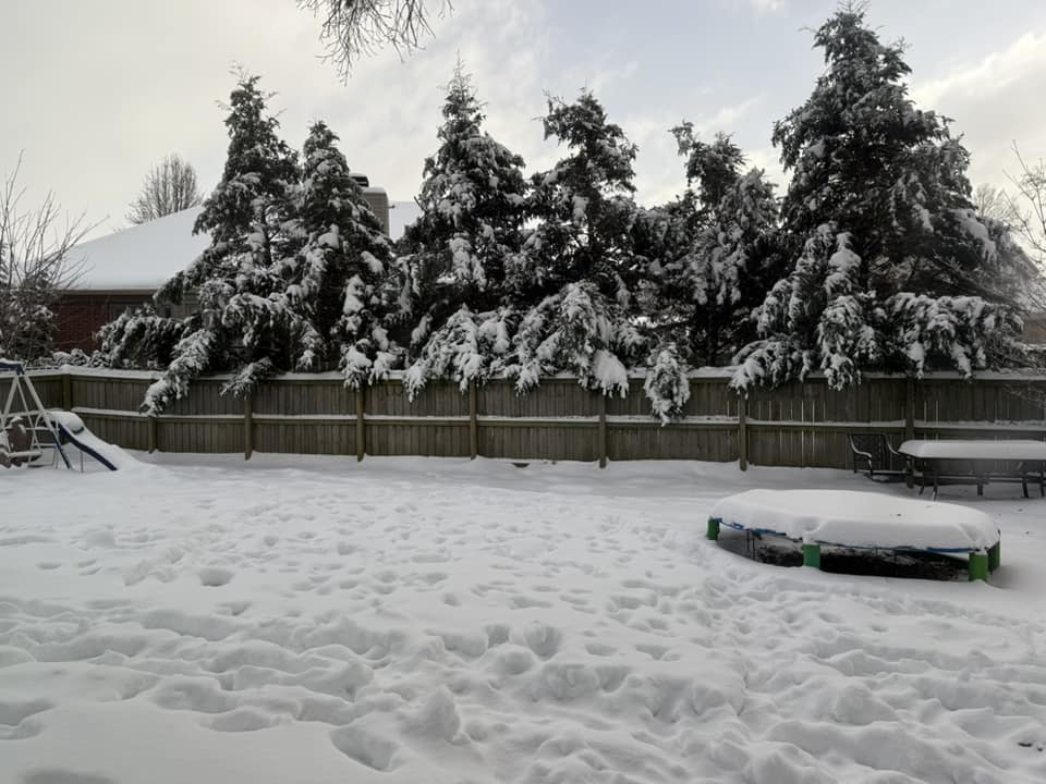
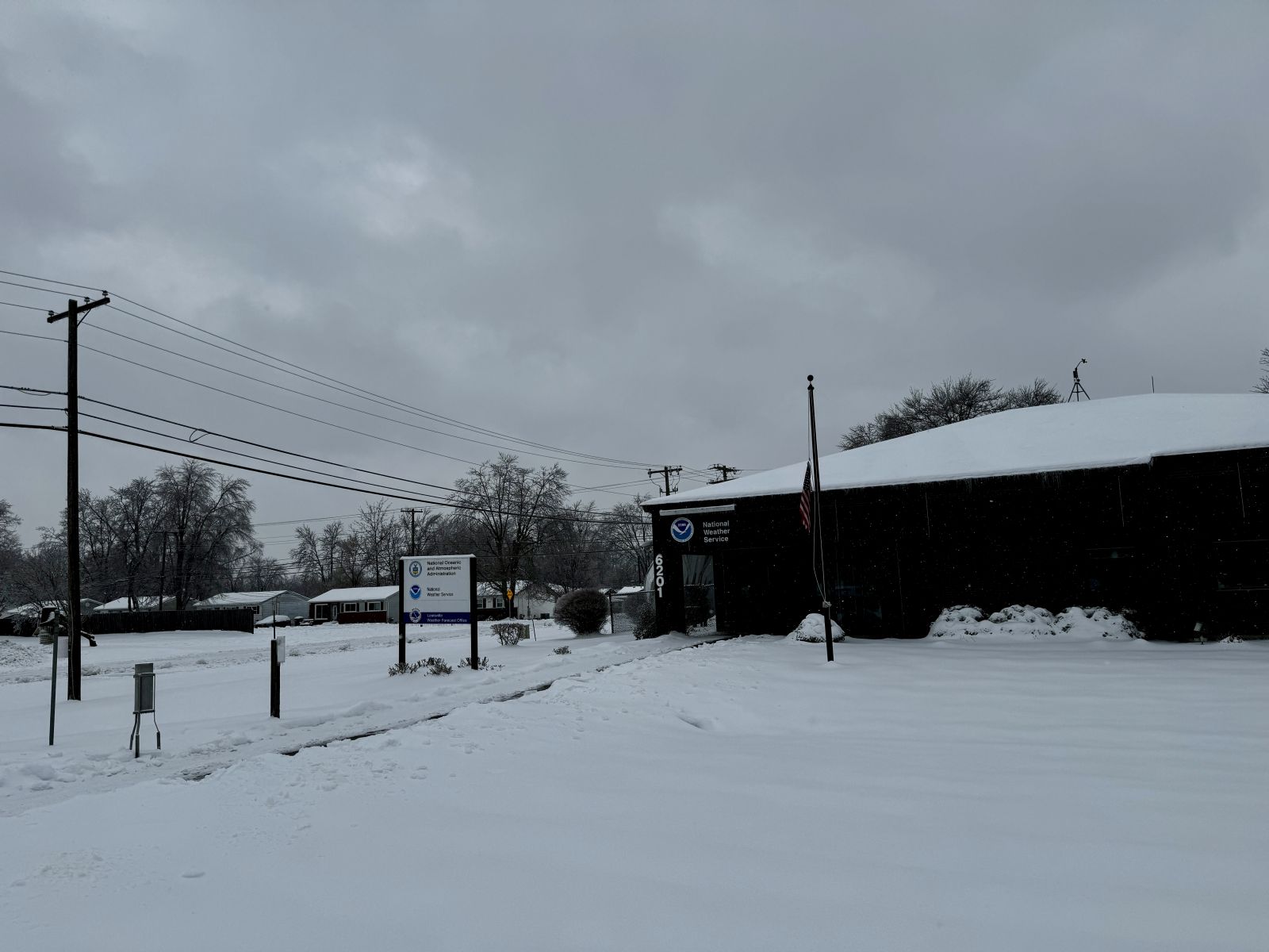
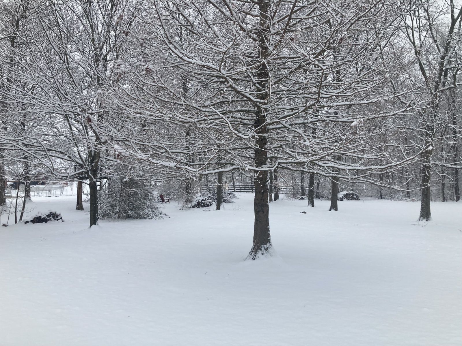
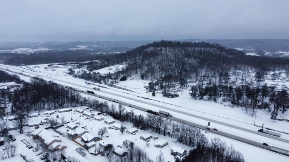
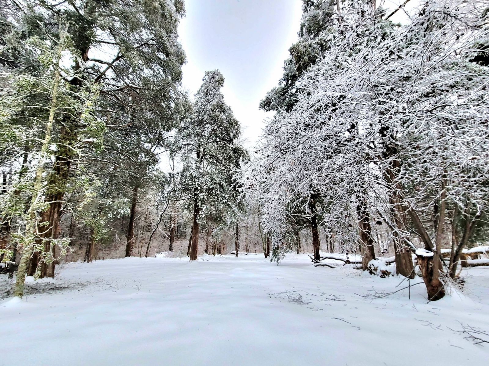
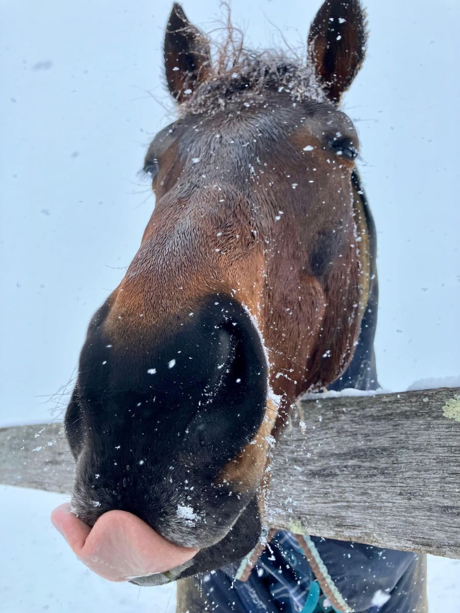
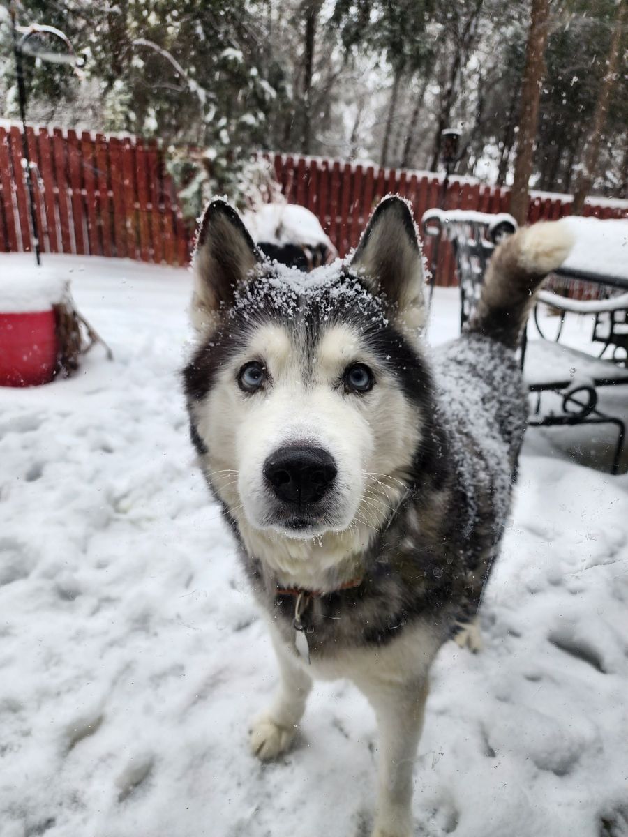
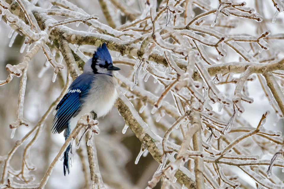
Photos from across the area.
 |
 |
 |
 |
|
Photo: Carol Howell
|
Photo: Ashley Duff
|
Louisville, Kentucky Photo: Margaret Carreiro |
Forest Hills, Kentucky Photo: Brittany Myers |
 |
 |
 |
 |
|
NWS Louisville Office
|
Charlestown, Indiana Photo: Amy Guidry |
Photo: Tina Webb
|
Mercer County Photo: Tyler Young |
 |
 |
 |
 |
|
Northeast Louisville Photo: William Slider |
Lexington, Kentucky Photo: Chance McNamara |
Mercer County Photo: Tyler Young |
Mount Eden, Kentucky Photo: Tori Howell |
 |
 |
 |
 |
|
Mercer County Photo: Tyler Young |
Photo: Kellie Reynolds |
Winchester, Kentucky Photo: Kami Cloyd |
Mount Washington, Kentucky Photo: Kaycee Salmon |
 |
 |
 |
 |
|
Photo: Alexa Riddle
|
Brandenburg, Kentucky Photo: Brittney Rice |
Mount Washington, Kentucky Photo: Shonda Wood Williams |
Peaks Mill, Kentucky Photo: Anita Skeen Manley |
Storm Reports
Preliminary Local Storm Report...Summary
National Weather Service Louisville KY
..TIME... ...EVENT... ...CITY LOCATION... ...LAT.LON...
..DATE... ....MAG.... ..COUNTY LOCATION..ST.. ...SOURCE....
..REMARKS..
0600 AM Snow Palmyra 38.41N 86.11W
01/06/2025 M12.0 Inch Harrison IN Cocorahs
1100 AM Snow 1 W Cementville 38.35N 85.77W
01/06/2025 M12.0 Inch Floyd IN Cocorahs
0700 AM Snow 1 SW Hamburg 38.37N 85.78W
01/06/2025 M11.0 Inch Floyd IN Broadcast Media
Meteorologist reported this snow amount,
including 1.25 inches of sleet.
0900 AM Snow 1 NW Jeffersonville 38.31N 85.74W
01/06/2025 M10.5 Inch Clark IN Cocorahs
0700 AM Snow 2 SW Portersville 38.48N 87.02W
01/06/2025 M10.0 Inch Dubois IN Cocorahs
0500 AM Snow 1 S Saint Joseph 38.38N 85.82W
01/06/2025 M9.0 Inch Floyd IN Public
Some sleet content. Temperature was 26.2 at
ob time.
0500 PM Snow Pleasure Ridge ParK 38.15N 85.85W
01/05/2025 M8.8 Inch Jefferson KY Public
0120 PM Snow 3 ENE Ferdinand 38.25N 86.81W
01/05/2025 M8.5 Inch Dubois IN Trained Spotter
Snow has changed to freezing rain.
0700 AM Snow 1 WSW Mentor 38.31N 86.73W
01/06/2025 M8.5 Inch Dubois IN Cocorahs
0800 AM Snow 1 SW Middletown 38.23N 85.53W
01/06/2025 M8.4 Inch Jefferson KY Cocorahs
0850 PM Snow 2 N Jeffersontown 38.23N 85.57W
01/05/2025 M8.3 Inch Jefferson KY NWS Employee
Combined snow and sleet accumulation. Storm
total.
0800 AM Snow 1 WNW Forks of Elkhorn 38.22N 84.82W
01/06/2025 M8.3 Inch Franklin KY Cocorahs
0700 AM Snow 1 S Buckner 38.36N 85.43W
01/06/2025 M8.2 Inch Oldham KY NWS Employee
0738 AM Snow 4 SE Pewee Valley 38.27N 85.44W
01/06/2025 M8.1 Inch Jefferson KY Cocorahs
Corrects previous snow report from 4 SE
Pewee Valley. No change in total value, just
to add that 1.2 inches of sleet included in
snow total.
0700 AM Snow 1 S Hanover 38.70N 85.47W
01/06/2025 E8.0 Inch Jefferson IN Cocorahs
0700 AM Snow 2 N White Cloud 38.27N 86.23W
01/06/2025 M8.0 Inch Harrison IN Cocorahs
0700 AM Snow 4 SE Pewee Valley 38.27N 85.44W
01/06/2025 M8.0 Inch Jefferson KY Cocorahs
6.9 inches snow, then 1.2 inches mixed ice
pellets, snow and freezing rain. 0.18 ice
glaze sent in freezing rain LSR.
0700 AM Snow 1 N Frankfort 38.21N 84.87W
01/06/2025 M8.0 Inch Franklin KY Utility Company
0700 AM Snow 2 NNW Shelbyville 38.24N 85.25W
01/06/2025 M8.0 Inch Shelby KY NWS Employee
0222 PM Snow 2 S Pewee Valley 38.28N 85.49W
01/05/2025 M7.9 Inch Jefferson KY Public
0309 PM Snow Mount Washington 38.05N 85.55W
01/05/2025 M7.8 Inch Bullitt KY Public
0531 PM Snow 2 WNW Floyds Knobs 38.33N 85.91W
01/05/2025 M7.8 Inch Floyd IN Public
0620 PM Snow 3 SSE Buckner 38.35N 85.41W
01/05/2025 M7.8 Inch Oldham KY NWS Employee
Sleet ongoing at time of observation.
0930 PM Snow 2 N Shelbyville 38.25N 85.23W
01/05/2025 M7.8 Inch Shelby KY NWS Employee
0145 PM Snow 2 SE Shively 38.17N 85.80W
01/05/2025 M7.5 Inch Jefferson KY Public
0415 PM Snow 2 SSW Highview 38.11N 85.65W
01/05/2025 M7.5 Inch Jefferson KY Official NWS Obs
0733 AM Snow 2 S Brooks 38.05N 85.72W
01/06/2025 M7.5 Inch Bullitt KY Cocorahs
Also reported less than a quarter inch of
ice, but no direct measurement.
0800 AM Snow Charlestown 38.45N 85.67W
01/06/2025 M7.4 Inch Clark IN Public
0342 PM Snow 5 E Fern Creek 38.14N 85.50W
01/05/2025 M7.3 Inch Jefferson KY Public
0125 PM Snow New Middletown 38.16N 86.05W
01/05/2025 E7.0 Inch Harrison IN Trained Spotter
0130 PM Snow Shepherdsville 37.99N 85.71W
01/05/2025 M7.0 Inch Bullitt KY Public
0149 PM Snow Saint Anthony 38.31N 86.83W
01/05/2025 M7.0 Inch Dubois IN Trained Spotter
Snow has changed to freezing rain.
0247 PM Snow Corydon 38.21N 86.12W
01/05/2025 M7.0 Inch Harrison IN Public
0300 PM Snow 2 W Forks of Elkhorn 38.22N 84.83W
01/05/2025 M7.0 Inch Franklin KY CO-OP Observer
Sleet and freezing rain mixing in at time of
observation.
0600 AM Snow Connersville 38.39N 84.41W
01/06/2025 M7.0 Inch Harrison KY Cocorahs
0800 AM Snow 4 NNW Bedford 38.65N 85.35W
01/06/2025 M7.0 Inch Trimble KY Cocorahs
0115 PM Snow Middletown 38.24N 85.52W
01/05/2025 M6.8 Inch Jefferson KY Public
0200 PM Snow 3 NNE Louisville Int'l 38.20N 85.73W
01/05/2025 M6.8 Inch Jefferson KY Public
0213 PM Snow 2 SE Louisville 38.23N 85.73W
01/05/2025 M6.8 Inch Jefferson KY Trained Spotter
0311 PM Snow 4 SSW Saint Matthews 38.20N 85.66W
01/05/2025 M6.8 Inch Jefferson KY Public
0800 AM Snow 4 NW Sadieville 38.43N 84.59W
01/06/2025 M6.8 Inch Scott KY Cocorahs
Also measured various ice accumulations on
different surfaces. Likely had at least 0.2
flat ice accumulation here.
0836 PM Snow 1 ENE Mckinley 38.76N 86.18W
01/05/2025 M6.6 Inch Washington IN Cocorahs
0700 AM Snow 1 N Mckinley 38.76N 86.20W
01/06/2025 M6.6 Inch Washington IN Cocorahs
0246 PM Snow 3 SE Chambersburg 38.49N 86.33W
01/05/2025 M6.5 Inch Orange IN Public
0305 PM Snow 1 NW Floyds Knobs 38.33N 85.88W
01/05/2025 M6.5 Inch Floyd IN Public
0314 PM Snow Saint Matthews 38.25N 85.64W
01/05/2025 M6.5 Inch Jefferson KY Public
0700 AM Snow 3 W Jeffersontown 38.21N 85.62W
01/06/2025 M6.5 Inch Jefferson KY Cocorahs
0900 AM Snow Shakertown 37.82N 84.87W
01/06/2025 M6.4 Inch Mercer KY Emergency Mngr
0330 PM Snow 1 WNW Forks of Elkhorn 38.22N 84.83W
01/05/2025 M6.3 Inch Franklin KY Public
0700 AM Snow 2 ESE Leopold 38.09N 86.55W
01/06/2025 M6.3 Inch Perry IN Cocorahs
0700 AM Snow 2 N Georgetown 38.23N 84.55W
01/06/2025 M6.1 Inch Scott KY Cocorahs
0110 PM Snow 3 ESE Jeffersontown 38.19N 85.51W
01/05/2025 E6.0 Inch Jefferson KY Public
0121 PM Snow Elizabethtown 37.70N 85.87W
01/05/2025 M6.0 Inch Hardin KY Public
0130 PM Snow Lawrenceburg 38.03N 84.89W
01/05/2025 M6.0 Inch Anderson KY Public
0137 PM Snow 1 SW Shepherdsville 37.97N 85.73W
01/05/2025 E6.0 Inch Bullitt KY Trained Spotter
0200 PM Snow Waddy 38.13N 85.07W
01/05/2025 M6.0 Inch Shelby KY Public
0206 PM Snow 2 NE Prospect 38.37N 85.59W
01/05/2025 M6.0 Inch Oldham KY Public
0213 PM Snow Jeffersontown 38.21N 85.57W
01/05/2025 M6.0 Inch Jefferson KY Public
0230 PM Snow 2 NE Harrisonville 38.10N 85.03W
01/05/2025 M6.0 Inch Anderson KY Public
0300 PM Snow 2 NNE Lexington 38.07N 84.49W
01/05/2025 M6.0 Inch Fayette KY Broadcast Media
Snow had transitioned to sleet and freezing
rain at observation time.
0305 PM Snow 2 NE Central 38.13N 86.13W
01/05/2025 E6.0 Inch Harrison IN Public
0307 PM Snow 1 WNW Forks of Elkhorn 38.22N 84.83W
01/05/2025 M6.0 Inch Franklin KY Public
0309 PM Snow Valley Station 38.10N 85.86W
01/05/2025 M6.0 Inch Jefferson KY Public
0311 PM Snow 6 NNW Forks of Elkhorn 38.30N 84.85W
01/05/2025 E6.0 Inch Franklin KY Public
0345 PM Snow La Grange 38.40N 85.38W
01/05/2025 M6.0 Inch Oldham KY Public
0700 AM Snow 1 SW Versailles 38.04N 84.74W
01/06/2025 M6.0 Inch Woodford KY Emergency Mngr
0800 AM Snow 3 NNW Breckinridge 38.47N 84.38W
01/06/2025 M6.0 Inch Harrison KY Cocorahs
Mentioned 0.5 inch of ice crust with snow.
0800 AM Snow 2 ESE Jeffersonville 38.29N 85.70W
01/06/2025 M6.0 Inch Clark IN Cocorahs
0800 AM Snow 4 N Alton 38.14N 84.93W
01/06/2025 M6.0 Inch Franklin KY Cocorahs
0800 AM Snow 3 SW New Zion 38.15N 84.52W
01/06/2025 M6.0 Inch Fayette KY Public
0352 PM Snow 1 NE Glensboro 38.00N 85.06W
01/05/2025 M5.8 Inch Anderson KY Public
0900 AM Snow Harrodsburg 37.77N 84.85W
01/06/2025 M5.8 Inch Mercer KY Emergency Mngr
0308 PM Snow Radcliff 37.82N 85.94W
01/05/2025 E5.7 Inch Hardin KY Public
0225 PM Snow 6 E Shoals 38.67N 86.68W
01/05/2025 M5.6 Inch Orange IN Amateur Radio
0235 PM Snow 1 W Bryantsville 37.71N 84.67W
01/05/2025 M5.5 Inch Garrard KY Public
0310 PM Snow Goshen 38.41N 85.59W
01/05/2025 E5.5 Inch Oldham KY Public
0350 PM Snow Pewee Valley 38.31N 85.49W
01/05/2025 M5.5 Inch Oldham KY Public
0210 PM Snow Hawesville 37.90N 86.76W
01/05/2025 M5.3 Inch Hancock KY Emergency Mngr
5 inches of snow and 0.25 inches of sleet.
0110 PM Snow 2 ENE Keene 37.94N 84.60W
01/05/2025 M5.0 Inch Jessamine KY Public
0112 PM Snow Lancaster 37.62N 84.58W
01/05/2025 M5.0 Inch Garrard KY Public
0309 PM Snow Coxs Creek 37.90N 85.47W
01/05/2025 M5.0 Inch Nelson KY Public
0311 PM Snow 2 SSE Saint Matthews 38.23N 85.63W
01/05/2025 M5.0 Inch Jefferson KY Public
0350 PM Snow Henryville 38.53N 85.77W
01/05/2025 E5.0 Inch Clark IN Public
0800 AM Snow 6 SSW Lexington 37.97N 84.54W
01/06/2025 M5.0 Inch Fayette KY Public
1000 AM Snow Loretto 37.64N 85.40W
01/06/2025 M5.0 Inch Marion KY Emergency Mngr
0150 PM Snow 1 SSW Georgetown 38.19N 84.56W
01/05/2025 M4.8 Inch Scott KY Public
0700 AM Snow 4 SE Colesburg 37.75N 85.74W
01/06/2025 M4.8 Inch Hardin KY Cocorahs
0326 PM Snow Winchester 38.00N 84.19W
01/05/2025 E4.5 Inch Clark KY Public
0400 PM Snow 2 ESE Richmond 37.74N 84.27W
01/05/2025 E4.4 Inch Madison KY Public
0122 PM Snow 3 SSE New Market 38.49N 85.59W
01/05/2025 E4.3 Inch Clark IN Public
0600 AM Snow 5 N Bradfordsville 37.57N 85.15W
01/06/2025 M4.2 Inch Marion KY Cocorahs
0123 PM Snow 5 NNE Nicholasville 37.94N 84.55W
01/05/2025 M4.0 Inch Jessamine KY Public
0227 PM Snow 2 ESE Richmond 37.74N 84.27W
01/05/2025 E4.0 Inch Madison KY Public
0624 PM Snow Perryville 37.65N 84.95W
01/05/2025 E4.0 Inch Boyle KY Trained Spotter
0800 AM Snow 1 SSW Balltown 37.72N 85.51W
01/06/2025 M4.0 Inch Nelson KY Cocorahs
1000 AM Snow Lebanon 37.57N 85.25W
01/06/2025 M4.0 Inch Marion KY Emergency Mngr
0232 PM Snow Stanford 37.53N 84.66W
01/05/2025 M3.8 Inch Lincoln KY Emergency Mngr
Freezing rain at time of observation.
1000 AM Snow New Market 37.50N 85.32W
01/06/2025 M3.4 Inch Marion KY Emergency Mngr
0330 PM Snow Berea 37.58N 84.29W
01/05/2025 E3.0 Inch Madison KY Public
0700 AM Snow 4 SE Gravel Switch 37.54N 85.00W
01/06/2025 M3.0 Inch Casey KY Cocorahs
0800 AM Snow 1 SE Liberty 37.31N 84.92W
01/06/2025 M3.0 Inch Casey KY Cocorahs
0700 AM Snow 3 SE Allendale 37.33N 85.55W
01/06/2025 M2.1 Inch Green KY Public
2 inches snow and 0.1 inch sleet.
0754 PM Snow Buffalo 37.52N 85.70W
01/05/2025 M2.0 Inch Larue KY Public
Combined snow and sleet total.
0800 AM Snow 1 NE Danville 37.65N 84.76W
01/06/2025 M2.0 Inch Boyle KY Cocorahs
Environment
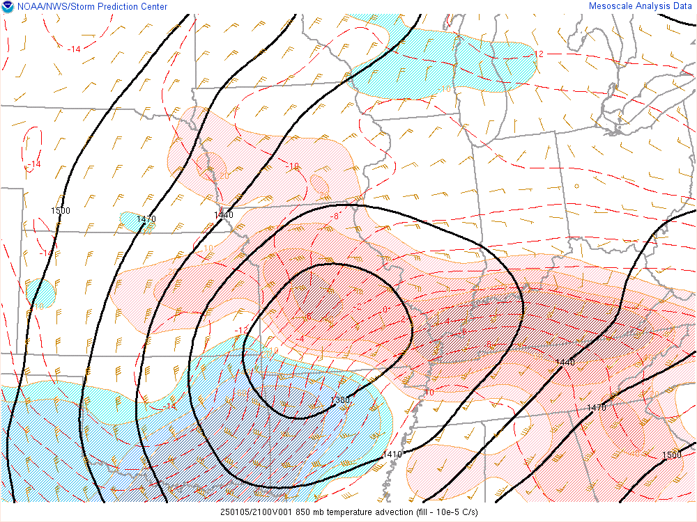
Cold temperatures in the mid and upper 20s were in place across the region on Sunday morning when precipitation began. Initially, it began as snow with intense rates between 1 and 2" per hour across northern KY and southern IN. This was due to strong low to mid level frontogenesis which yielded many snow and sleet totals in the 6 to 9" range. However as a warm surge of low level air moved into the area, it overran the cold air at the surface and changed precipitation to sleet, and then finally prolonged freezing rain. The event then ended on Monday with one last round of snowfall that yielded another 1 to 3" of snowfall.
 |
 |
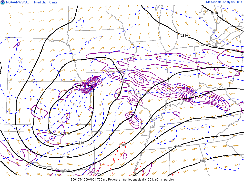 |
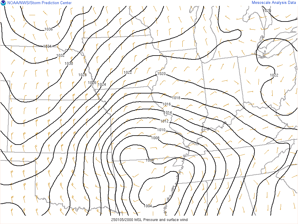
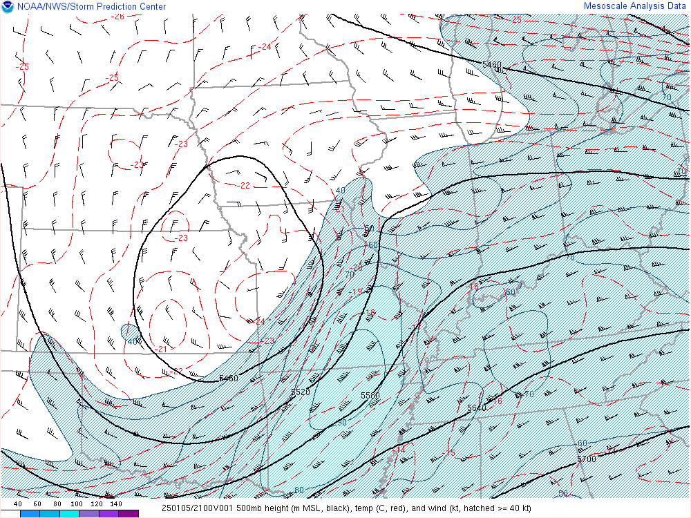
| Figure 1: A strong surface low passed just to the south of KY | Figure 2: A strong mid level low pressure system was also noted, and was the main driver of the last round of snow on Monday. | Figure 3: Mid level frontogenesis showing up nicely over the areas that saw the heaviest snow. |
 |
 |
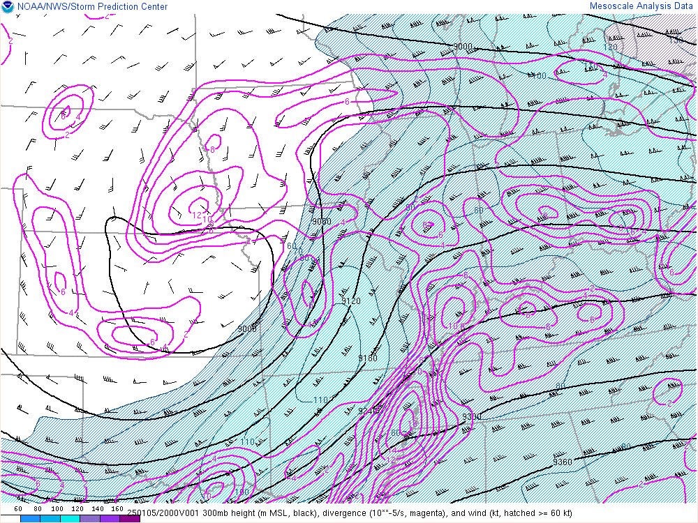 |
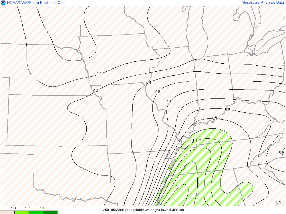
| Figure 4: A warm "nose" of air overran the cold sub-freezing air at the surface to produce mixed precipitation, mainly freezing rain, across almost all of Kentucky later Sunday into Sunday night. Nearly 100,000 folks were without power by Monday morning. | Figure 5: This was an incredibly moist system that held the equivalent of around 1.5 to 2" of liquid equivalent precipitation. This image shows where the deepest moisture resided near the peak of the event. | Figure 6: Additional lift in the atmosphere was provided by a strong upper level jet stream entering the area as well. |
 |
Media use of NWS Web News Stories is encouraged! Please acknowledge the NWS as the source of any news information accessed from this site. |
|


 Weather Story
 Weather Map
 Local Radar