
A prolonged atmospheric river event will continue to bring moderate to heavy rain to northern and central California through the Pacific Northwest with mountain snow in the Cascades and northern Rockies today into next week. Read More >
Louisville, KY
Weather Forecast Office
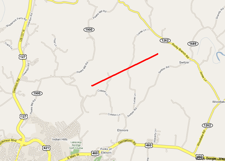
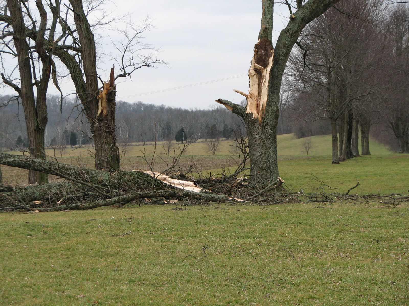
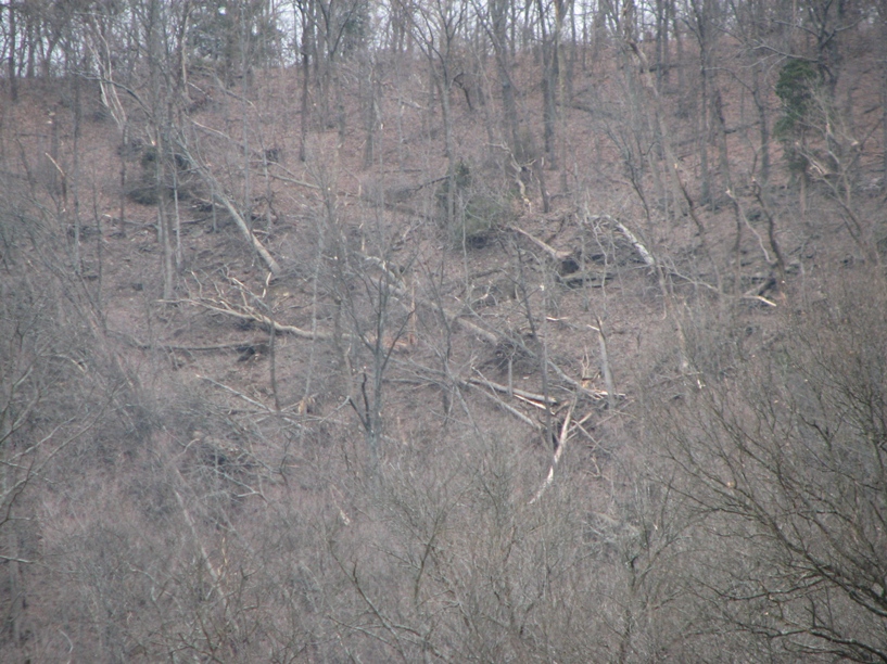
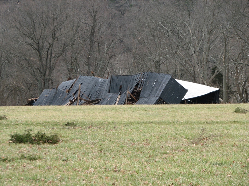
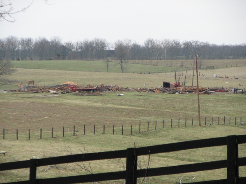
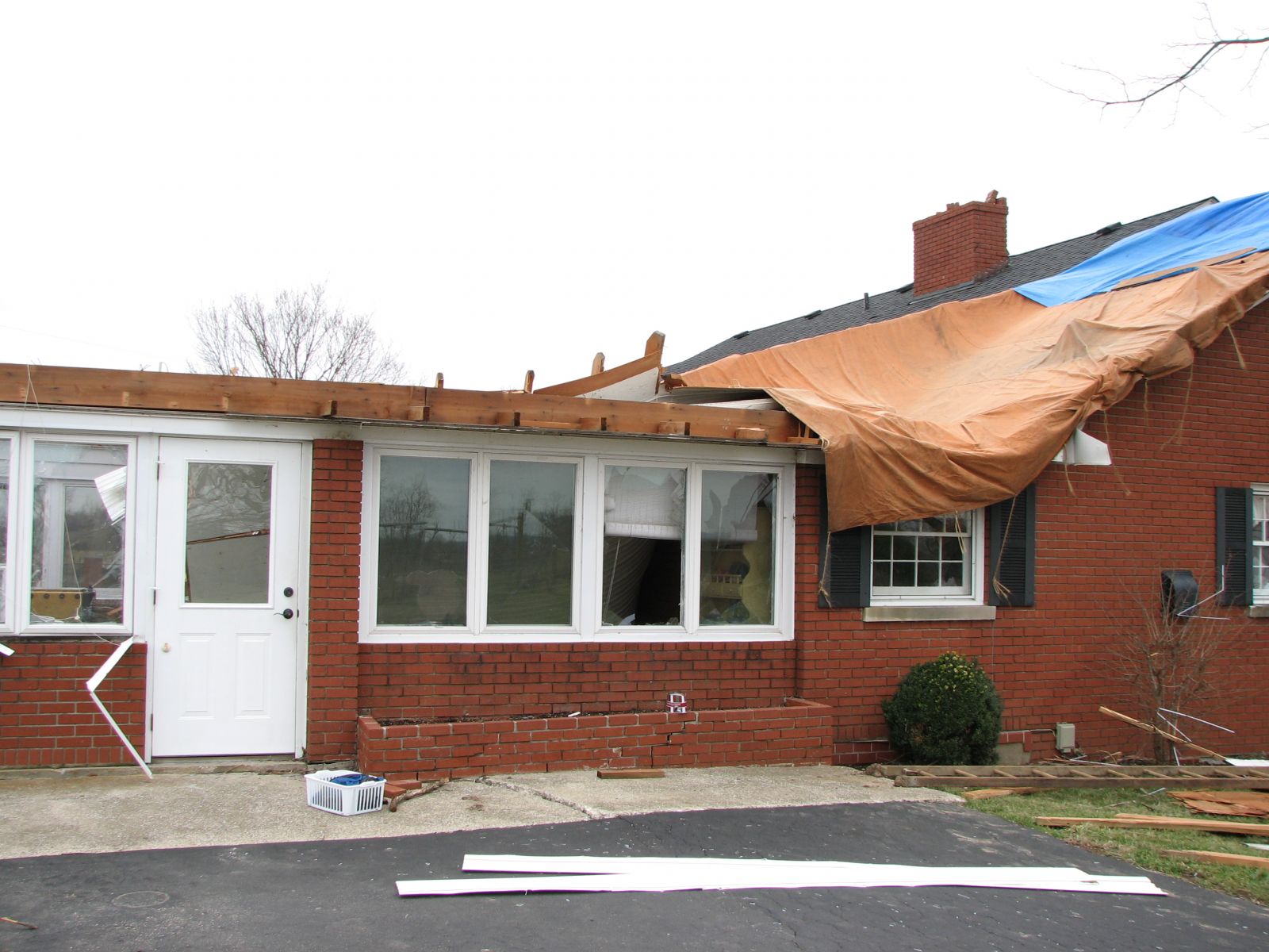
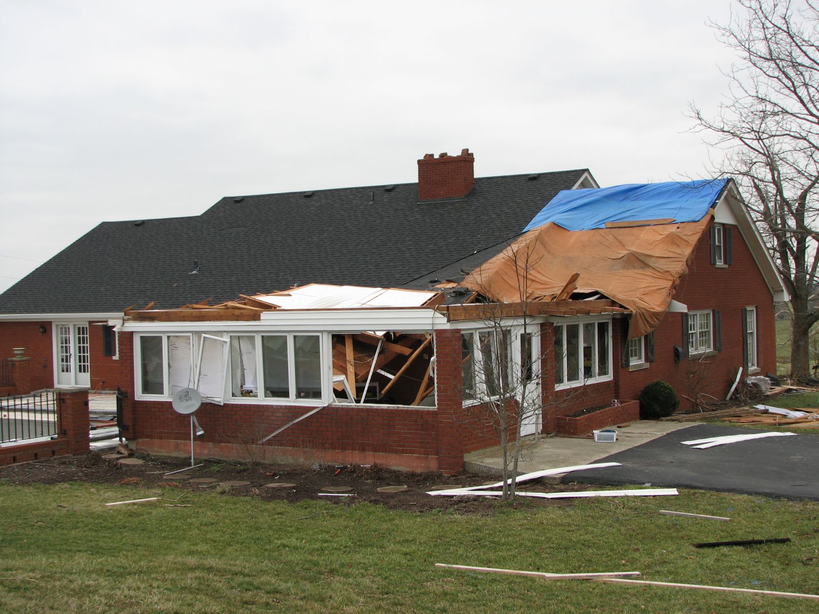
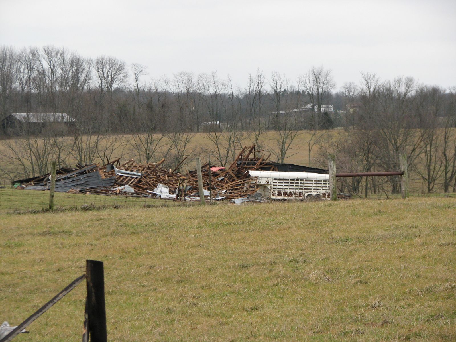
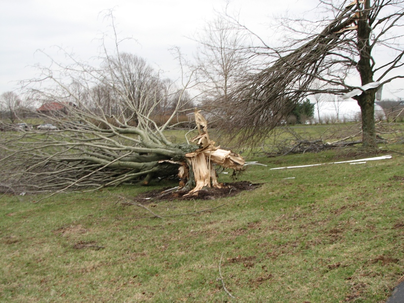
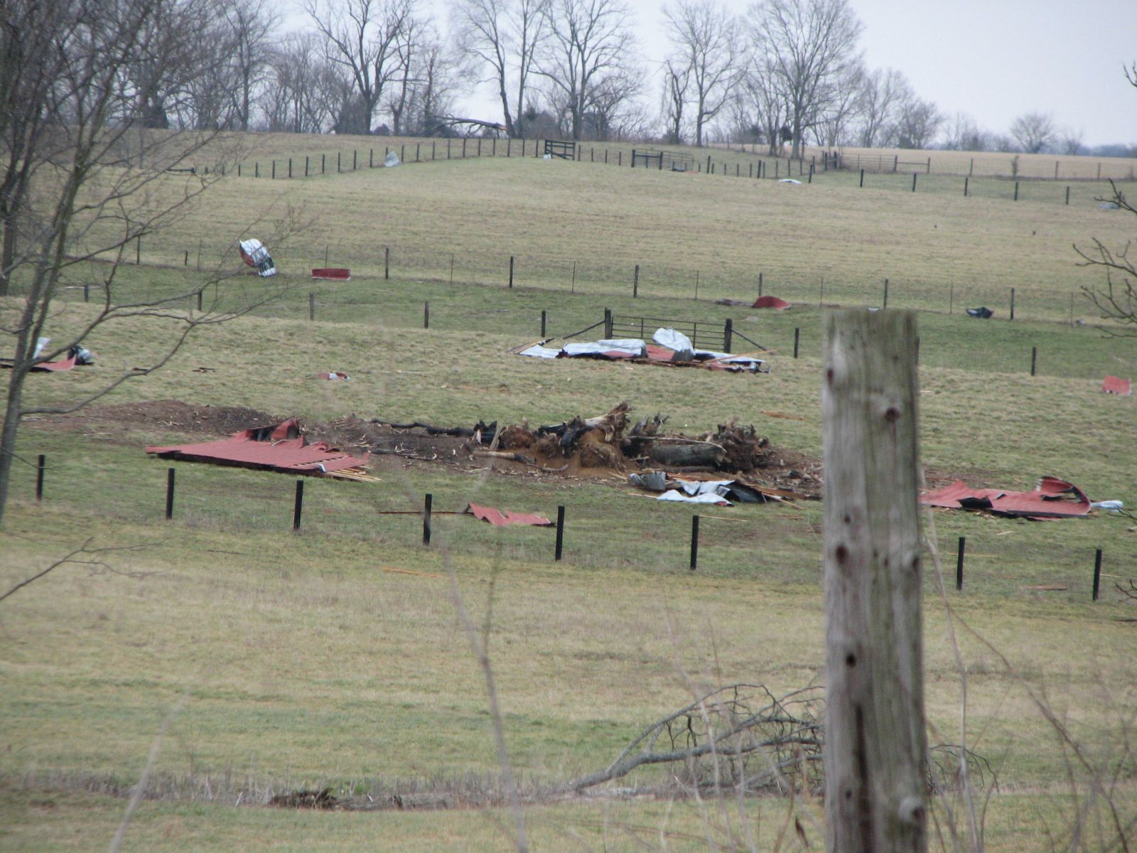
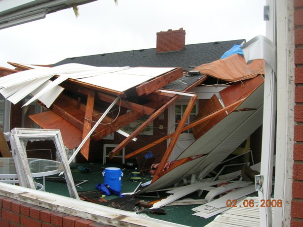
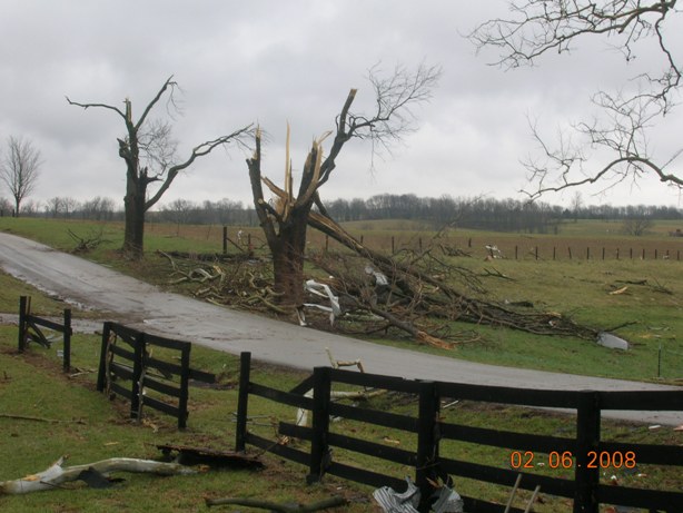
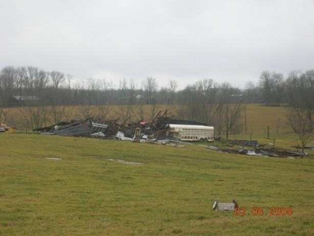
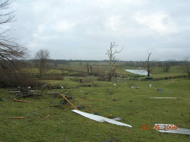
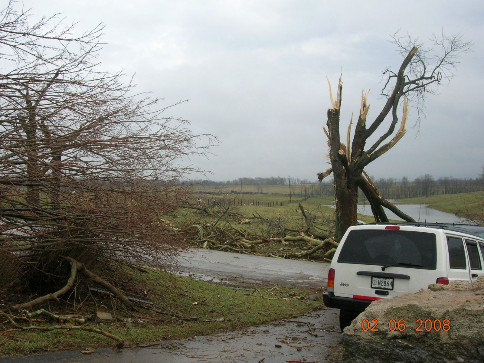
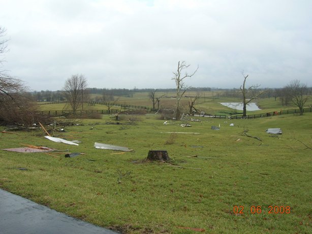
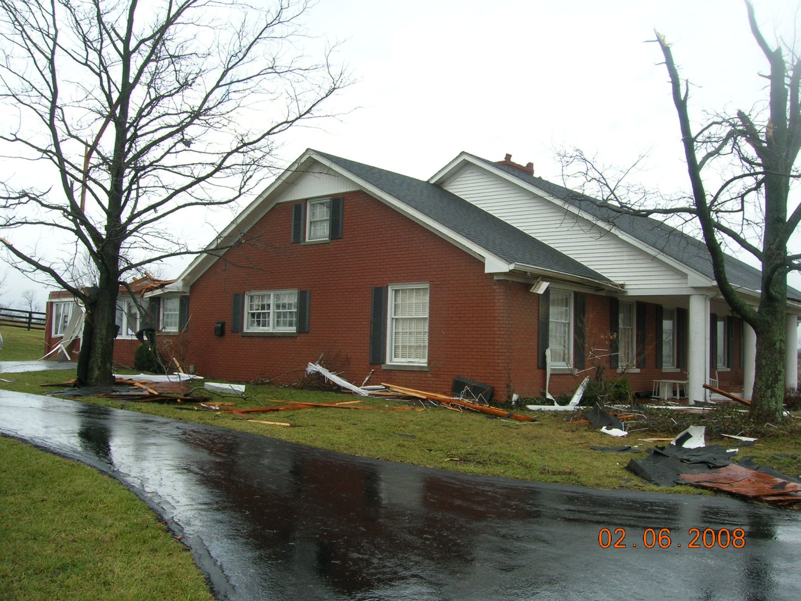
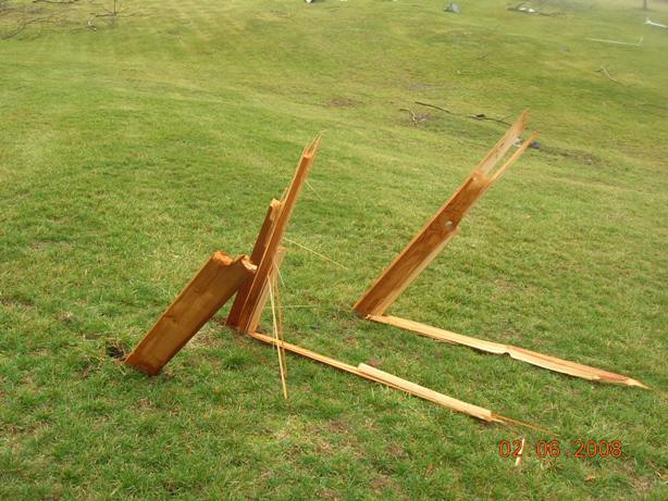
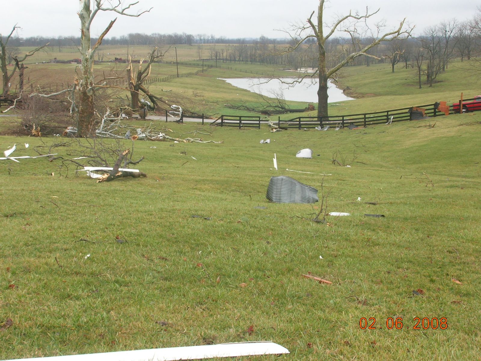
Damage first occurred with 70mph downburst winds west of Steadmantown Lane about a mile north of Frankfort with downed trees and barn damage. The tornado touched down near Elkhorn Creek where it downed many hardwood trees and traveled up a steep ridge. The tornado reached EF1 intensity at the top of the ridge where it blew down many trees. On Lucas Lane, two homes on the west side of the road sustained extensive roof damage, and five barns on the east side of the road were destroyed. The tornado continued to the northeast for another quarter mile through fields before it dissipated.
(Click on the image for a larger version):
 |
 |
 |
 |
 |
 |
 |
 |
 |
 |
The following photos were sent to us by Franklin County Emergency Management:
 |
 |
 |
 |
 |
 |
 |
 |
 |
Click here for radar imagery on this event.
Page updated: 03/16/2008
Current Hazards
Hazardous Weather Outlook
Storm Prediction Center
Submit a Storm Report
Advisory/Warning Criteria
Radar
Fort Knox
Evansville
Fort Campbell
Nashville
Jackson
Wilmington
Latest Forecasts
El Nino and La Nina
Climate Prediction
Central U.S. Weather Stories
1-Stop Winter Forecast
Aviation
Spot Request
Air Quality
Fire Weather
Recreation Forecasts
1-Stop Drought
Event Ready
1-Stop Severe Forecast
Past Weather
Climate Graphs
1-Stop Climate
CoCoRaHS
Local Climate Pages
Tornado History
Past Derby/Oaks/Thunder Weather
Football Weather
Local Information
About the NWS
Forecast Discussion
Items of Interest
Spotter Training
Regional Weather Map
Decision Support Page
Text Products
Science and Technology
Outreach
LMK Warning Area
About Our Office
Station History
Hazardous Weather Outlook
Local Climate Page
Tornado Machine Plans
Weather Enterprise Resources
US Dept of Commerce
National Oceanic and Atmospheric Administration
National Weather Service
Louisville, KY
6201 Theiler Lane
Louisville, KY 40229-1476
502-969-8842
Comments? Questions? Please Contact Us.


 Weather Story
 Weather Map
 Local Radar