Louisville, KY
Weather Forecast Office
April started off with a bang with very warm temperatures and a significant severe weather outbreak. On the second day of the month two waves of severe storms rolled through the area. The first wave, in the morning, produced 6 tornadoes between 8:50am and 9:30am -- a very unusual time of day for tornadic activity. The second wave, in the afternoon and evening, resulted four more twisters including an EF-2 that touched down near the intersection of I-65 and I-265 in southern Indiana and moved east through Prospect, KY and into Oldham County near Buckner. This resulted in 22 injuries, all in Jefferson County, which was the most injuries in a tornado in Jefferson County since the April 3, 1974 Super Outbreak.
Other than some scattered storms with strong gusty winds on the 18th, the remainder of the month was free of severe weather.
There was a period of unusually warm weather from the 14th to the 18th with the temperature rising well into the 80s on those days.
| Average Temperature | Departure from Normal | Precipitation | Departure from Normal | Snow | Departure from Normal | |
| Bowling Green | 62.5° | +3.4° | 5.07" | +0.26" | 0 | -0.1 |
| Frankfort | 59.2° | +2.5° | 5.43" | +0.88" | ||
| Lexington | 59.8° | +3.6° | 4.40" | -0.02" | 0 | -0.2" |
| Louisville Ali | 62.2° | +3.2° | 4.93" | +0.13" | 0 | -0.1" |
| Louisville Bowman | 59.5° | +1.4° | 5.04" | +0.35" |
Records
1st: Warm low of 68° at Bowling Green, warm low of 68° at Frankfort, warm low of 66° at Lexington, warm low of 69° at Louisville
11th: Precipitation of 1.76" at Frankfort
15th: High of 88° at Louisville
6th warmest April on record at Bowling Green
10th warmest April on record at Frankfort
4th warmest April on record at Lexington
5th warmest April on record at Louisville
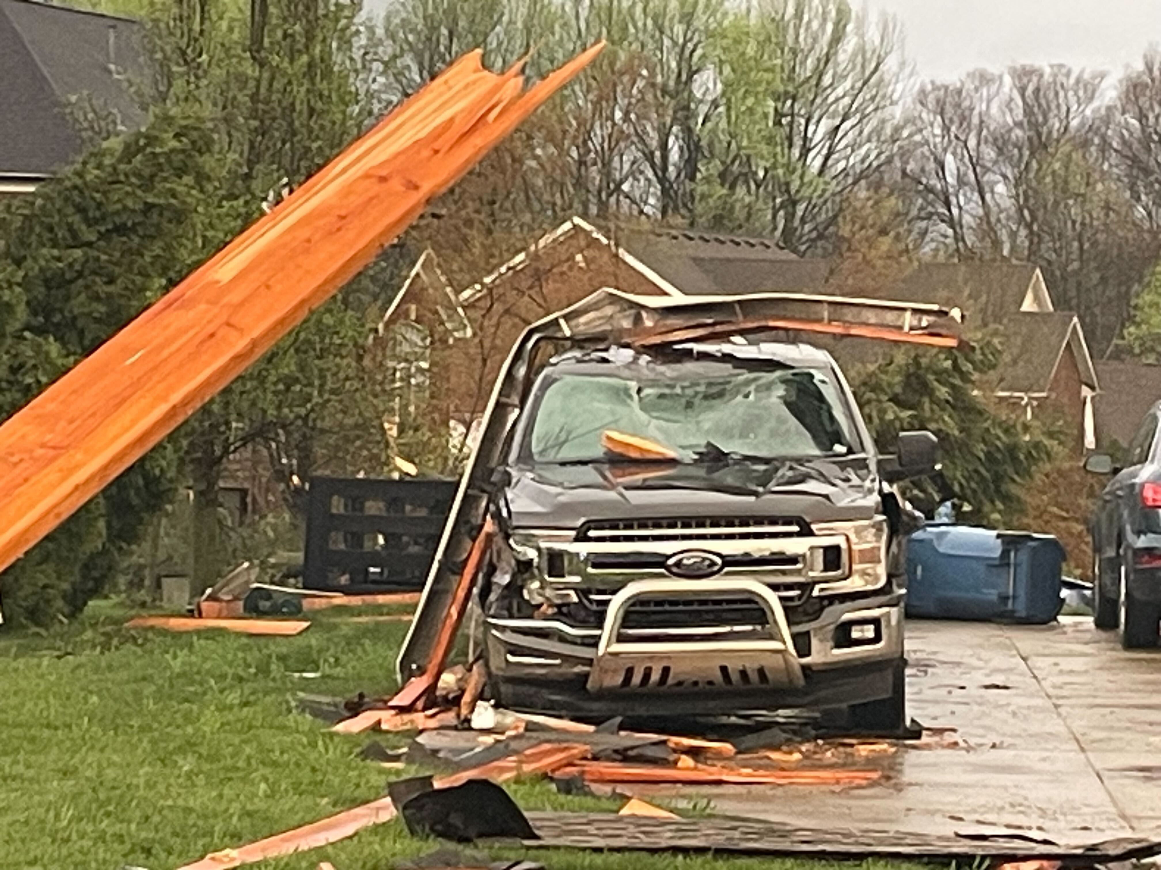
Tornado damage near Buckner on the 2nd.
Current Hazards
Hazardous Weather Outlook
Storm Prediction Center
Submit a Storm Report
Advisory/Warning Criteria
Radar
Fort Knox
Evansville
Fort Campbell
Nashville
Jackson
Wilmington
Latest Forecasts
El Nino and La Nina
Climate Prediction
Central U.S. Weather Stories
1-Stop Winter Forecast
Aviation
Spot Request
Air Quality
Fire Weather
Recreation Forecasts
1-Stop Drought
Event Ready
1-Stop Severe Forecast
Past Weather
Climate Graphs
1-Stop Climate
CoCoRaHS
Local Climate Pages
Tornado History
Past Derby/Oaks/Thunder Weather
Football Weather
Local Information
About the NWS
Forecast Discussion
Items of Interest
Spotter Training
Regional Weather Map
Decision Support Page
Text Products
Science and Technology
Outreach
LMK Warning Area
About Our Office
Station History
Hazardous Weather Outlook
Local Climate Page
Tornado Machine Plans
Weather Enterprise Resources
US Dept of Commerce
National Oceanic and Atmospheric Administration
National Weather Service
Louisville, KY
6201 Theiler Lane
Louisville, KY 40229-1476
502-969-8842
Comments? Questions? Please Contact Us.


 Weather Story
 Weather Map
 Local Radar