Overview
A week with two heavy rain events plus some real gusty winds to close out the weekend.Wind:
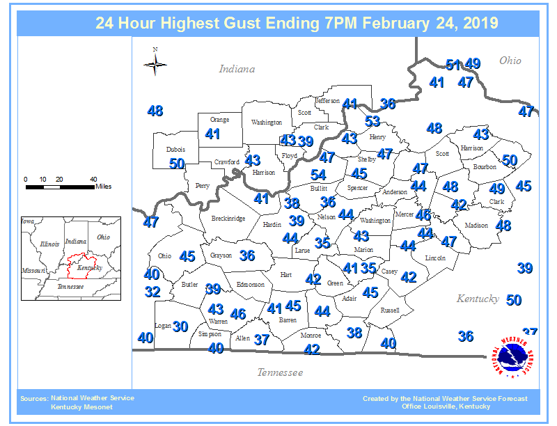
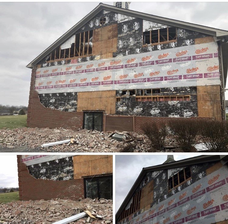
The event ended as a strong cold front crossed the region early Sunday. Winds behind this front cranked to near 50 mph in a few spots, with higher values north of our region, where a High Wind Warning was issued. The map below shows some peak wind gusts for central Kentucky and southern Indiana.
Flooding
Hydrographs
 |
 |
 |
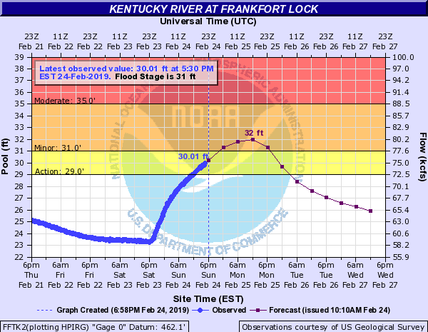 |
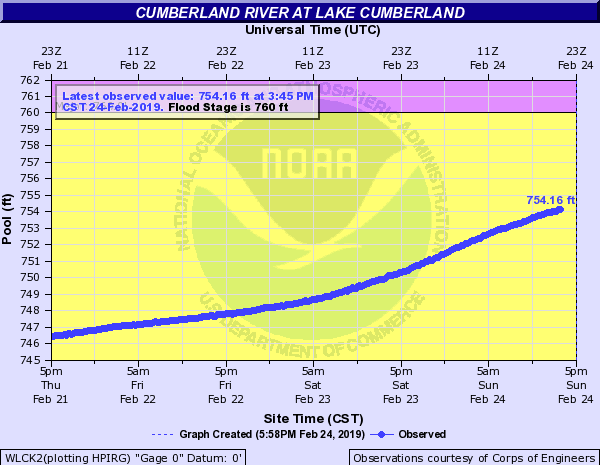
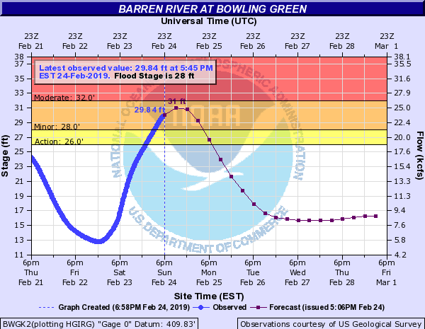
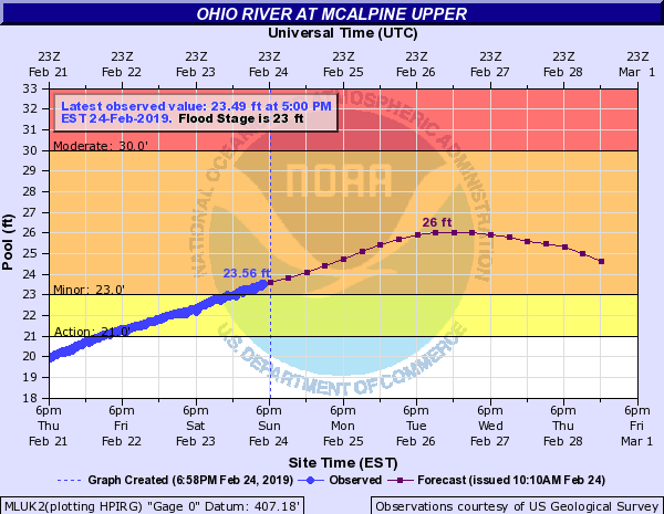
| Lake Cumberland filling up. Dam operators are having to release water into the Cumberland River downstream, prompting an Areal Flood Warning along the river. | Barren River nearing Moderate Flood Stage at Bowling Green, KY | Ohio River in Louisville returning to Minor Flood stage after an earlier trip into flood stage in the middle of February | Kentucky River near Frankfort forecast to rise to flood stage. |
Satellite Interpretation
The latest GOES-East satellite can highlight excessive water well. This series of images shows a "difference" between the visible imagery and vegetation-focused visible imagery for the day following the two heavy rain events and then the next day after that. The last image puts the two images together side by side.
Photos
 |
 |
 |
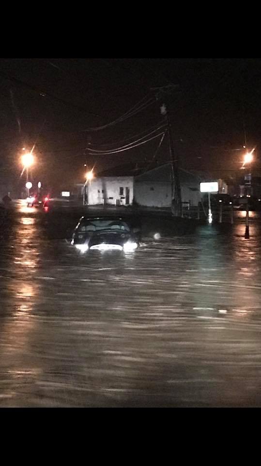 |
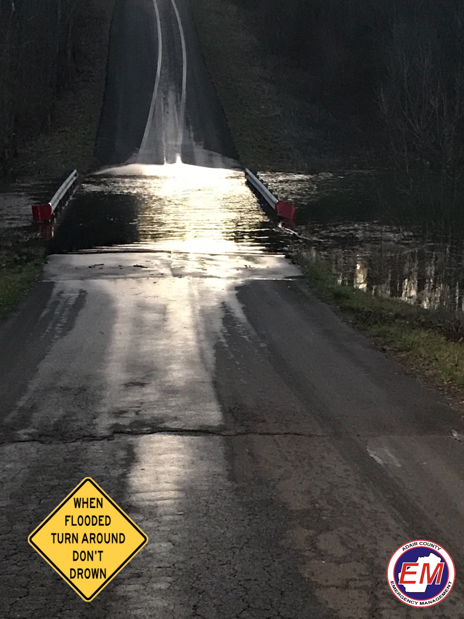
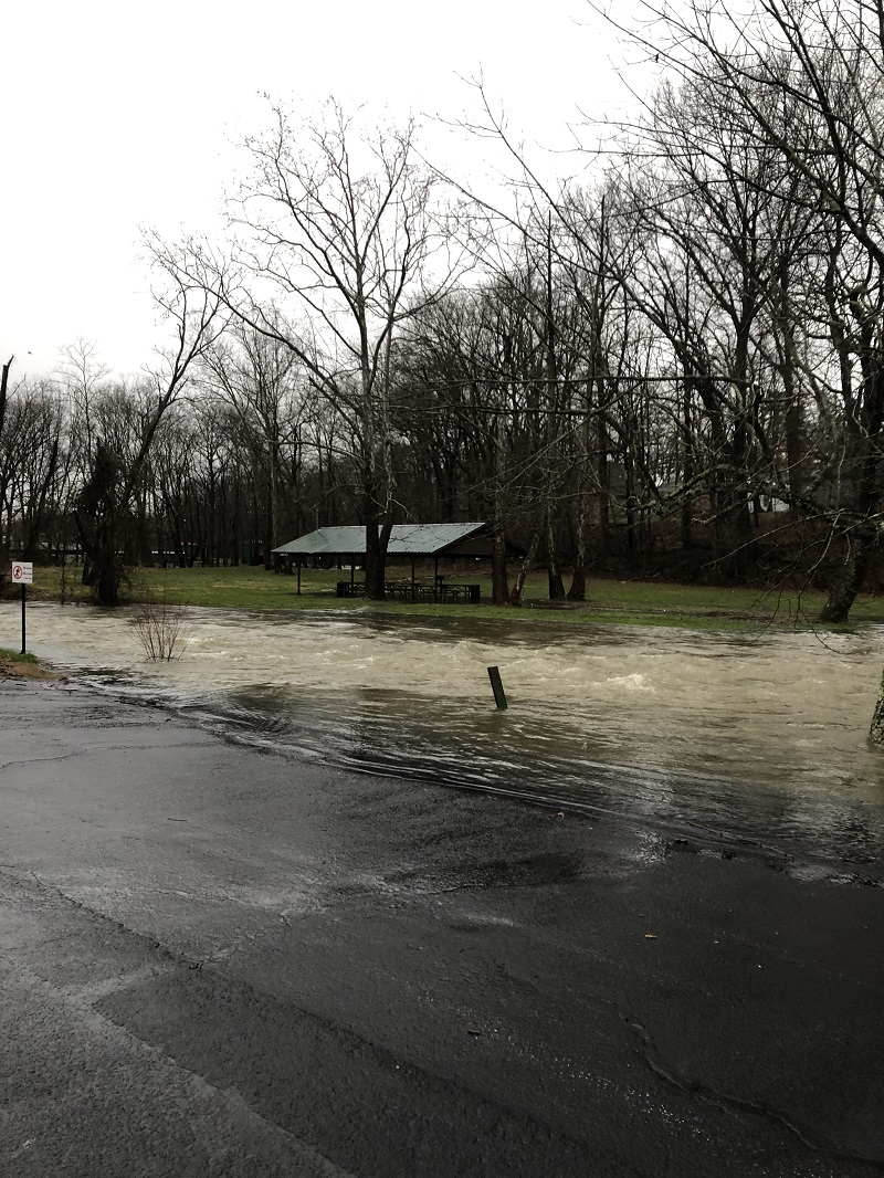
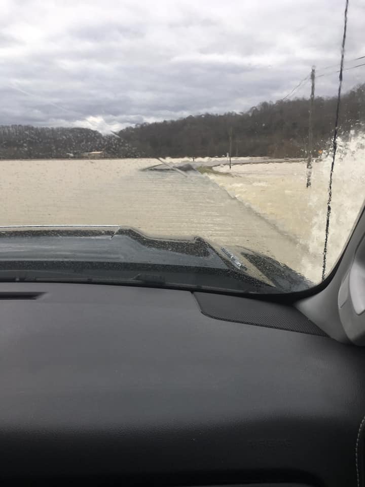
| Flooding on Snake Creek Bridge in Green County (courtesy of Mike Keltner, 2/24/2019) | Flooding on Trace Creek in Campbellsville, KY (courtesy of Ronnie Dooley, 2/20/2019) | Flooding along Goose Creek in Dunnville, KY (courtesy of Crystal Sallee, 2/24/2019) | Flooding along Knob Lick Creek in Yosemite, KY (courtesy of Crystall Sallee, 2/23/2019) |
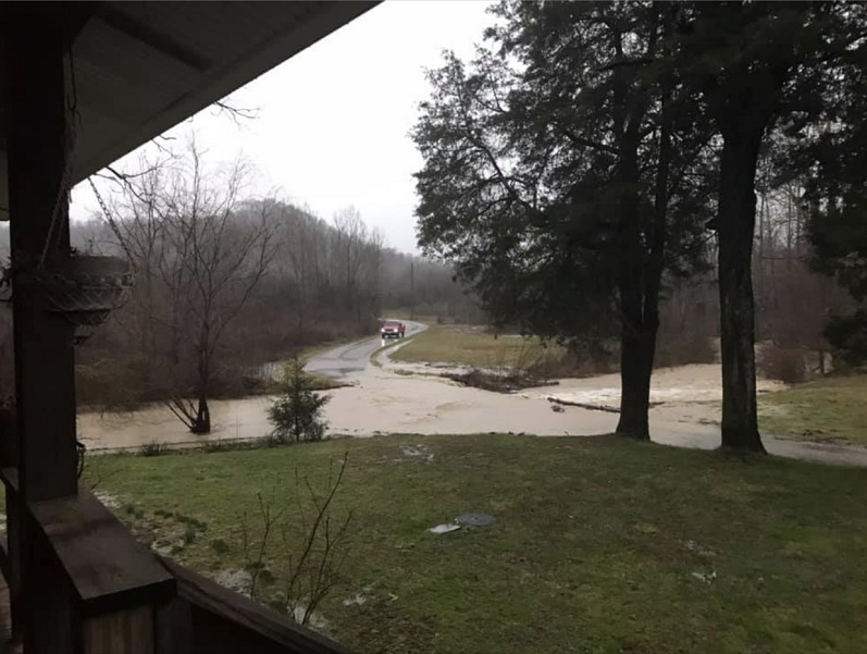 |
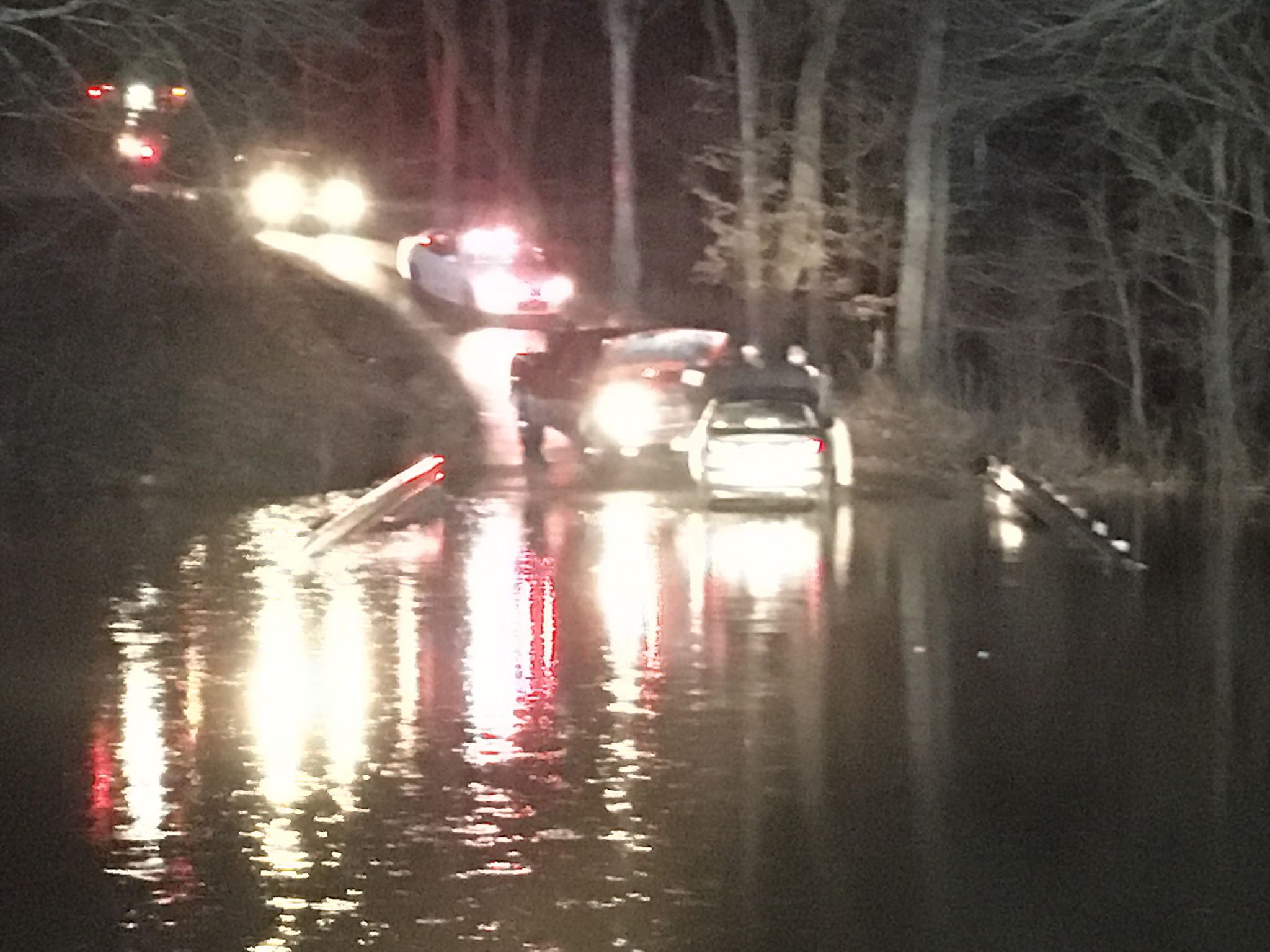 |
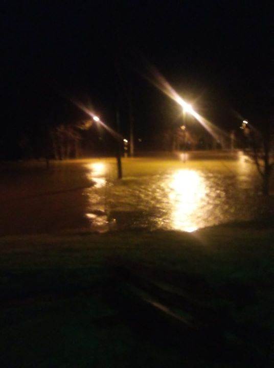 |
 |
| Dry Creek near Atterson, KY (courtesy of Bruce Garber, 2/20/2019) | Marion County, KY (courtesy of Hayden Johnson, 2/20/2019 | Hodgenville, KY (courtesy of Jonathon Upton, 2/23/2019) | Edmonson County, KY (Courtesy of Tim Skees, 2/21/2019) |
 |
 |
 |
|
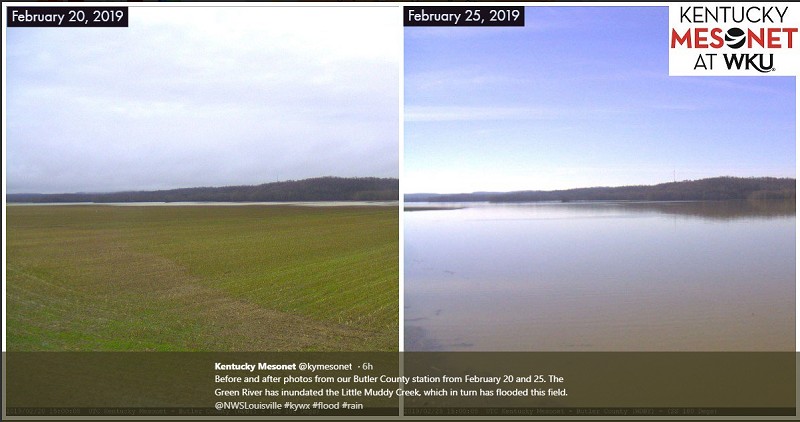
| Non-Thunderstorm Wind Damage in Frankfort, KY 2/24/2019 (courtesy of Justin Harrod) | Non-Thunderstorm Wind Damage in Shelbyville, KY 2/24/2019 (courtesy of Matthew Sparks) | Before and after comparison of the Butler County Kentucky Mesonet site, near Little Muddy Creek off the Barren and Green Rivers | Caption (source) |
Rain Reports
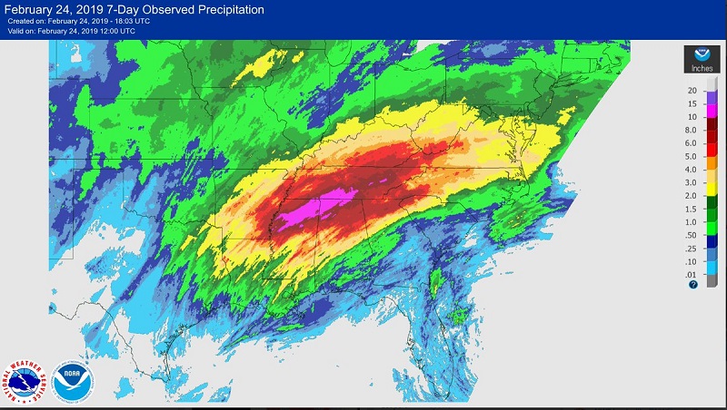
Here is the 7-day observed rainfall:
Zooming in on our area over the past 5 days, here are the observed reports we've collected.
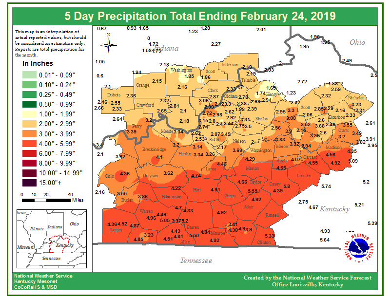
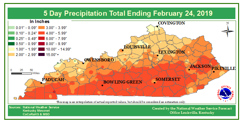
Here is a zoomed out look for 5-day rainfall across Kentucky.
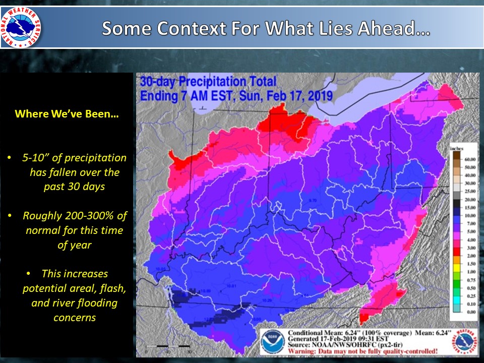
The signal for heavy rainfall was pretty well advertised by many models. Given that we already had a wet period to start the year, ahead of these rains, we were primed for flooding. Here is the set up ahead of the event...showing the previous 30-day rainfall totals.
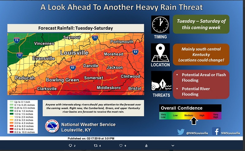
Here is a look at a long-range forecast we issued ahead of the two events.
Environment
Insert synoptic summary.
| Figure 1: Caption | Figure 2: Caption | Figure 3: Caption |
Near-storm environment summary.
| Figure 4: Caption | Figure 5: Caption | Figure 6: Caption |
Additional environmental data.
| Figure 7: Caption | Figure 8: Caption | Figure 9: Caption |
 |
Media use of NWS Web News Stories is encouraged! Please acknowledge the NWS as the source of any news information accessed from this site. |
 |