Overview
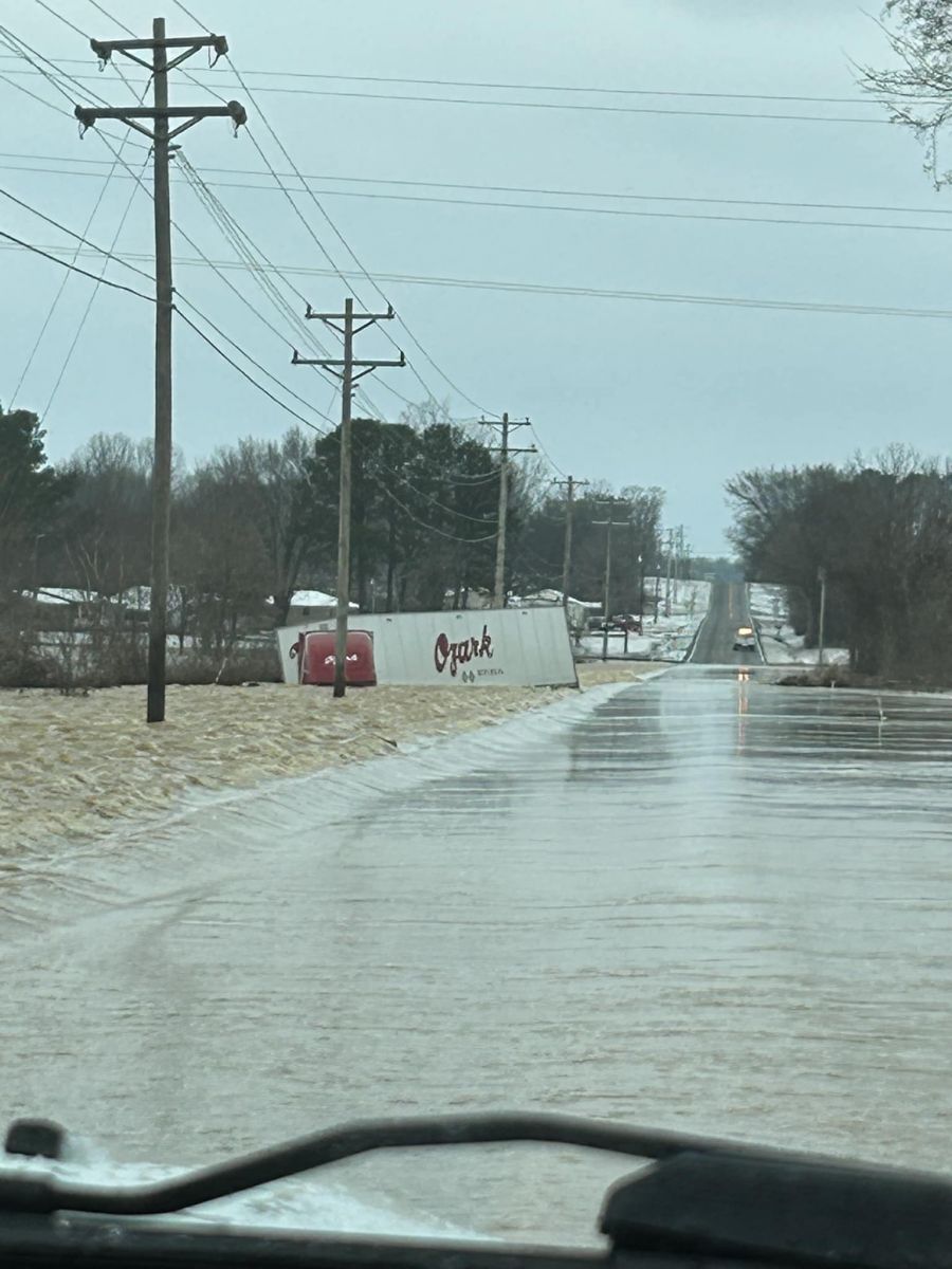
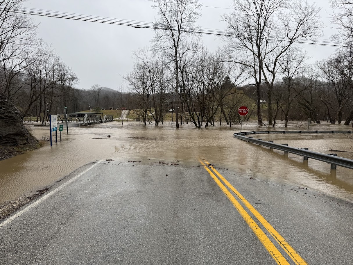
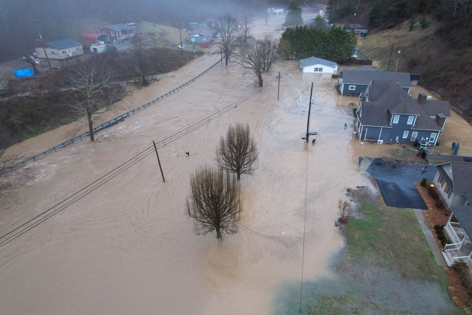
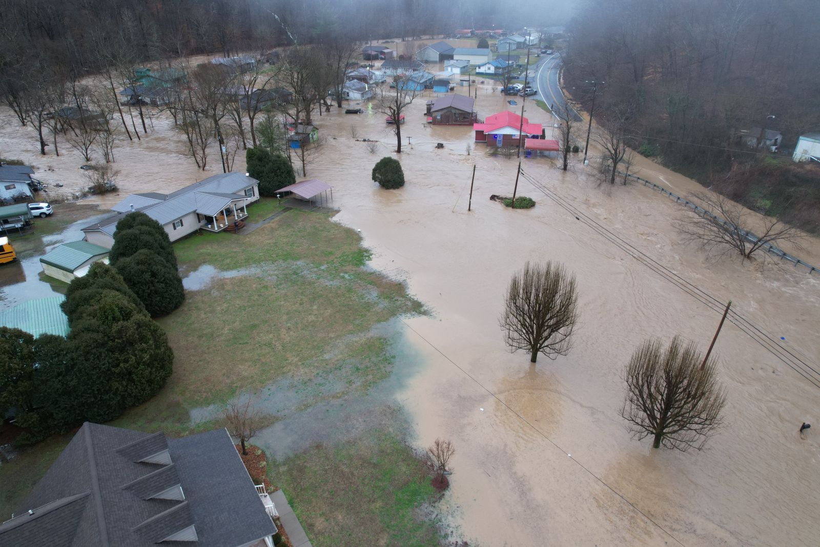
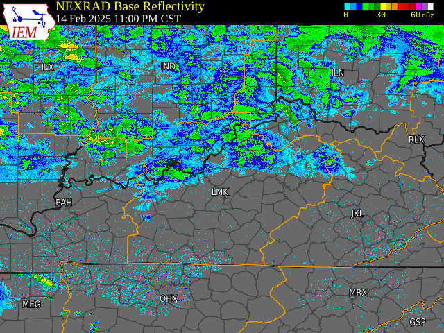
A prolonged period of heavy rain brought widespread flooding to Kentucky during the weekend of February 15th and 16th 2025. Widespread rainfall totals ranging from 2 to 6+ inches occurred, with the highest amounts found from southwest to central portions of the state. The majority of this rain fell from Friday night, February 14th through Saturday, February 15th. At least a dozen river sites had preliminary crests within the top 5 of recorded crests. In addition, a few severe thunderstorms were found across the state bringing large hail and damaging wind gusts.
The National Weather Service Offices issued a total of 30 Flood Warnings and 47 Flash Flood Warnings. There were also 11 Severe Thunderstorm Warnings and 2 Tornado Warnings. The Weather Prediction Center even issued a rare High Risk for Excessive Rainfall for Saturday, February 15th. This High Risk was issued on the Day 2 and the Day 1 forecast. The impacts were felt across the state with 300+ road closures, 40,000+ without power, and over 1,000 water rescues have been performed. There were reports of evacuation of a hospital, nursing home, and apartment complex. The Weather Forecast Office in Jackson, KY were required to shelter in place on generator power when a flooded road cut off their exit route.
Flooding
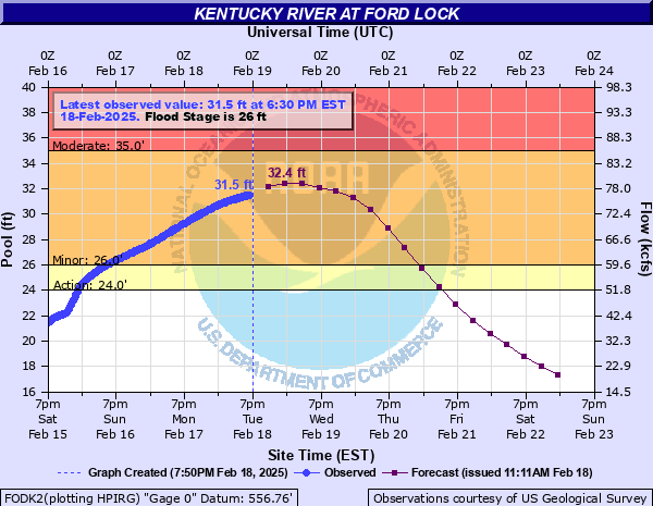
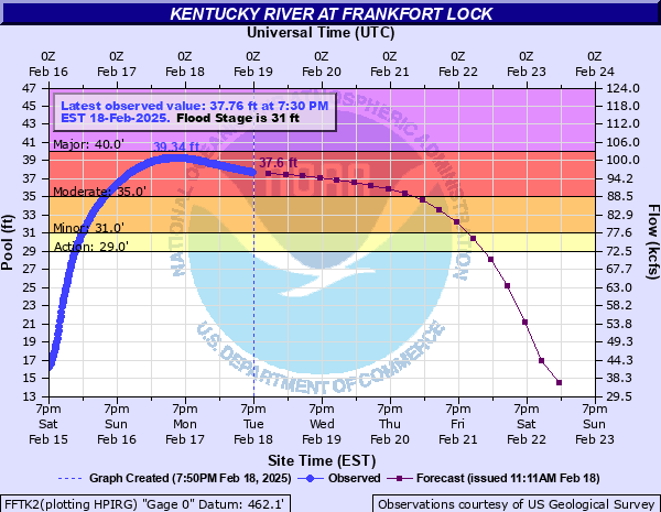
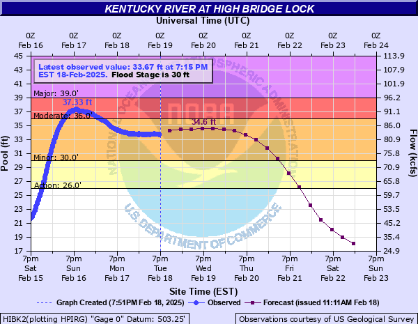
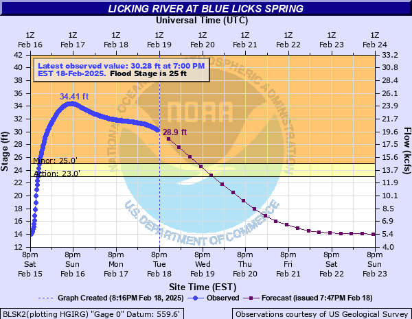
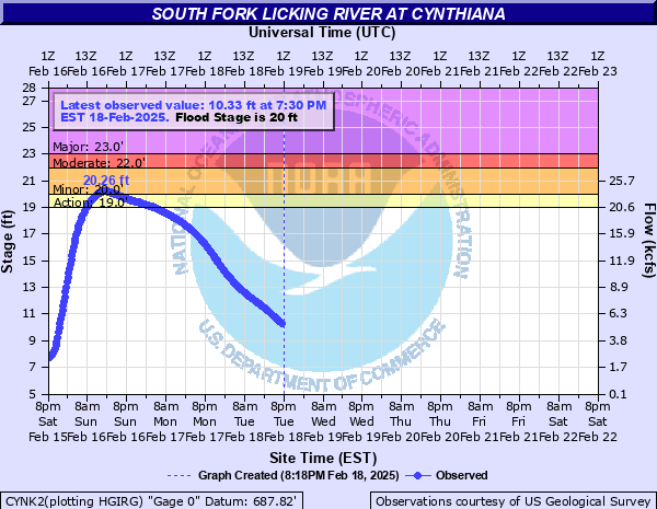
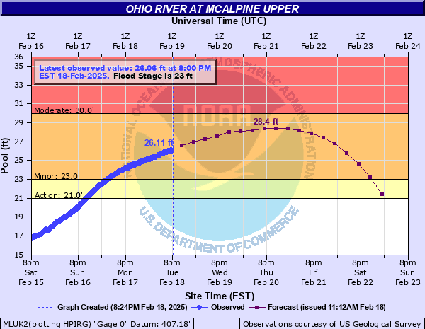
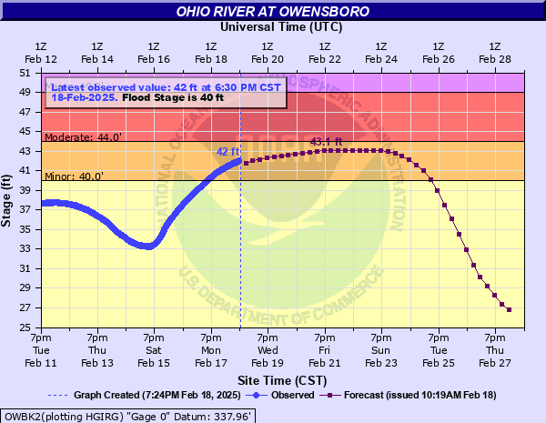
Below are observed hydrographs for select rivers in Kentucky.
Hydrographs
Barren River | Creeks | Cumberland River | Dix River | Green River | Kentucky River | Levisa Fork | Licking River | Little River | Little Sandy River | Mississippi River | Ohio River | Red River | Rolling Fork River | Rough River | Salt River | Tug Fork River
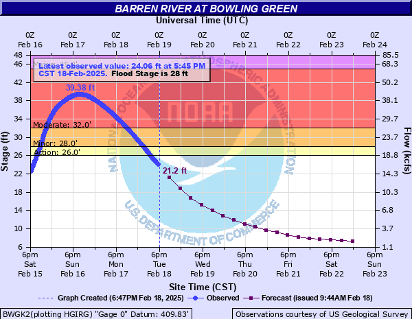 |
| Barron River Near Bowling Green |
 |
 |
 |
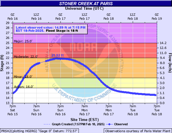 |
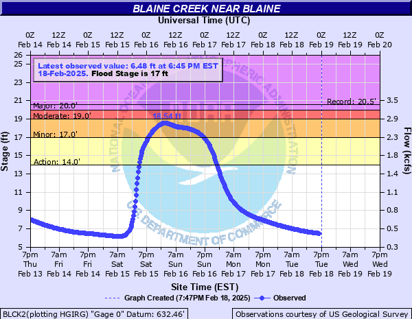
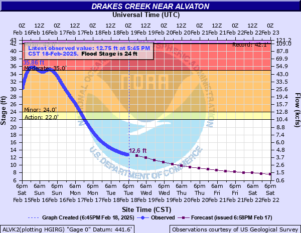
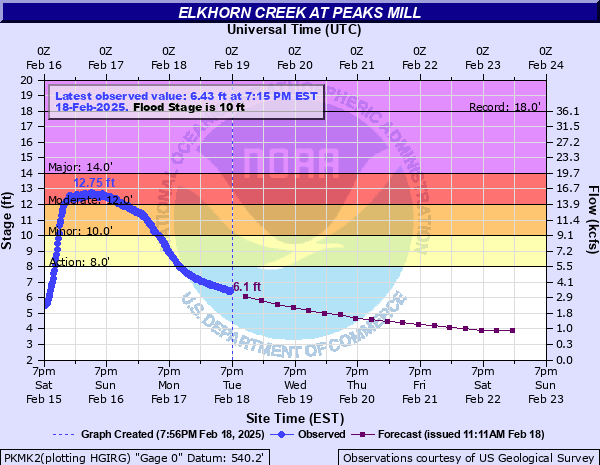
| Blaine Creek Near Blaine | Drakes Creek Near Alvaton | Elkhorn Creek Near Peaks Mill | Stoner Creek Near Paris |
 |
 |
 |
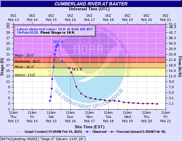 |
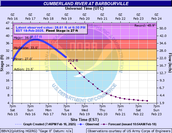
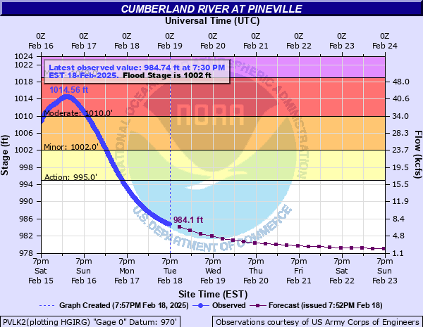
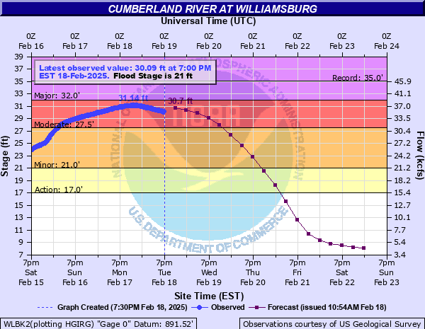
| Cumberland River Near Barbourville | Cumberland River Near Pineville | Cumberland River Near Williamsburg | Cumberland River Near Baxter |
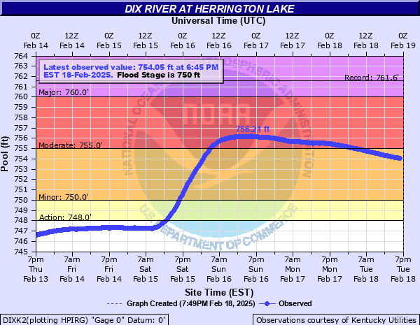 |
| Dix River Near Herrington Lake |
 |
 |
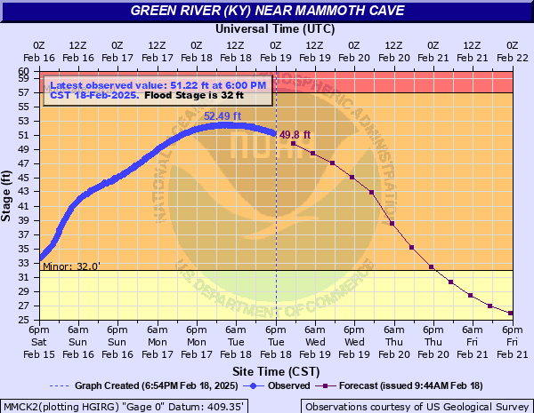 |
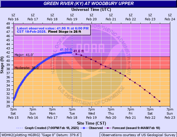
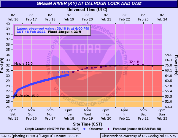
| Green River Above Woodbury Upper | Green River Near Calhoun Lock and Dam | Green River Near Mammoth Cave |
 |
 |
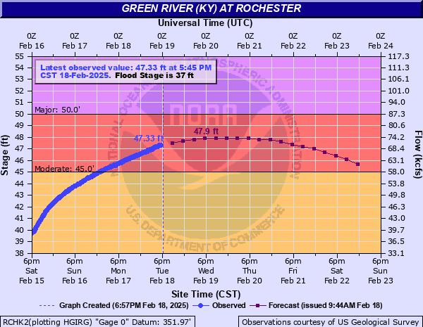 |
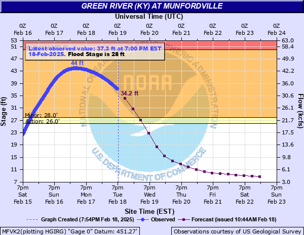
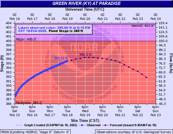
| Green River Near Munfordville | Green River Near Paradise | Green River Near Rochester |
 |
 |
 |
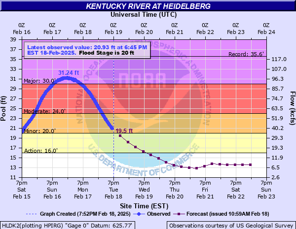 |
| Kentucky River Near Camp Nelson | Kentucky River Near Ford Lock | Kentucky River Near Frankfort Lock | Kentucky River Near Heidelberg |
 |
 |
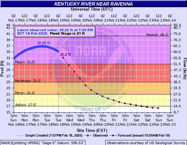 |
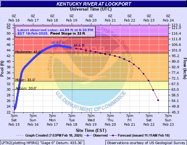
| Kentucky River Near High Bridge Lock | Kentucky River Near Lockport | Kentucky River Near Ravenna |
 |
 |
 |
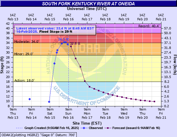 |
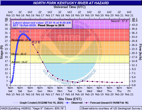
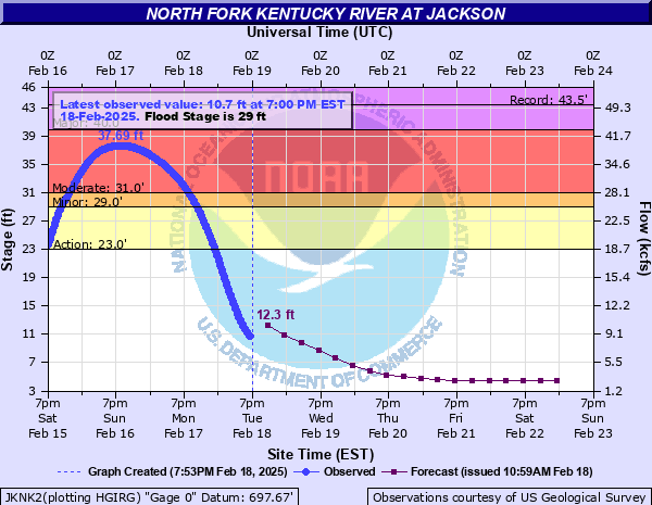
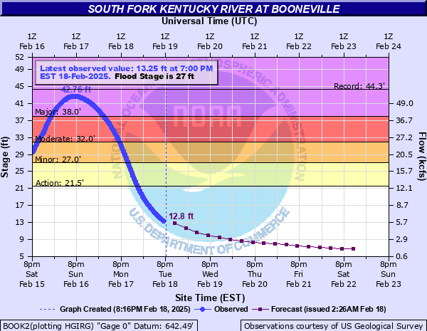
| North Fork Kentucky River Near Hazard | North Fork Kentucky River Near Jackson | South Fork Kentucky River Near Booneville | South Fork Kentucky River Near Oneida |
 |
 |
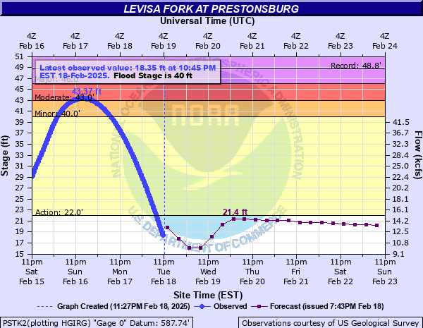 |
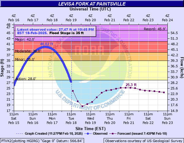
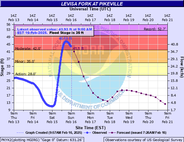
| Levisa Fork Near Paintsville | Levisa Fork Near Pikeville | Levisa Fork Near Prestonsburg |
 |
 |
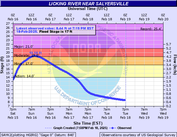 |
| Licking River Near Blue Licks Spring | Licking River Near Cynthiana | Licking River Near Salyersville |
 |
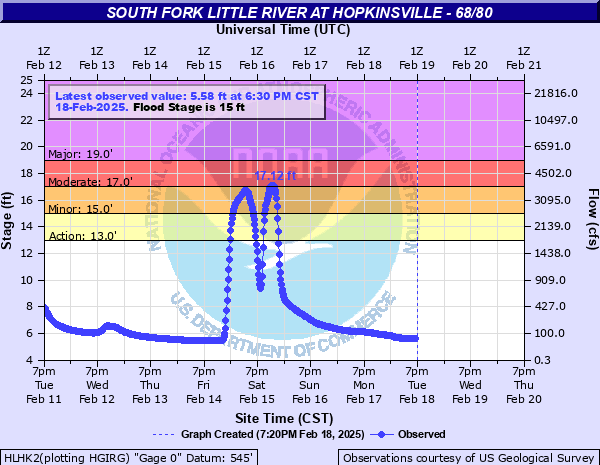 |
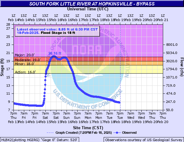
| South Fork Little River Near Hopkinsville | South Fork Little River Near Hopkinsville 60/80 |
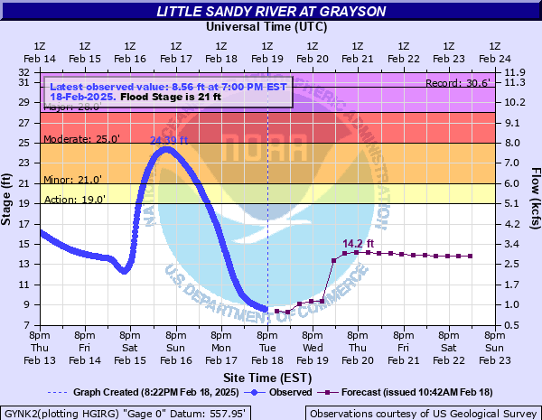 |
| Little Sandy River Near Grayson |
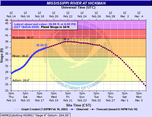 |
| Mississippi River Near Hickman |
 |
 |
 |
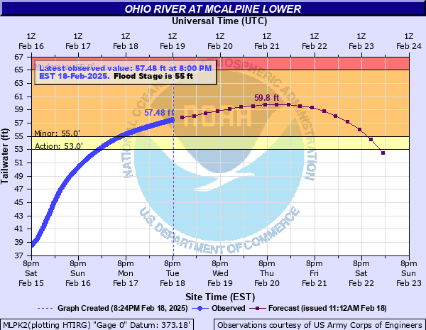 |
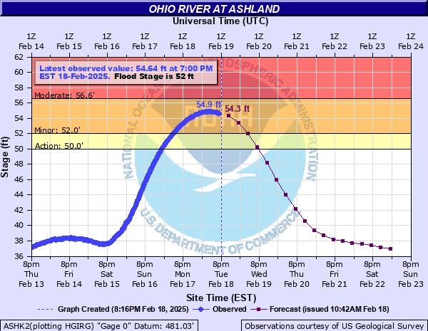
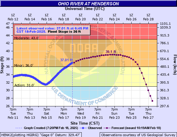
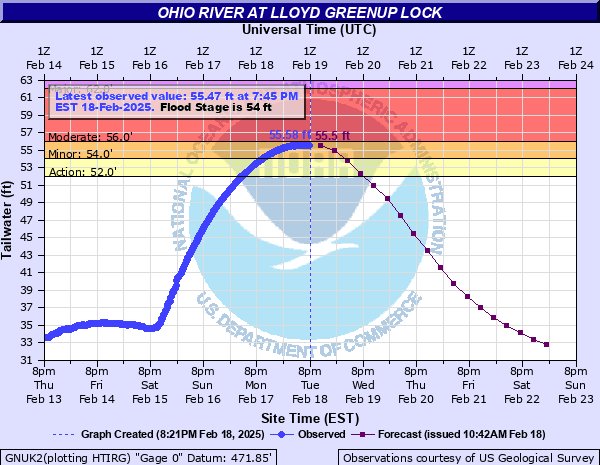
| Ohio River Near Ashland | Ohio River Near Henderson | Ohio River Near Lloyd Greenup Lock | Ohio River Near McAlpine Lower |
 |
 |
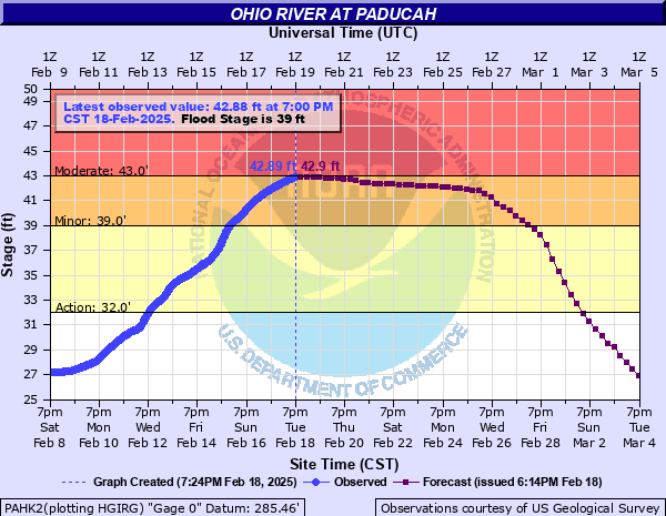 |
| Ohio River Near McAlpine Upper | Ohio River Near Owensboro | Ohio River Near Paducah |
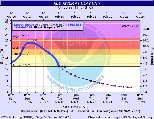 |
| Red River Near Clay City |
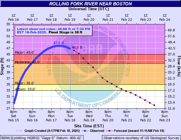 |
| Rolling Fork River Near Boston |
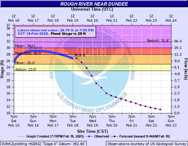 |
| Rough River Near Dundee |
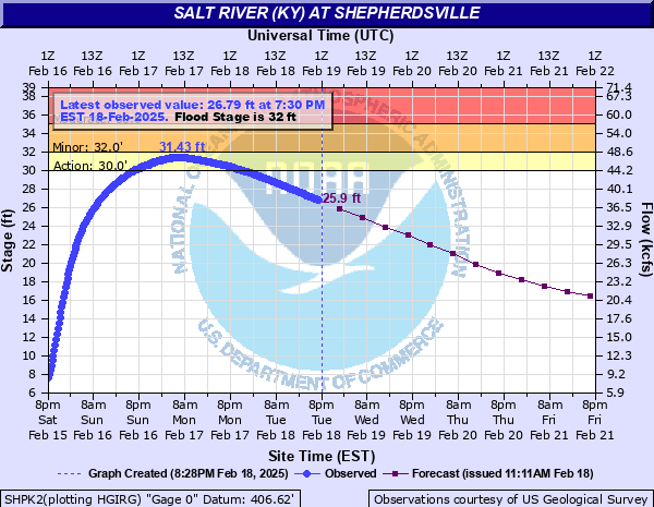 |
| Salt River Near Shephersville |
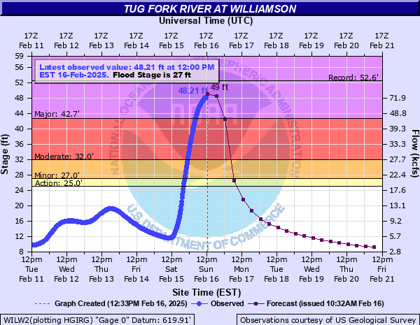 |
| Tug Fork River Near Williamson (West Virginia) |
Records
The preliminary data shows several river gauges were within their top 5 highest recorded river crests. See the table below for more details.
| Site | February 2025 Peak Crest (Date) | Preliminary Rank of February 2025 Crest | Record Crest (Date) |
| South Fork Little River at Hopkinsville | 20.16 ft (February 15th 2025) | 3 | 21.35 ft (July 7th 2016) |
| Tug Fork River at Williamson (West Virginia) | 48.35 ft (February 16th 2025) | 2 | 52.56 ft (April 5th 1977) |
| Cumberland River at Pineville | 1014.56 ft (February 16th 2025) | 4 | 1021.80 ft (April 5th 1977) |
| South Fork Kentucky River at Oneida | 34.30 ft (February 16th 2025) | 4 | 40.43 ft (June 28th 1947) |
| South Fork Kentucky River at Booneville | 41.95 ft (February 16th 2025) | 3 | 44.33 ft (March 1st 2021) |
| Cumberland River at Baxter | 24.50 ft (February 15th 2025) | 5 | 34.20 ft (April 4th 1977) |
| Levisa Fork at Pikeville | 46.68 ft (February 16th 2025) | 5 | 52.72 ft (January 30t 1957) |
| Middle Fork Kentucky River at Hyden | 28.83 ft (February 15th 2025) | 2 | 33.30 ft (January 29th 1957) |
| Cutshin Creek at Wooton | 15.21 ft (February 15th 2025) | 4 | 19.43 (January 1st 1957) |
| Goose Creek at Machester | 30.78 ft (February 15th 2025) | 5 | 40.60 ft (June 28th 1947) |
| Russell Fork at Elkhorn City | 19.86 ft (February 15th 2025) | 5 | 24.80 ft (April 4th 1977) |
| Sturgeon Creek at Cressmont | 16.42 ft (February 15th 2025) | 4 | 20.34 ft (March 1st 2021) |
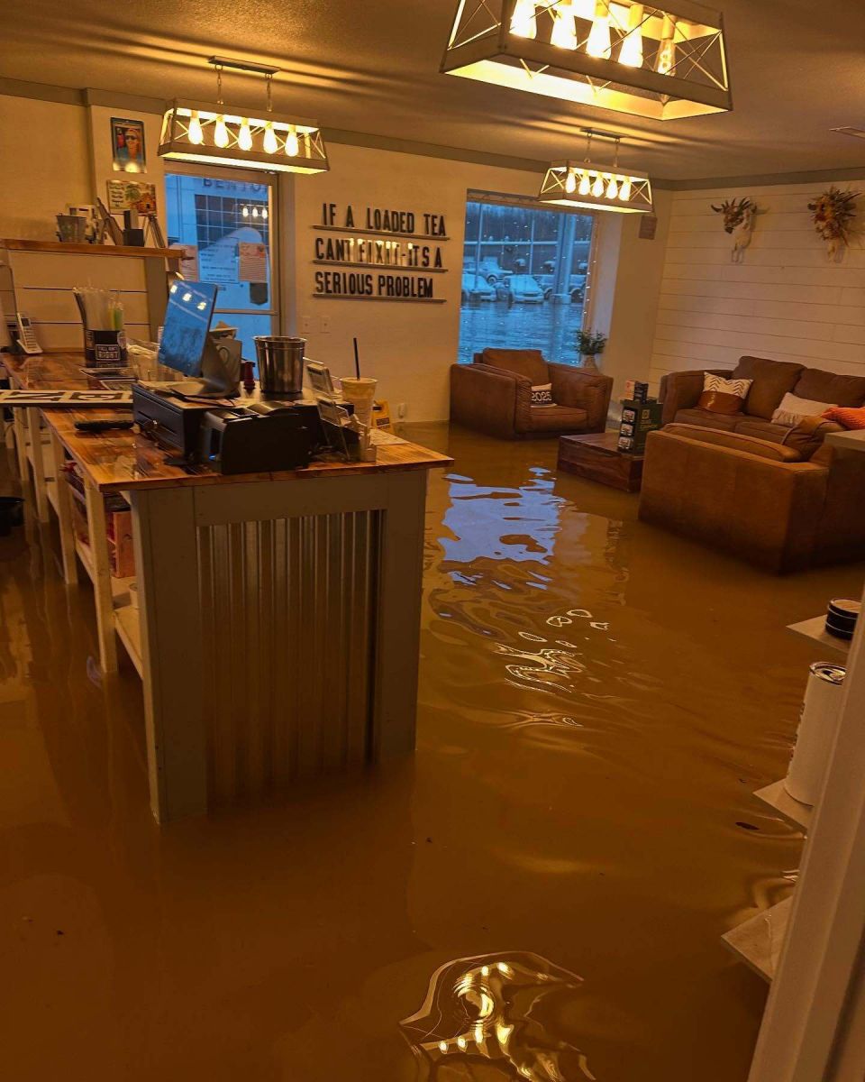
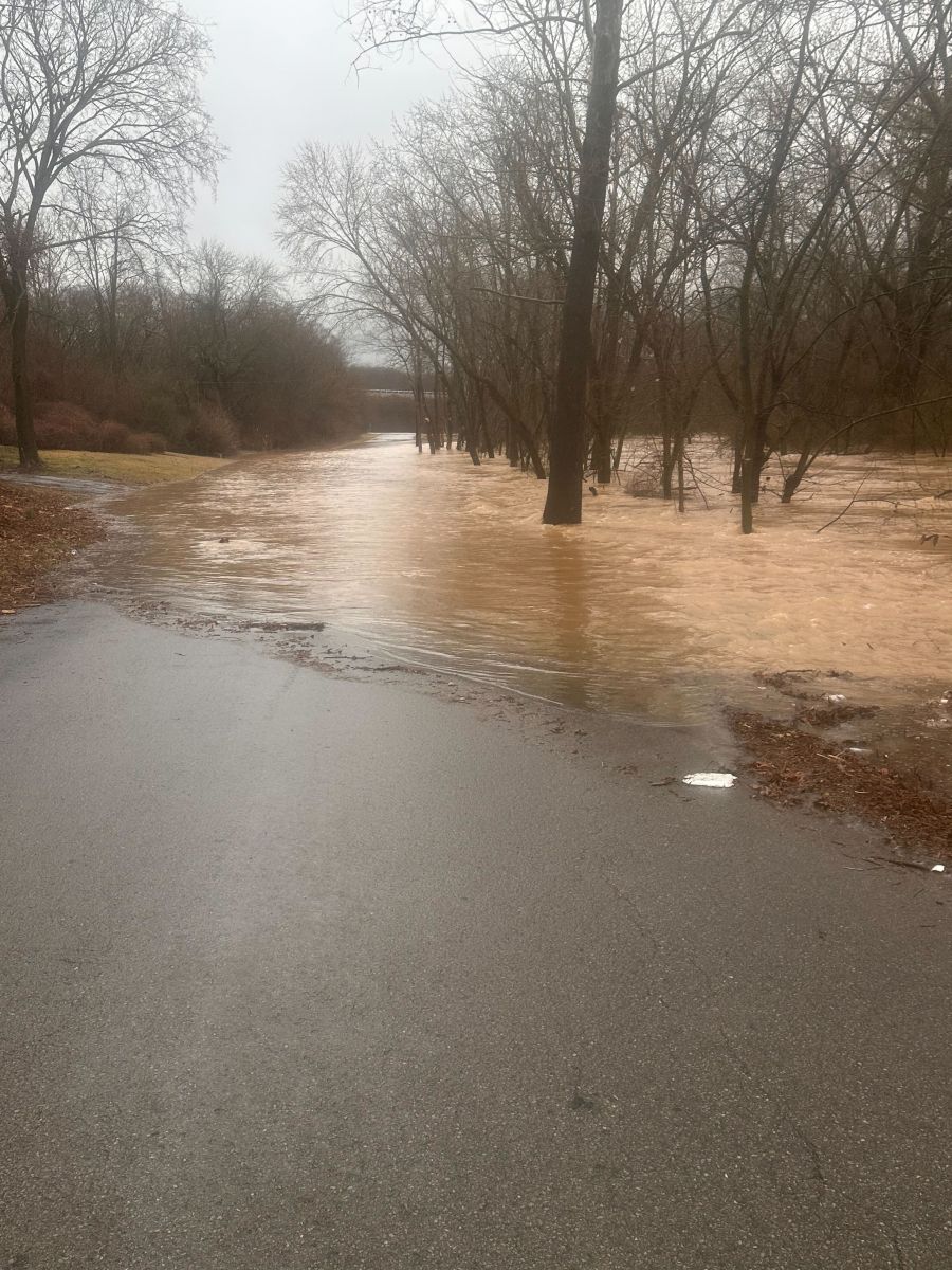
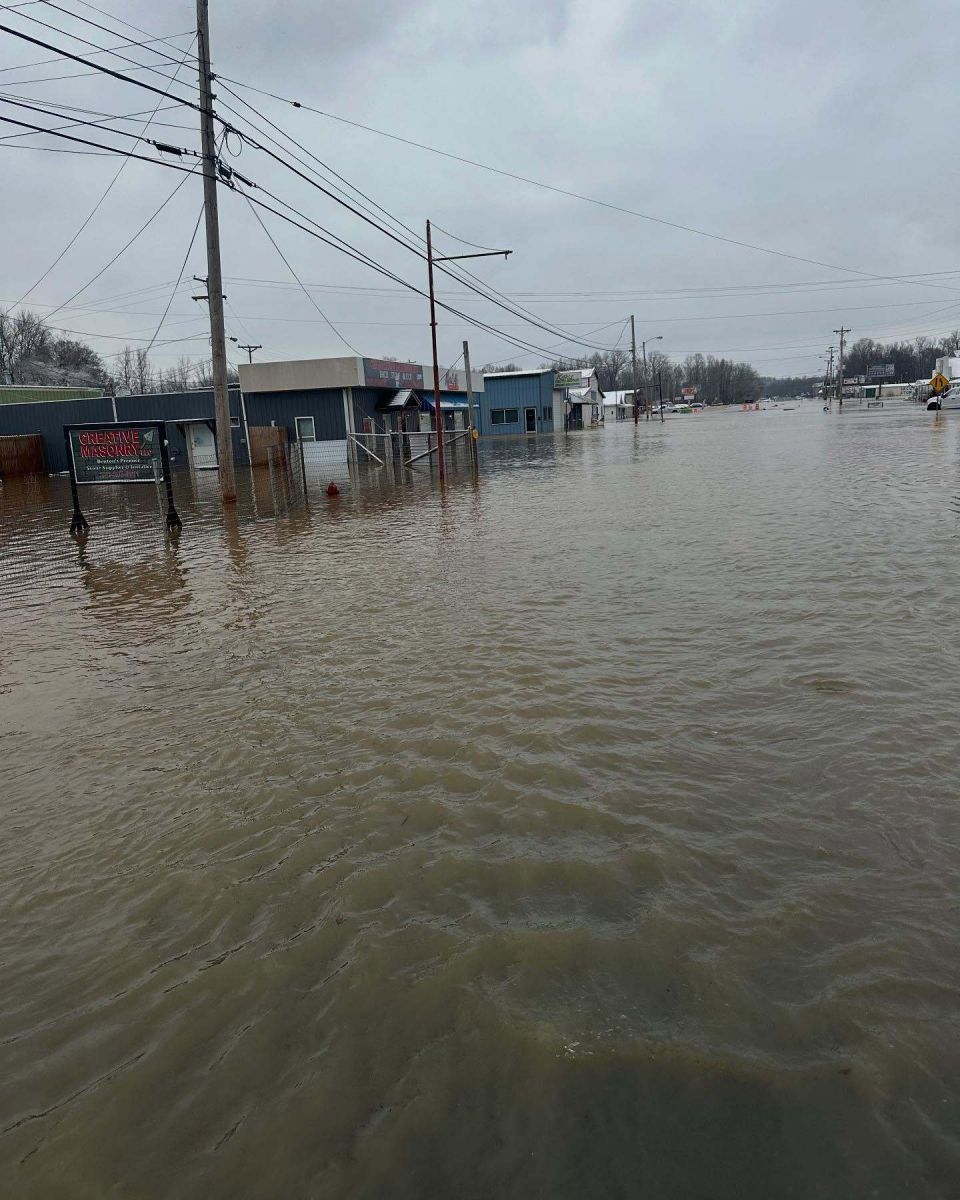
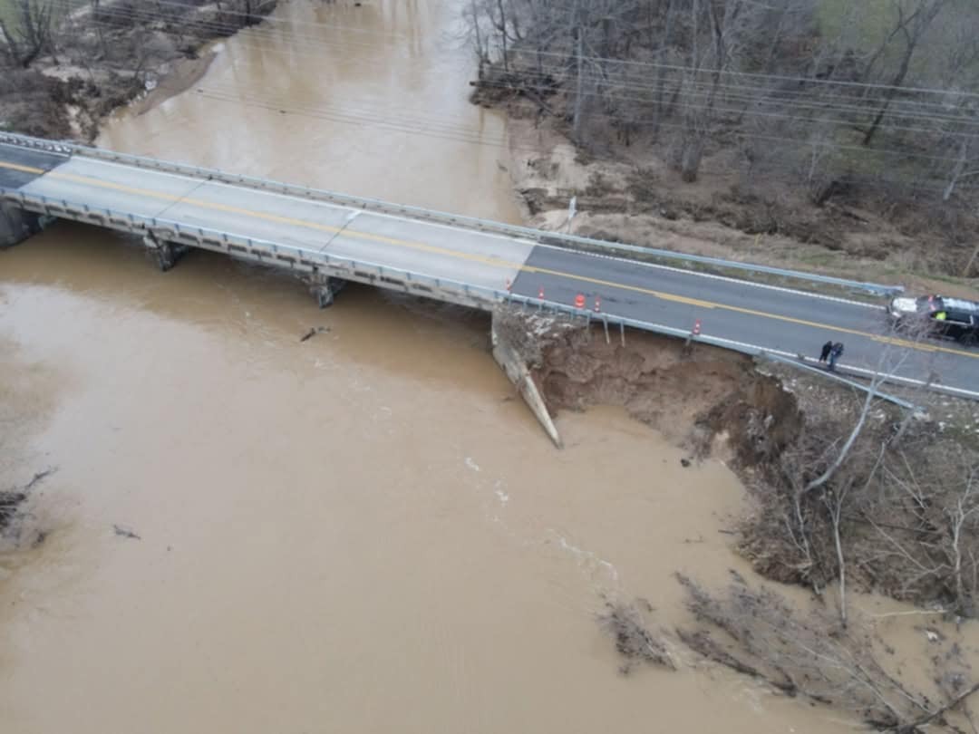
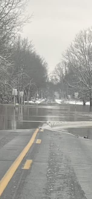
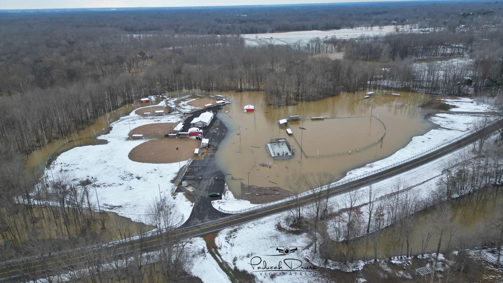
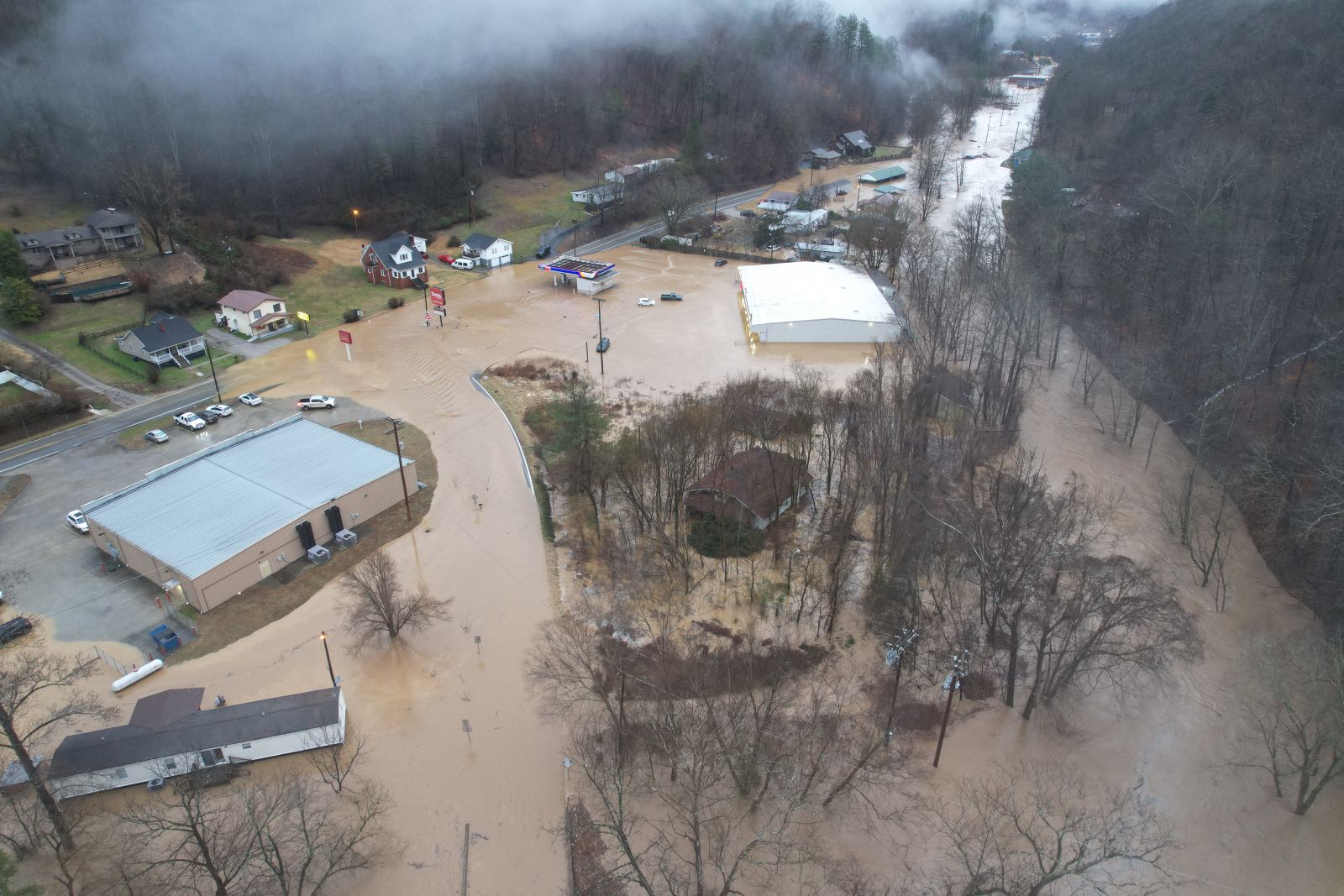
Photos
 |
 |
 |
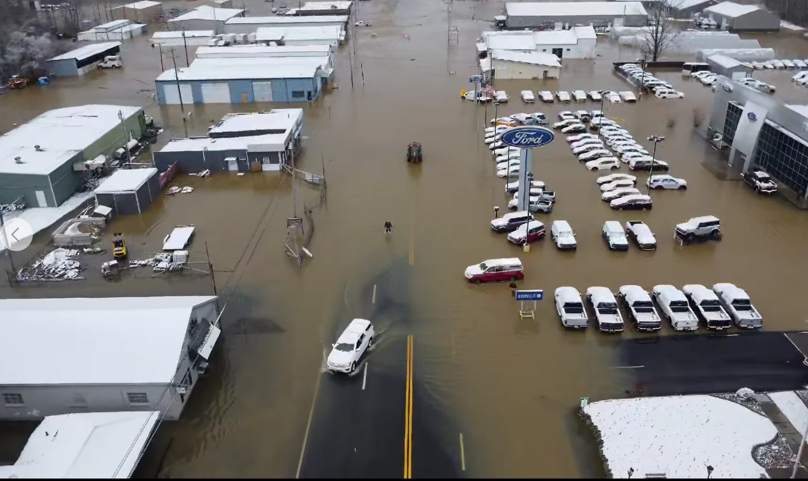 |
| Benton Kentucky flooded store front Courtesy Beau Dodson. | Christian Quarry Road in Hopkinsville, KY. Courtesy Paul Rush. | Downtown Benton, KY. Courtesy Beau Dodson. | Drone footage of downtown Benton, KY. Courtesy Justin Lamb. |
 |
 |
 |
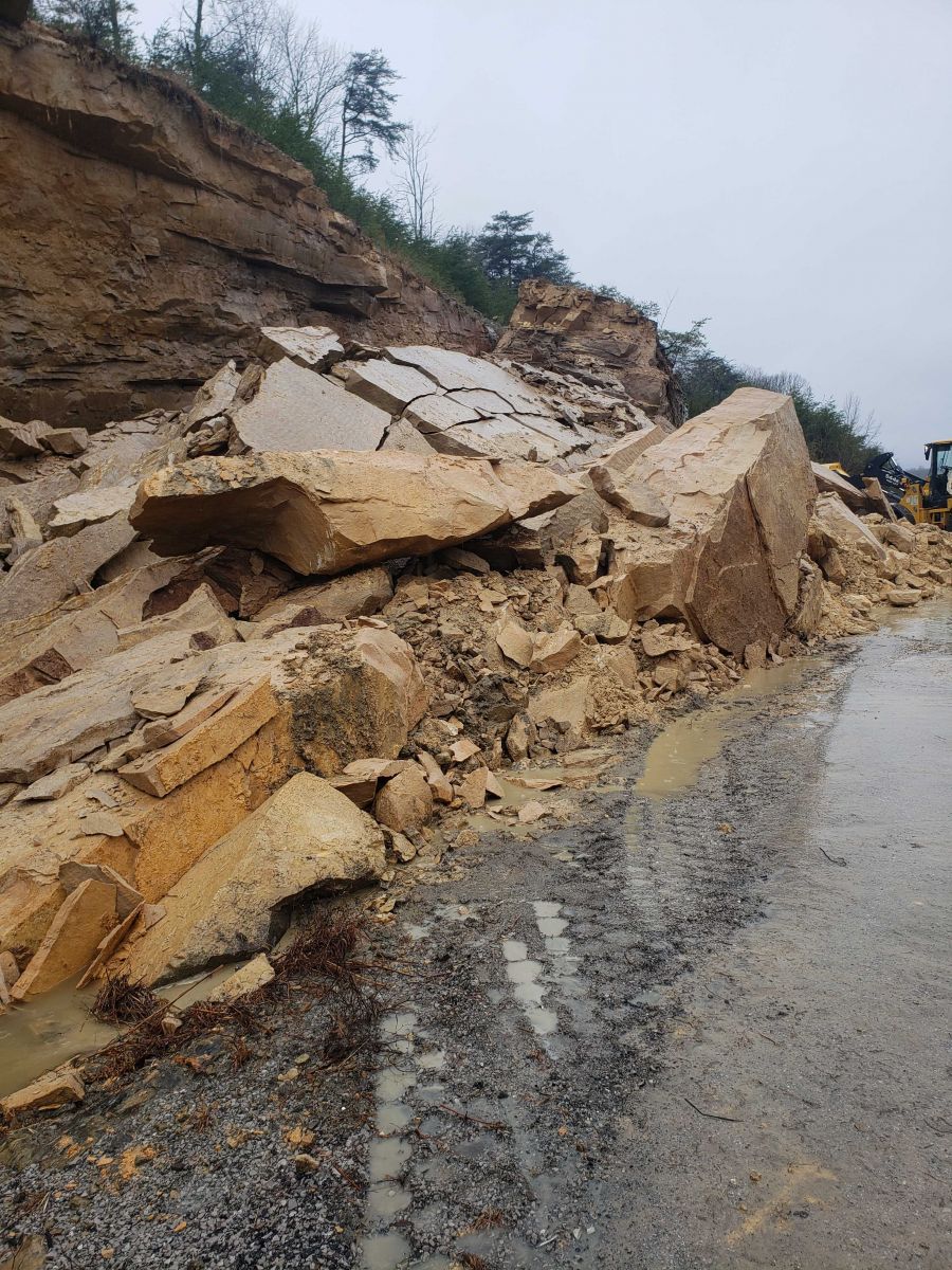 |
| Highway 408 in Marshall County, KY. Courtesy Beau Dodson. | Oaks Road near Reidland, KY. Courtesy Kimberly Knight. | Reidland, KY Ballfield. Courtesy Paducah Drone. | Rockslide on Interstate 69 at Dawson Springs, KY. Courtesy KY EM David Coon. |
 |
 |
 |
| US 51 in Hickman County KY. Courtesy Hickman County EMA. | Water Rescue in Marshall County, KY. Courtesy Marshall County Sheriffs Office. | NWS Jackson - Picture at bottom of mountain from NWS Jackson Office. This is the exit route from the office. Courtesy NWS Meteorologist Alex Vorst. |
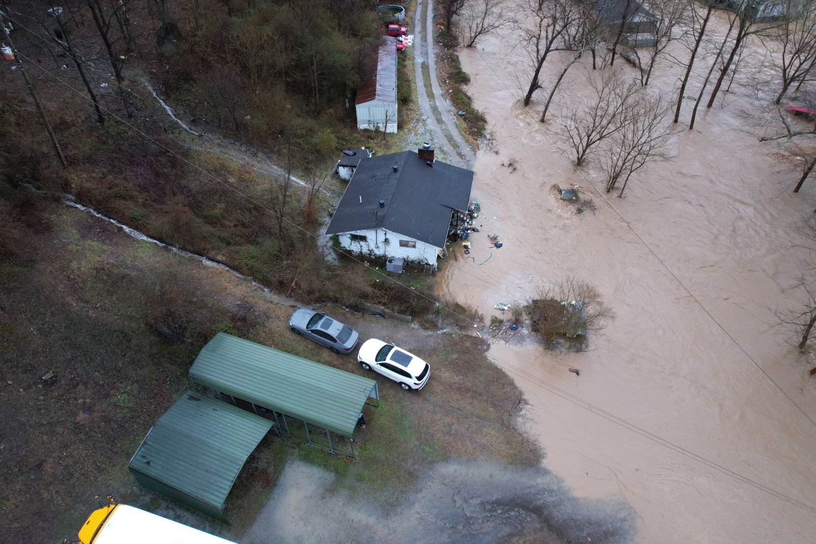
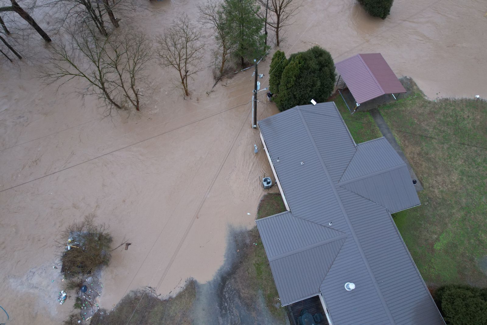
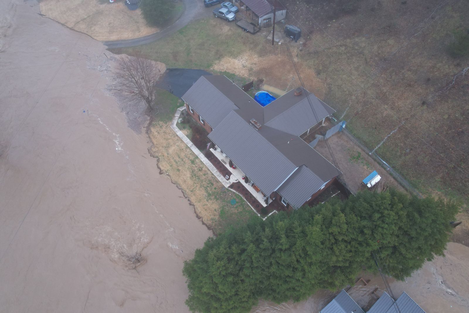
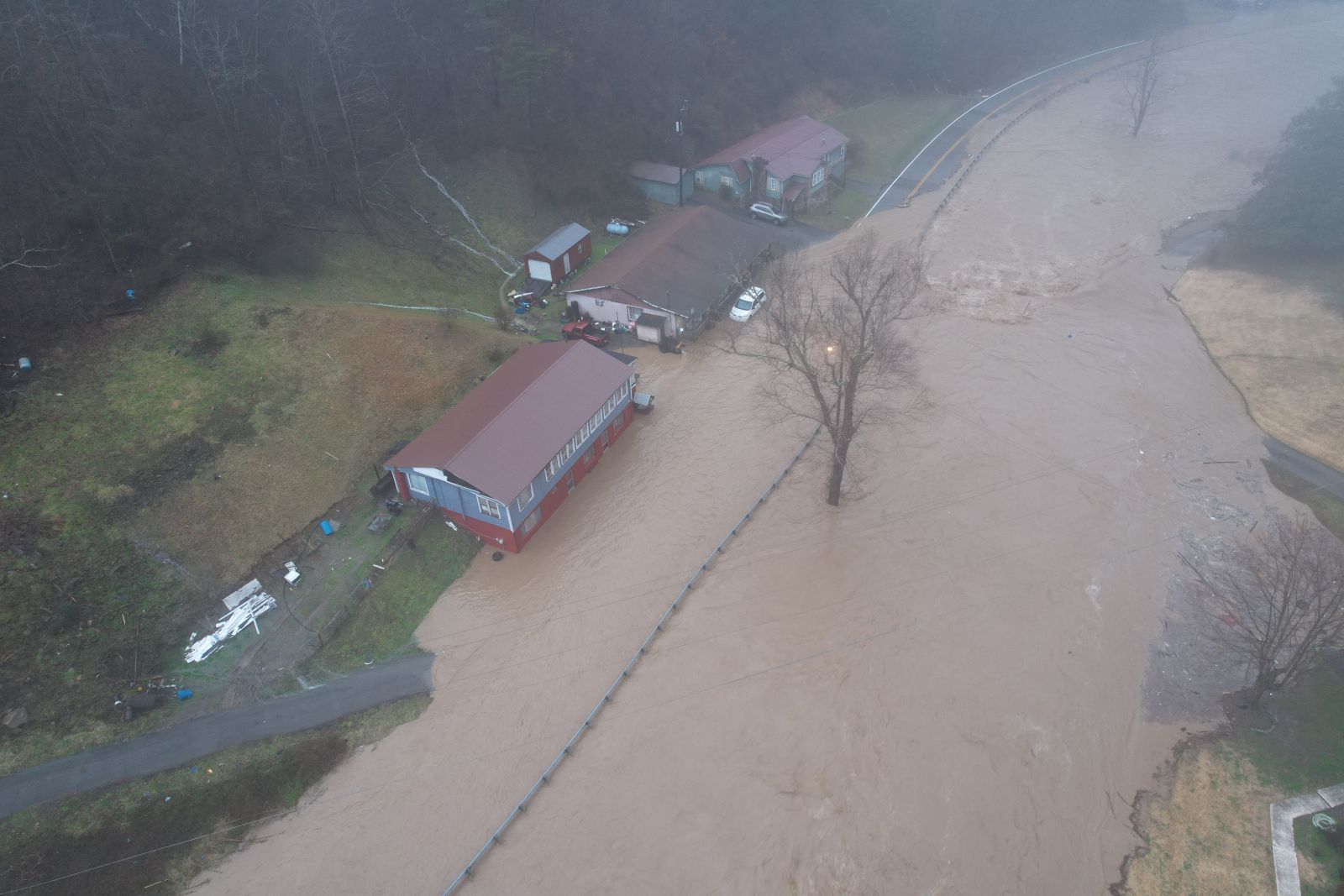
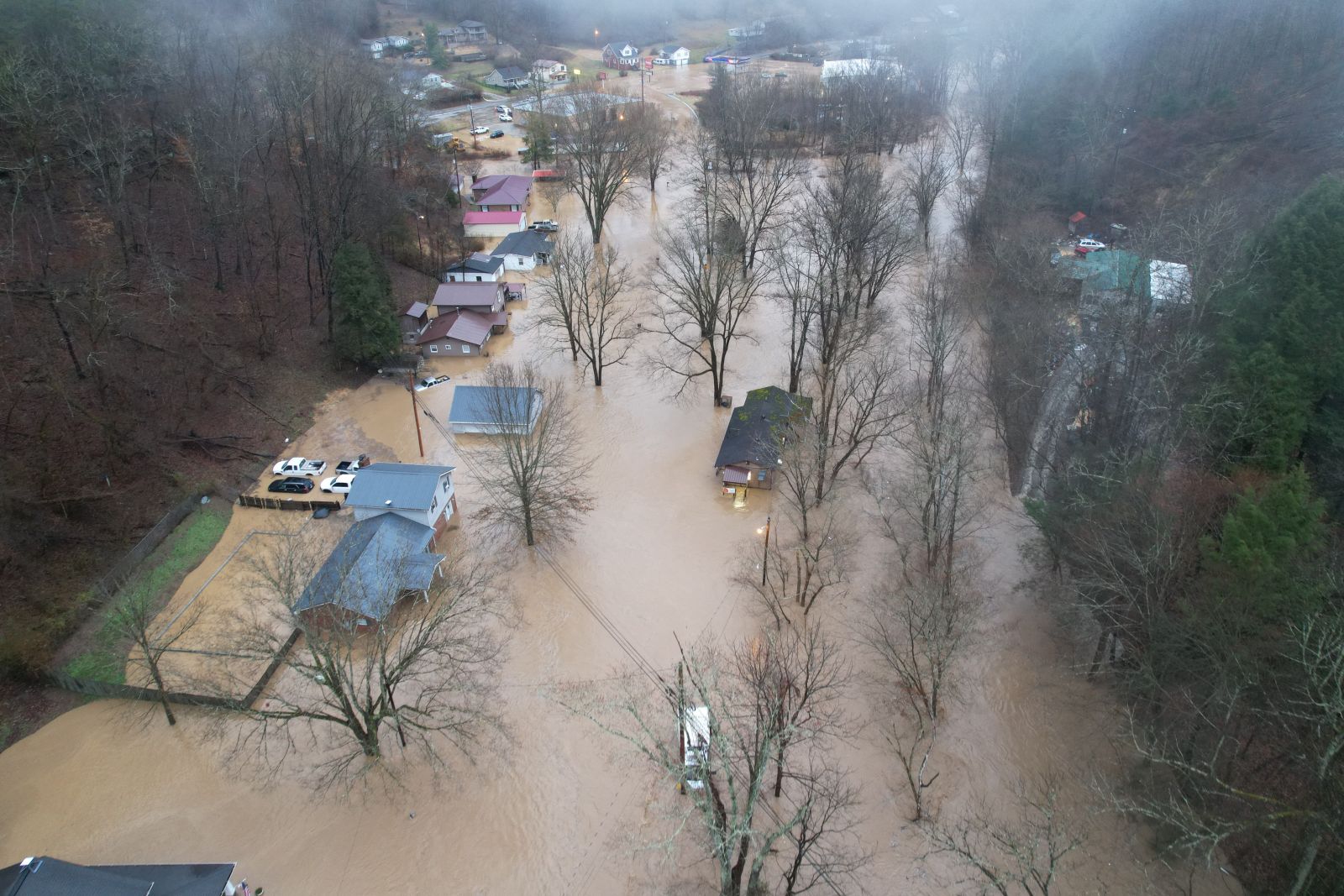
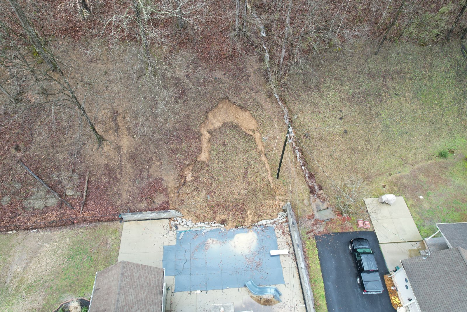
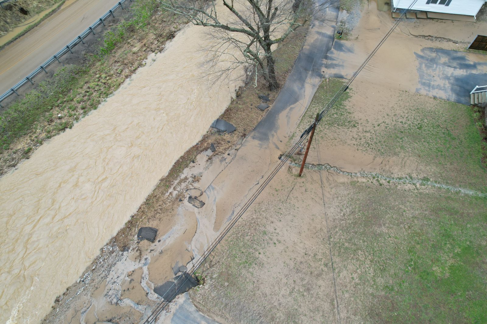
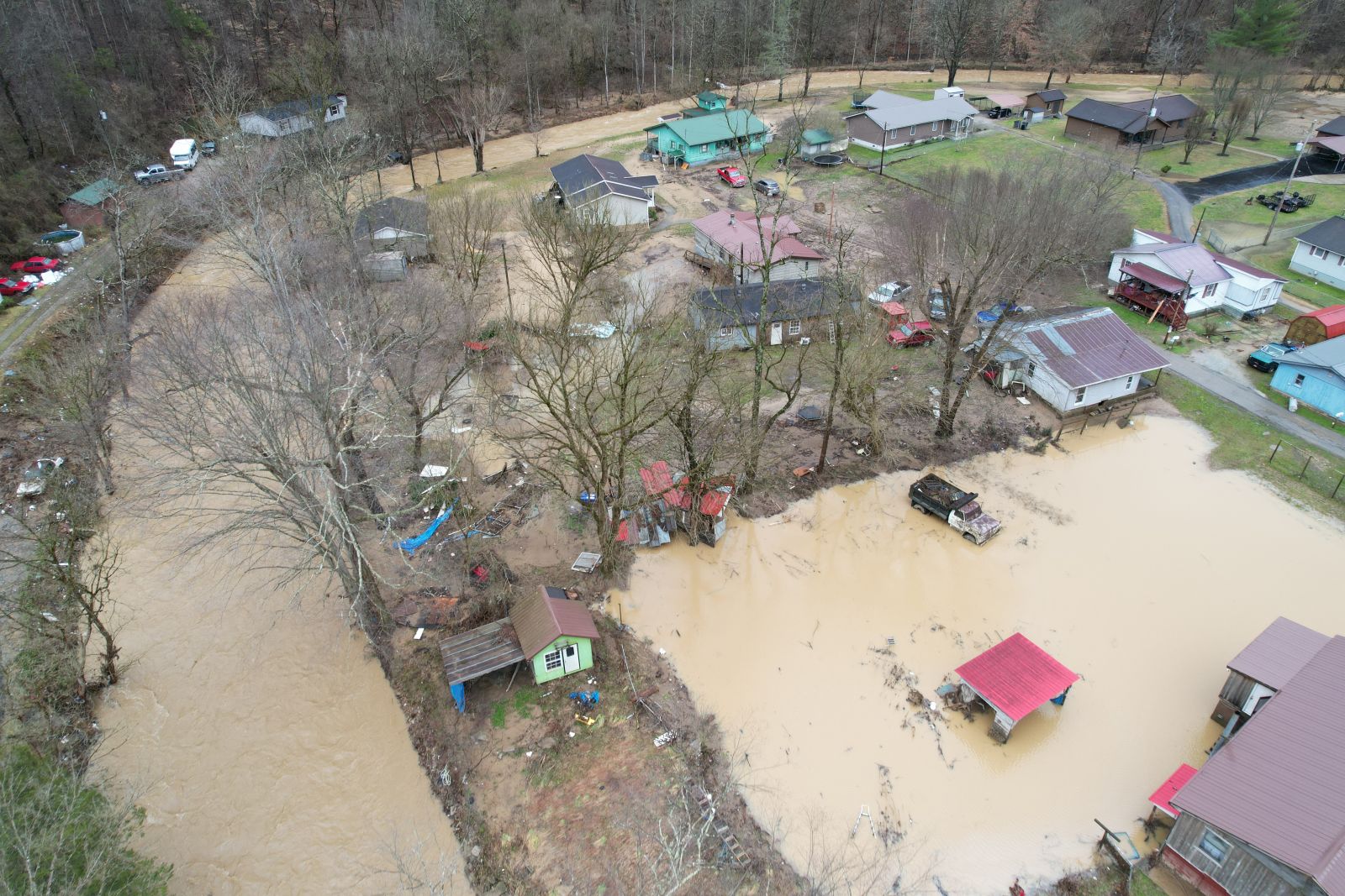
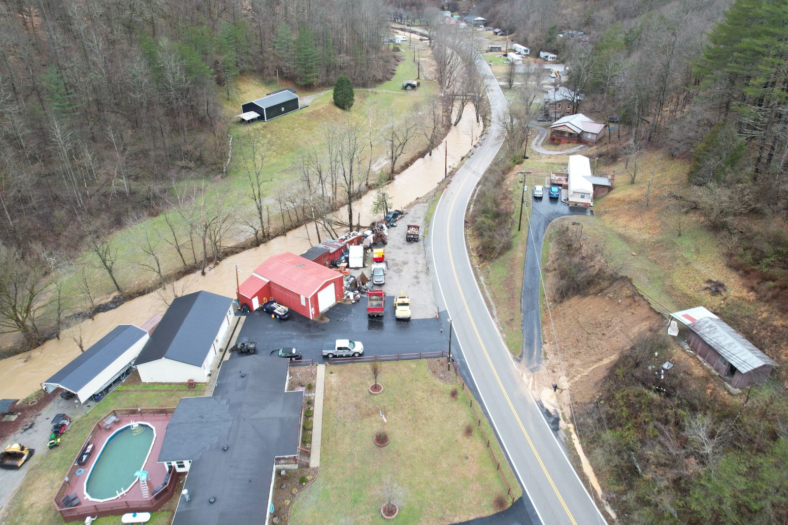
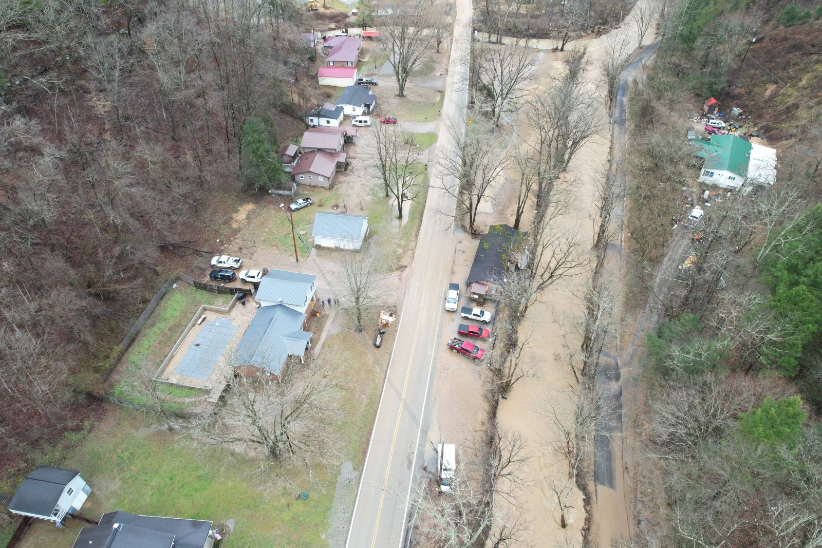
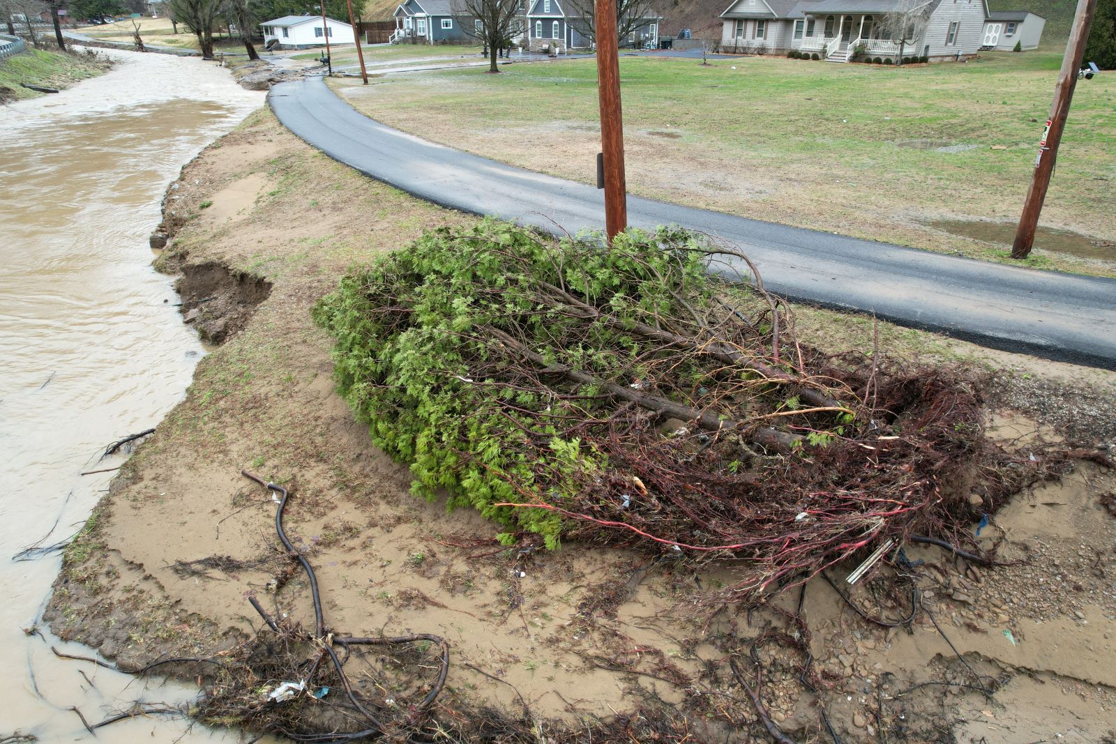
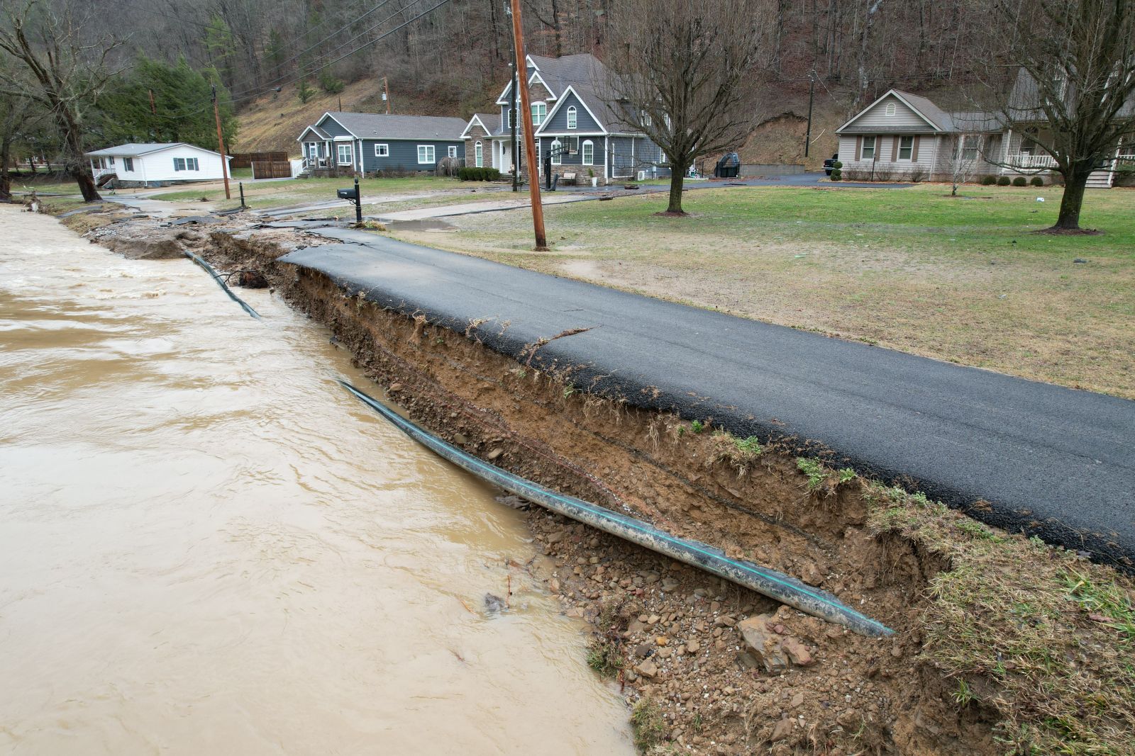
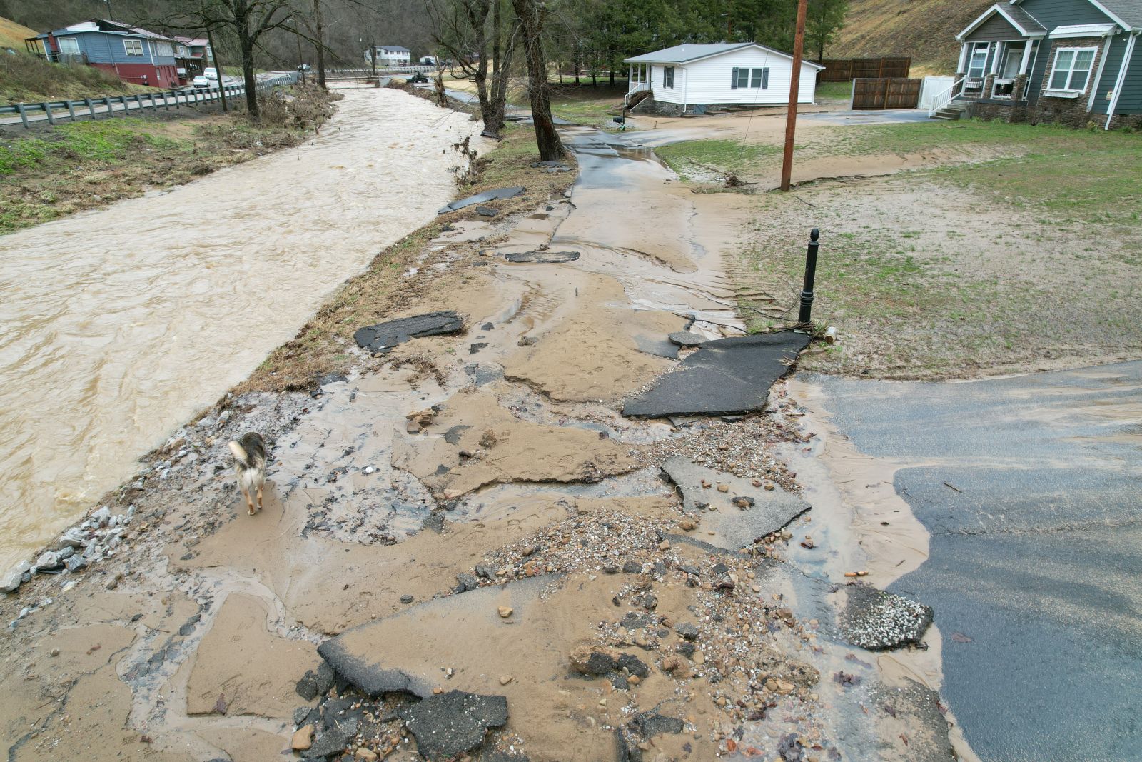
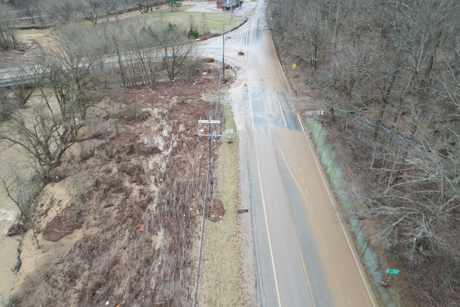
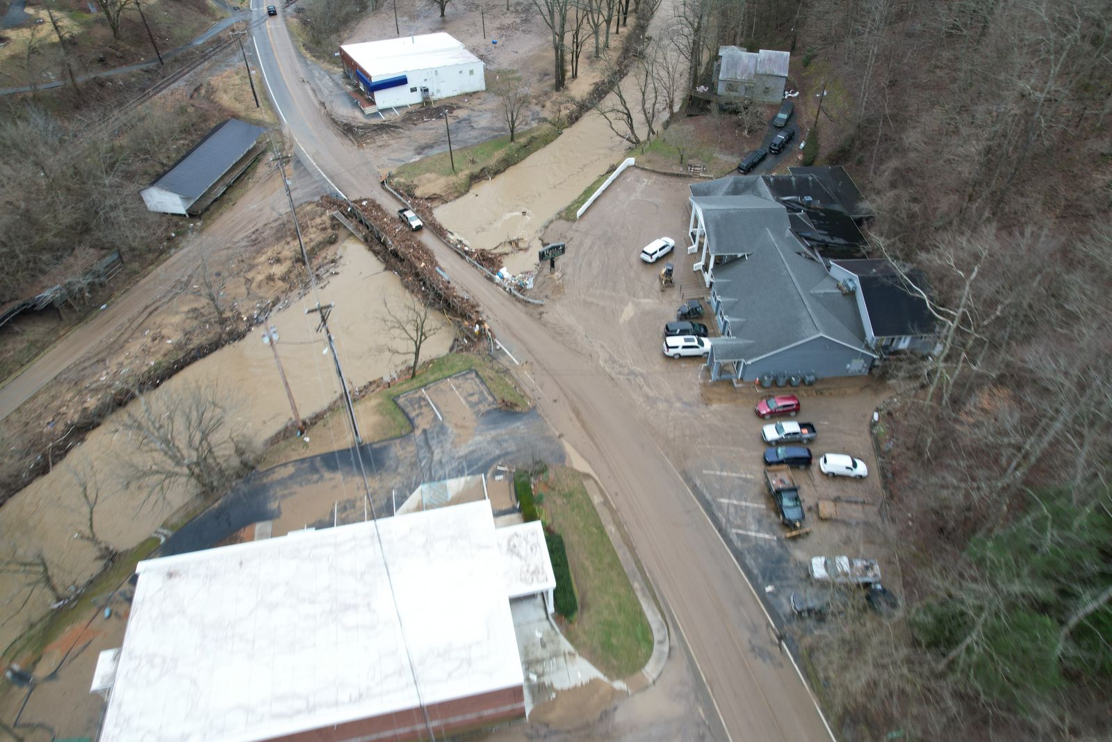
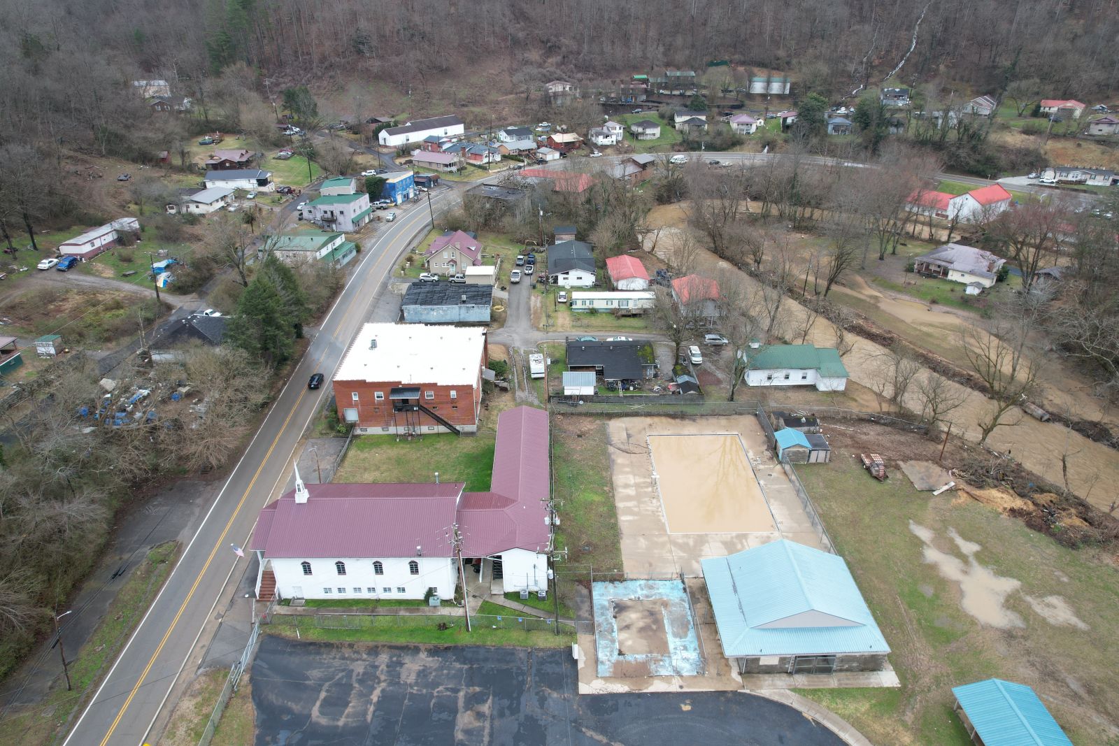
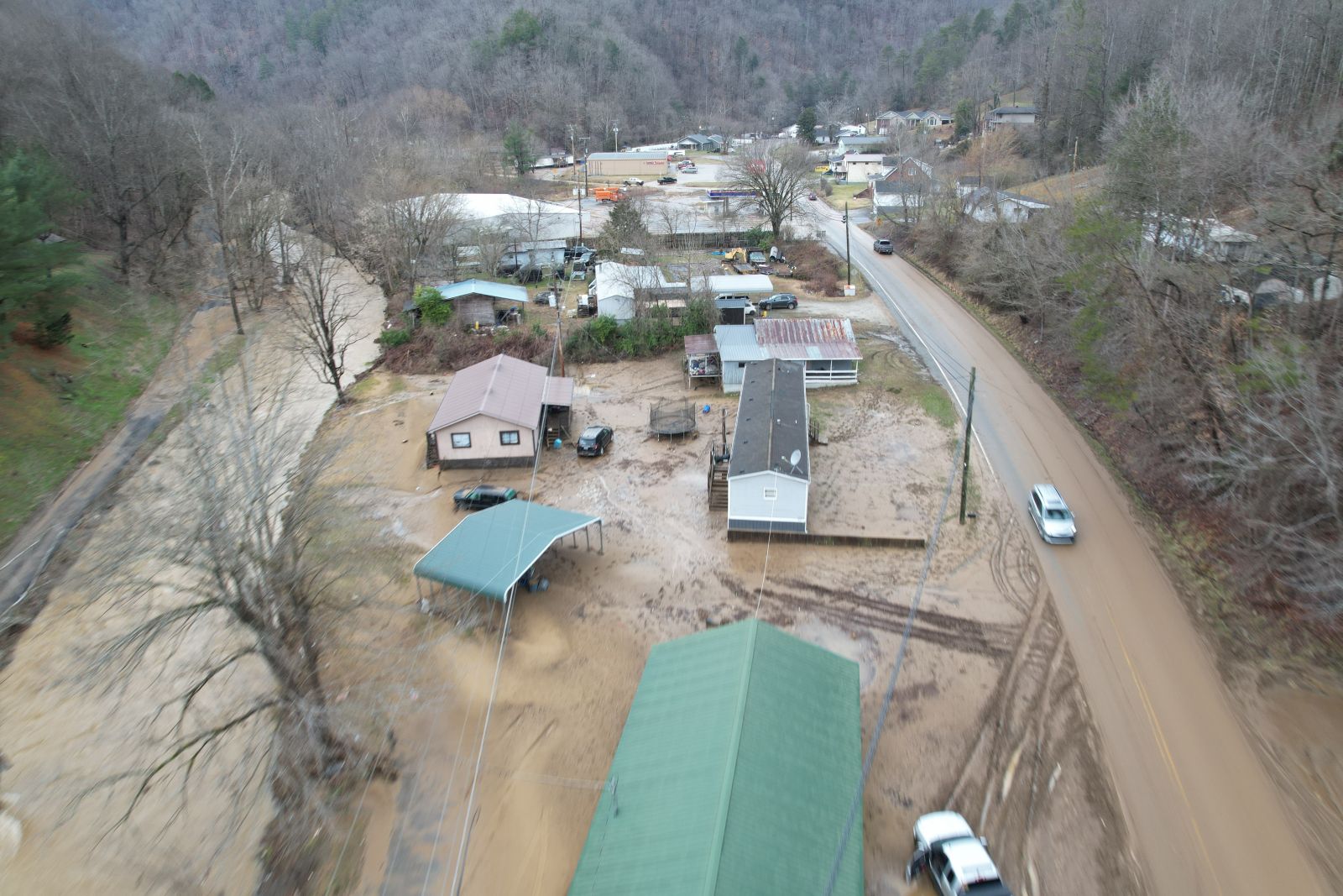
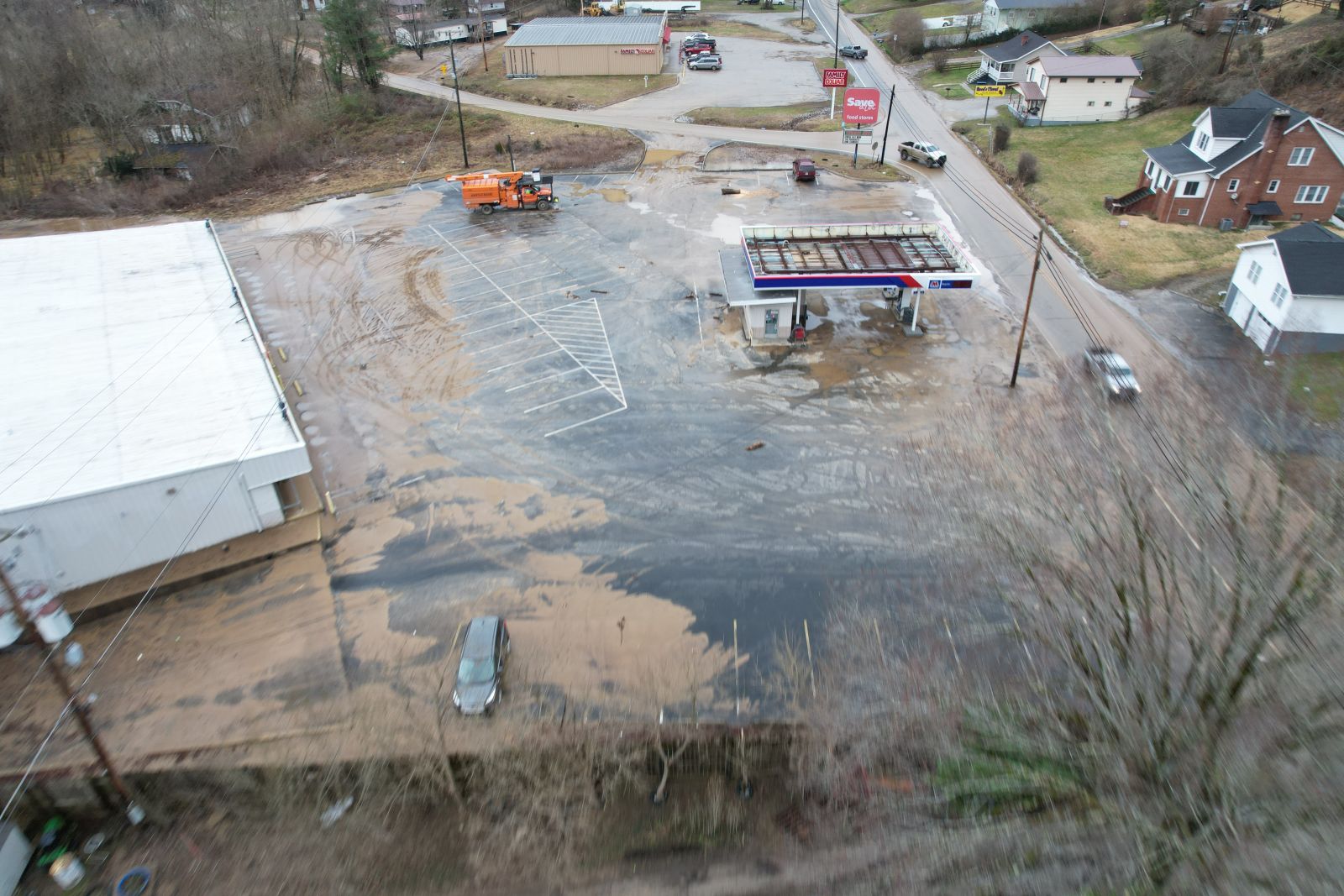
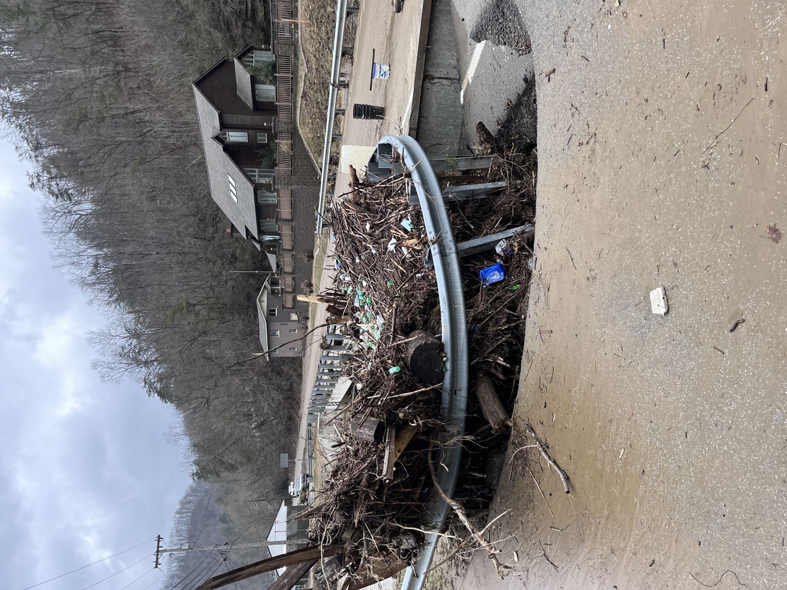
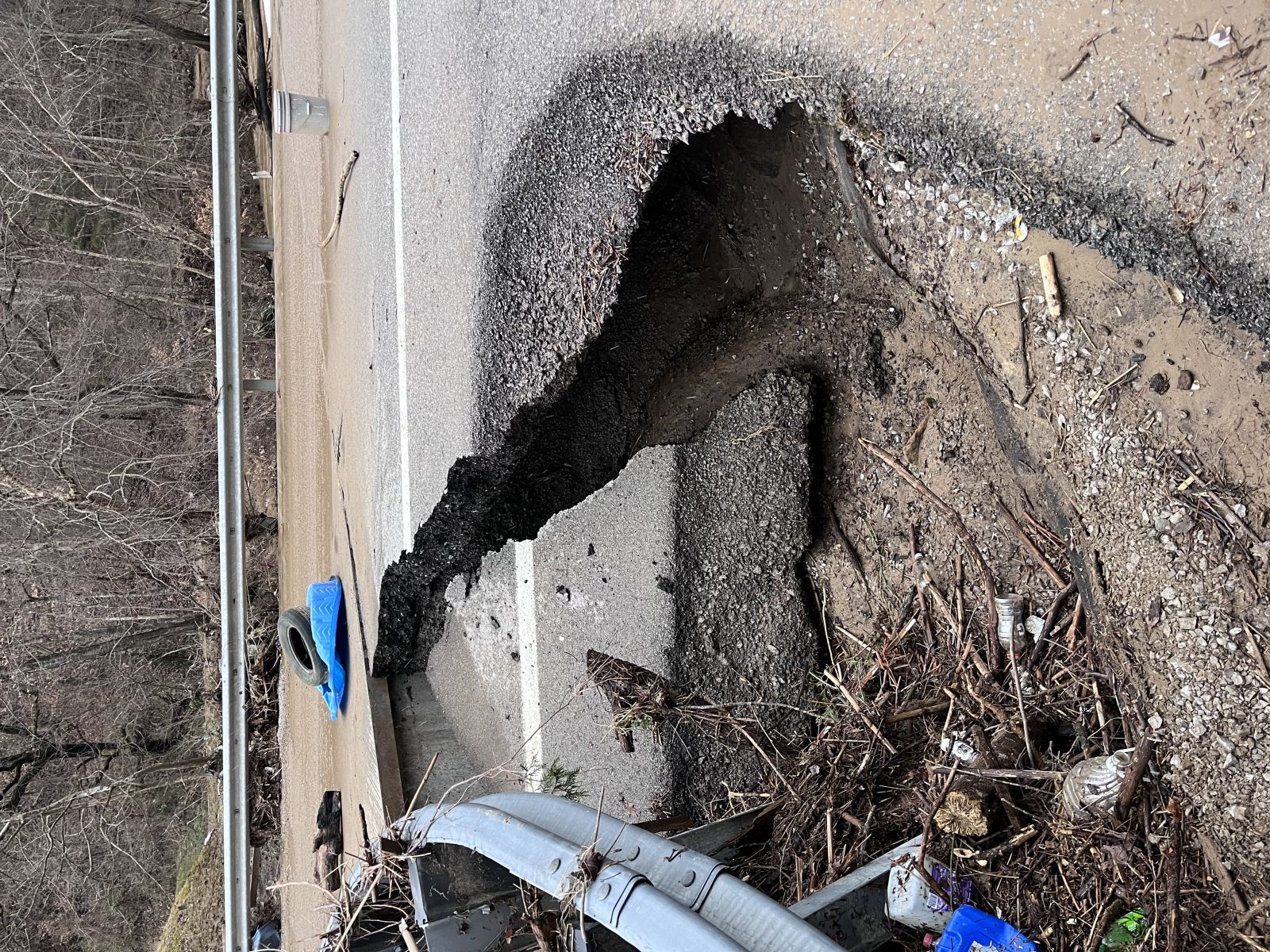
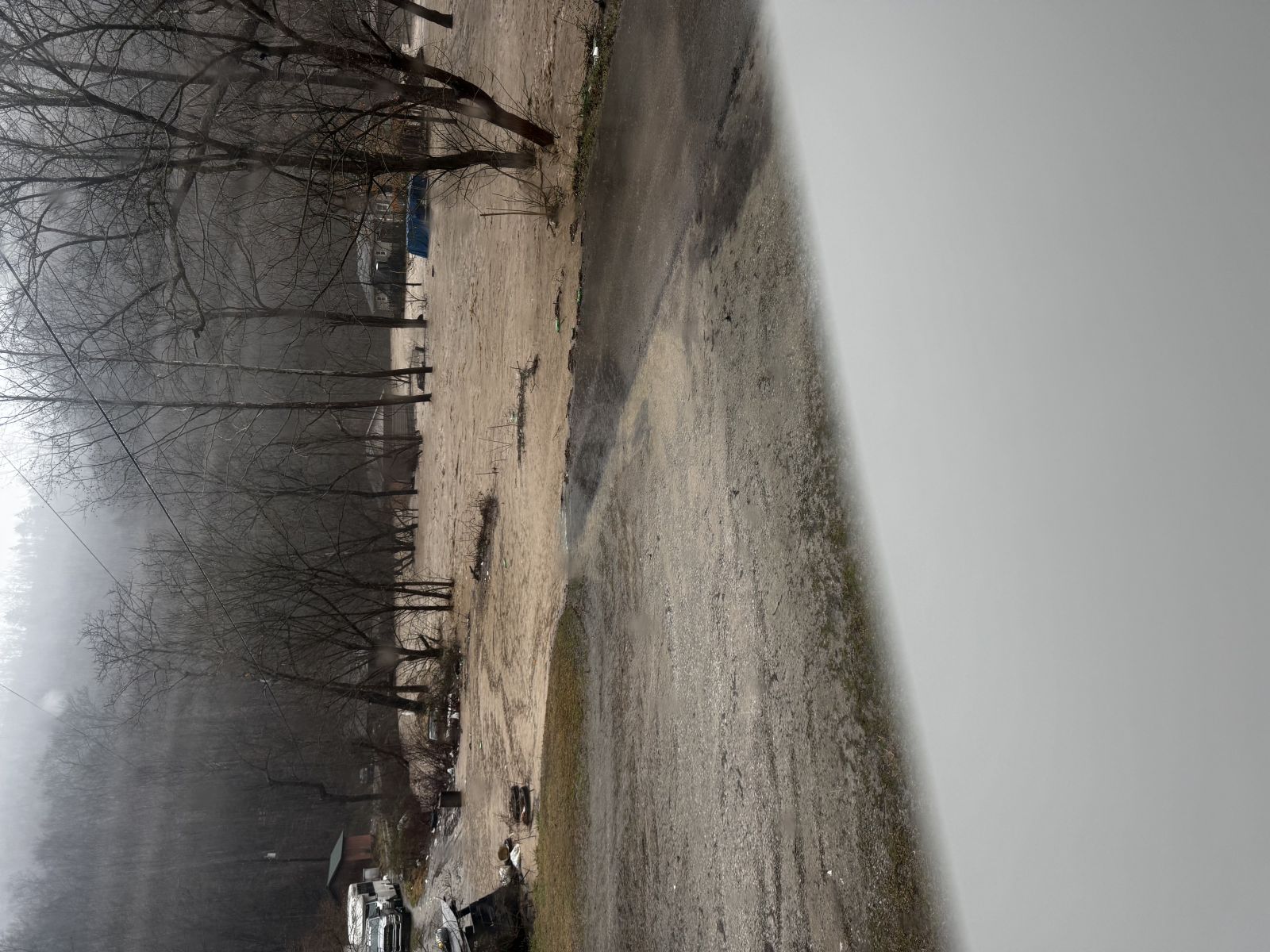
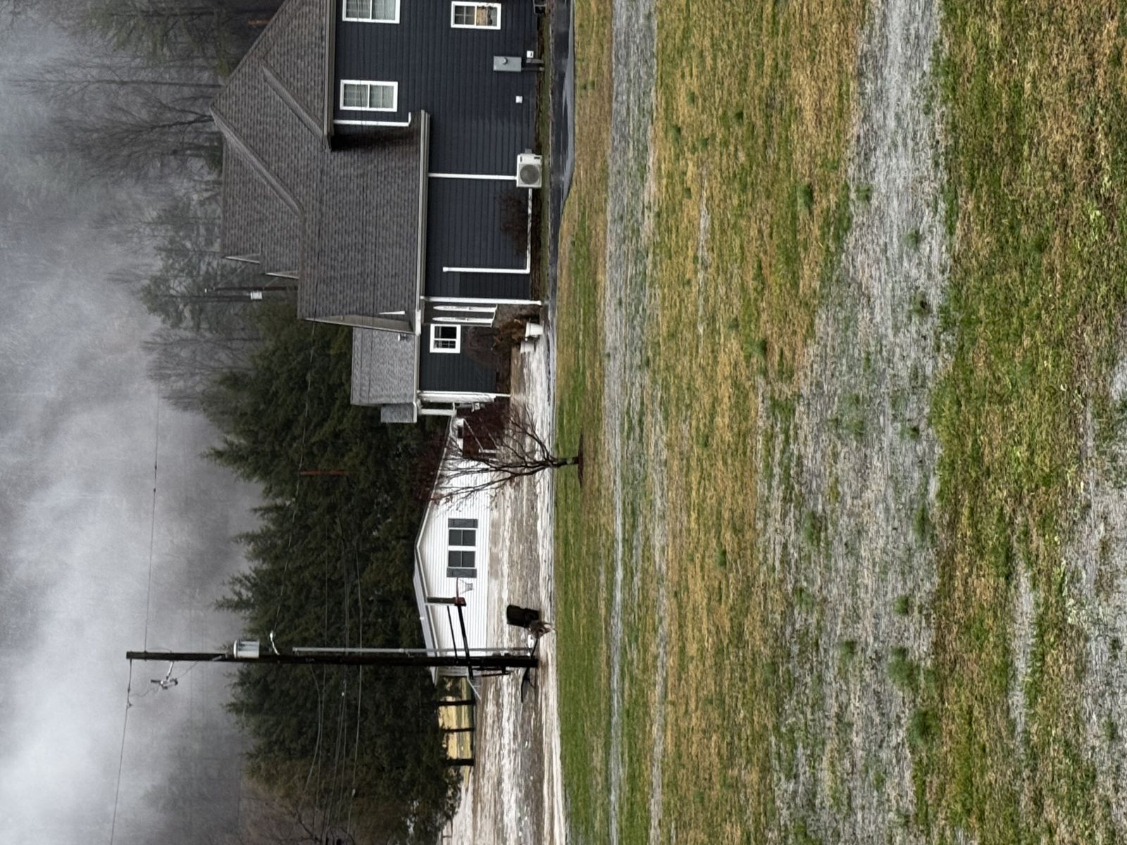
Photos Courtesy KY SEOC Drone
 |
 |
 |
 |
 |
 |
 |
|
 |
 |
 |
 |
 |
 |
 |
 |
 |
 |
 |
 |
 |
 |
 |
 |
 |
 |
.jpeg) |
 |
Storm Reports
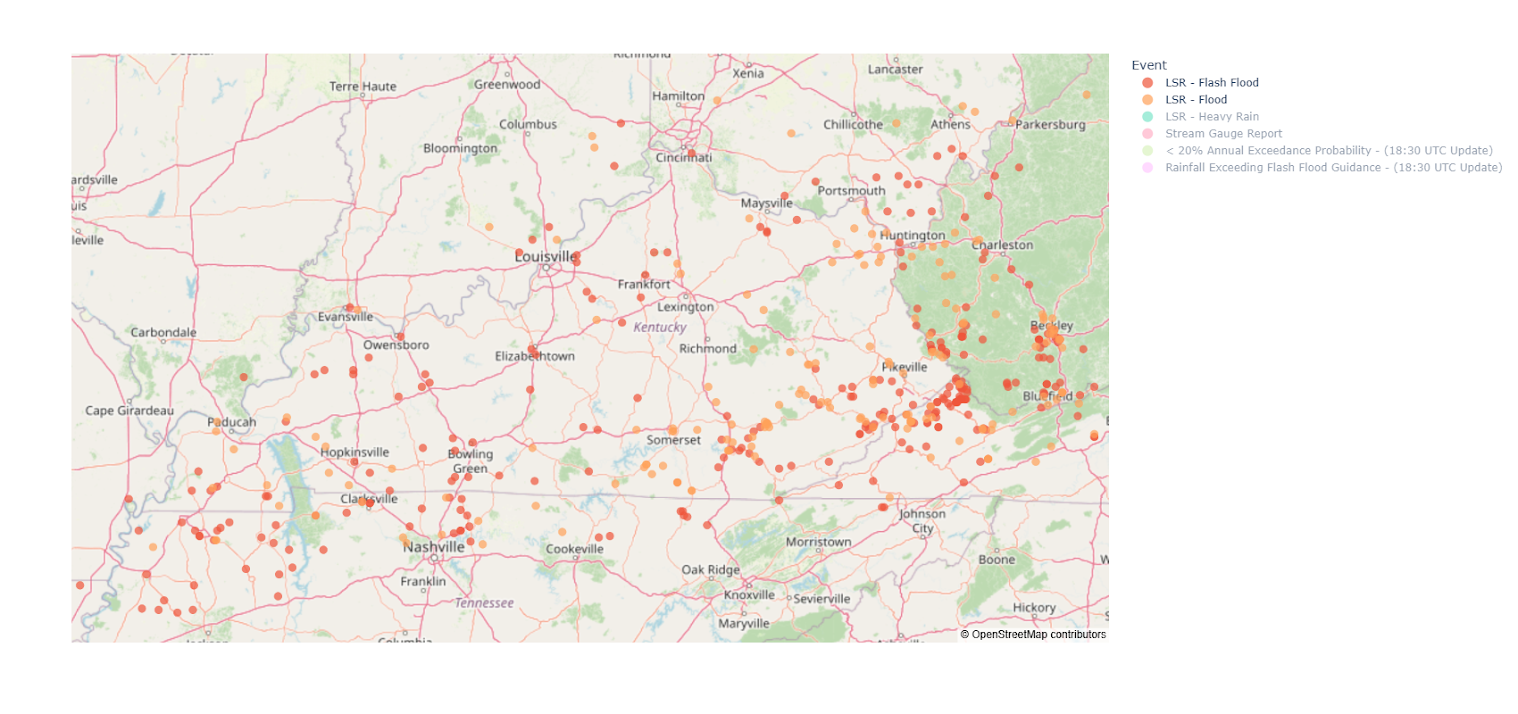 |
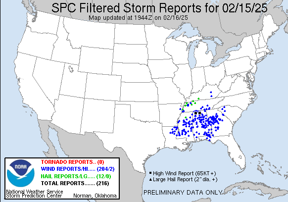 |
| Local Storm Reports for flooding | Local Storm Reports for Severe Weather February 15th 2025 |
For more reports in southwestern Kentucky see this Local Storm Report Summary.
For more reports in central Kentucky see this Local Storm Report Summary.
For more reports in eastern Kentucky see this Local Storm Report Summary.
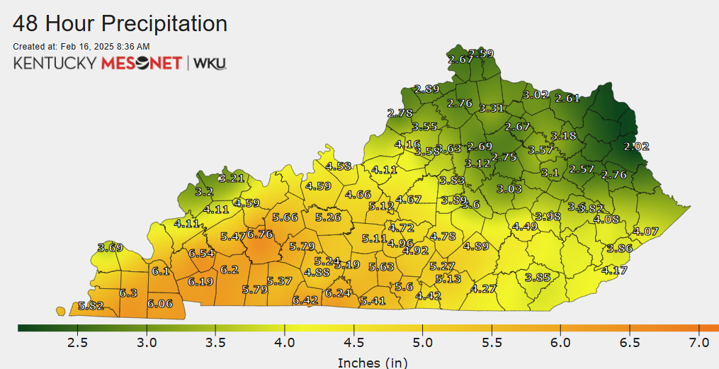
Rain Reports
Image courtesy Kentucky MESONET.
(Green values on the map below signify amounts of 2.0 to 4.0", while yellows to light orange were 4.0 to 6.0", and darker orange colors are over 6 inches)
 |
Environment
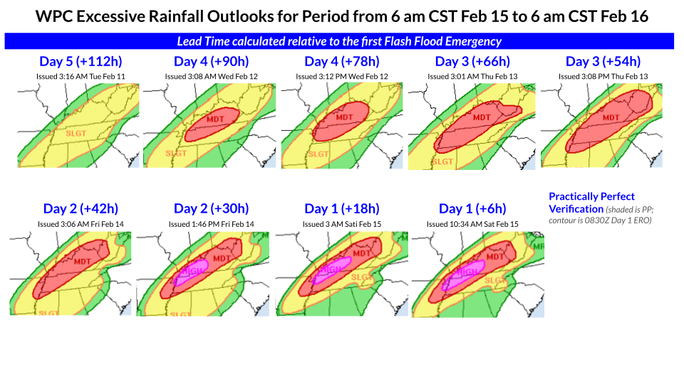
A surface low moving across the southern plains brought southerly winds to the state Friday night (February 14th) through Saturday (February 15th). This southerly wind advected high amounts a precipitable water over an inch, which for this time of year trends towards the 90th percentile to max climatological values. The southerly flow eventually set up a warm front that brought widespread rain from west to east on Saturday, February 15th. After the warm front lifted, a cold front associated with the mentioned surface low brought the potential for severe weather across the western part of the state. As the low and front pushed across the state Saturday night through Sunday, light snow was forecast and observed. However the main concern with this system was wide spread flooding. Forecast rainfall amounts of 2 to 5+ inches, combined with an already soggy ground with limited vegetation, made for the Weather Prediction Center (WPC) to issue a rare High Risk for excessive rain on Day 2 and Day 1. Below are some graphics that shows the forecast evolution of this impactful event.
Weather Prediction Center (WPC) Graphics and Forecasts
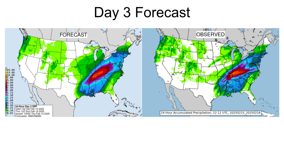 |
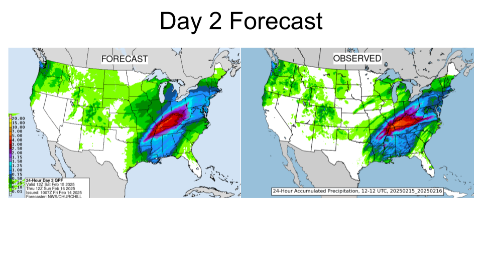 |
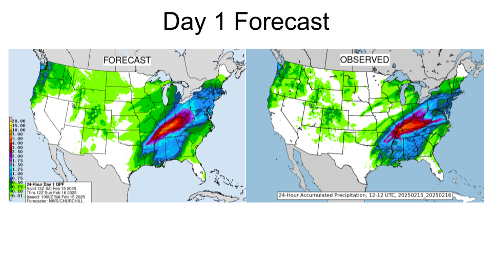 |
| WPC Day 3 Forecast and Observed Precipitation. | WPC Day 2 Forecast and Observed Precipitation. | WPC Day 1 Forecast and Observed Precipitation. |
 |
 |
 |
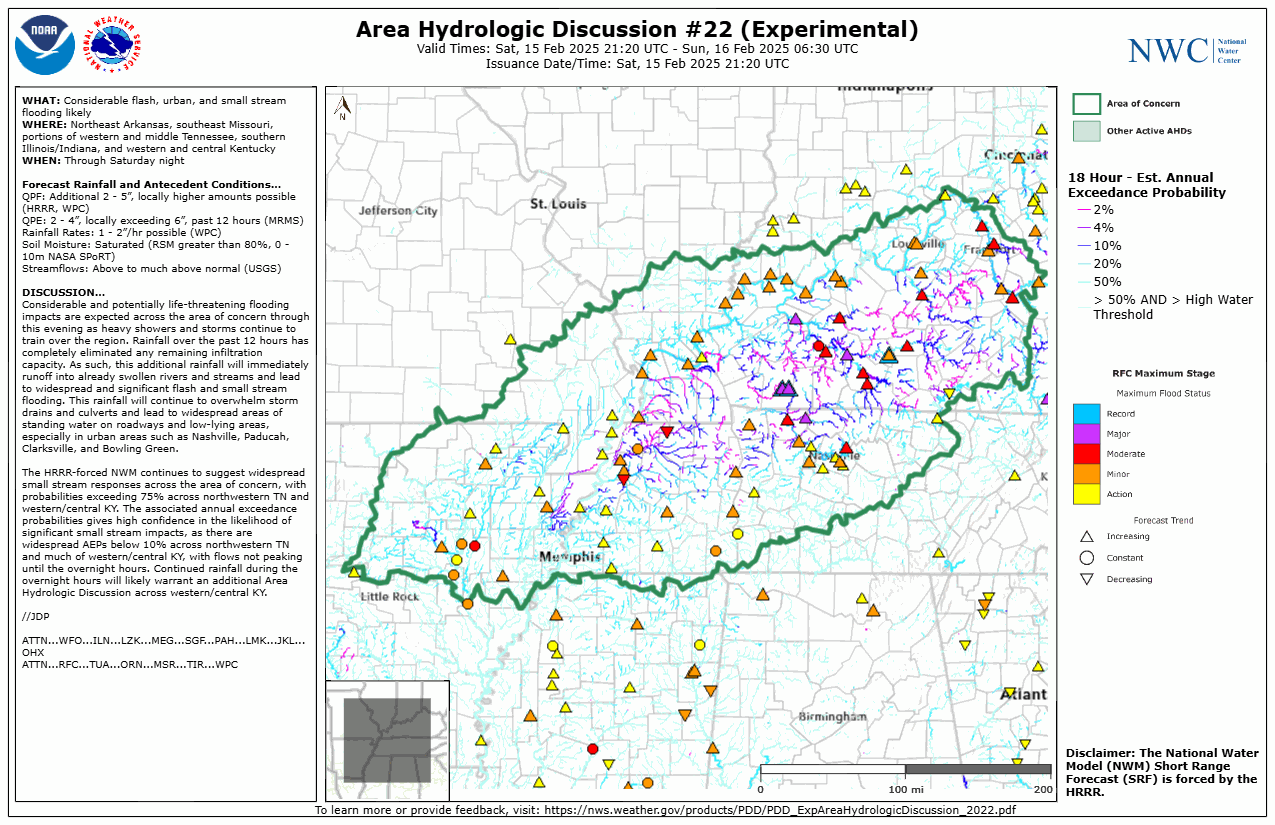 |
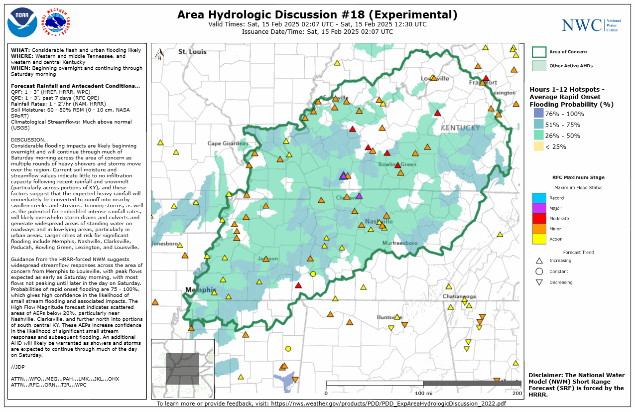
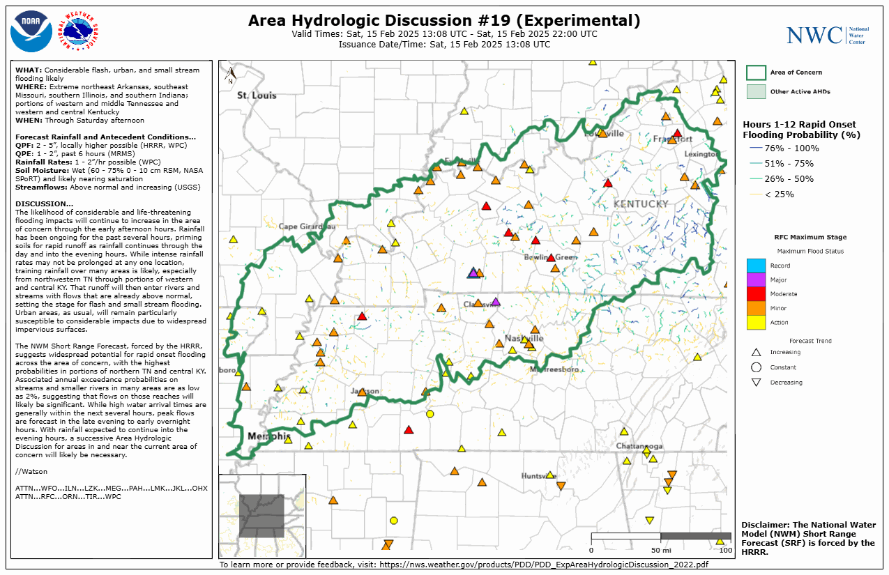
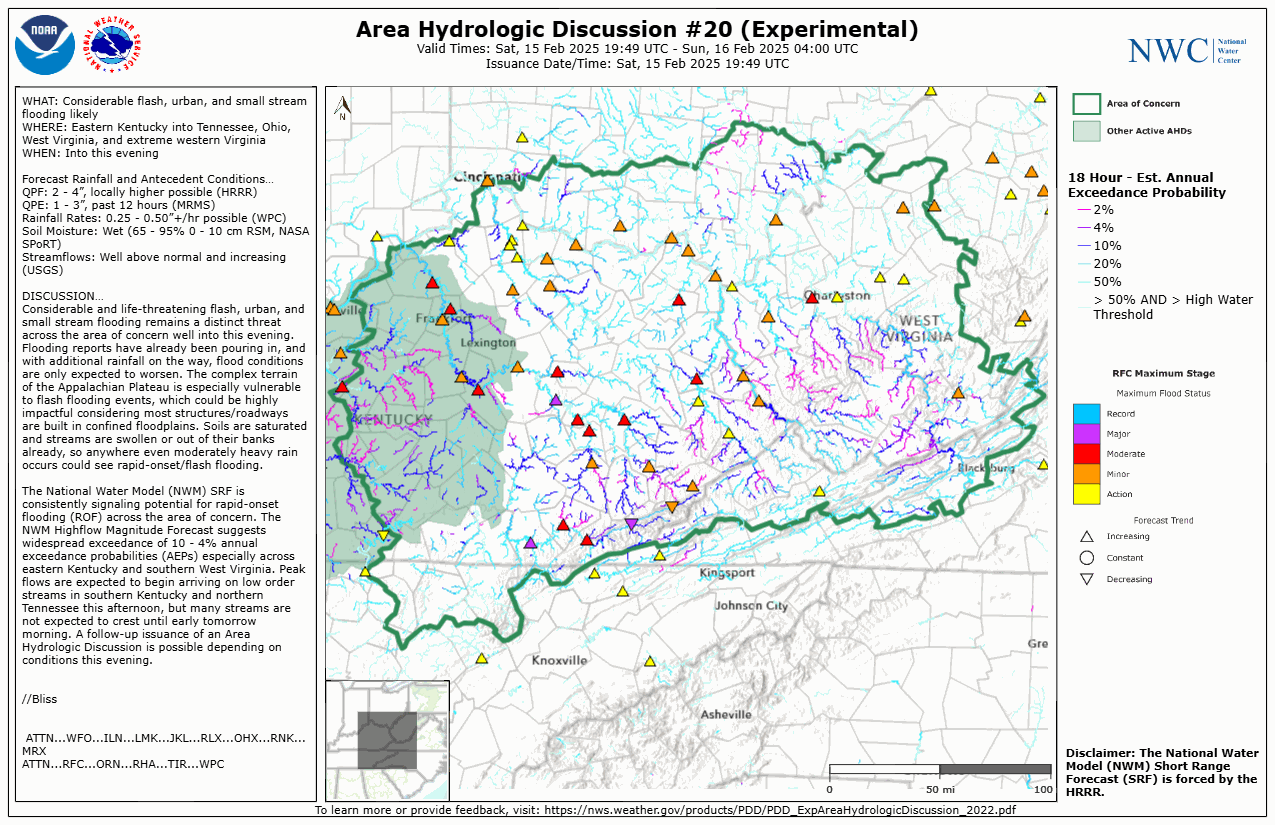
| Experimental Area Hydrologic Discussion Issued Friday, February 14th, evening. | Experimental Area Hydrologic Discussion Issued Saturday, February 15th, morning. | Experimental Area Hydrologic Discussion Issued Saturday, February 15th, afternoon. | Experimental Area Hydrologic Discussion Issued later Saturday, February 15th, afternoon. |
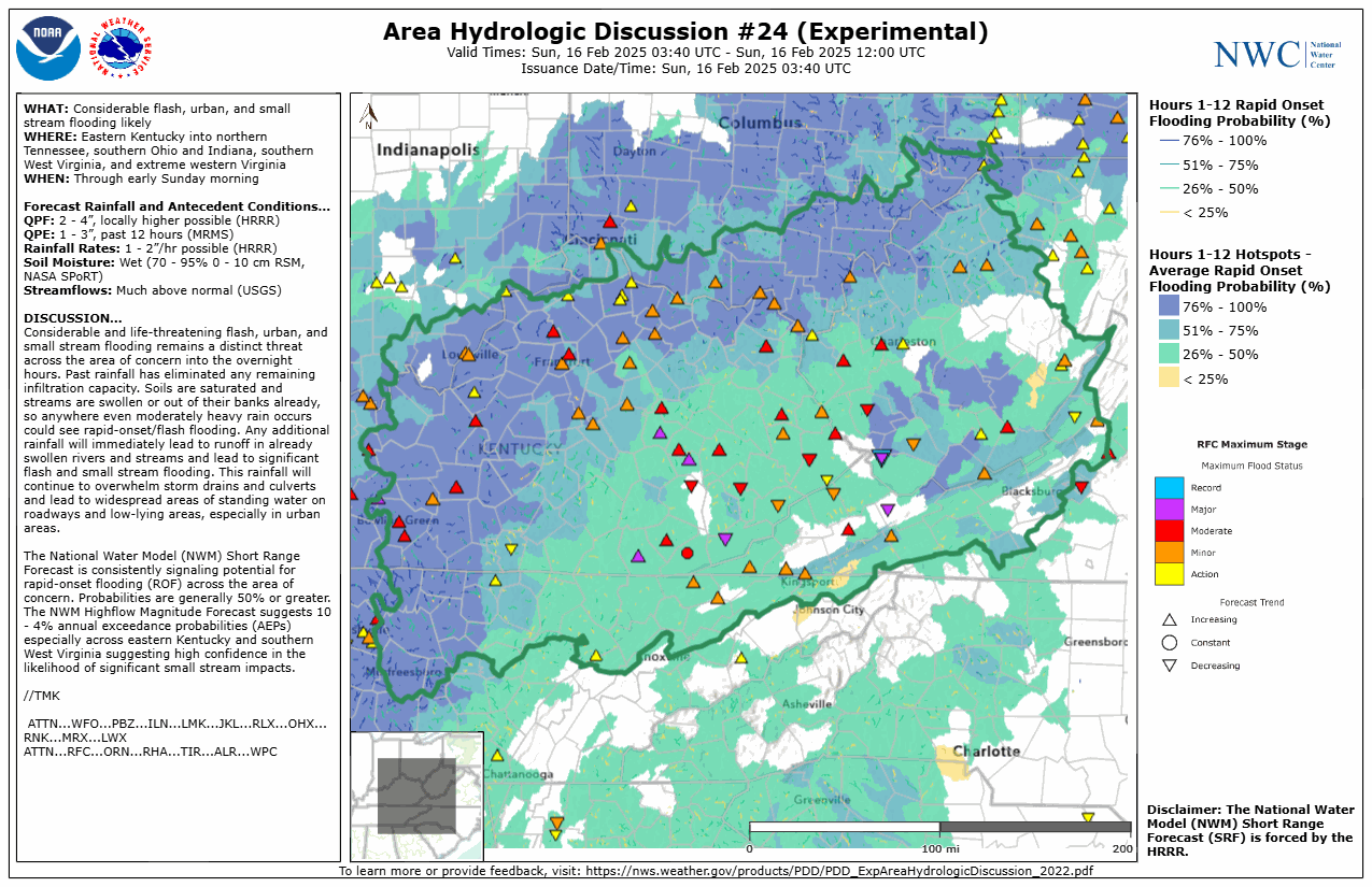 |
| Experimental Area Hydrologic Discussion Issued Saturday, February 15th, evening. |
 |
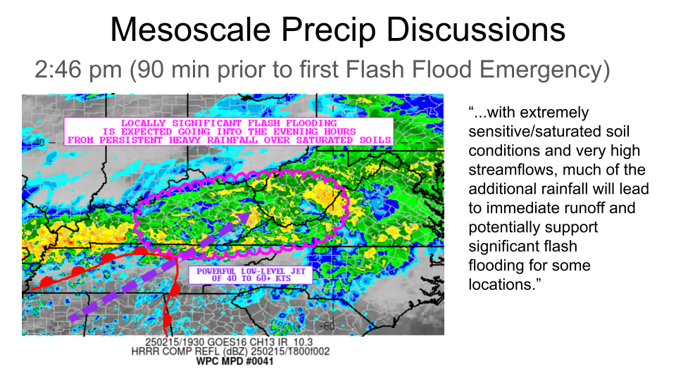 |
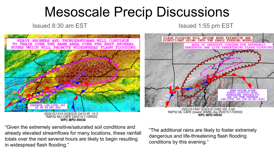
| Mesoscale Precipitation Discussion from WPC issued Saturday morning. | Mesoscale Precipitation Discussion from WPC issued Saturday afternoon. |
 |
 |
 |
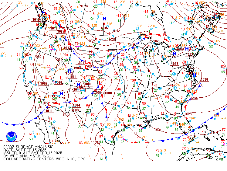
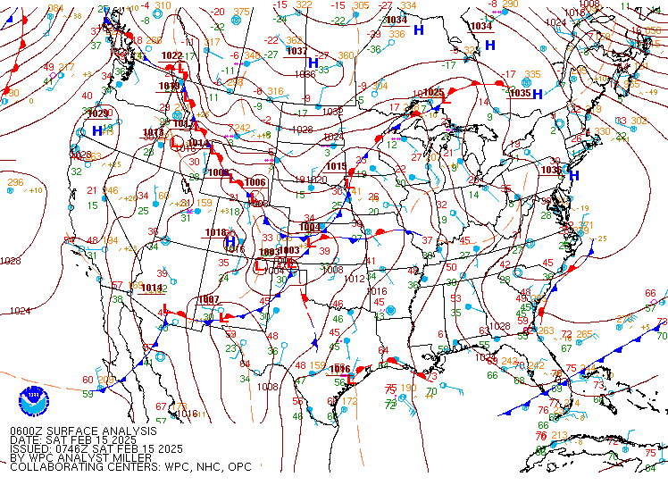
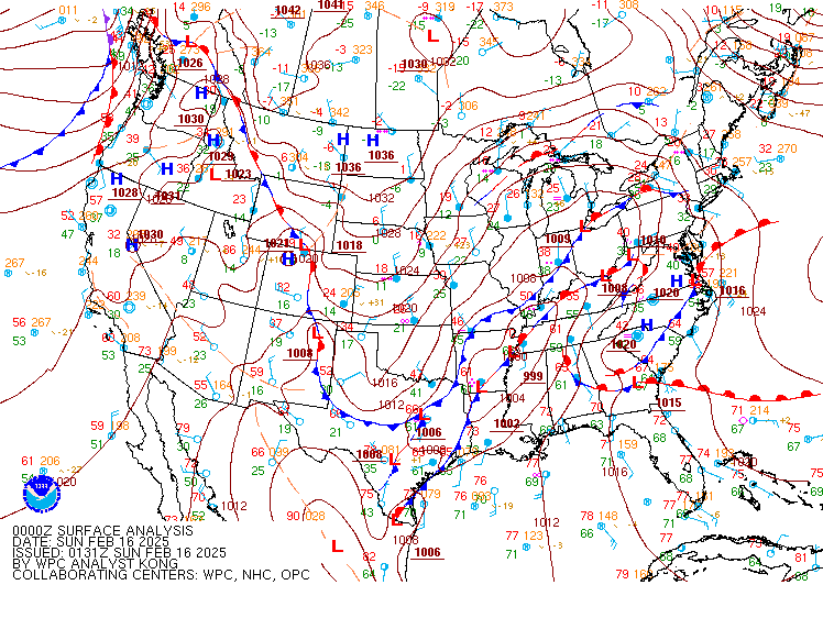
| WPC Surface Analysis Friday Evening. Note the surface low developing in eastern Colorado. | WPC Surface Analysis Friday night. Note the surface low is now in the southern plains while moist southerly flow has returned to Kentucky. | WPC Surface Analysis Saturday morning. Note the surface low remains in the southern plains with rain starting in southern Kentucky along a surface boundary. |
 |
 |
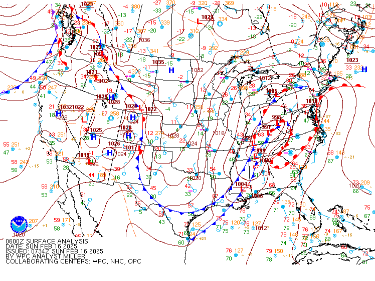 |
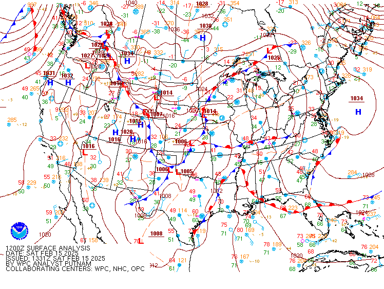
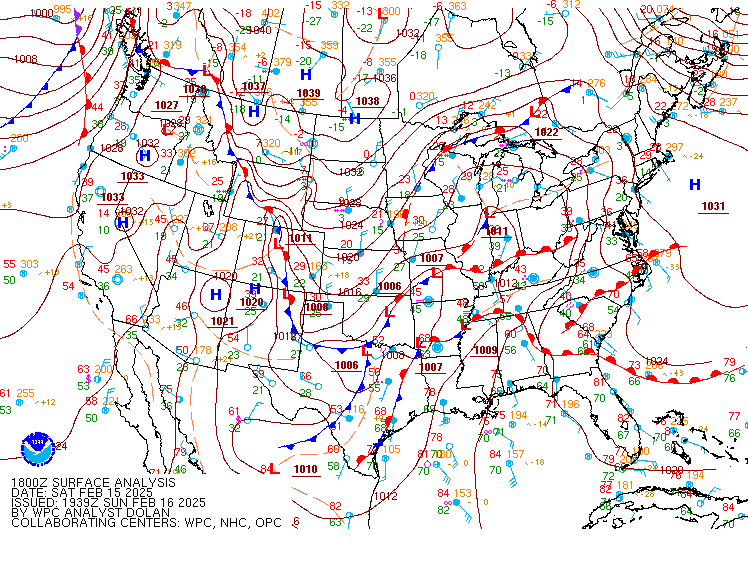
| WPC Surface Analysis Saturday afternoon. Note the surface low approaching the area with rain continuing in Kentucky along a warm front. | WPC Surface Analysis Saturday evening. Note the surface low now in the region with the cold front trailing. This becomes the focus for severe weather. | WPC Surface Analysis Saturday night. Note the surface low and cold front now pushing through the state. This will continue to push eastward through Sunday. Rain changes to snow, with light accumulations on Sunday. |
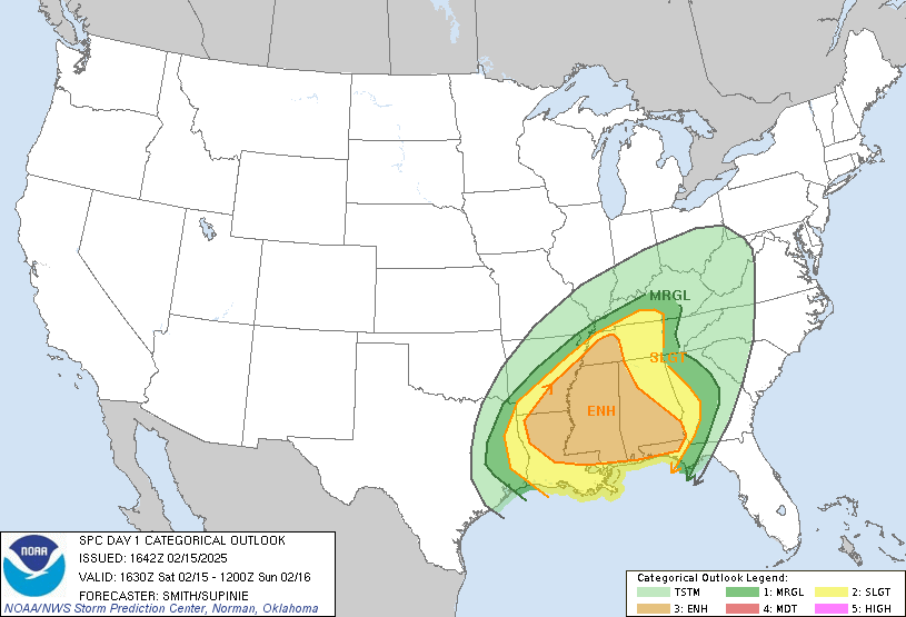
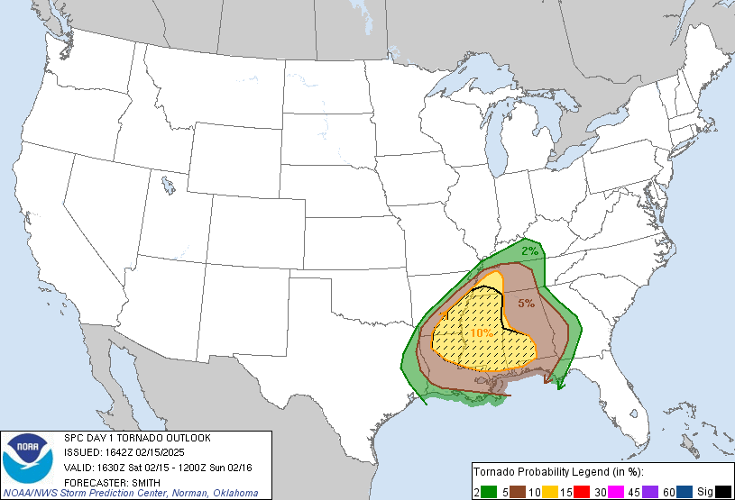
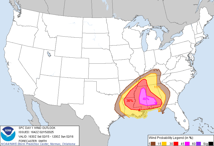
Storm Prediction Center (SPC) Graphics and Forecasts
 |
 |
 |
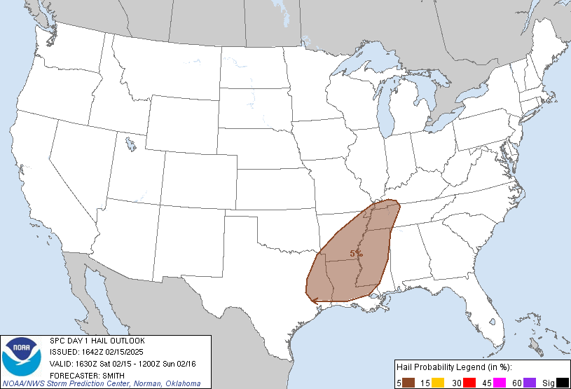 |
| SPC Day 1 Outlook for severe weather on Saturday, February 15th | SPC Day 1 risk for tornados on Saturday, February 15th | SPC Day 1 risk for wind on Saturday, February 15th | SPC Day 1 risk for hail on Saturday, February 15th |
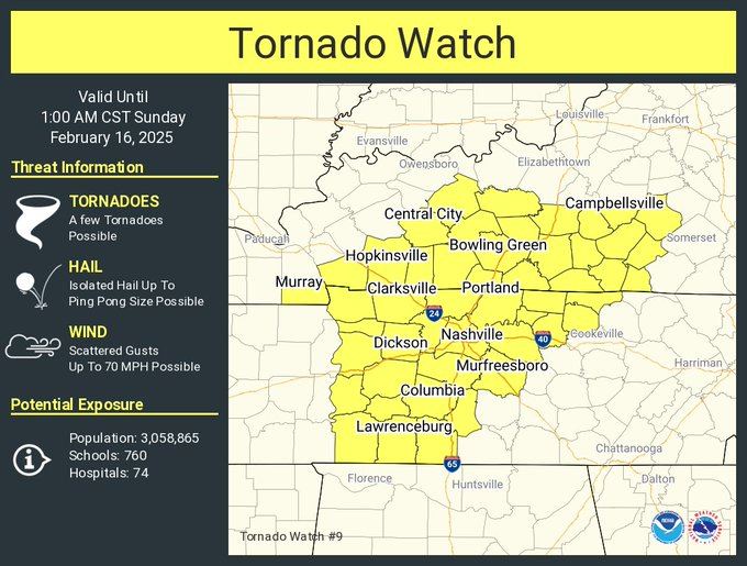 |
| Tornado Watch issued Saturday (February 15th) evening. |
Additional Information
Impacts
***These impacts are as of February 17th 2025 at 3 PM ET***
Video Briefing
| Facebook Live Briefing from NWS Paducah on Saturday Morning (February 15th) |
| Facebook Live Briefing from NWS Paducah on Saturday Afternoon (February 15th) |
| Facebook Live Briefing from NWS Louisville on Friday Afternoon (February 14th) |
Other Video
| Louisville flooding video courtesy Ben Childers | Cumberland Falls flooding video courtesy Ben Childers |
| Hazard flooding video courtesy Ben Childers | Jackson flooding video courtesy Ben Childers |
| Pikeville flooding video courtesy Ben Childers |
 |
Media use of NWS Web News Stories is encouraged! Please acknowledge the NWS as the source of any news information accessed from this site. |
|


 Weather Story
 Weather Map
 Local Radar