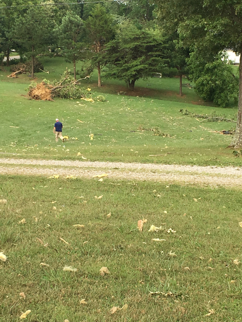
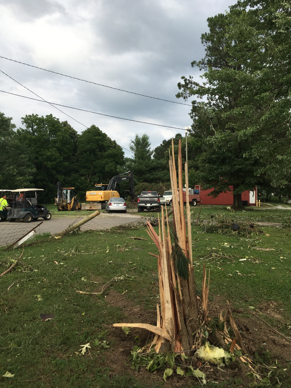
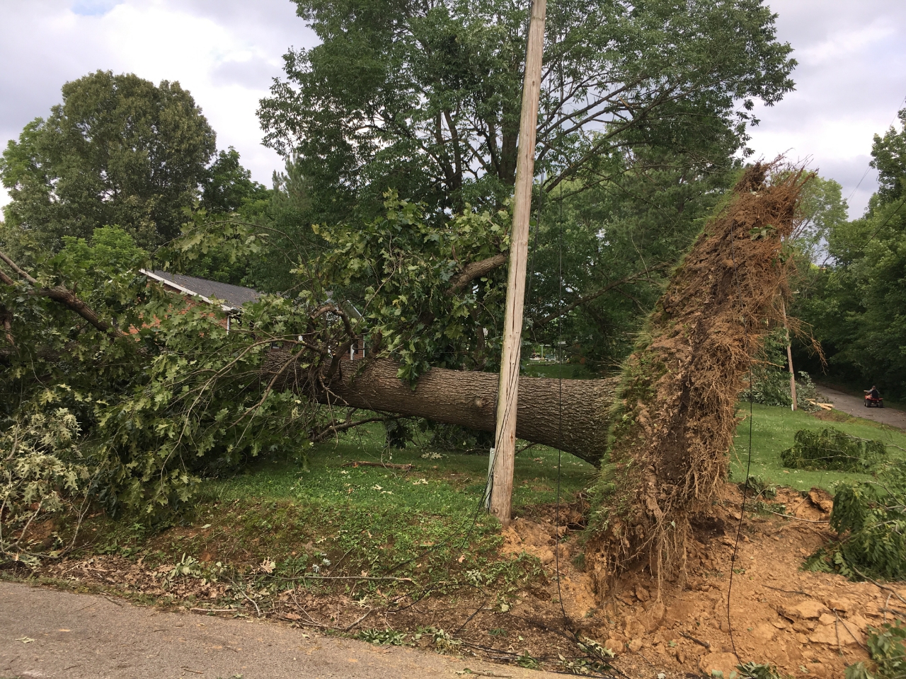
...NWS Damage Survey for 06/25/2018 Tornado Event...

.Ohio County, KY Tornado...

EF Scale Rating:           EF-1
Estimated Peak Wind:       95-100 mph
Path Length/Statue/:       0.6 miles
Path Width/Maximum/:       100 yards
Fatalities:                0
Injuries:                  0

Start Date:                06/25/2018
Start Time:                10:50 AM CDT
Start Location:            3.1 miles WSW of Beaver Dam, KY, in
McHenry
Start Lat/Lon:             37.385 / -86.9288

End Date:                  06/25/2018
End Time:                  10:52 AM CDT
End Location:              2.6 Miles WSW of Beaver Dam, KY, in
McHenry
End Lat/Lon:               37.8590 / -86.9179

Survey Summary:This brief tornado did most of its damage at treetop level, snapping
the trunks of or uprooting at least two dozen large, mature oaks
and cedars, and causing limb damage to many others.  In one case, it
snapped the 2-foot diameter trunk of a large cedar less than 5 feet
above the ground, but lofted the tree over nearby utility lines -
which remained intact - and deposited the tree 200 feet to the east.
 The tornado did occasionally reach closer to the ground, causing
significant damage to two structures.  The first was a large brick
ranch home, which had most of the north half of its roof torn off,
and insulation spread eastward in a narrow path. One piece of
roofing lumber was found 500 feet ENE of the home.  A second
building - a large 2-story brick industrial building 1/2 mile east -
had about 20 percent of its metal roof peeled off.  Immediately
after hitting this building and downing trees in a nearby cemetery,
it crossed U.S. Hwy 62 and did additional tree damage for another
several hundred feet as it moved through a wooded area.  The National Weather Service thanks Ohio County Emergency
Management for their assistance in this survey, including drone
surveillance that helped identify the path of this storm.

EF Scale:  The Enhanced Fujita Scale classifies tornadoes into the
following categories:

EF0...Weak.....65 to 85 MPH
EF1...Weak.....86 to 110 MPH
EF2...Strong...111 to 135 MPH
EF3...Strong...136 to 165 MPH
EF4...Violent..166 to 200 MPH
EF5...Violent..>200 MPH

Note:  The information in this statement is preliminary and subject
to change pending final review of the event and publication in NWS
storm data.

For the latest updates, please visit our webpage at
weather.gov/louisville.

You can follow us on Facebook at NWSLouisville.

You can follow us on Twitter at @NWSLouisville.


 Weather Story
 Weather Map
 Local Radar