
A storm system will continue to produce widespread showers and thunderstorms as it progresses eastward across the central U.S. into the Northeast through the weekend. There are risks of severe thunderstorms and excessive rainfall on Saturday from the Ozarks into the mid-Mississippi River Valley with potential for damaging winds, large hail, tornadoes, and flash flooding. Read More >
Overview
|
Strong to severe thunderstorms impacted southern Indiana and central Kentucky Friday night into early Saturday morning. A few short-lived tornadoes developed between 8pm and midnight EDT on the evening of the 18th. |
 |
Tornadoes:
Interactive Damage Survey Map - Zoom in and click the points to see damage information and pictures. All damage points are preliminary at this time. Performance of this map may be slow due to heavy internet traffic.

|
Tornado - Salem, IN
Track Map
|
||||||||||||||||
|
Tornado - Bewleyville, KY
Track Map 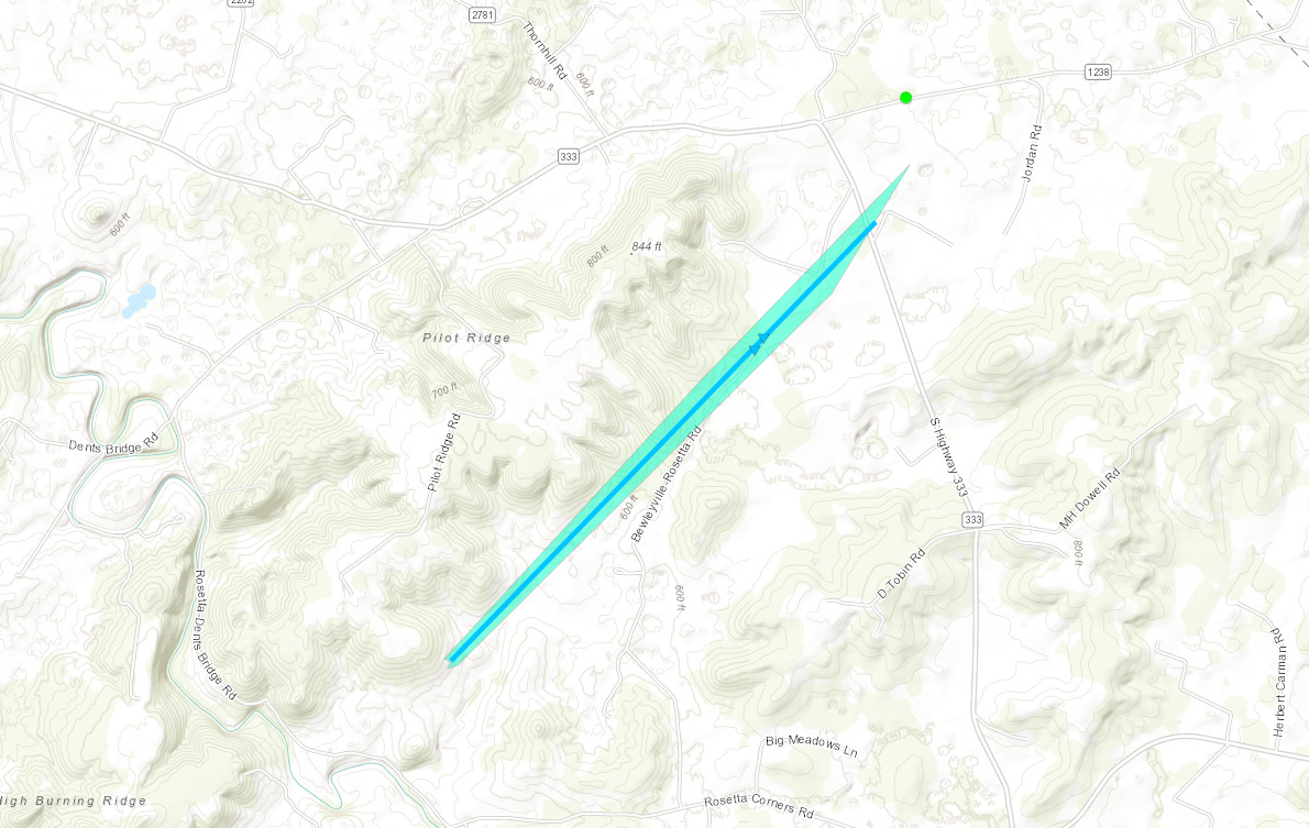 
|
||||||||||||||||
|
Tornado - Rineyville, KY
Track Map
|
||||||||||||||||
|
Tornado - West Point, KY
Track Map
|
||||||||||||||||
|
Tornado - Lebanon Junction, KY
Track Map 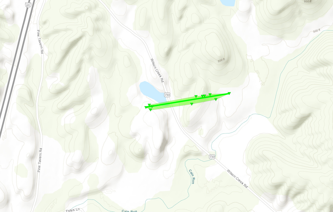 
|
||||||||||||||||
The Enhanced Fujita (EF) Scale classifies tornadoes into the following categories:
| EF0 Weak 65-85 mph |
EF1 Moderate 86-110 mph |
EF2 Significant 111-135 mph |
EF3 Severe 136-165 mph |
EF4 Extreme 166-200 mph |
EF5 Catastrophic 200+ mph |
 |
|||||
Photos & Video
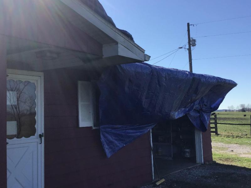
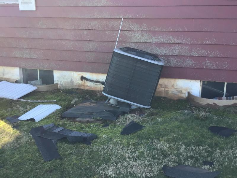
Washington County, IN
 |
 |
 |
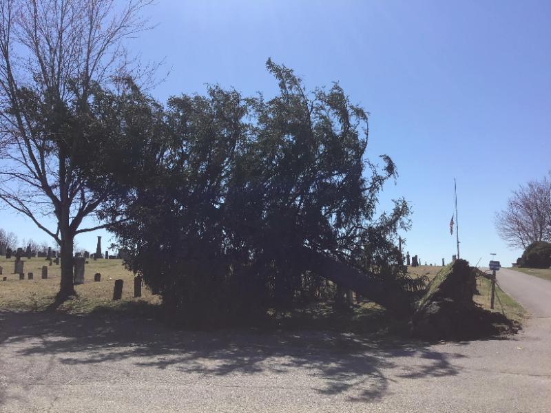 |
| Tornado Damage on Wilson Lane Courtesy NWS Storm Survey | Tornado Damage on Wilson Lane Courtesy NWS Storm Survey |
Tornado Damage on Wilson Lane Courtesy NWS Storm Survey | Tornado Damage in Crown Hill Cemetery in Salem Courtesy NWS Storm Survey |
Hardin County, KY (Rineyville)
 |
 |
 |
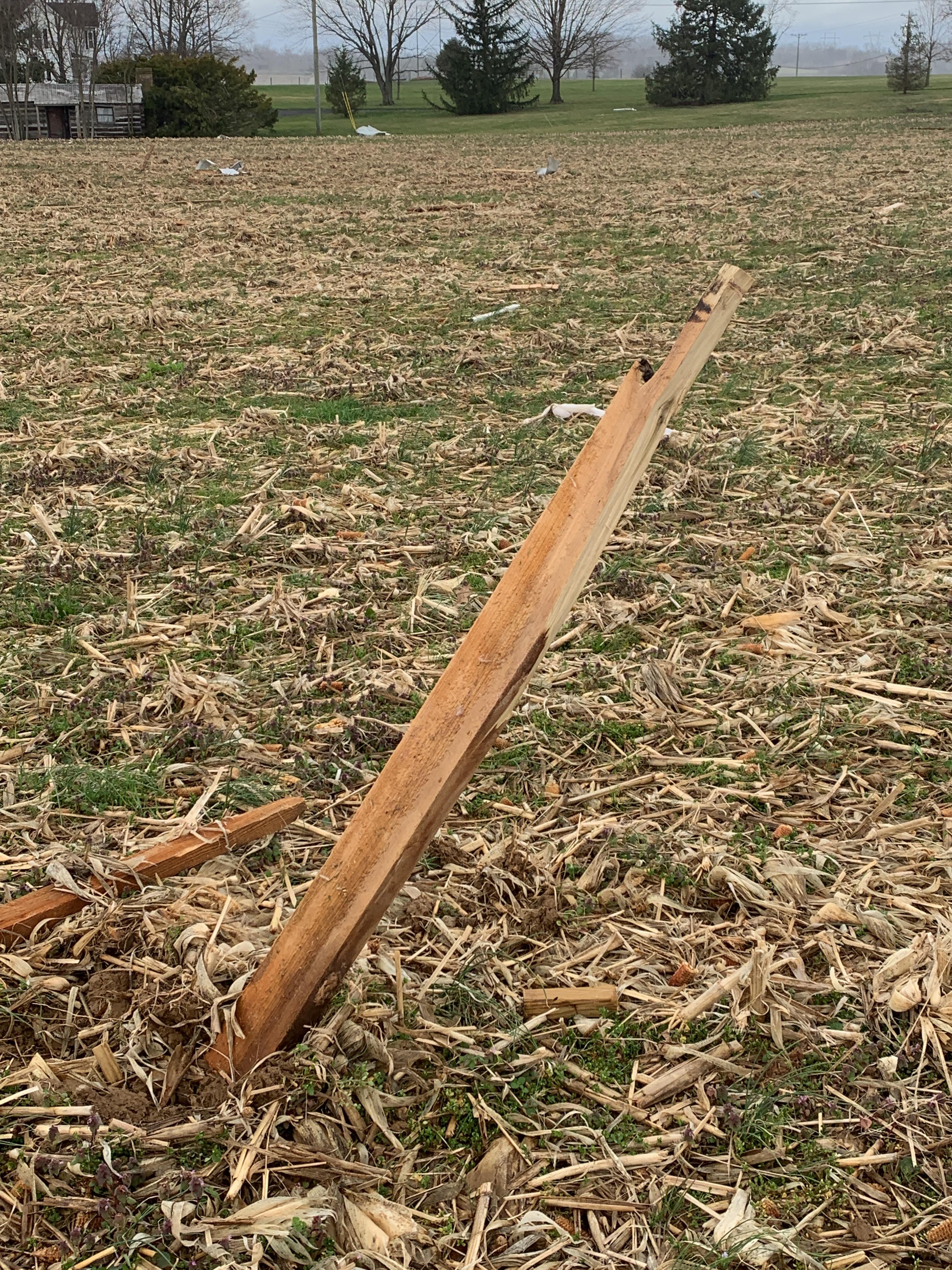 |
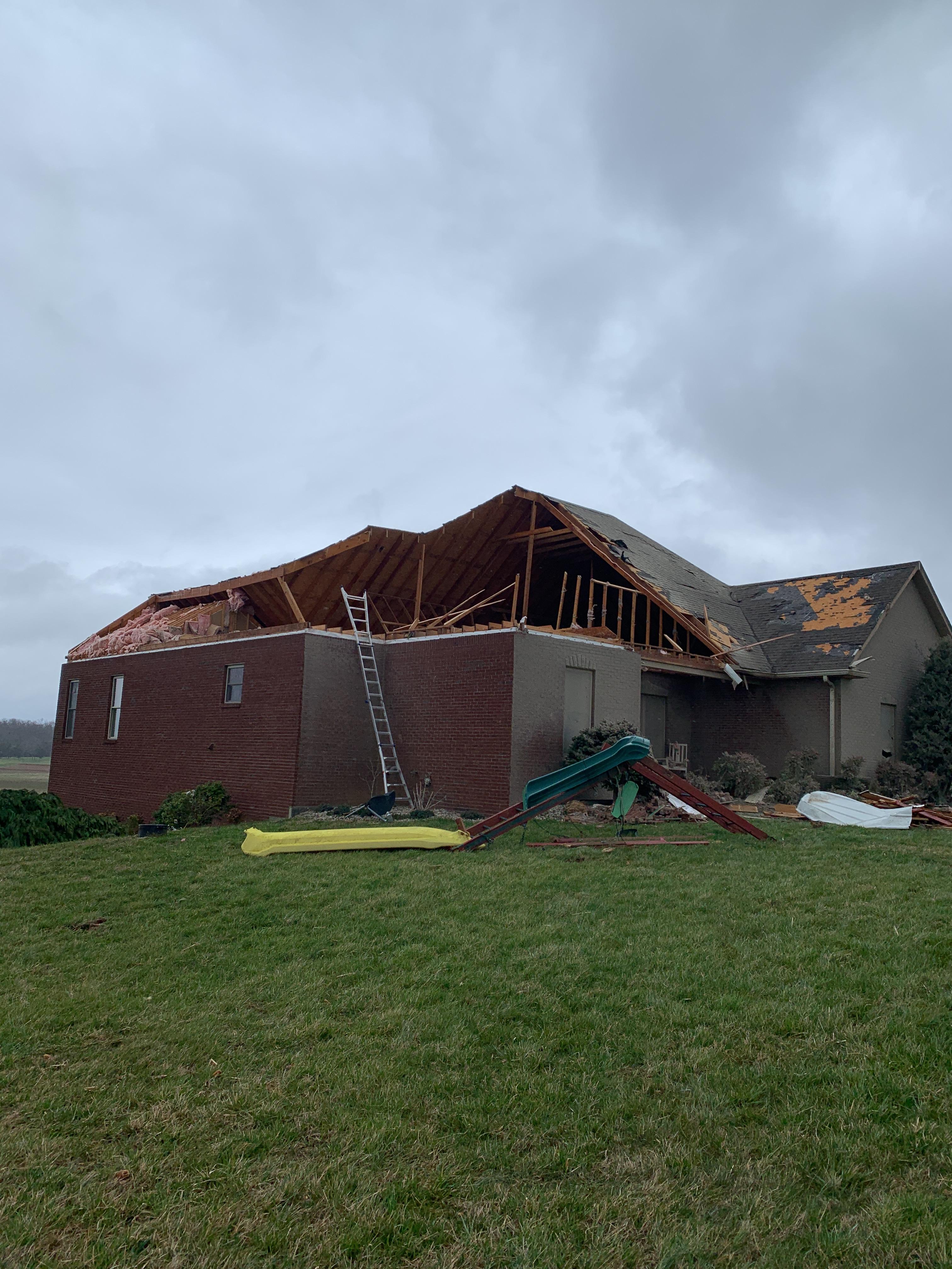
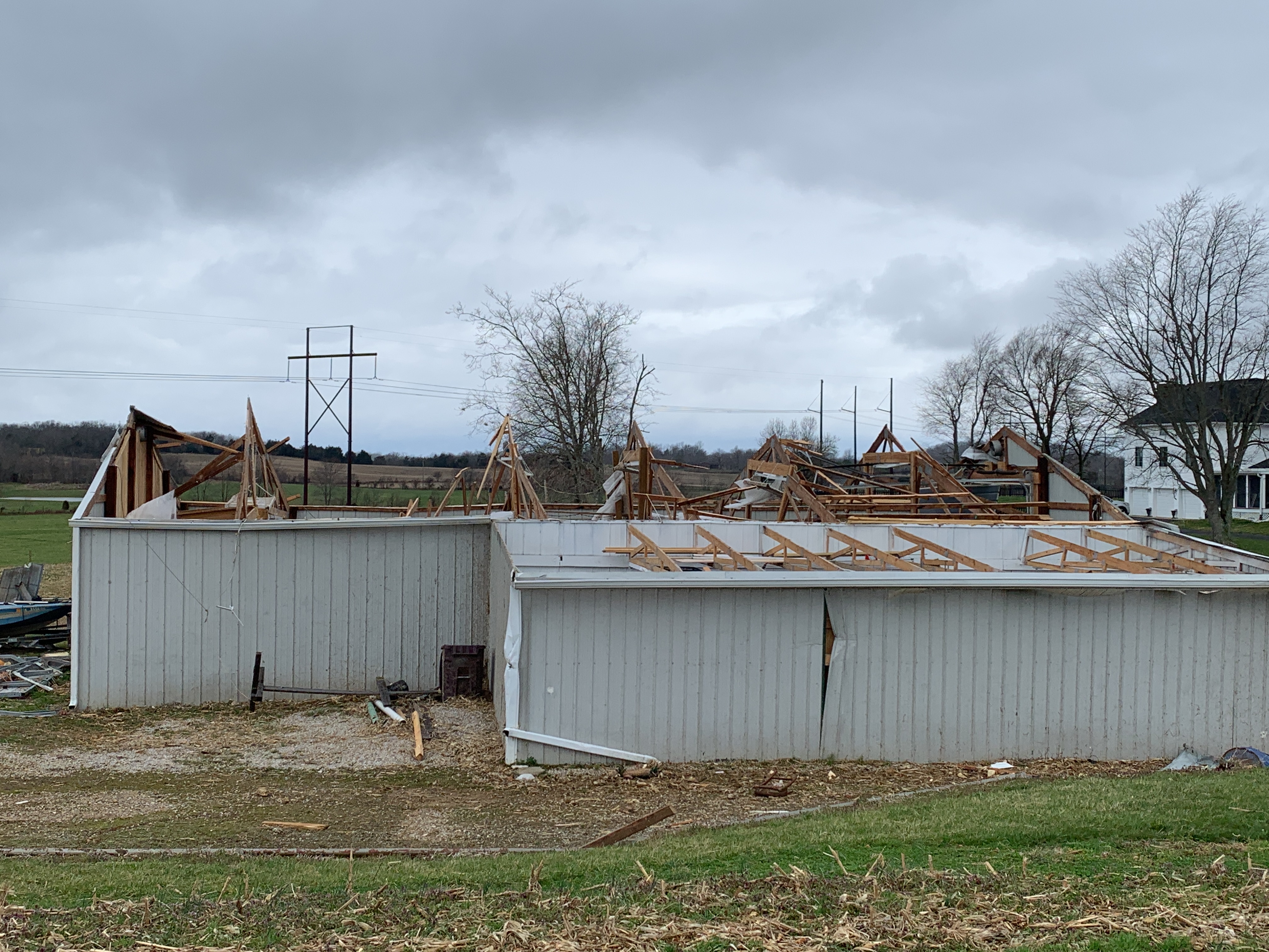
| Tornado Damage near Rineyville Courtesy of NWS Storm Survey | Tornado Damage near Rineyville Courtesy of NWS Storm Survey |
Tornado Damage near Rineyville Courtesy of NWS Storm Survey | Tornado Damage near Rineyville Courtesy of NWS Storm Survey |
Drone video of tornado damage in Hardin County, Kentucky
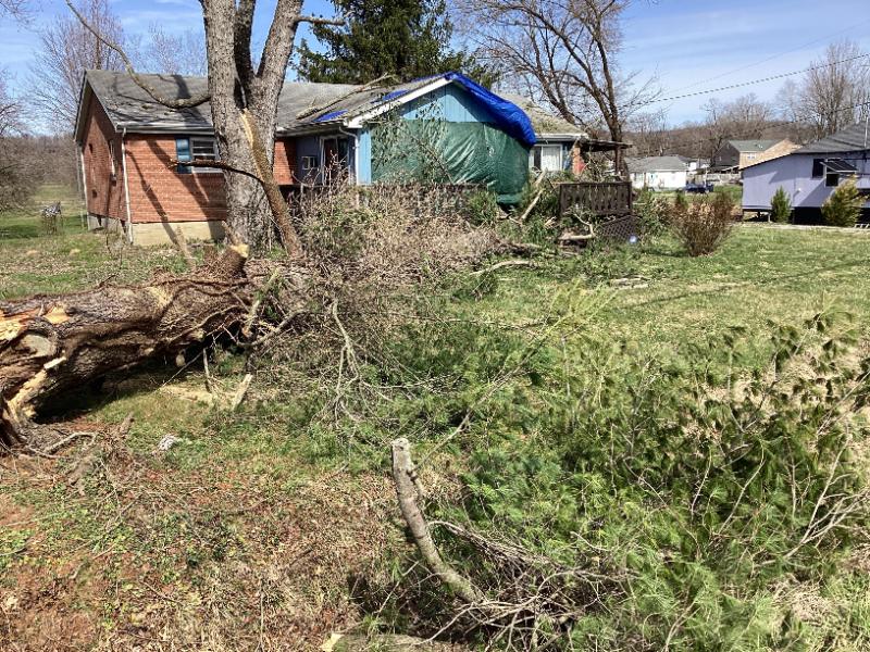
Hardin County, KY (West Point)
 |
 |
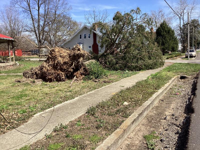 |
| Tornado Damage in West Point Courtesy NWS Storm Survey |
Tornado Damage in West Point Courtesy NWS Storm Survey | Tornado Damage in West Point Courtesy NWS Storm Survey |
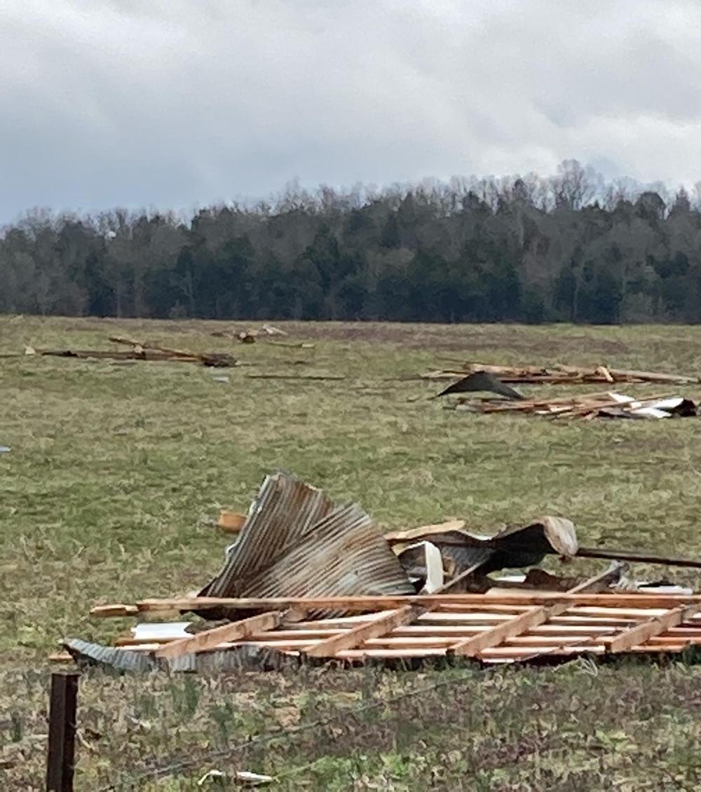
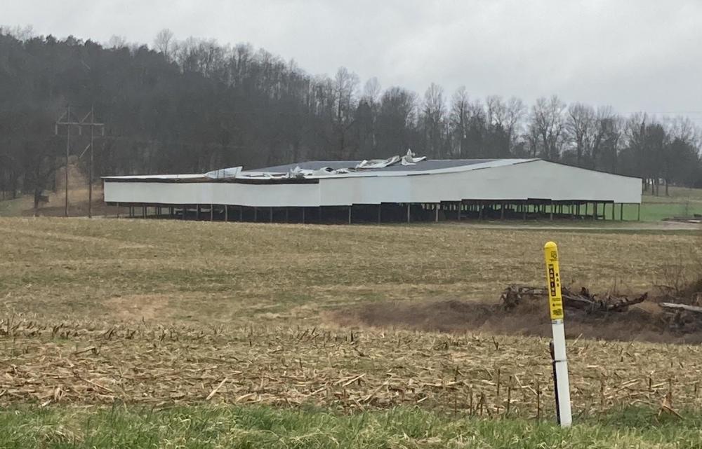
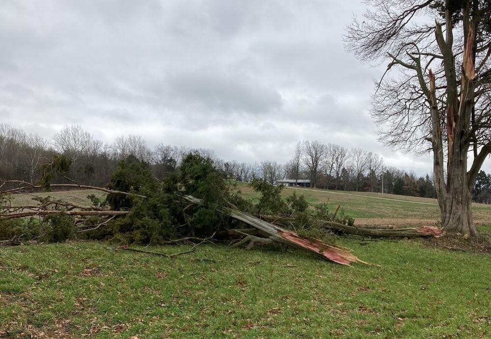
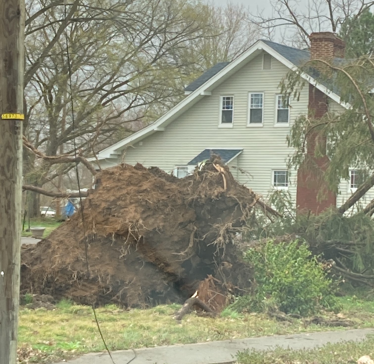
Breckinridge/Meade County, KY
 |
 |
 |
 |
| Tornado Damage near Bewleyville Courtesy of NWS Storm Survey |
Straight Line Wind Damage in Meade County. Courtesy of NWS Storm Survey | Straight Line Wind Damage in Meade County. Courtesy of NWS Storm Survey | Straight Line Wind Damage in West Point. Courtesy of NWS Storm Survey |
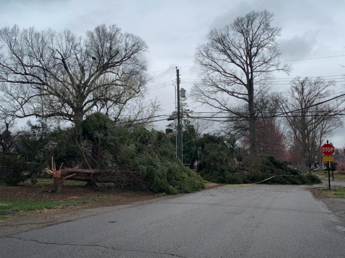
Jefferson County, KY
 |
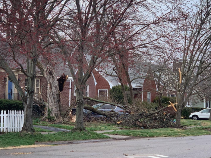 |
| Straight Line Wind Damage in St. Matthews. Courtesy of Tyler Voelker | Straight Line Wind Damage in St. Matthews. Courtesy of Tyler Voelker |
Radar
Washington County, IN
 |
 |
 |
 |
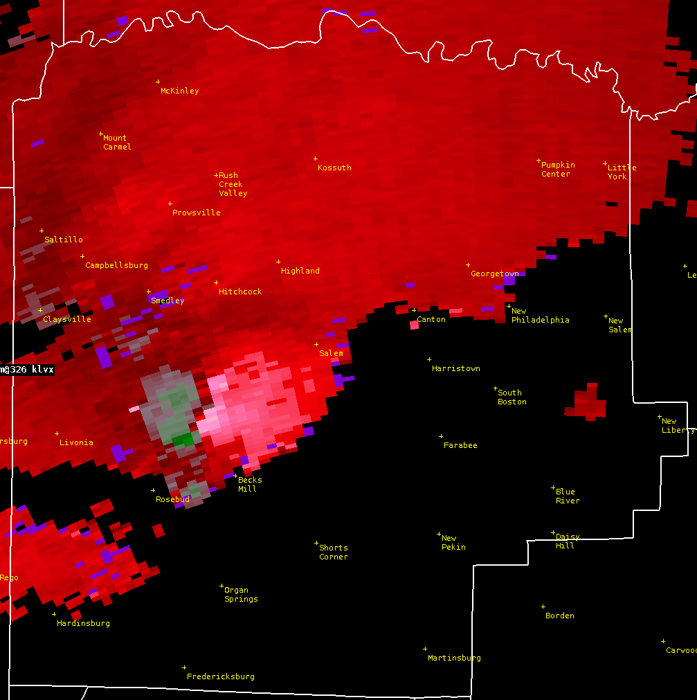
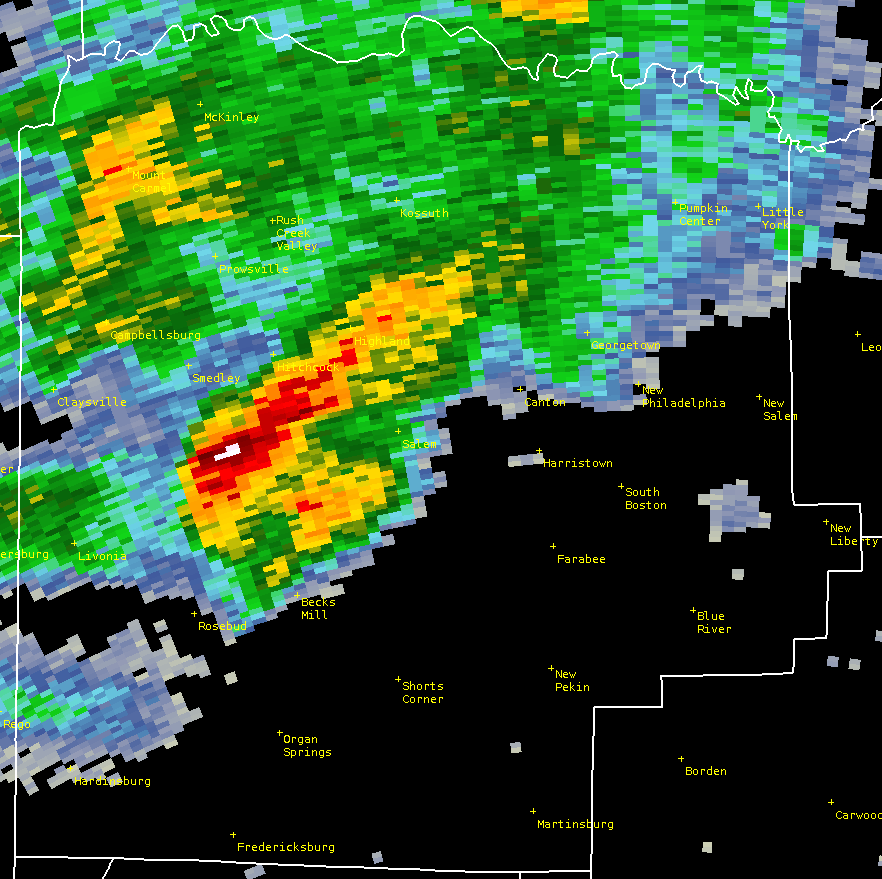
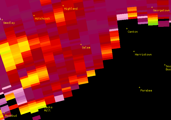
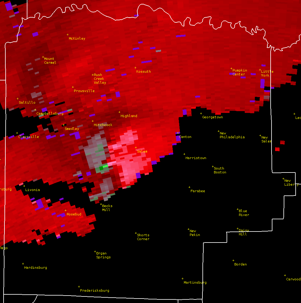
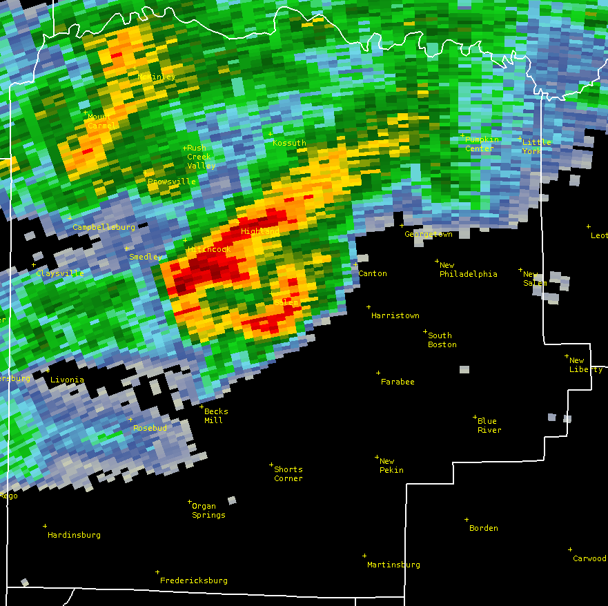
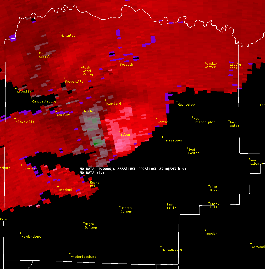
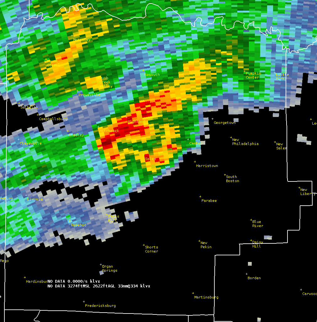
| 8:06pm EDT Storm Relative Velocity | 8:06pm EDT Reflectivity |
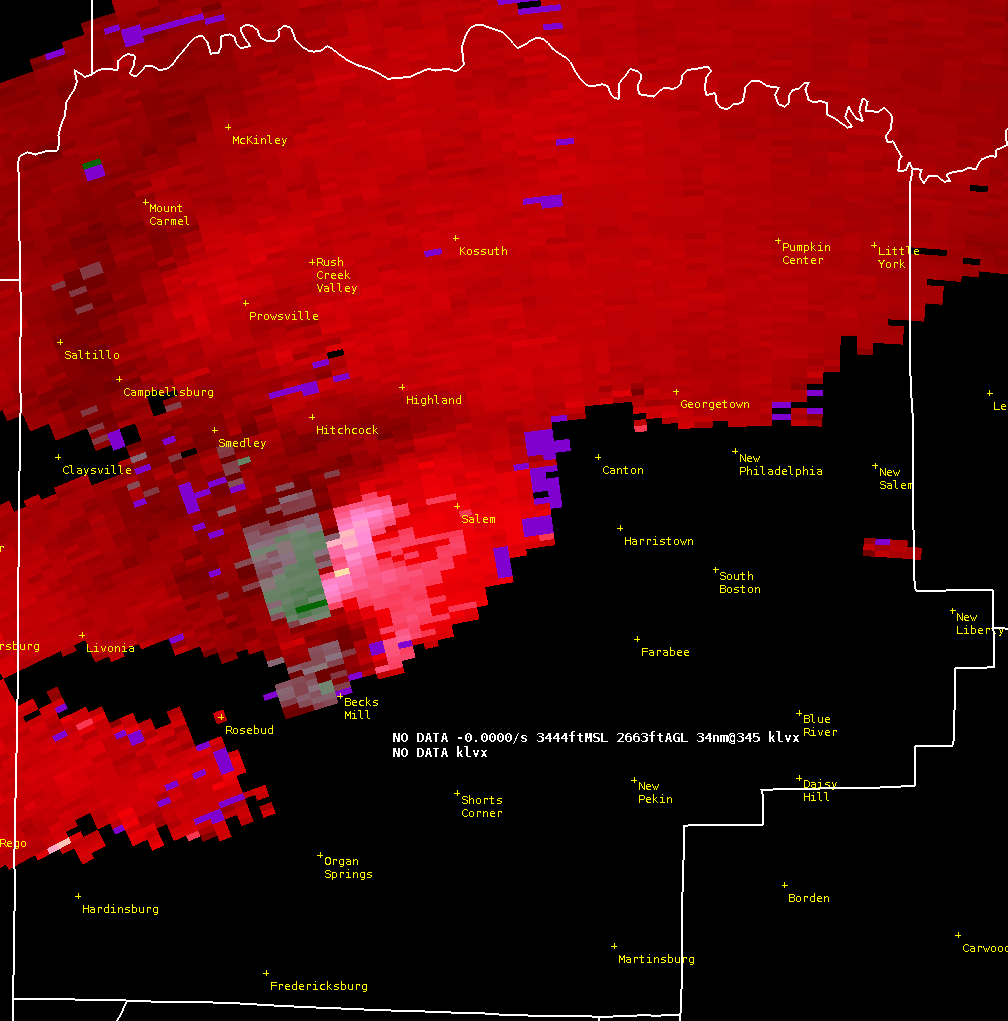
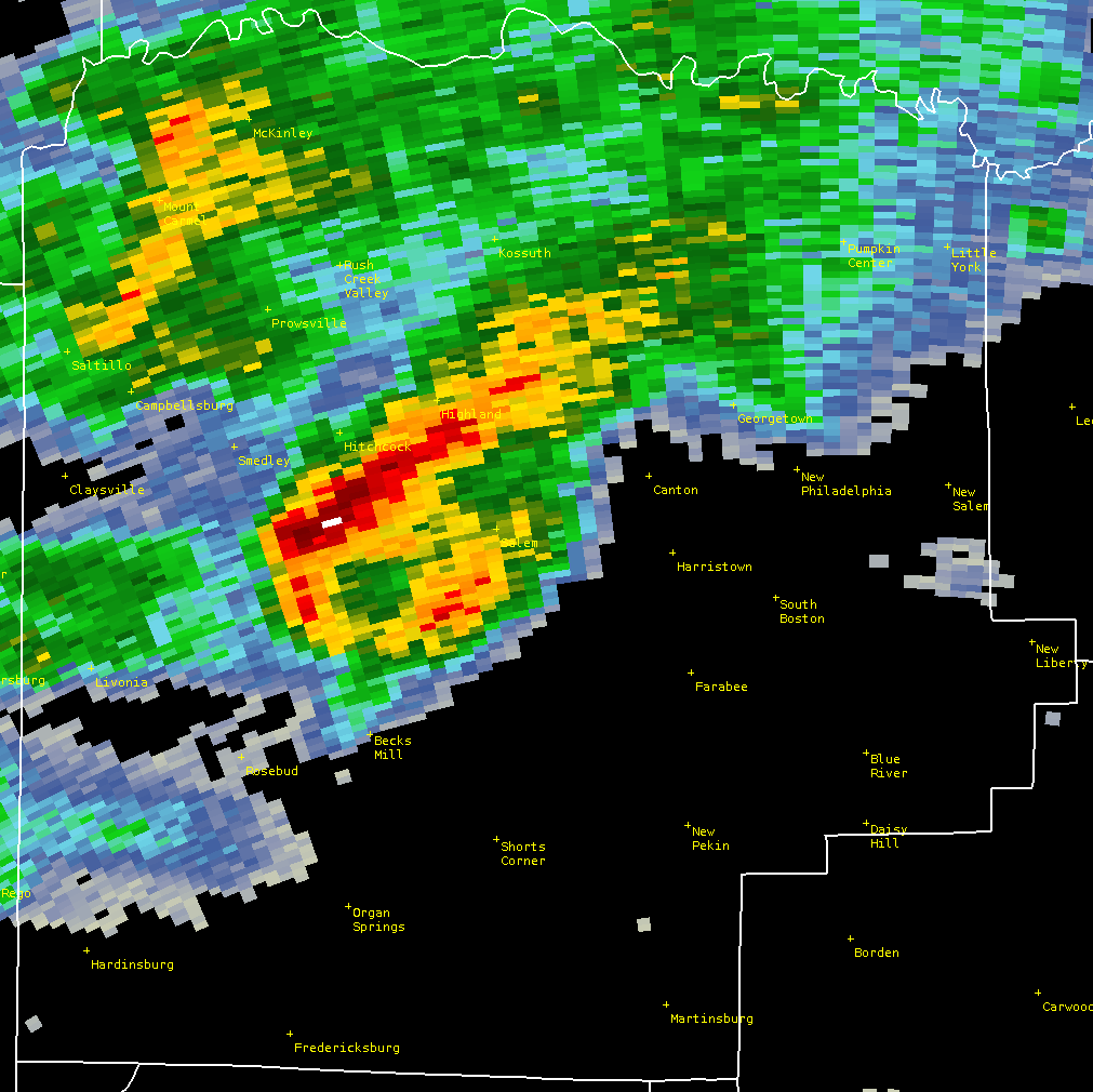
8:08pm EDT Storm relative Vorticity | 8:08pm EDT Reflectivity |
 |
 |
 |
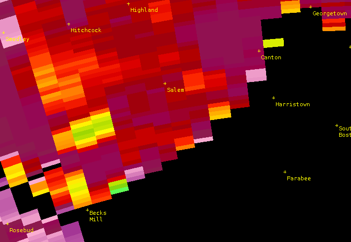 |
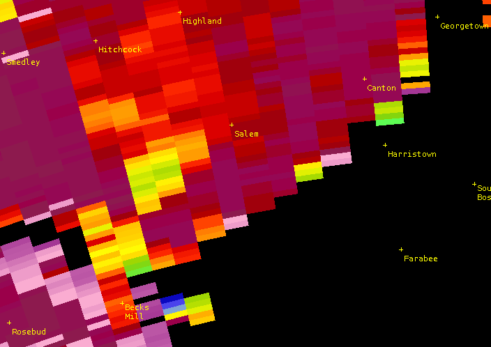
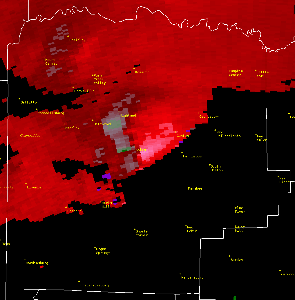
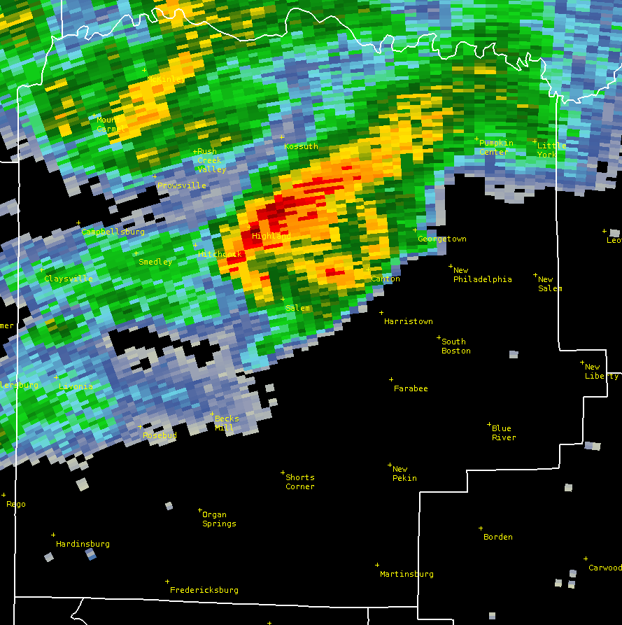
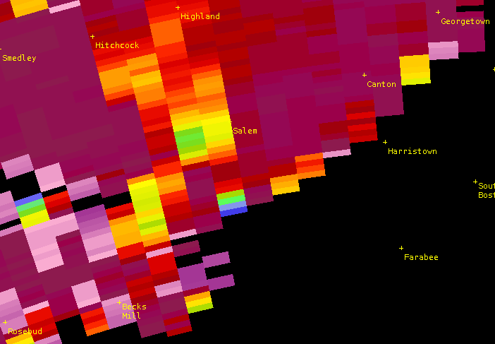
| 8:08pm Correlation Coefficient. Just two minutes into the tornado's lifetime, debris is being lofted into the air northwest of Becks Mill. | 8:10pm EDT Storm relative Vorticity | 8:10pm EDT Reflectivity | 8:10pm Correlation Coefficient. Debris showing up more clearly in the green and yellow shades surrounded by purple north of Becks Mill. |
 |
 |
 |
 |
| 8:12pm EDT Storm relative Velocity | 8:12pm EDT Reflectivity |
8:12pm EDT Correlation Coefficient | 8:14pm Storm Relative Velocity |
 |
 |
 |
 |
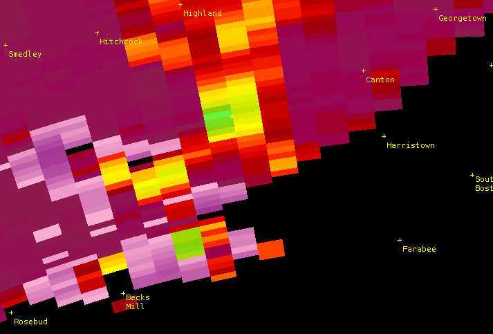
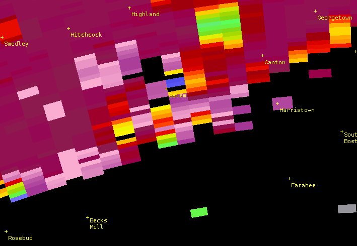
| 8:14pm EDT Reflectivity | 8:14pm EDT Correlation Coefficient. The tornado ended two minutes ago but lightweight debris continues to swirl in the skies over Salem. |
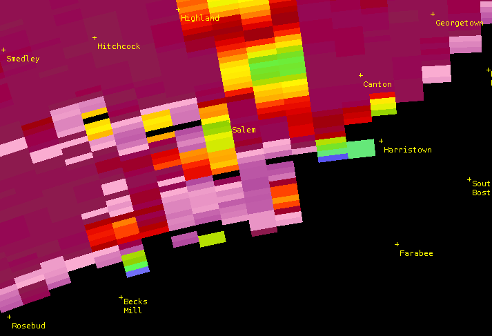
8:16pm Correlation Coefficient. | 8:19pm Correlation Coefficient |
 |
|||
| 8:21pm EDT Correlation Coefficient. Seven minutes after the tornado, debris still visible aloft (green colors northeast of Salem). |
Hardin County (Rineyville), KY
 |
 |
 |
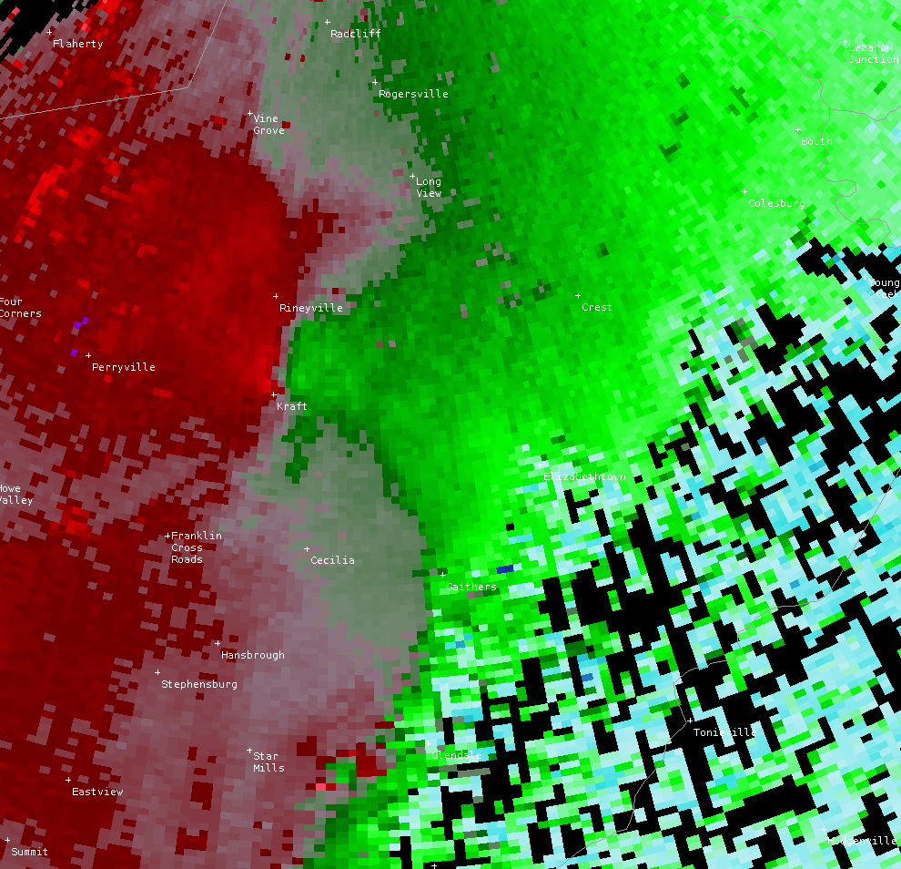 |
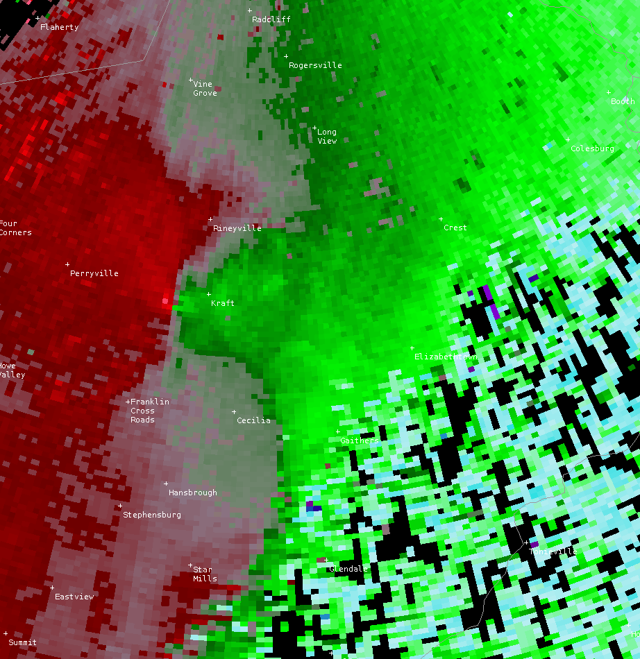
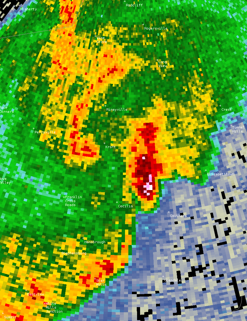
| 10:41pm EDT Storm Relative Velocity | 10:41pm EDT Reflectivity |
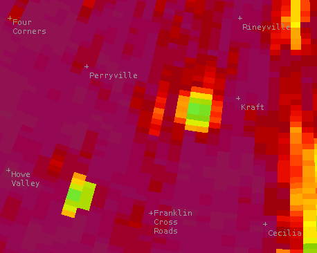
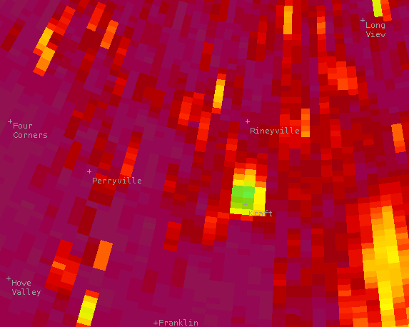
10:41pm EDT Correlation Coefficient showing debris aloft west of Kraft. | 10:43pm EDT Storm Relative Velocity |
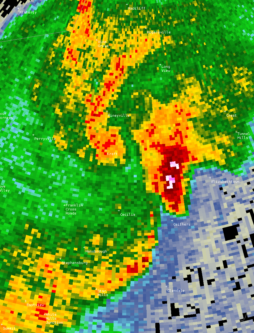 |
 |
 |
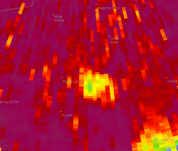 |
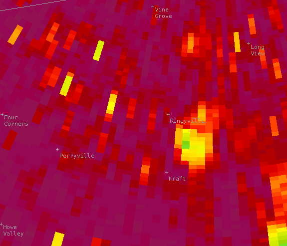
| 10:43pm EDT Reflectivity | 10:43pm EDT Correlation Coefficient | 10:45pm EDT Correlation Coefficient | 10:47pm EDT Correlation Coefficient |
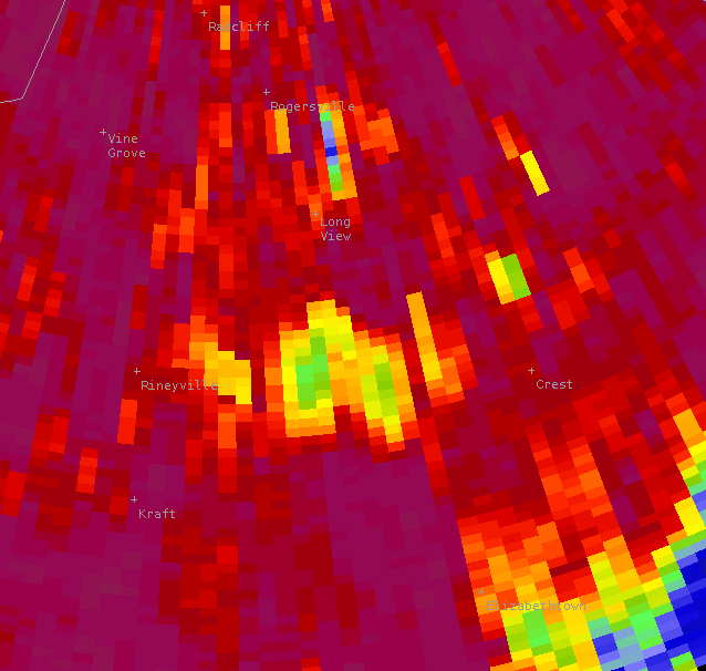 |
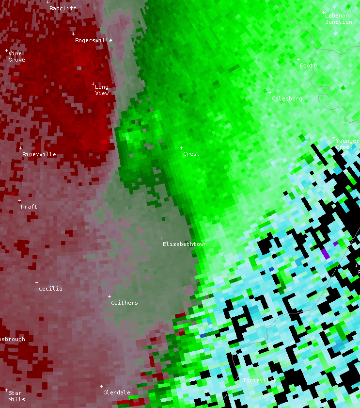 |
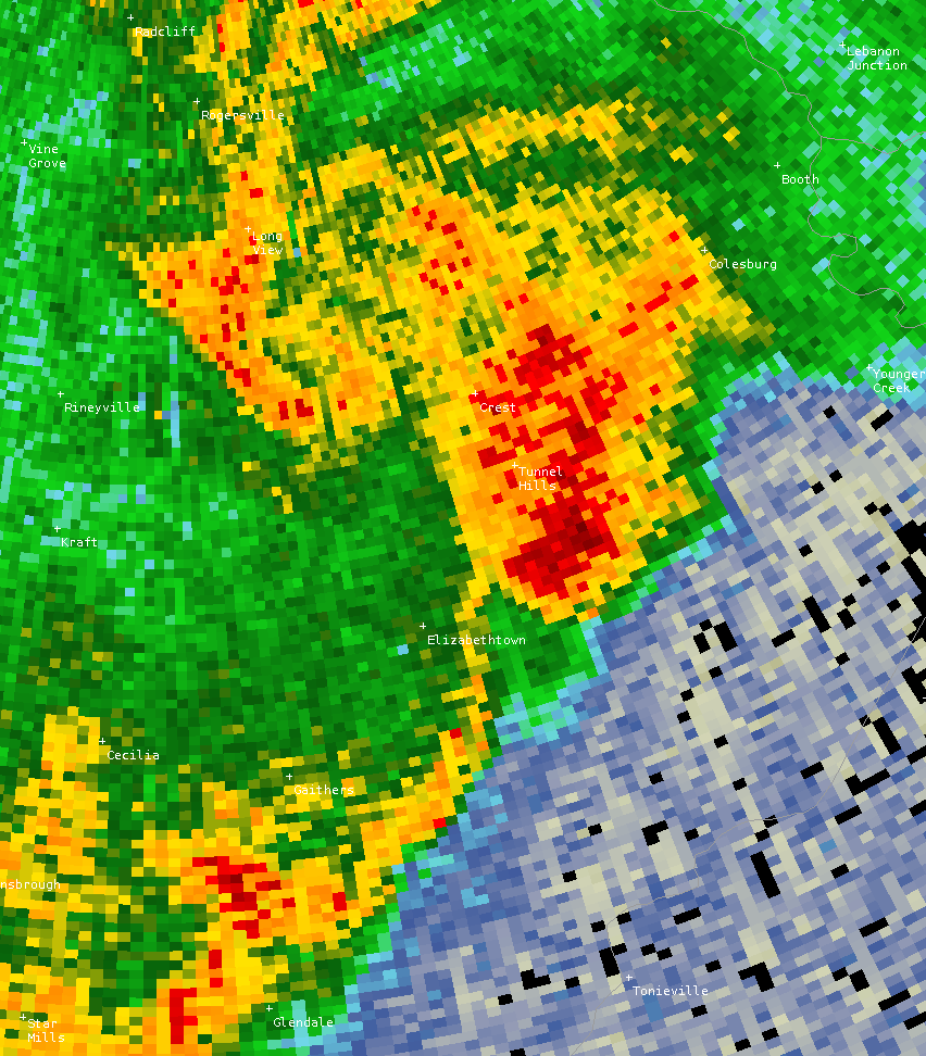 |
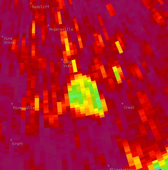 |
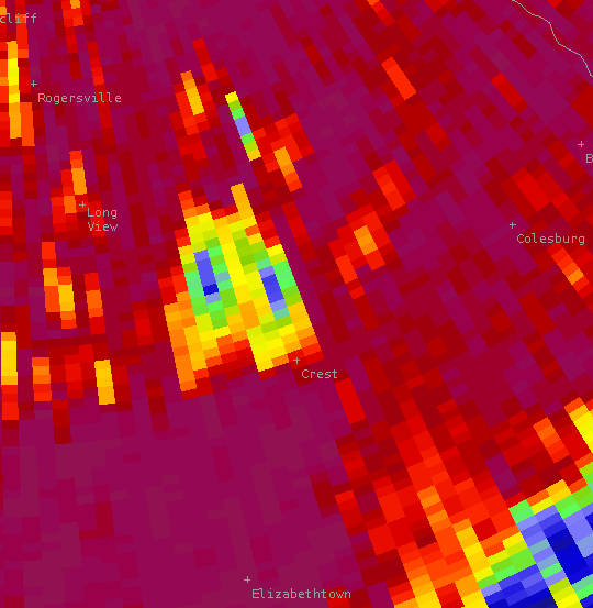
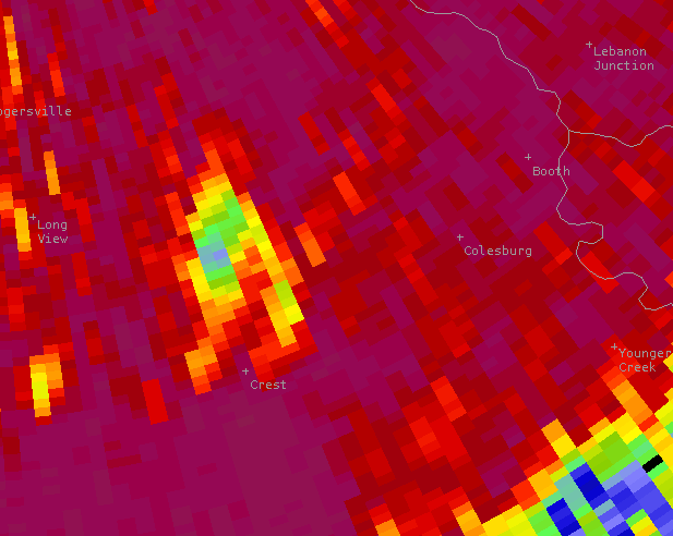
| 10:49pm EDT Correlation Coefficient | 10:50pm EDT Storm Relative Velocity | 10:50pm EDT Reflectivity | 10:50pm EDT Correlation Coefficient two minutes after the end of the tornado shows lightweight debris still suspended in the air. |
 |
 |
||
| 10:52pm EDT Correlation Coefficient | 10:54pm EDT Correlation Coefficient |
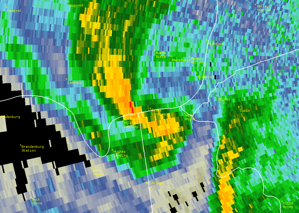
Hardin County (West Point), KY
 |
 |
||
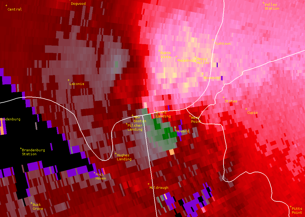
| 10:53pm EDT Storm Relative Velocity | 10:53pm EDT Reflectivity |
Breckinridge County and Bullitt County, KY
 |
 |
 |
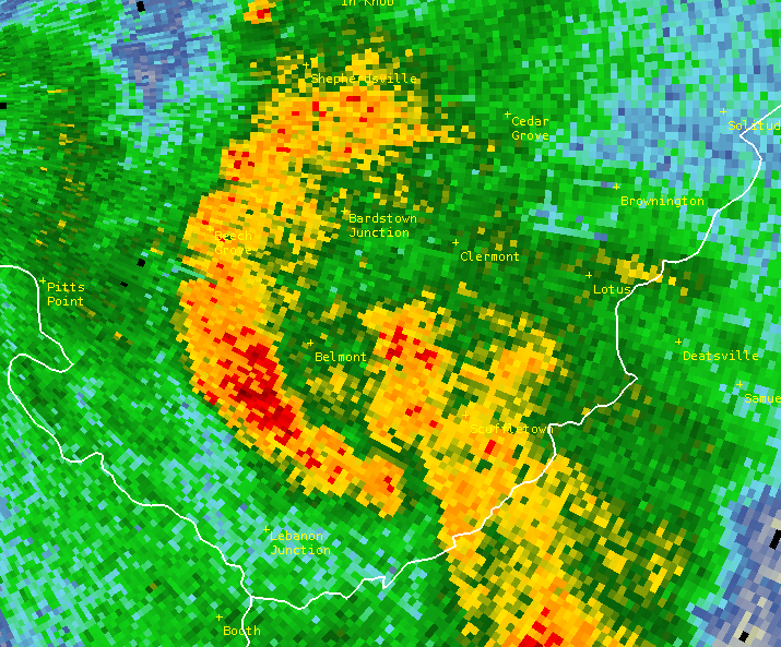 |
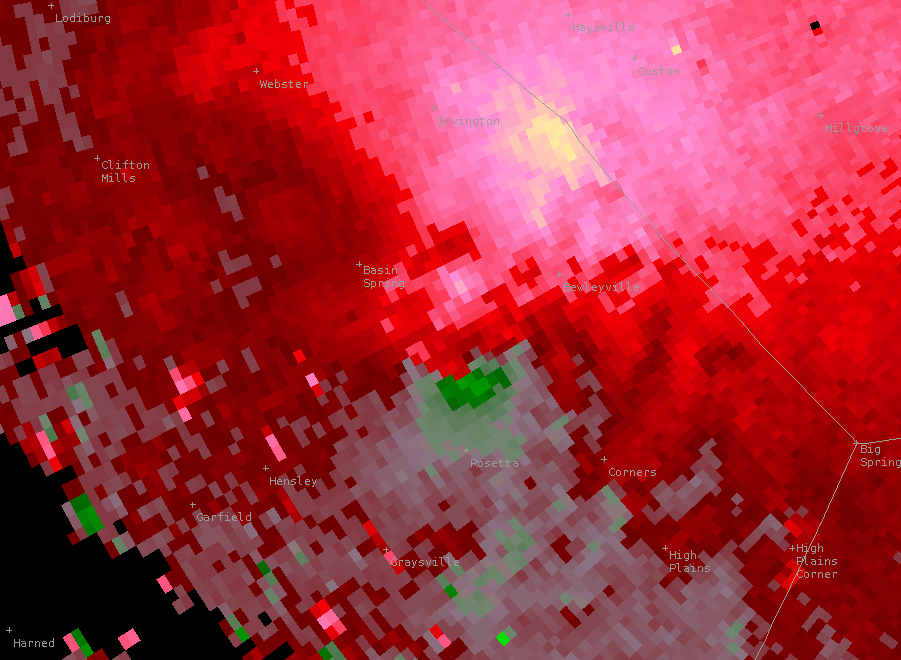
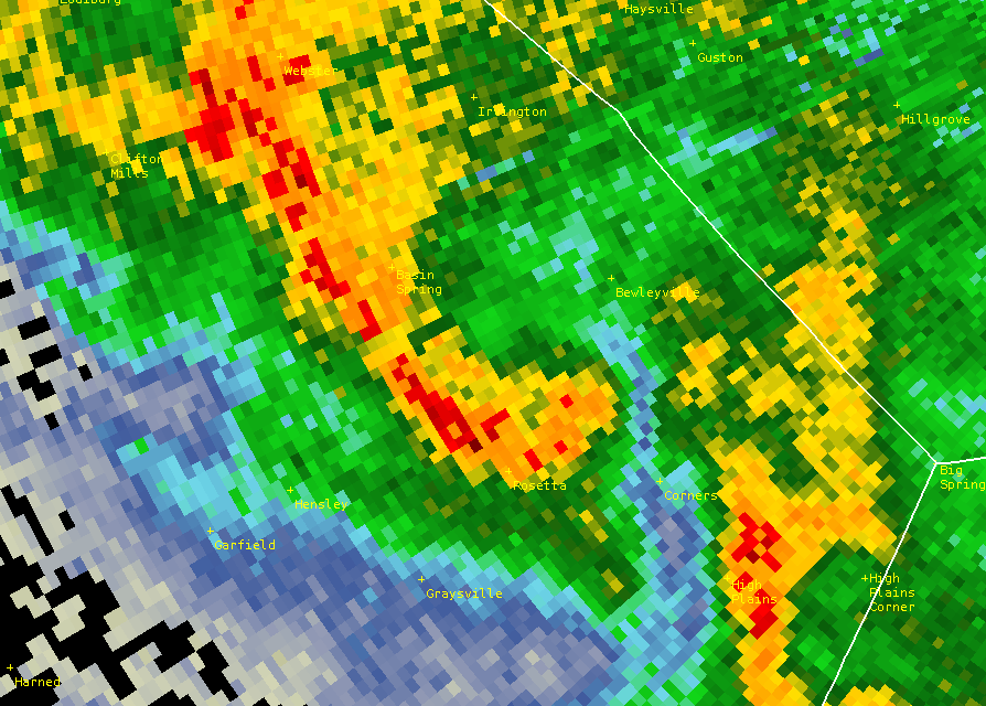
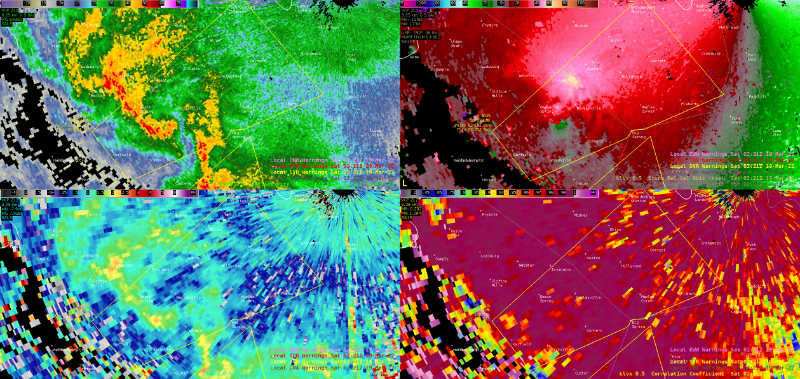
| 10:21pm EDT Breckinridge County Storm Relative Velocity | 10:21pm EDT Breckinridge County Reflectivity |
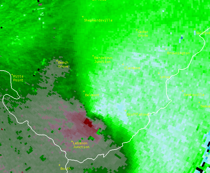
11:09pm EDT Bullitt County Storm Relative Velocity | 11:09pm EDT Bullitt County Reflectivity |
 |
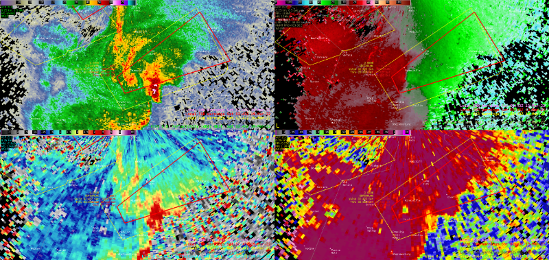 |
| Breckinridge County, KY Tornado | Hardin County, KY Tornado |
Storm Reports
These reports are PRELIMINARY. Final reports will be published in the Storm Events Database at NCEI. It may be a few months before the final reports are filed.
..TIME...   ...EVENT...      ...CITY LOCATION...     ...LAT.LON...
..DATE...   ....MAG....      ..COUNTY LOCATION..ST.. ...SOURCE....
            ..REMARKS..
0806 PM     TORNADO          5.5 SW SALEM            38.56N 86.18W
03/18/2022                   WASHINGTON         IN   NWS STORM SURVEY

            TORNADO TOUCHED DOWN 5.5 MILES SOUTHWEST OF
            SALEM AND LIFTED ON THE NORTHWEST SIDE OF
            THE PUBLIC SQUARE IN SALEM, MISSING THE
            WASHINGTON COUNTY COURTHOUSE BY LESS THAN
            200 FEET. THE TORNADO WAS ON THE GROUND FOR
            8 MINUTES AND HAD A PEAK WIND SPEED OF 105
            MPH (EF-1) AND PEAK WIDTH OF 200 YARDS ABOUT
            4 MILES SOUTHWEST OF SALEM.
1020 PM     TORNADO          3 SW BEWLEYVILLE        37.81N 86.28W
03/18/2022                   BRECKINRIDGE       KY   NWS STORM SURVEY

            A TORNADO OCCURRED IN BRECKINRIDGE COUNTY,
            KY THAT WAS 100 YARDS WIDE, 2.6 MILES LONG
            WITH MAX WINDS OF 80 MPH. PLEASE SEE THE
            ASSOCIATED PNS FOR MORE INFORMATION.

1038 PM     TORNADO          4 SSW RINEYVILLE        37.70N 86.00W
03/18/2022                   HARDIN             KY   NWS STORM SURVEY

            A TORNADO TOUCHED DOWN NEAR THE INTERSECTION
            OF SPEARS LANE AND ST. JOHN ROAD AND
            CONTINUED FOR 10 MINUTES, LIFTING NEAR
            LEASOR LANE AT 10:48 EDT. THE TORNADO WAS
            100 YARDS WIDE AND ON THE GROUND FOR 4.12
            MILES WITH MAXIMUM WINDS OF 100 MPH. PLEASE
            SEE ASSOCIATED PNS FOR MORE INFORMATION.

1052 PM     TORNADO          WEST POINT              37.99N 85.96W
03/18/2022                   HARDIN             KY   NWS STORM SURVEY

            75 YARD WIDE EF-0 TORNADO SKIPPED ACROSS
            WEST POINT AND ENDED NEAR THE OHIO VALLEY
            DRAGWAY IN THE SOUTHWEST TIP OF JEFFERSON
            COUNTY. ABOUT A DOZEN HOMES HAD ROOF AND
            SIDING DAMAGE.


1105 PM     TSTM WND DMG     VALLEY STATION          38.10N 85.85W
03/18/2022                   JEFFERSON          KY   BROADCAST MEDIA

            REPORT OF TREE DOWN ON A HOUSE ON GRAFTON
            HALL RD. IN VALLEY STATION.

1109 PM     TORNADO          3 NE LEBANON JUNCTION   37.86N 85.70W
03/18/2022                   BULLITT            KY   NWS STORM SURVEY

            A TORNADO OCCURRED IN BULLITT COUNTY, KY
            THAT WAS 100 YARDS WIDE, 0.32 MILES LONG
            WITH MAX WINDS OF 105 MPH. PLEASE SEE THE
            ASSOCIATED PNS FOR MORE INFORMATION.

1124 PM     TSTM WND GST     4 NW OKOLONA            38.18N 85.74W
03/18/2022  M68 MPH          JEFFERSON          KY   ASOS

            KSDF ASOS MEASURED 68 MPH WIND GUST...

1125 PM     TSTM WND DMG     3 NNW OKOLONA           38.18N 85.71W
03/18/2022                   JEFFERSON          KY   BROADCAST MEDIA

            TREE DOWN ON POWER LINES IN LYNNVIEW.

1132 PM     TSTM WND DMG     1 SSE SAINT MATTHEWS    38.24N 85.64W
03/18/2022                   JEFFERSON          KY   PUBLIC

            LARGE TREE DOWN ON POWER LINES VIA SOCIAL
            MEDIA AROUND BROWN PARK OFF BROWNS LANE AND
            KRESGE WAY.

1136 PM     TSTM WND GST     2 SW SAINT MATTHEWS     38.23N 85.66W
03/18/2022  M58 MPH          JEFFERSON          KY   ASOS

            KLOU ASOS MEASURED WIND GUST OF 58 MPH.

1203 AM     TSTM WND DMG     3 ESE FINCHVILLE        38.13N 85.27W
03/19/2022                   SHELBY             KY   EMERGENCY MNGR

            UNANCHORED 30X60 POLE BARN BLOWN OFF
            FOUNDATION INTO ROAD. TREE DOWN.
Warnings issued by NWS Louisville. Severe Thunderstorm Warnings are in yellow, Tornado Warnings are in red.
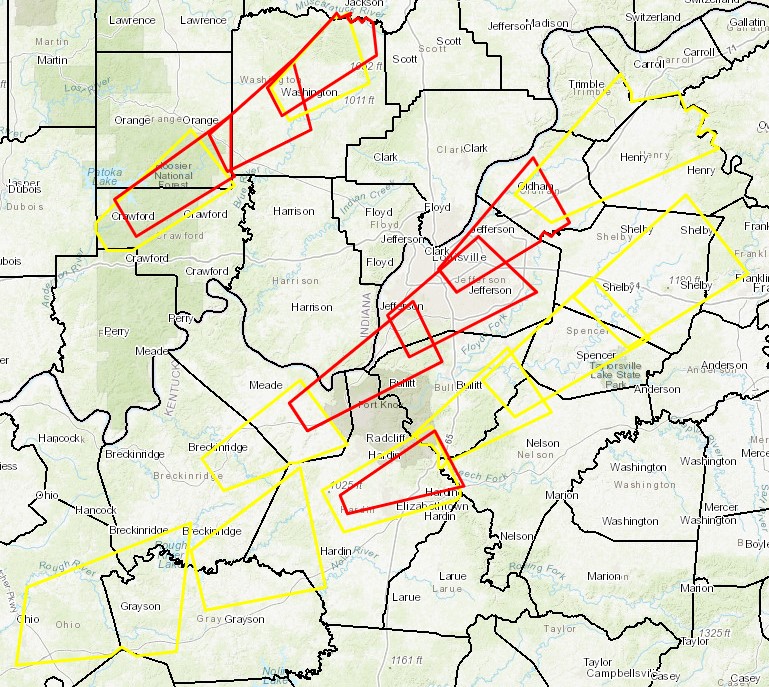
From 1987 to March 18, 2022 there have been 52 times where some part of Jefferson County, Kentucky (Louisville) was under a Tornado Warning. That's an average of about one every year and a half. The most in one year, by far, was 10 in 2011. Eight of those were on the same day: June 22 when 5 tornadoes developed in the metro area including an EF-2 that struck Churchill Downs. The greatest number of days in one year under which the county was under a Tornado Warning is 3, which has happened four times (1990, 2006, 2011, and 2012). The longest gap between Tornado Warnings was 1,853 days from January 30, 2013 to February 26, 2018 (followed very closely by a stretch of 1,802 days from June 7, 1990 to May 14, 1995). It's a four-way tie for the most common month to have at least one Tornado Warning: April, May, and June. During this time period (1987-March 18, 2022) there have been no Tornado Warnings issued for Jefferson County in the months of August, September, or December. Looking back through the historical record, there was an F2 in Jefferson County on August 27, 1854; but we know of no tornadoes that have struck the county in September or December.
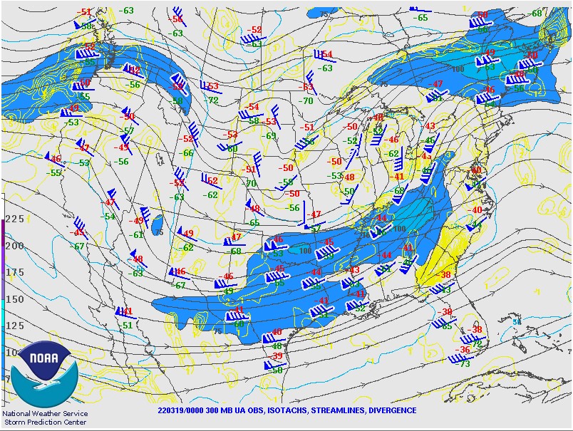
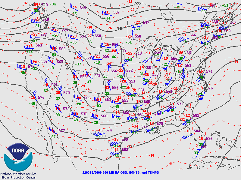
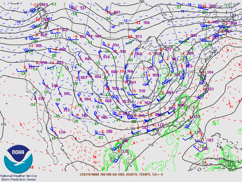
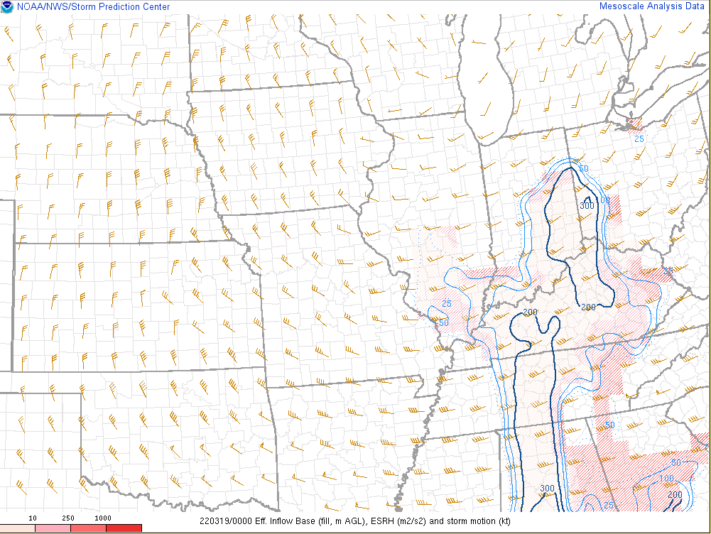
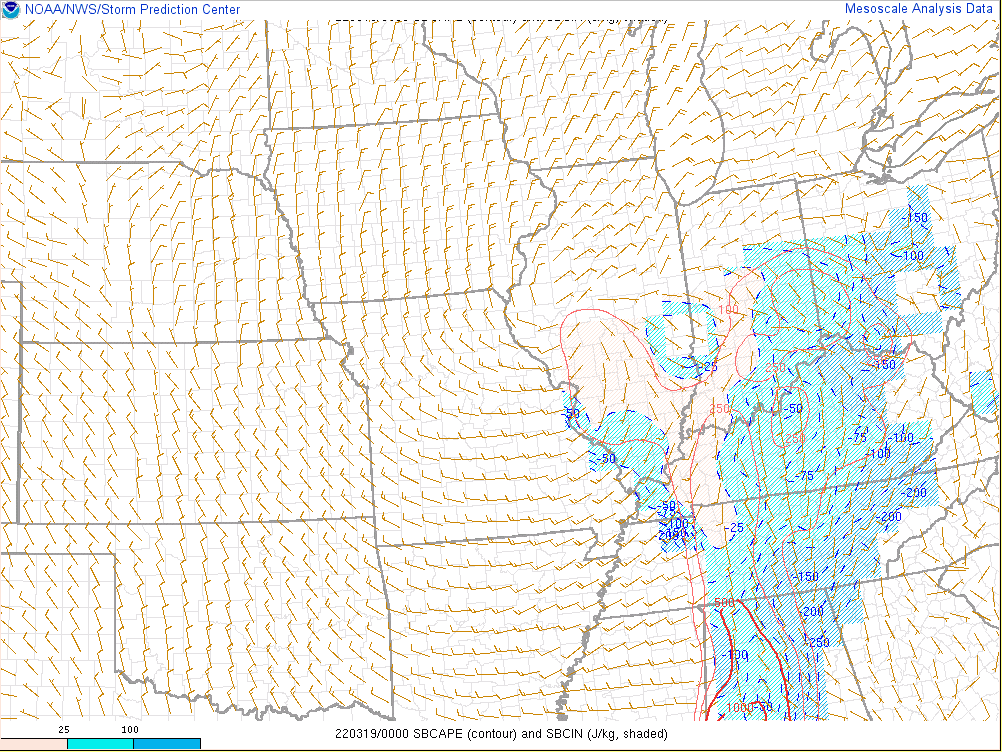
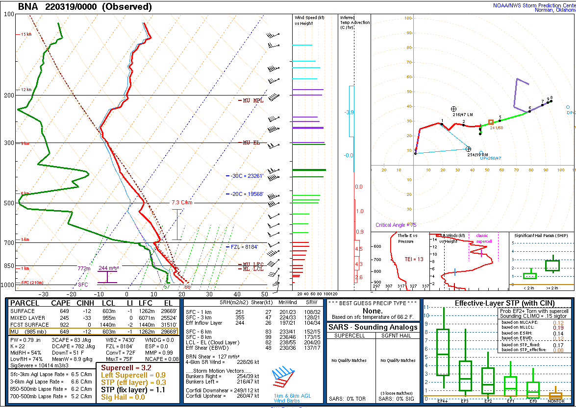
Environment
 |
 |
 |
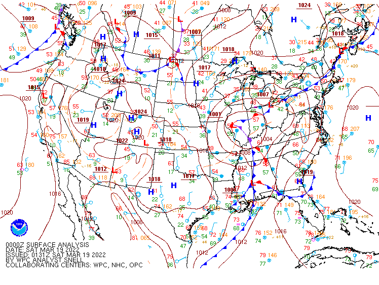 |
| 300mb Analysis (00z) | 500mb Analysis (00z) | 700mb Analysis (00z) | Surface Analysis (00z) |
 |
 |
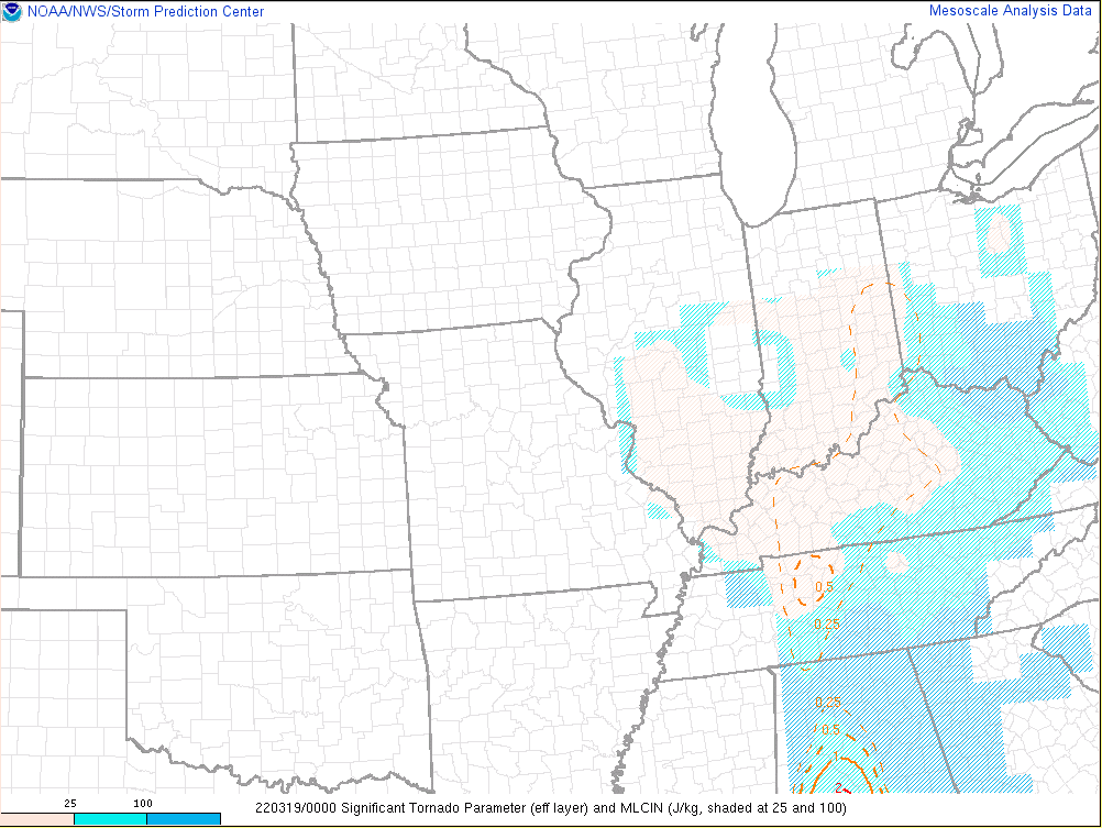 |
| Effective SRH (00z) | SBCAPE (00z) | Effective STP (00z) |
 |
 |
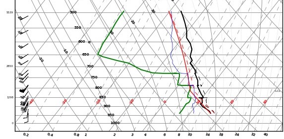 |
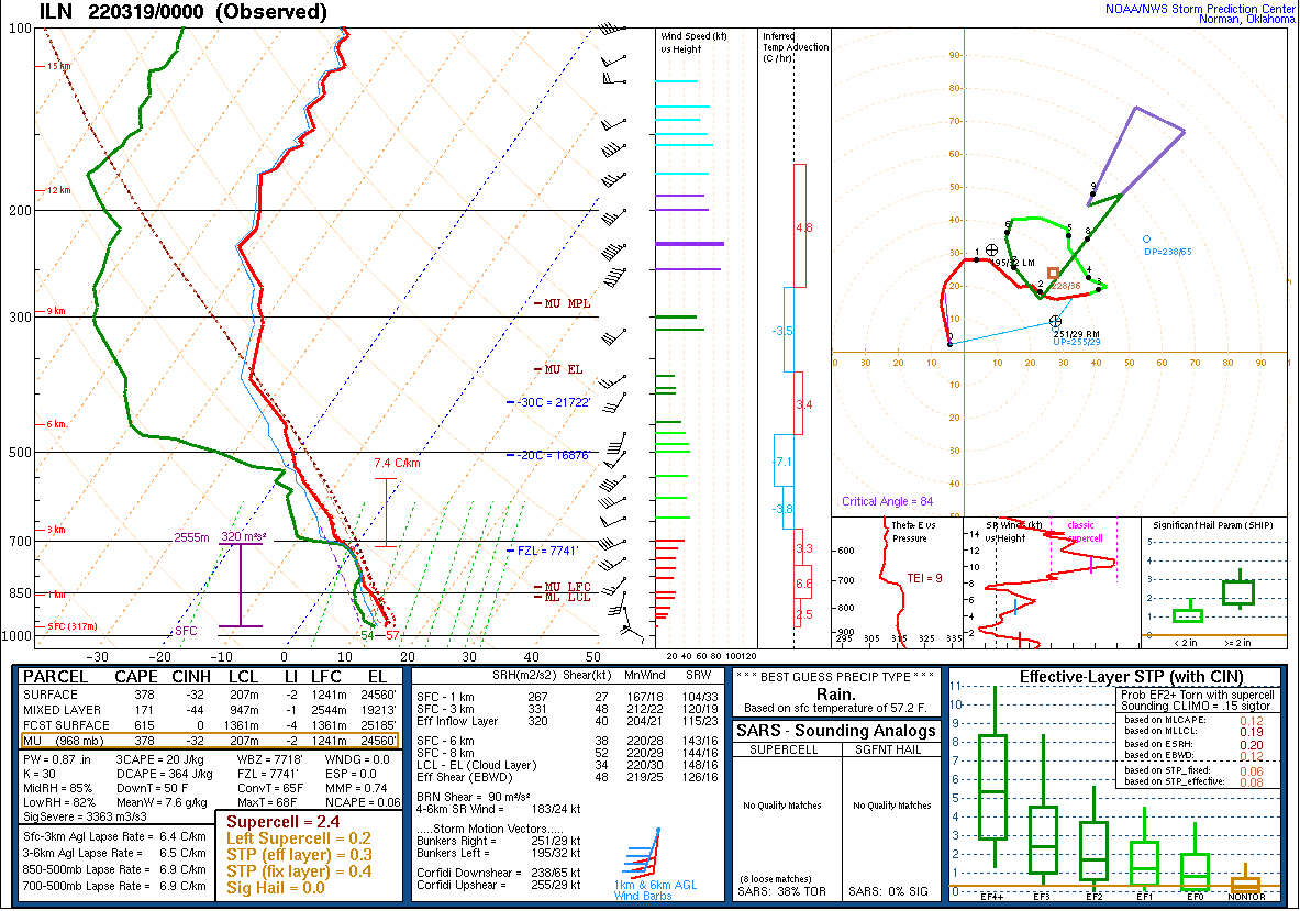
| Nashville 00z Sounding | Wilmington, OH 00z Sounding | Aircraft sounding from a plane landing at Louisville International Airport 23 minutes before a 68 mph surface wind gust. |
 |
Media use of NWS Web News Stories is encouraged! Please acknowledge the NWS as the source of any news information accessed from this site. |
 |