Louisville, KY
Weather Forecast Office
Begin Time: 4:02 PM EST
End Time: 4:03 PM EST
Begin Point: 1 SW Guston
End Point: 1 S Guston
EF Scale: EF-0
Wind Speed: 75 MPH
Path Length: 3/4 mile
Path Width: 30 yards
Injuries: 0
Fatalities: 0
Narrative:
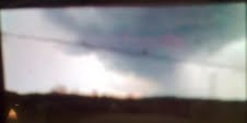
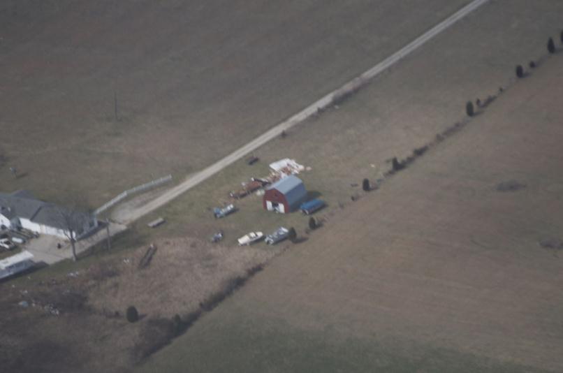
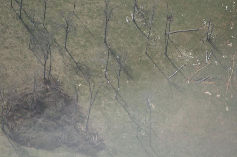
The National Weather Service in conjunction with Meade County Emergency Management has determined that an EF-0 tornado with maximum wind speeds of 75 mph briefly touched down just east of the Breckinridge/Meade county line in Meade county. The tornado was photographed from Ekron, looking southwestward. Aerial photos of damage were also taken by volunteer general aviation pilots Mark Powers and Josh Kieffer and aerial photographer Austin Lassell in aircraft N16NA. The pilots were associated with the Kentuckiana Volunteer Aviators. Both the aerial photos and picture of the
tornado relayed by the emergency manager were matched up with a radar signature indicating rotation. The tornado touched down near the Hill Grove and Guston area on the south side of U.S. 60, blowing a porch off the side of a house. A sign was also blown down at abusiness along U.S. 60.
Meade County, KY Aerial Photos Courtesy Mark Powers, Josh Kiefer, and Austin Lassel of Kentuckiana Volunteer Aviators
 |
 |
 |
Current Hazards
Hazardous Weather Outlook
Storm Prediction Center
Submit a Storm Report
Advisory/Warning Criteria
Radar
Fort Knox
Evansville
Fort Campbell
Nashville
Jackson
Wilmington
Latest Forecasts
El Nino and La Nina
Climate Prediction
Central U.S. Weather Stories
1-Stop Winter Forecast
Aviation
Spot Request
Air Quality
Fire Weather
Recreation Forecasts
1-Stop Drought
Event Ready
1-Stop Severe Forecast
Past Weather
Climate Graphs
1-Stop Climate
CoCoRaHS
Local Climate Pages
Tornado History
Past Derby/Oaks/Thunder Weather
Football Weather
Local Information
About the NWS
Forecast Discussion
Items of Interest
Spotter Training
Regional Weather Map
Decision Support Page
Text Products
Science and Technology
Outreach
LMK Warning Area
About Our Office
Station History
Hazardous Weather Outlook
Local Climate Page
Tornado Machine Plans
Weather Enterprise Resources
US Dept of Commerce
National Oceanic and Atmospheric Administration
National Weather Service
Louisville, KY
6201 Theiler Lane
Louisville, KY 40229-1476
502-969-8842
Comments? Questions? Please Contact Us.


 Weather Story
 Weather Map
 Local Radar