Louisville, KY
Weather Forecast Office
Strength: EF-2
Wind Speed: 130 mph
Path Length: 7.2 miles
Path Width: 150 yards
Estimated touchdown/ending time: 122 PM CST - 229 PM EST
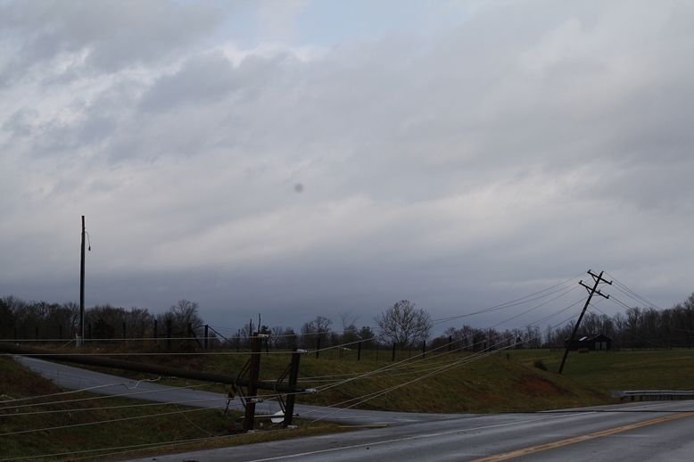
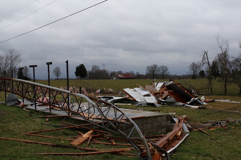
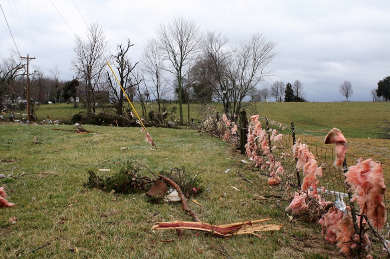
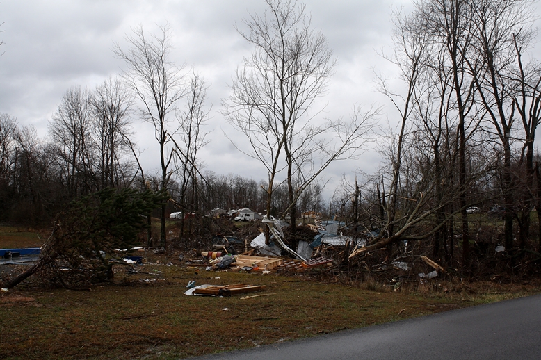
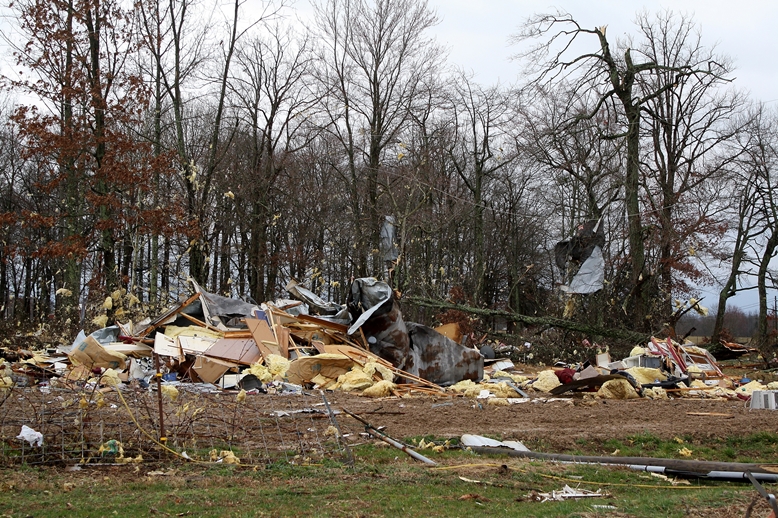
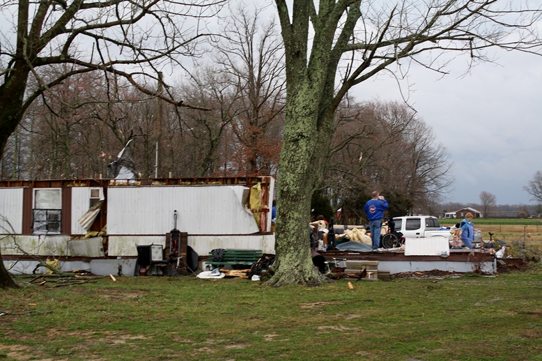
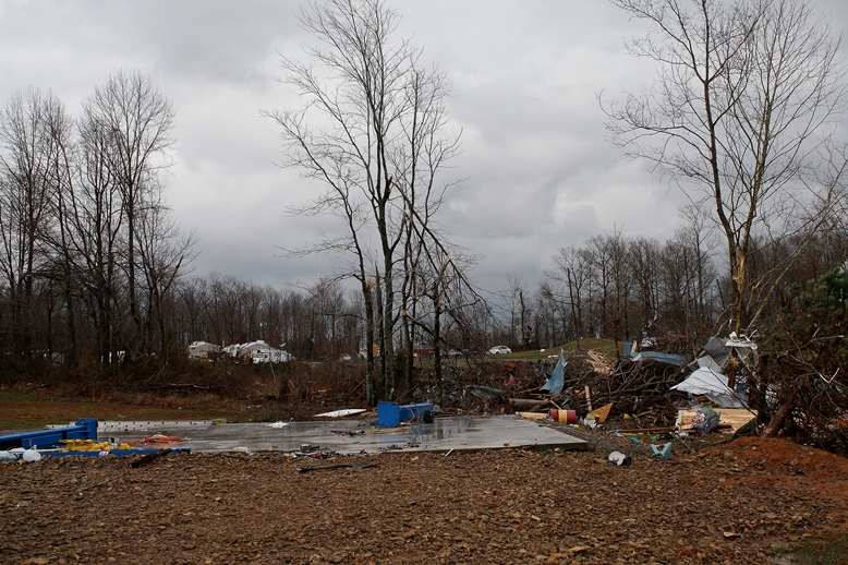
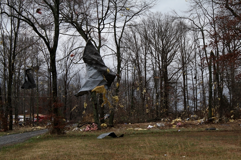
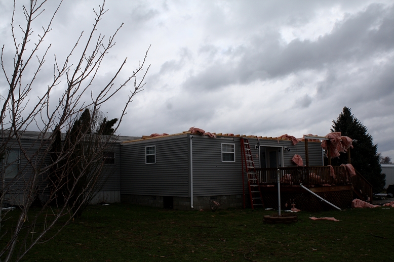
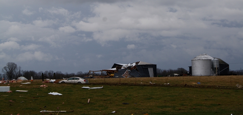
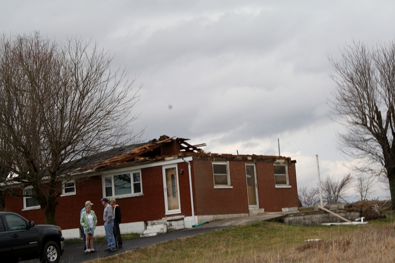
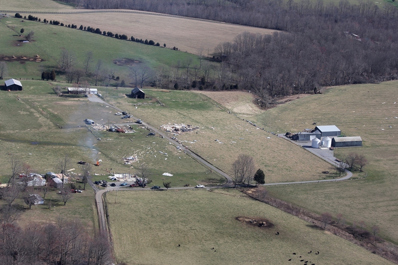
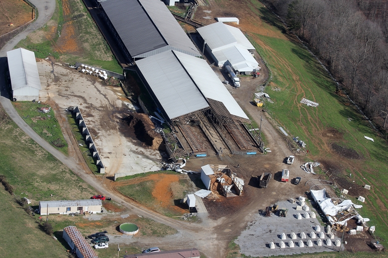
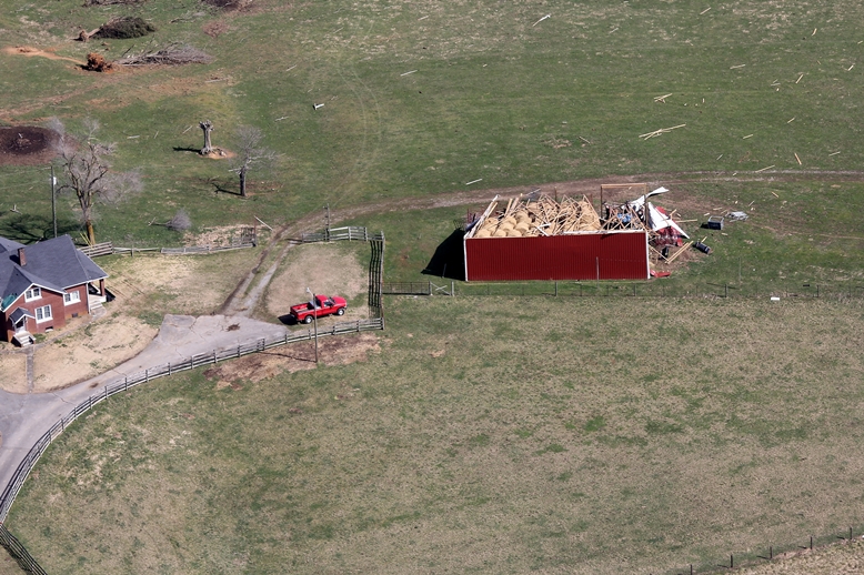
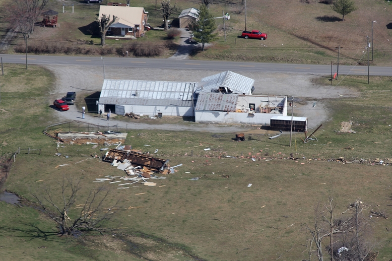
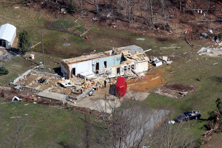
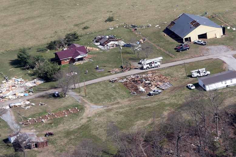
The tornado first touched down north of Russell Springs in northern Russell County west of Highway 127 where it did minor damage to trees, barns, and outbuildings. The tornado then intensified as it moved east with the worst damage occurring along a 1.5 mile stretch from Highway 76 eastward over Oak Grove Road to Pattie Ridge Road. On Highway 76 two mobile homes were totally destroyed and a modular home was rotated 30-80 feet counterclockwise off its foundation (with a quarter of the home blown away). Two residents survived in an underground tornado shelter where they took refuge having heard of the warning via sirens and phone calls 3-5 minutes before the tornado destroyed their homes. Residents were not home at the time of the tornado at the other homes destroyed along its path. The tornado then weakened as it moved into southern Casey County where it damaged more trees, barns, and outbuildings. The tornado lifted west-southwest of Windsor.
Photos from the official NWS Storm Survey Team:
 |
 |
 |
 |
 |
 |
 |
 |
 |
 |
 |
 |
 |
 |
 |
 |
 |
 |
|
|
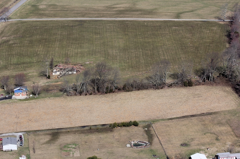
Aerial photos from Kim Ball in cooperation with the Pulaski County Sheriff's office:
 |
 |
 |
 |
 |
 |
 |
 |
|
|
Current Hazards
Hazardous Weather Outlook
Storm Prediction Center
Submit a Storm Report
Advisory/Warning Criteria
Radar
Fort Knox
Evansville
Fort Campbell
Nashville
Jackson
Wilmington
Latest Forecasts
El Nino and La Nina
Climate Prediction
Central U.S. Weather Stories
1-Stop Winter Forecast
Aviation
Spot Request
Air Quality
Fire Weather
Recreation Forecasts
1-Stop Drought
Event Ready
1-Stop Severe Forecast
Past Weather
Climate Graphs
1-Stop Climate
CoCoRaHS
Local Climate Pages
Tornado History
Past Derby/Oaks/Thunder Weather
Football Weather
Local Information
About the NWS
Forecast Discussion
Items of Interest
Spotter Training
Regional Weather Map
Decision Support Page
Text Products
Science and Technology
Outreach
LMK Warning Area
About Our Office
Station History
Hazardous Weather Outlook
Local Climate Page
Tornado Machine Plans
Weather Enterprise Resources
US Dept of Commerce
National Oceanic and Atmospheric Administration
National Weather Service
Louisville, KY
6201 Theiler Lane
Louisville, KY 40229-1476
502-969-8842
Comments? Questions? Please Contact Us.


 Weather Story
 Weather Map
 Local Radar