Northern Walthall County, MS Tornado - April 12, 2020
|
Rating:
|
EF-4
|
|
Estimated Maximum Wind:
|
170 mph
|
|
Injuries/Fatalities:
|
2/0
|
|
Damage Path Length:
|
6.7 miles
|
|
Maximum Path Width:
|
1300 yards
|
|
Approximate Start Point/Time:
|
5 miles NW of Salem, MS at 339 PM
|
|
Approximate End Point/Time:
|
7 miles NE of Salem, MS at 347 PM
|
|
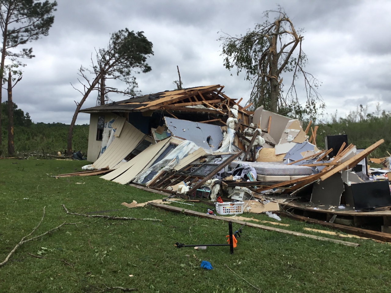
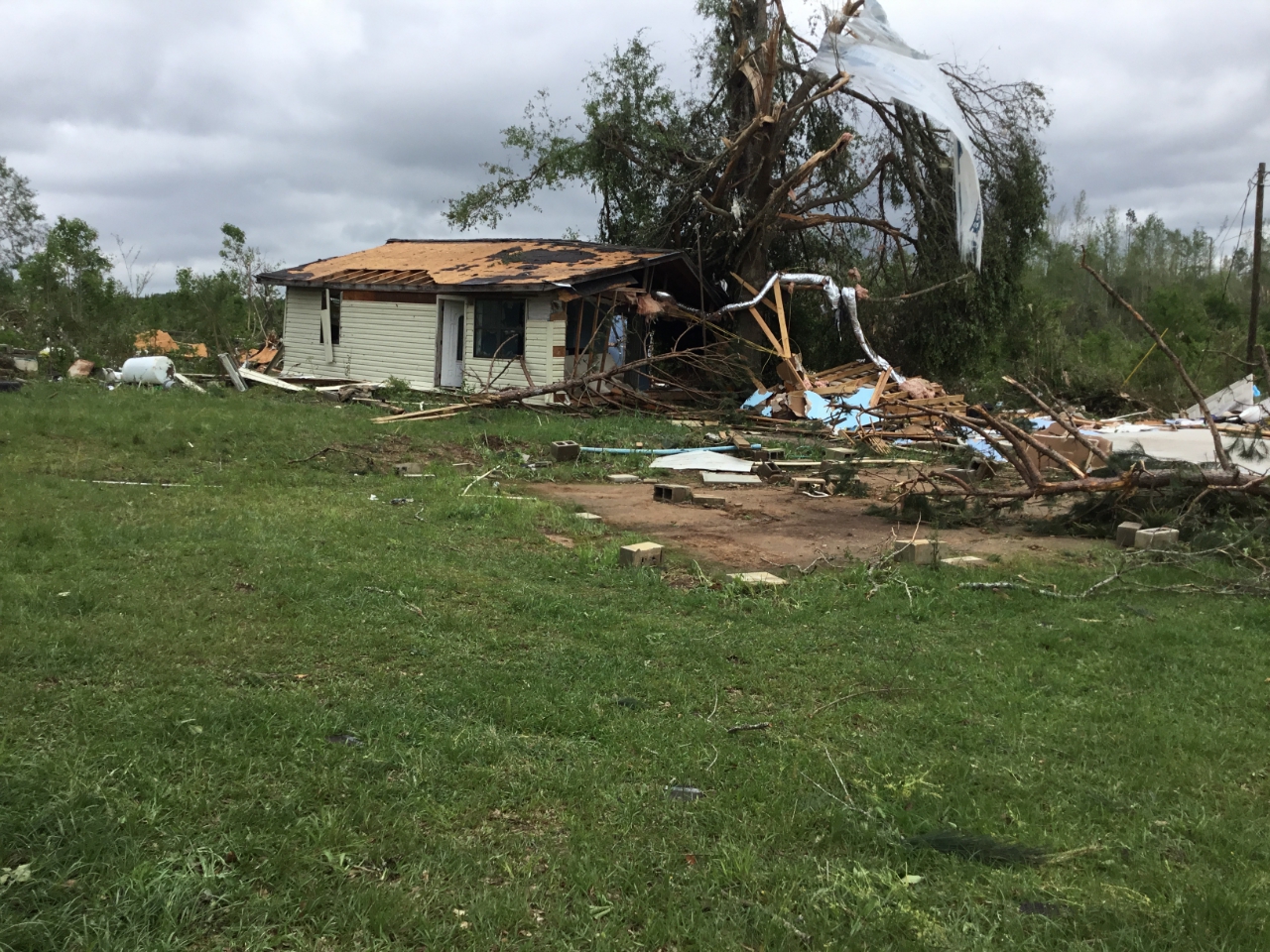
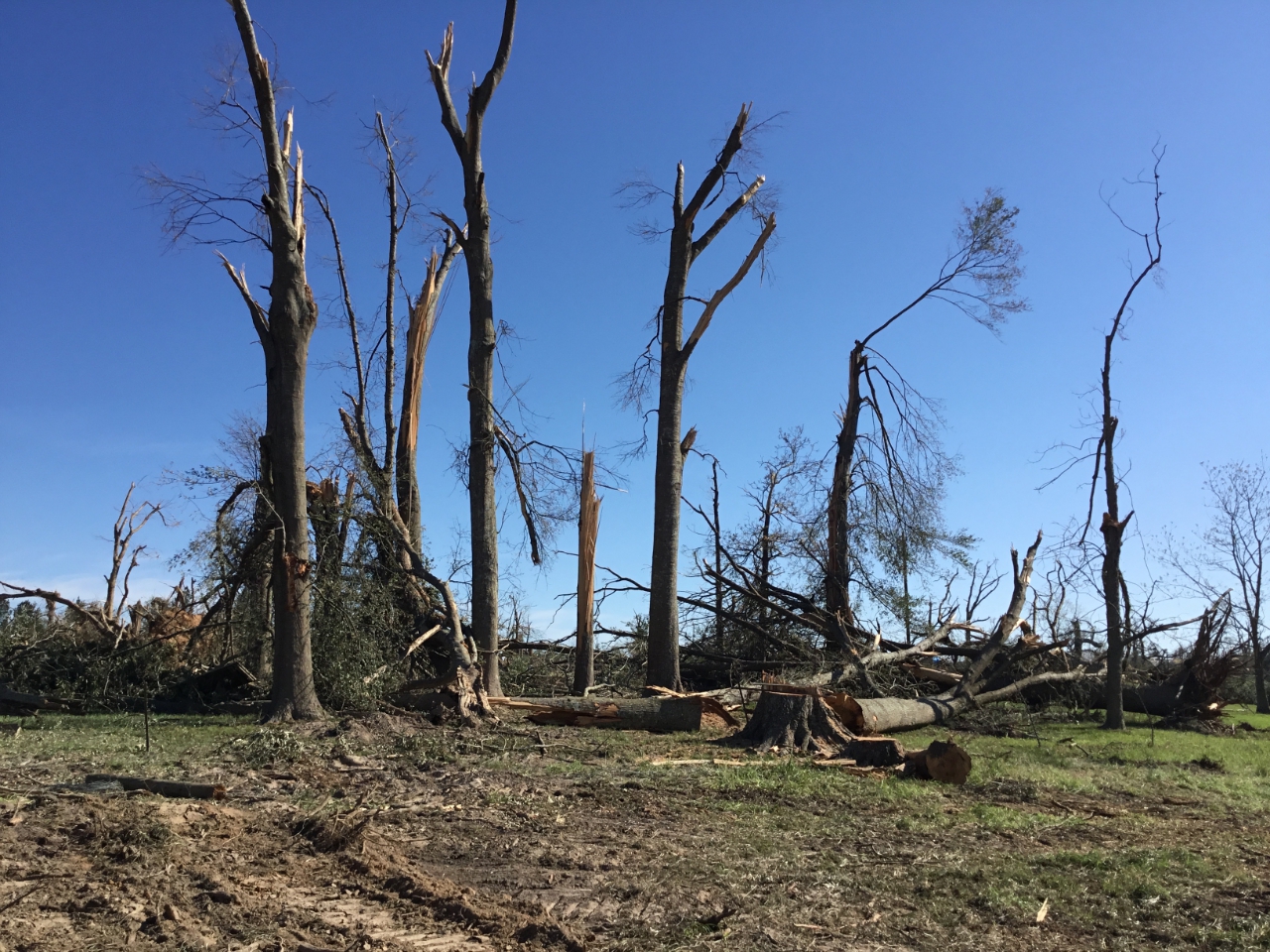
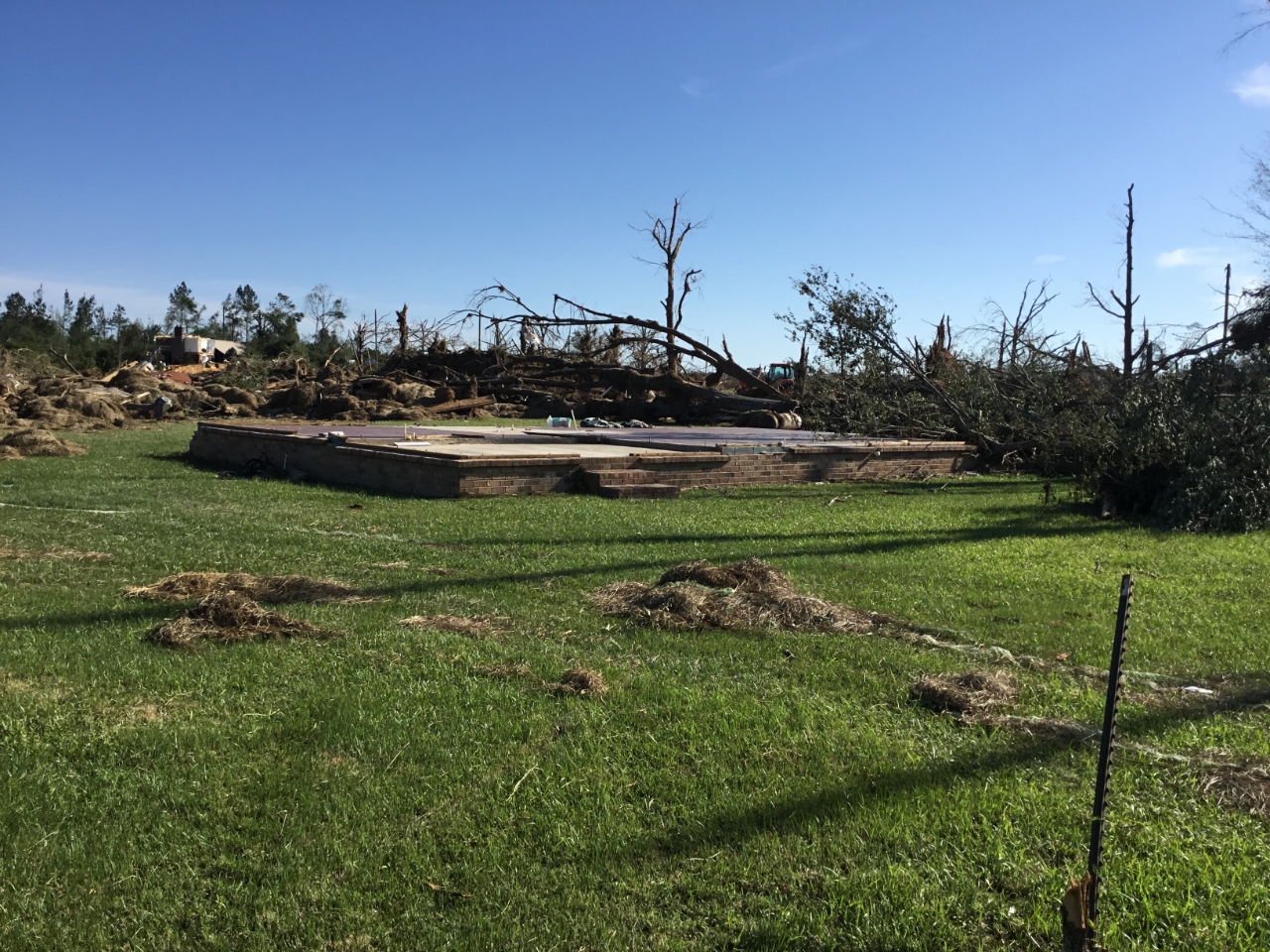
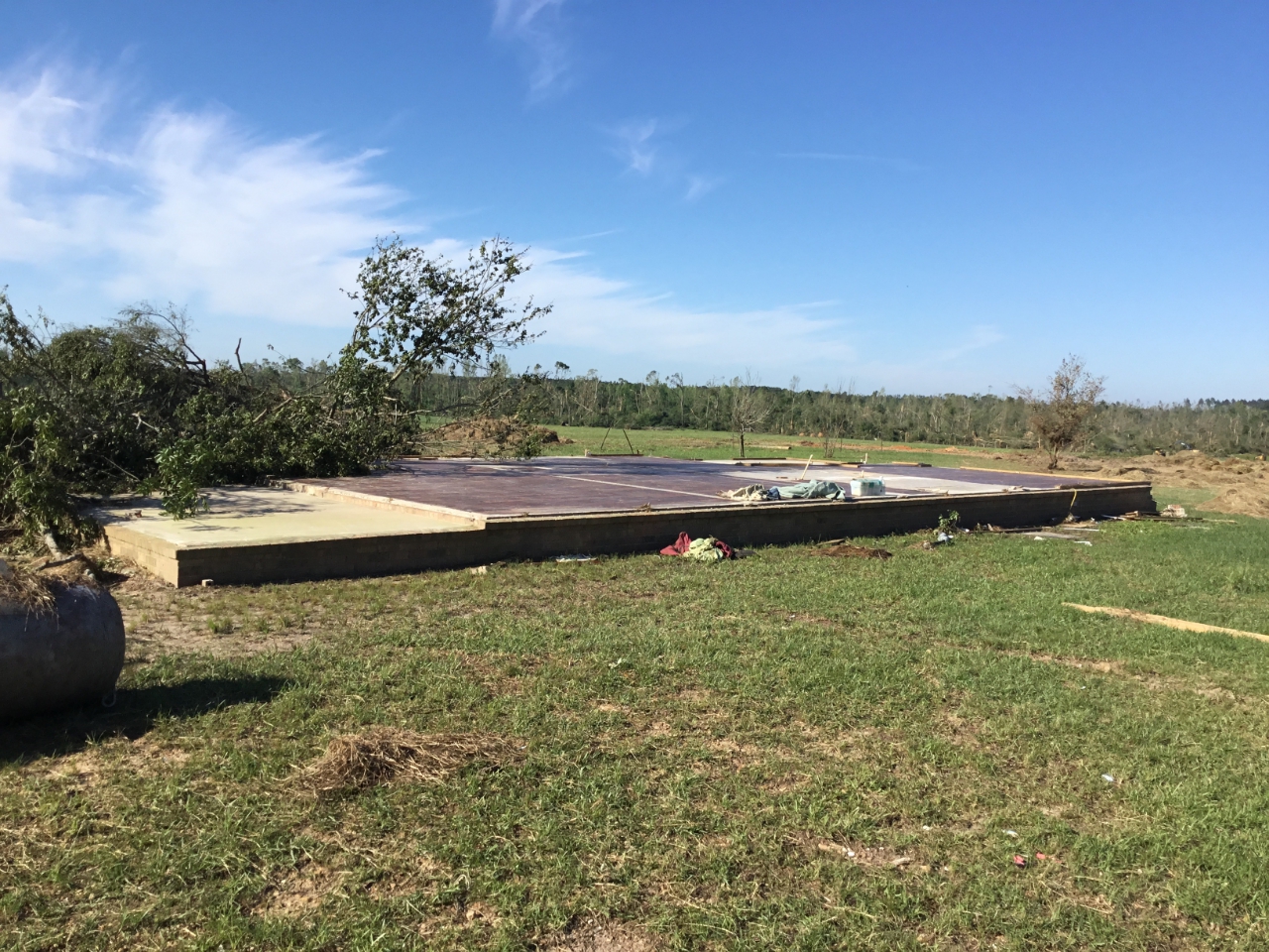
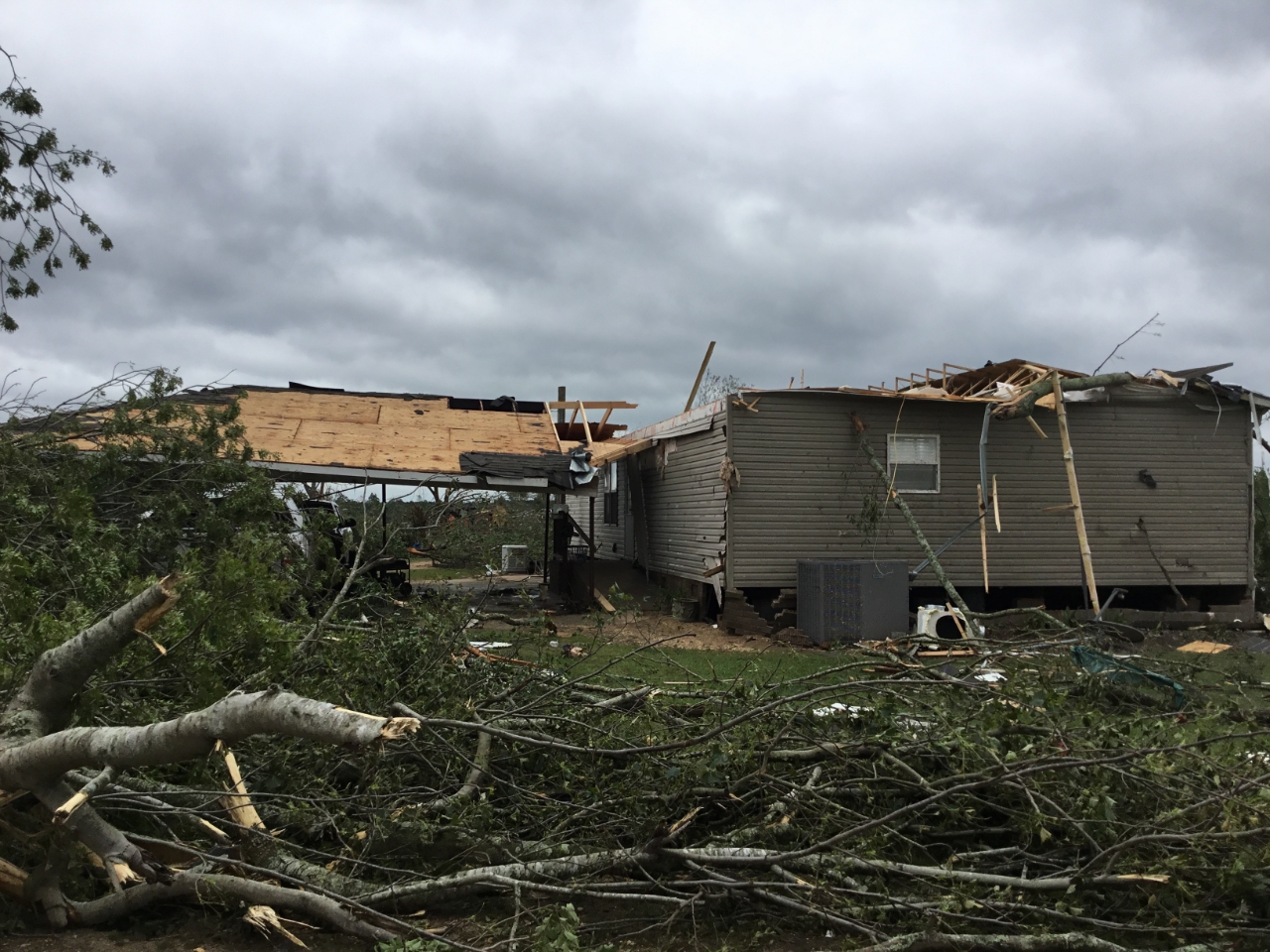
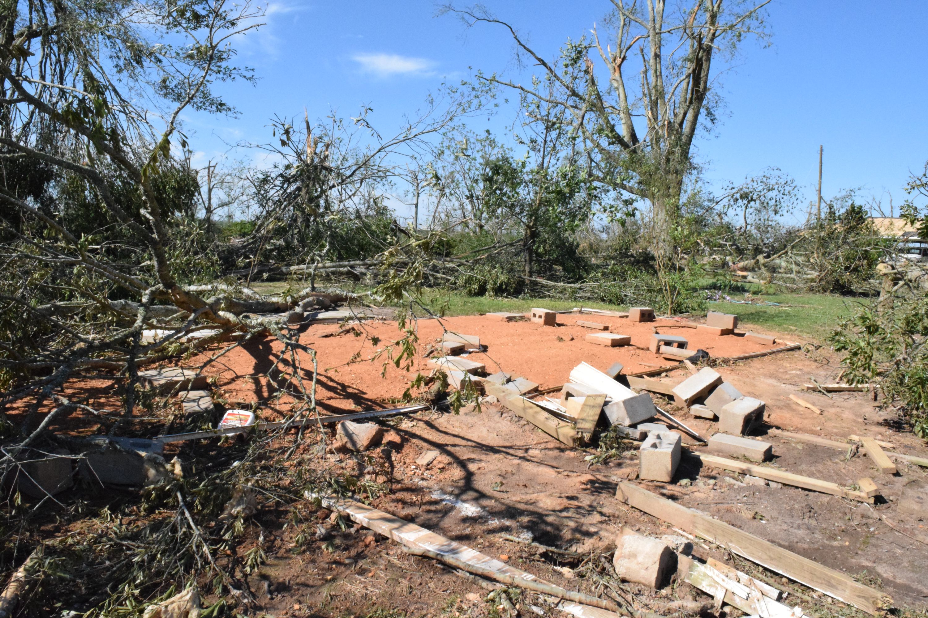
The tornado touched down near Jefferson Rd just east of the intersection with Jack Foil Rd. It quickly strengthened as it moved northeastward through the Hope area where it produced damage consistent with 115 mph winds. It also quickly grew in width and was roughly 1200 yd/0.67 mi wide by the time it approached Hwy 27. As it crossed Hwy 27 it continued to cause significant damage along East Sartinville Rd. The tornado was strongest as it approached James Ratcliff Rd. Two homes on this road were leveled, one being reduced to a slab. Consultation with subject matter experts including both engineers and experts in forensic tornado damage analysis supports raising the maximum intensity to 170 mph based on the house that was reduced to a slab and a large hard wood tree that was uprooted and tossed several feet from where it stood. The increased wind speed makes the tornado an EF-4 on the Enhanced Fujita scale. The other home that was leveled suffered damage consistent with a high end EF-3. While all walls were collapsed, there was no evidence of bolts that would have held the sill plates to the foundation. Thus, the wind speed for this particular damage is reduced slightly from the expected. The tornado was also widest in this area, reaching a maximum width of around 1300 yards or approximately 0.75 miles. As it continued to move northeastward, it continued snapping every tree near the center of its path. It also caused substantial damage to several small cinder block buildings, tore the roof off of a home and rolled a tied down single-wide manufactured home as it crossed East Sartinville Rd. From there it continued northeastward and tore the entire roof from a brick home just before moving into Lawrence County. It should be noted that from just southwest of James Ratcliff Rd through the remainder of the Walthall Co portion of the track, nearly every tree in the path of the tornado was snapped or uprooted. The tornado was responsible for two fatalities in Walthall County.
As a point of interest, this is only the 4th F/EF-4 tornado on record in the WFO LIX forecast area. The last F/EF-4 in the forecast area occurred on December 6, 1983.
|
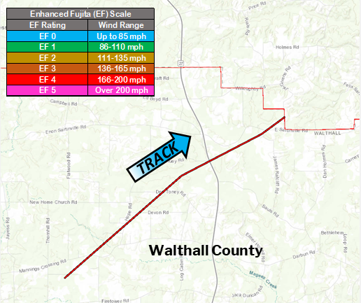
Surveyed damage track in Northern Walthall County, MS
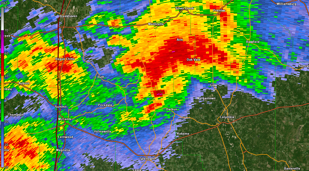
KLIX WSR-88D Reflectivity for Northern Walthall County, MS tornado at 347 PM CDT 4/12/2020
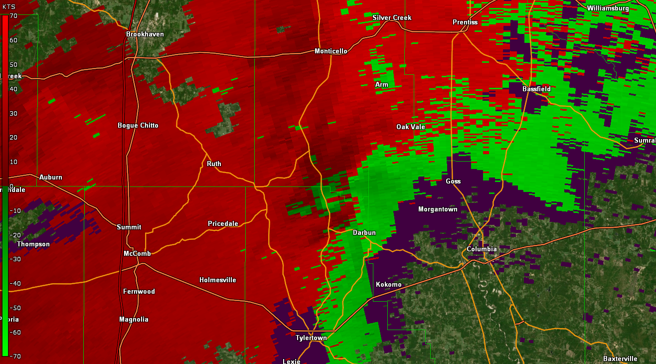
KLIX WSR-88D Storm Relative Velocity at maximum intensity at 741 PM CDT 4/4/2011
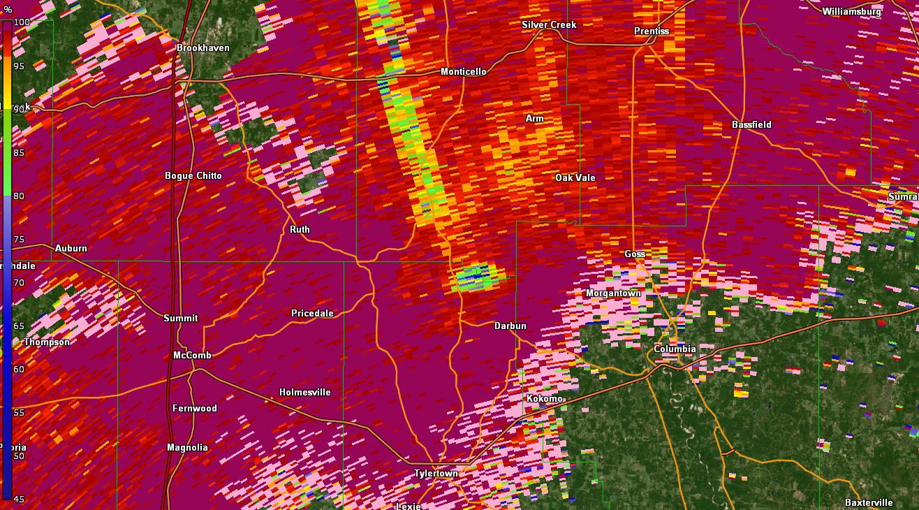
KLIX WSR-88D Correlation Coefficient drop at maximum intensity at 347 PM CDT 4/12/2020
|
|
||||||||||||||||||||||