Amite and Pike County, MS Tornado - April 23, 2020
|
Rating:
|
EF-2
|
|
Estimated Maximum Wind:
|
130 mph
|
|
Injuries/Fatalities:
|
None
|
|
Damage Path Length:
|
18.3 miles
|
|
Maximum Path Width:
|
1.0 miles
|
|
Approximate Start Point/Time:
|
5 miles NE of Liberty, MS at 307 AM
|
|
Approximate End Point/Time:
|
2 miles NNE of McComb, MS at 328 AM
|
|
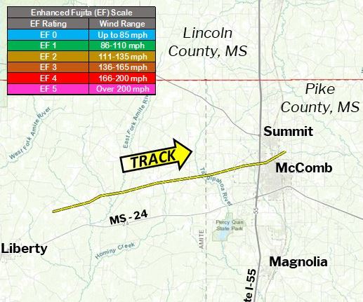
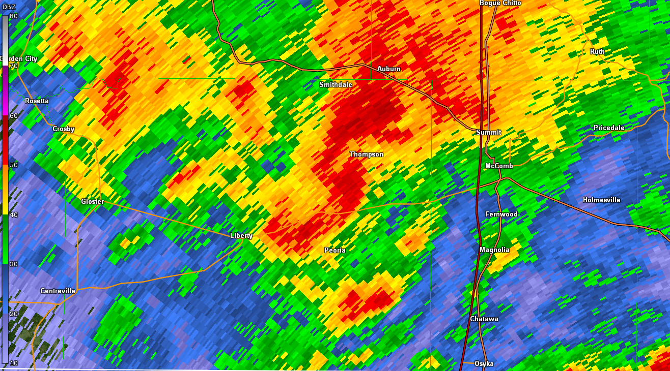
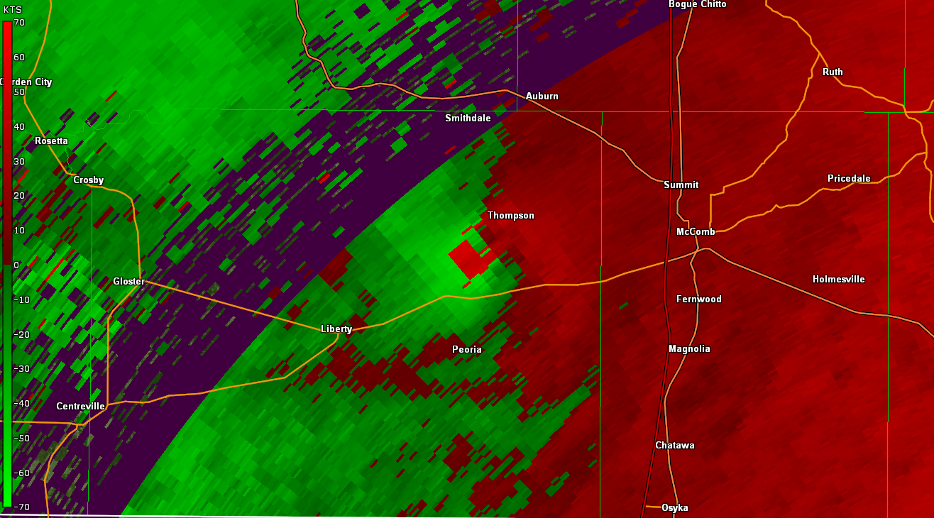
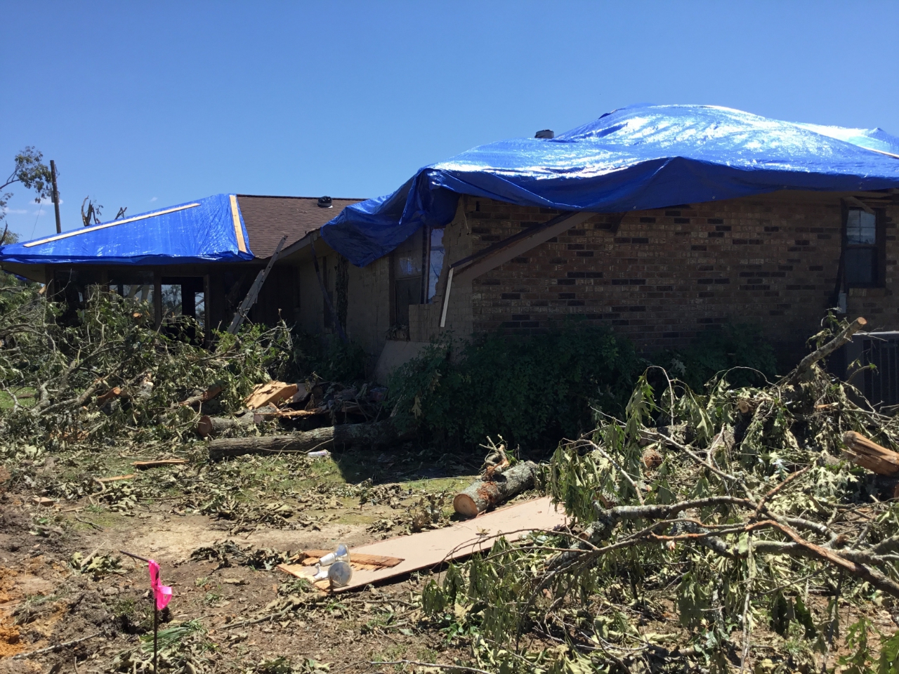
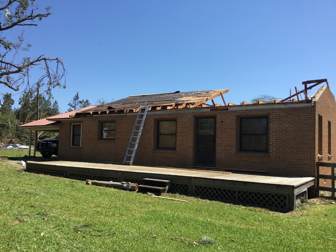
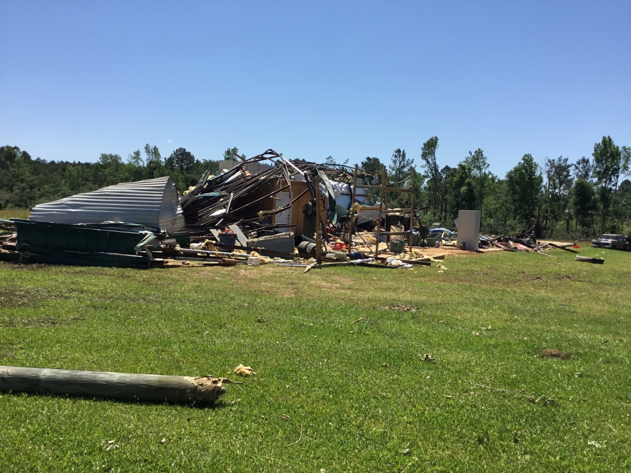
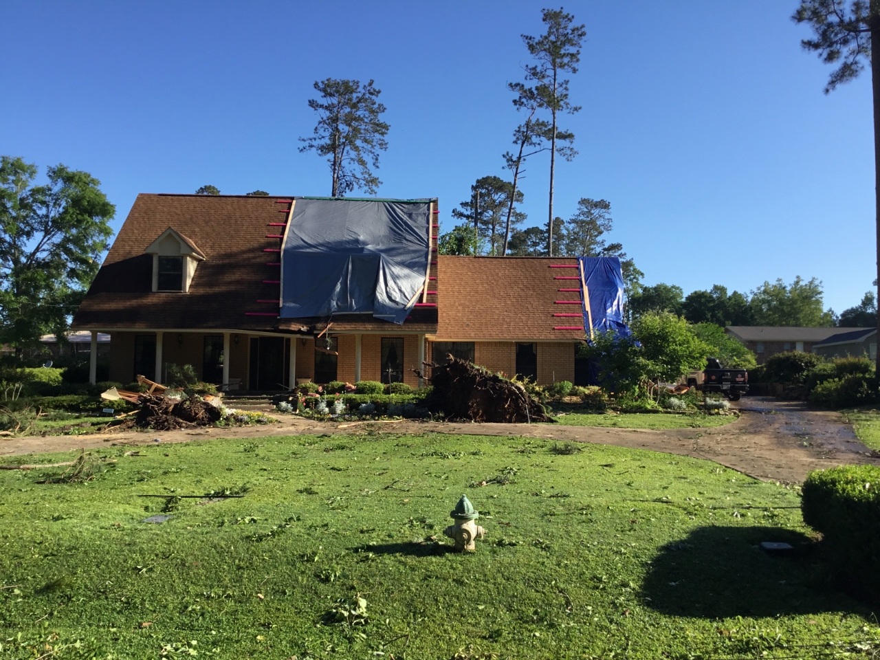
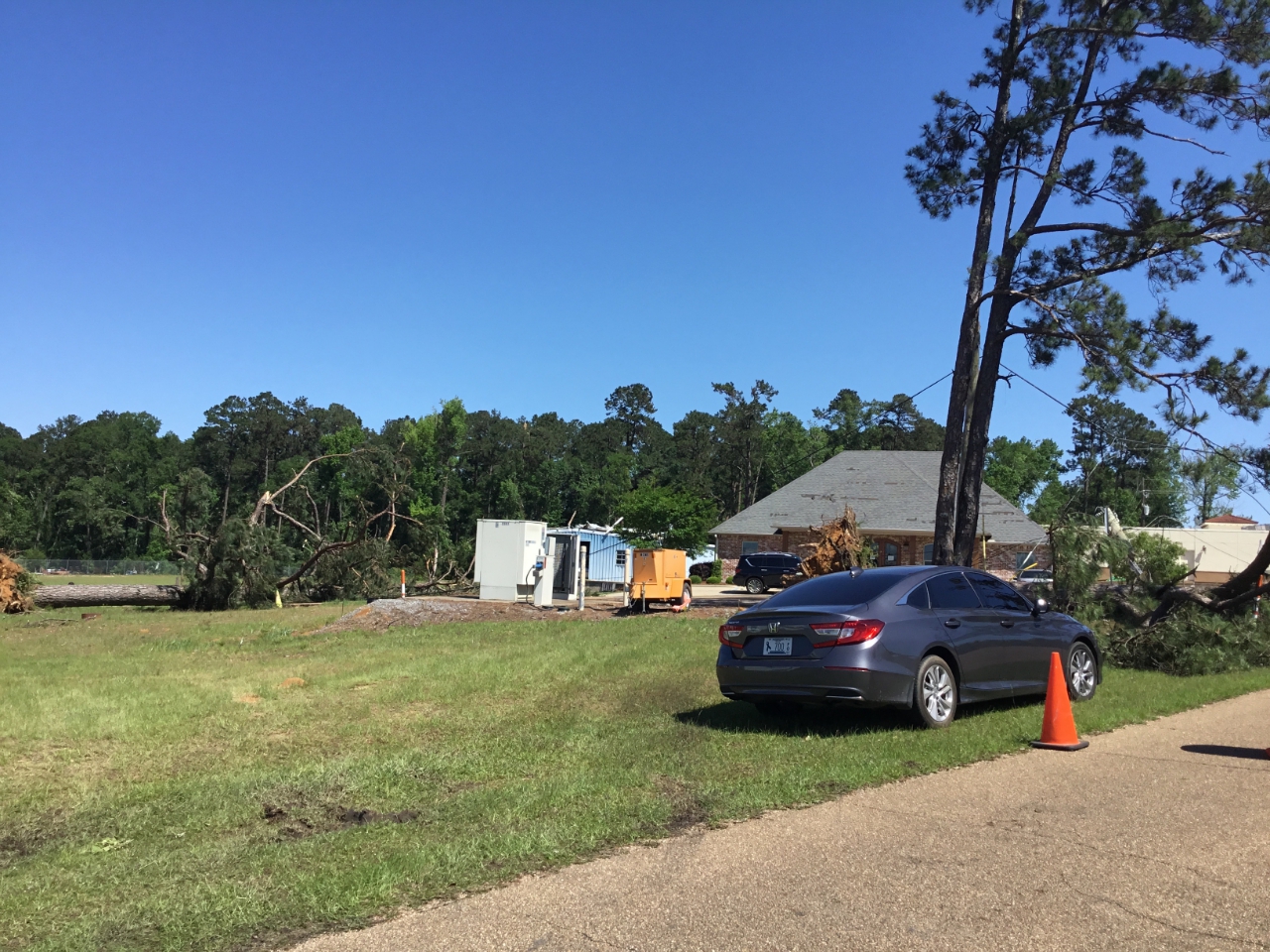
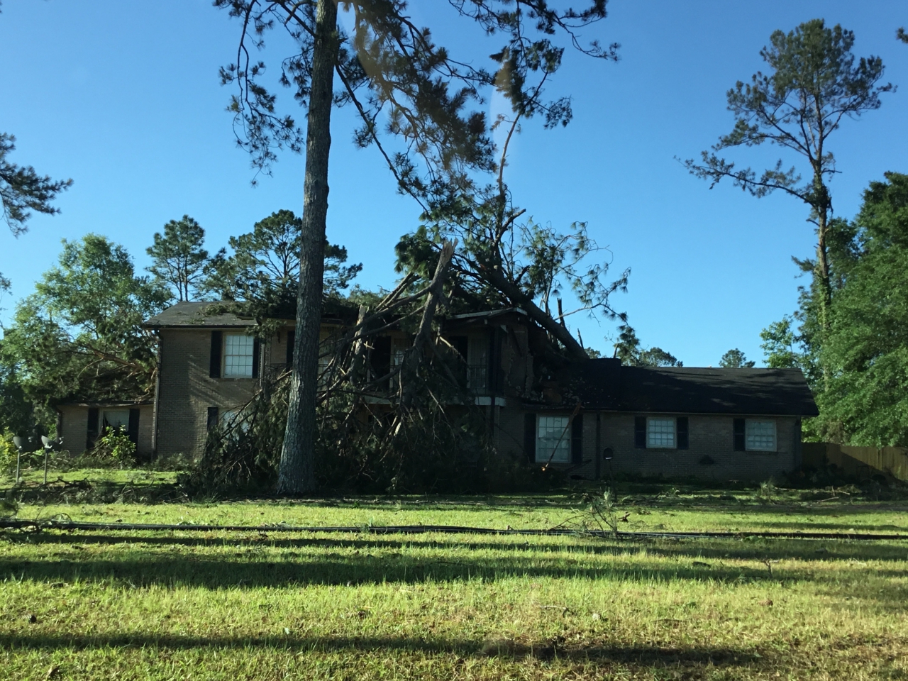
A National Weather Service Damage Assessment Team has surveyed the storm damage in Amite and Pike Counties including in the city of McComb. It has been determined the damage was the result of a tornado. The tornado has been rated a EF-2 on the Enhanced Fujita Scale. Damage estimates were consistent with winds of 130 mph. The tornado touched down in a forested area east of Hwy 569 and the start point is an approximation due to inaccessibility. It moved east-northeastward and quickly strengthened. By the time it reached Clark Rd, it was snapping or uprooting most trees near the center of its path. It turned slightly more northeastward as it approached Shaw Rd and was strongest as it crossed Wells Rd. On Wells Rd it tore most of the roof structure off of a single family home and also completely destroyed a 60x40 metal building bolted to a concrete slab. Also in this area, nearly every tree near the center of the path was snapped. This damage is consistent with maximum winds of around 130 mph. It was also widest in this area, reaching a maximum width of 1 mile. It continued travelling east northeast snapping and uprooting trees along its path. Then it crossed into Pike County just south of the intersection of Slay Rd with County Line Rd. As it continued moving east-northeast it snapped and uprooted numerous hard and soft wood trees, some of which caused damage to homes as they fell. After briefly contracting to around one half mile in width as it neared and crossed the county line, it widened again to around one mile in width as it approached McComb and crossed I-55. On both sides of the interstate, damage was primarily to trees, with several trees snapped or uprooted along the path. Again, falling trees caused some structural damage to homes. After crossing Marion Ave between Christine Dr and Stewart St, it turned more northeastward and weakened a bit, causing far fewer trees to be snapped or uprooted along the remainder of its path. It lifted just northeast of Summit-Holmsville Rd, before reaching Buck Circle. |
|
|
|
|
||||||||||||||