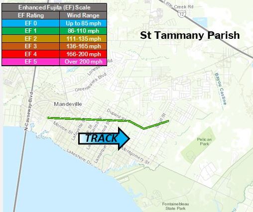
Mandeville, LA Tornado - April 19, 2020
|
Rating:
|
EF-1
|
|
Estimated Maximum Wind:
|
100 mph
|
|
Injuries/Fatalities:
|
None
|
|
Damage Path Length:
|
3.1 miles
|
|
Maximum Path Width:
|
300 yards
|
|
Approximate Start Point/Time:
|
0.5 miles SW of Mandeville, LA at 1013 PM
|
|
Approximate End Point/Time:
|
2.5 miles E of Mandeville, LA at 1017 PM
|
|
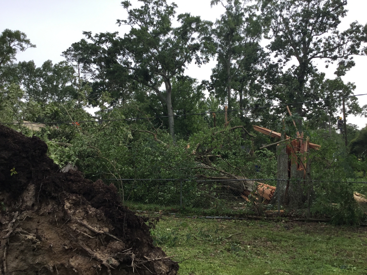
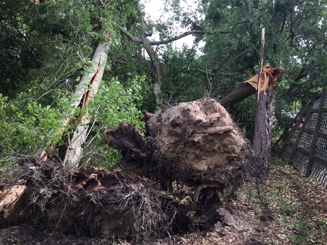
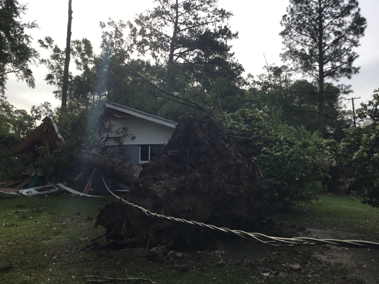
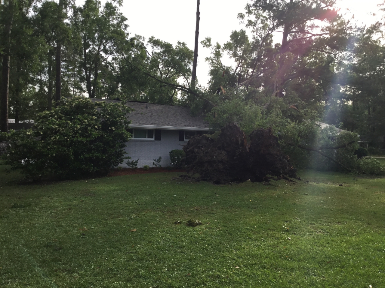
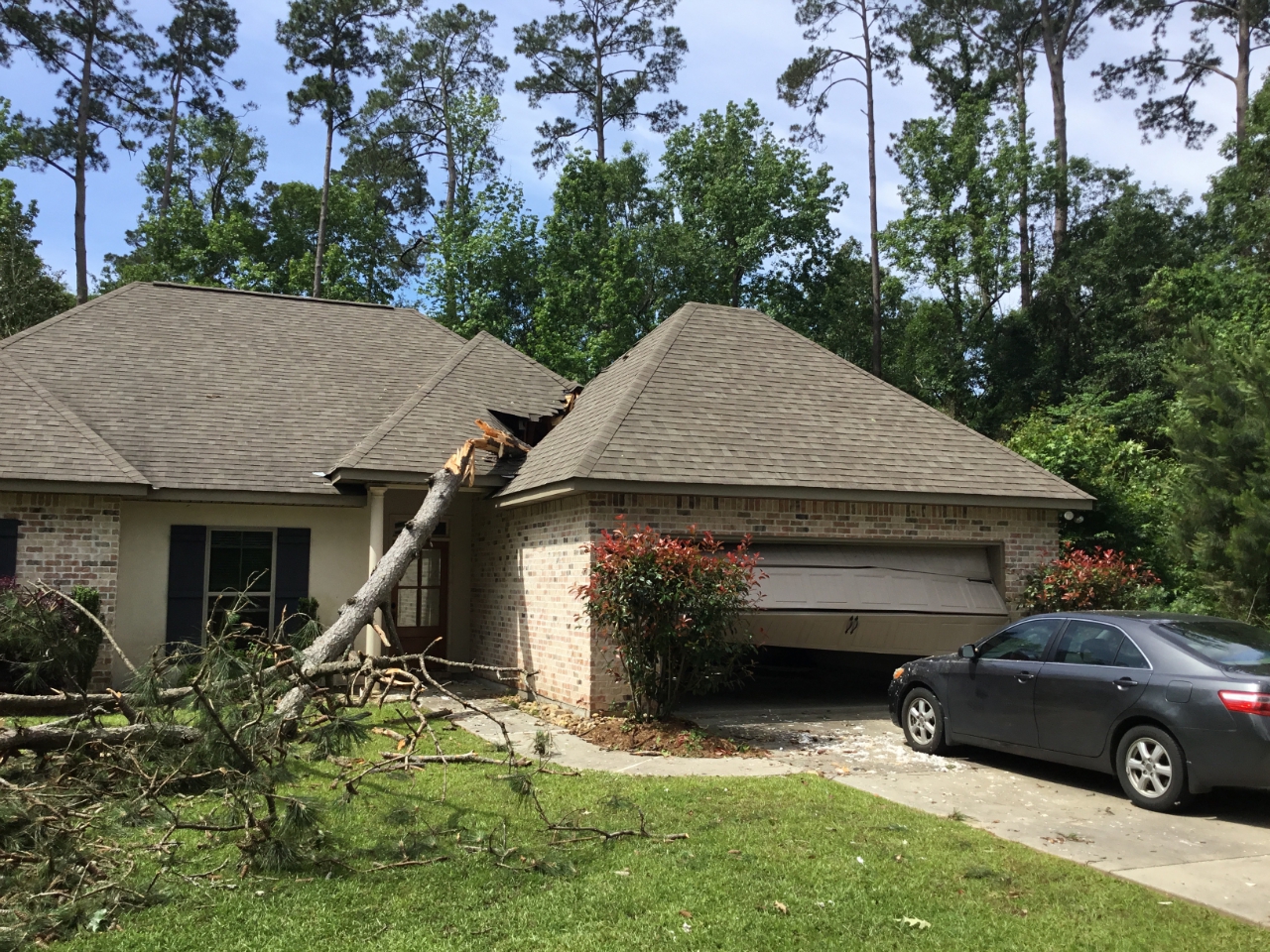
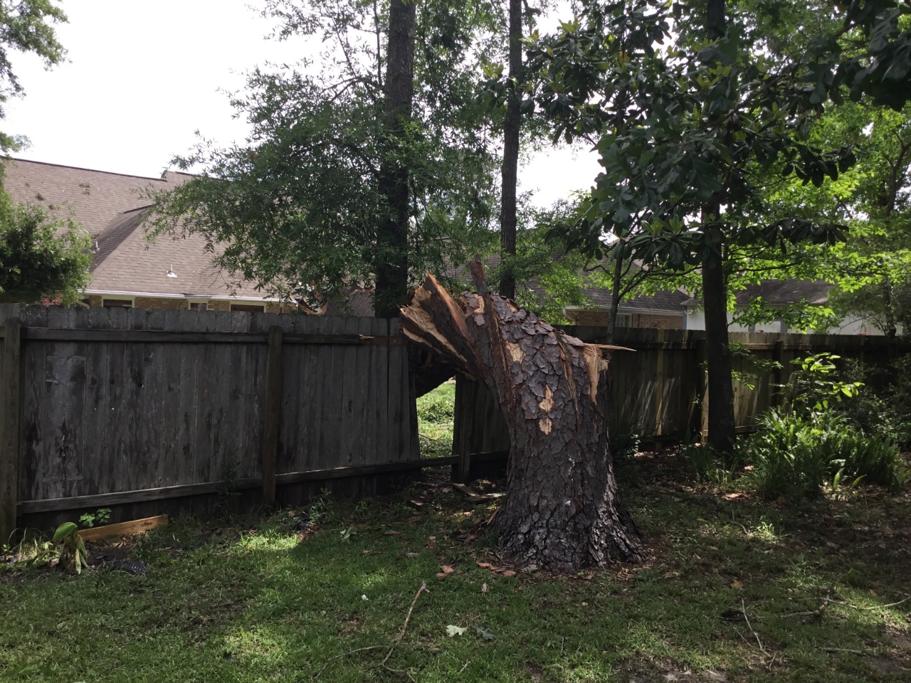
A National Weather Service Damage Assessment Team has surveyed the storm damage in Mandeville, LA. It has been determined the damage was the result of a tornado. The tornado has been rated a EF-1 on the Enhanced Fujita Scale. Damage estimates were consistent with winds of 100 mph. Tornado began in old Mandeville near the corner of Kleber St and Monroe St. It then began moving to the east with mainly tree damage along as it crossed Hutchinson, Massena, and Maple Streets. There were numerous trees both hardwood and softwood that were snapped or uprooted and a few fell on houses and vehicles. Some of the strongest tree damage occurred along Hutchinson and Massena where a few very large hardwood trees, about 4 feet thick were snapped at the base. As the tornado crossed over Maple street it did lead to some minor roof damage to a small building on the campus of Mandeville Elementary. The tin roof was peeled up back to the west. The tornado continued to the east leading to additional tree damage over Magnolia Ridge Dr East, Villere St, and Galvez St. Another area of more extensive tree damage was along the corner of Villere St and Park Ave. 3 large hardwoods were uprooted on one property with 2 falling on a house. The tornado would continue to the east likely lifting momentarily as it crossed hwy 190. The tornado would begin again only half a mile later near the intersection of America and Carroll Streets. Sporadic mostly weak EF0 tree damage would continue from Lafitte St across hwy 59 and to the intersection of Clausel and Dupard Streets. The tornado intensified momentarily as it led to additional snapped and uprooted trees along Dupard, Albert, and Carmel St. A large 4 feet thick softwood tree was twisted at the base and fell on the back of a house along Lucia Ln. Sporadic tree damage would continue over Monterrey Dr and Soult St with the tornado finally lifting just before Dupre St. |
|
|
|
|
||||||||||||||