New Orleans/Baton Rouge
Weather Forecast Office
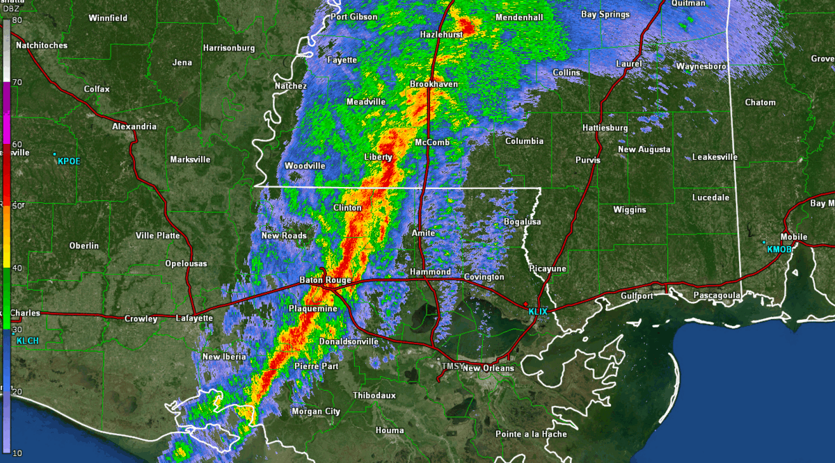
A strong upper level disturbance and surface low produced a line of severe thunderstorms with embedded tornadoes that impacted much of Southeast Louisiana and Southern Mississippi during the late afternoon and evening hours of Wednesday March 30, 2022. This line of thunderstorms produced straight line wind damage and a few tornadoes in the area. The strongest tornado was reported in rural areas of northern Jackson County, MS. There were also very strong gradient winds that impacted the region during the early afternoon hours and several wind gusts in excess of 50 mph were reported.
4 tornadoes have been confirmed from this event. These tornadoes have been determined to range in strength from EF0 to EF1 after NWS storm surveys were conducted.
Current Hazards
Storm Prediction Center
Extended Outlooks
Outlooks
Fire Manager Quick Brief
Briefing Page
Forecasts
Fire Weather Forecast
Hourly Weather Graph
Air Quality Forecasts
Marine Forecast
Activity Planner
River Forecasts
Tropical Forecast
Forecast Discussion
Aviation Weather Forecast
Graphical Forecast
Weather Models and Maps
US Dept of Commerce
National Oceanic and Atmospheric Administration
National Weather Service
New Orleans/Baton Rouge
62300 Airport Rd.
Slidell, LA 70460-5243
504.522.7330 985.649.0429
Comments? Questions? Please Contact Us.

