
Heavy rain and widely scattered severe storms capable of large hail, damaging winds, and possibly a tornado are expected over portions of the central and southern Plains into the Lower Missouri Valley. Unseasonable warmth will continue for a few more days across the Midwest and Southeast where several daily record highs could fall. Read More >
Lake Charles, LA
Weather Forecast Office
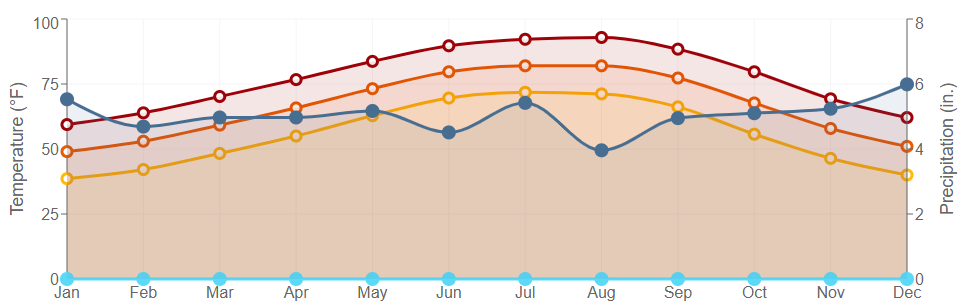
| COOPERATIVE STATION NORMALS | ||
 |
||
|
||
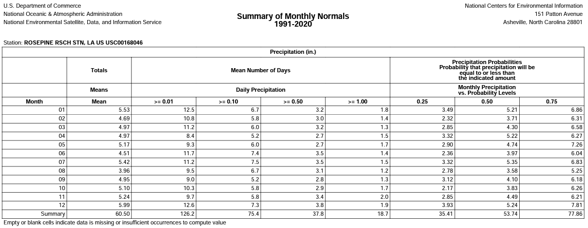
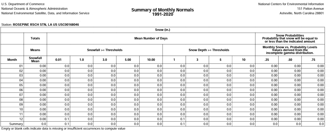
Click data images to enlarge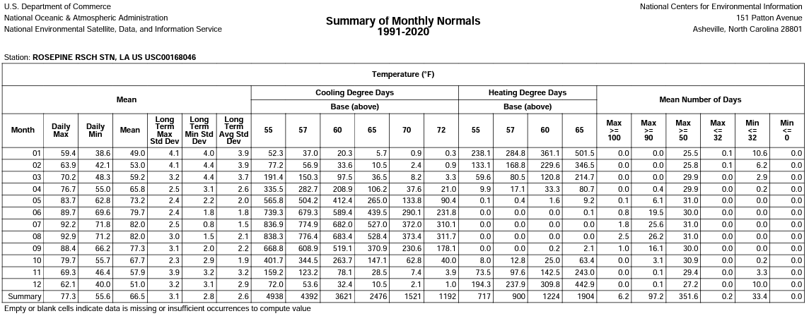 |
||
 |
||
 |
Note: Sums/averages of monthly values may not equate to yearly sums/averages due to rounding -
click here for more info
 |
Data/graphics courtesy of the National Centers for Environmental Information
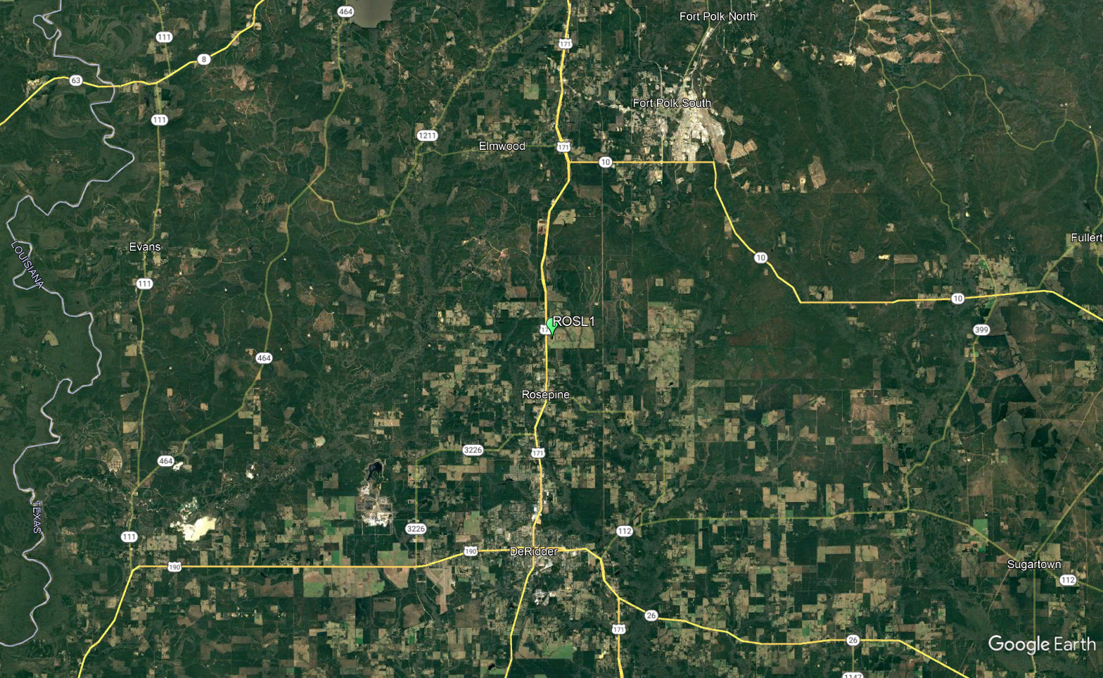
Map courtesy of Google
Forecasts
Graphical Forecasts
Wet Bulb Globe Temps
Aviation Weather
Activity Planner
Mardi Gras Decision Support
Marine Forecasts
Local Products
Model Data
Forecaster's Discussion
Fire Weather
Other Links
National Hurricane Ctr
Storm Prediction Ctr
Weather Prediction Ctr
Other Links
Office History
LCH StoryMap
Hazards
Severe Weather
Tropical Weather
National Outlooks
Local Storm Reports
Tropical Cyclone Reports
Current
Satellite Data
Observations
Tide Data
Hydrology
Calcasieu Par. Network
Jefferson Co. DD6 Network
River/Lake Forecasts
Radar
Shreveport (SHV)
New Orleans (LIX)
Fort Polk (POE)
Houston/Galveston (HGX)
Lake Charles (LCH)
Probabilistic Pages
Probabilistic DSS
Probabilistic Snowfall
Probabilistic Rainfall

US Dept of Commerce
National Oceanic and Atmospheric Administration
National Weather Service
Lake Charles, LA
500 Airport Boulevard
Lake Charles, LA 70607
(337) 477-5285 M-F 8a to 4p only
Comments? Questions? Please Contact Us.



 Follow us on X
 Follow us on Facebook
 Follow us on YouTube
 LCH RSS Feed