|
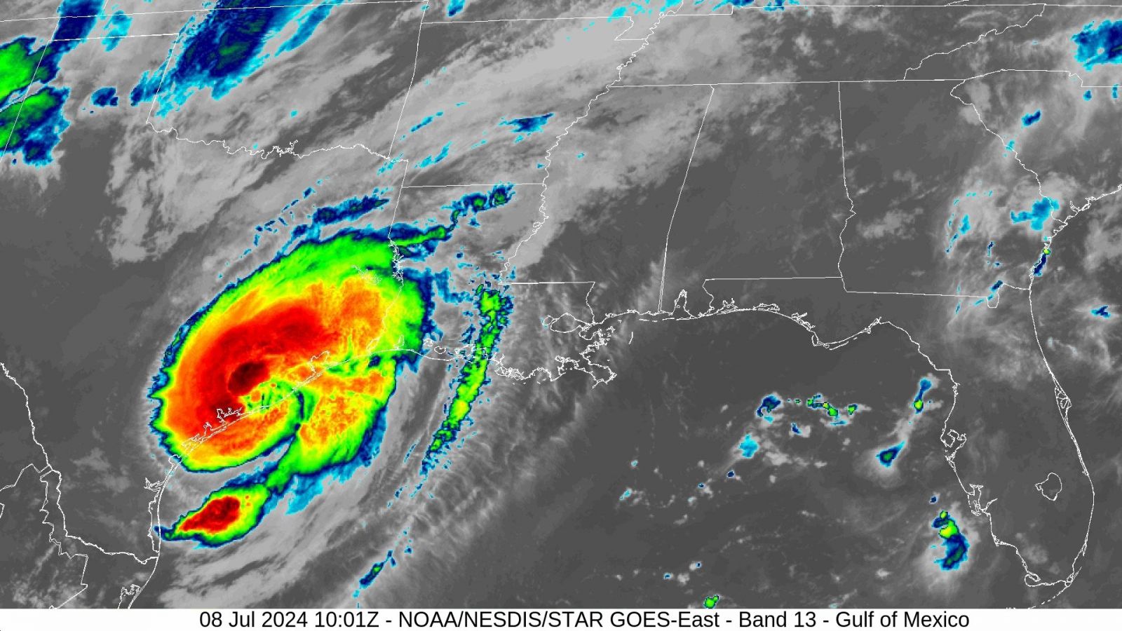
Above: GOES 16 Infrared Satellite Image of Hurricane Beryl at landfall near Mategorda, Texas at 4:01 AM CDT July 8, 2024.
Hurricane Beryl was a long-lived tropical cyclone that began across the deep tropical Atlantic’s Main Development Region on June 28th, and steered westward by a large mid to upper-level ridge of high pressure across the Central and Western North Atlantic Ocean. The tropical cyclone quickly strengthened to a tropical storm that evening, and a hurricane on June 29th. Beryl quickly strengthened to a major hurricane, making landfall on the island of Carriacou in Grenada as a high-end Category 4 on July 1st, and later strengthened to a category 5 in the Eastern Caribbean Sea. Weakening only very little, Beryl passed just south of Jamaca as a category 4 hurricane on July 3rd. Further weakening occurred before making a second landfall on the Yucatán Peninsula as a high-end category 2 hurricane early on July 5th.
Beryl weakened during its passage over the Yucatán Peninsula, emerging into the Southwest Gulf the evening of July 5th as a strong tropical storm. Beryl began to move northwest as a large mid to upper-level trough of low pressure over the Central U.S. eroded the strong ridge of high pressure over the Gulf. Also, increased wind shear and dry air entrainment limited any strengthening of Beryl, remaining nearly steady state through daybreak on July 7th. Later that morning, Beryl began to move north northwest towards the Central Texas coast as the mid to upper-level trough to the north deepened. Decreased wind shear and increased moisture allowed Beryl to slowly get better organized, re-attaining minimal hurricane strength by 11 PM CDT July 7th. Hurricane Beryl made landfall over Mategorda Bay, Texas around 3:40 AM CDT July 8th with maximum sustained winds of 90 mph (80 knots) and a minimum central pressure of 978 millibars (28.88 inches).
After landfall, Hurricane Beryl began to move north northeast, only slowly weakening the next several hours. Beryl weakened to a tropical storm just northwest of Houston by 10 AM CDT, with further weakening as it traveled northeast across East Texas. Beryl weakened to a tropical depression by 10 PM CDT just northwest of Shreveport, Louisiana. Beryl became a post tropical cyclone by late morning on July 9th across Northwest Arkansas, and moving quickly across the Northeast U.S. through July 10th.
WINDS & PRESSURE:
Sustained tropical storm force winds occurred across the coastal waters from Cameron westward to High Island, and across Jefferson County in Southeast Texas and Western Cameron Parish in Southwest Louisiana. The highest winds recorded within our area occurred at Sabine Pass, Texas with a maximum sustained wind of 55 mph (48 knots) and a peak wind gust of 70 mph (61 knots) around 11 AM CDT July 8th. Sustained winds of 40 to 50 mph with gusts of 50 to 70 mph were common across Southeast Texas and extreme Southwest Louisiana mainly along and south of the Intracoastal Waterway. Further north and east across Inland Southeast Texas and Southwest Louisiana, sustained winds of 20 to 30 mph with gusts of 30 to 50 mph occurred with the passing squalls. For complete wind and pressure reports, see the Winds and Pressure section of the Post Tropical Cyclone Report.
WATER LEVELS:
Moderate storm surge flooding occurred along Coastal Cameron Parish across Southwest Louisiana, and Coastal Jefferson County across Southeast Texas with tides 2.50 to 3.25 feet MHHW. Across Jefferson County Texas, most of Highway 87 from Sabine Pass to Sea Rim State Park has water and debris covering the road. At Sea Rim State Park, damage to buildings and entrance roadways occurred due to storm surge of 1 to 2 feet above park grounds. In Cameron Parish, storm surge covered all of Highway 27 from the Cameron Ferry to Holly Beach. Storm surge covered most of Highway 82 from Holly Beach to the Sabine River. Storm surge covered Holly Beach camp roads. There was some damage to the parish roads. Long Beach Road in Johnson Bayou sustained damage. Debris was noted over these parish roads and Highways 82 and 27. For complete water levels reports, see the Water Levels section of the Post Tropical Cyclone Report.
RAINFALL:
Three to 6 inches of rainfall occurred across Southeast Texas, with 2 inches or less across Central and Southern Louisiana. For complete storm total rainfall, see the Rainfall section of the Post Tropical Cyclone Report.
TORNADOES:
One EF2 tornado was reported in Jasper, Texas injuring one person. For complete details on the tornadoes reported, see the Tornadoes section of the Post Tropical Cyclone Report.
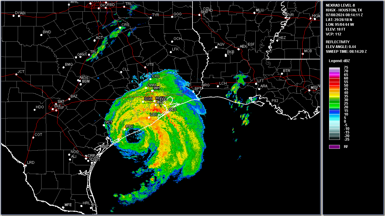
Above: Houston, TX WSR-88D radar image of Hurricane Beryl at 3:14 AM CDT on July 8, 2024.
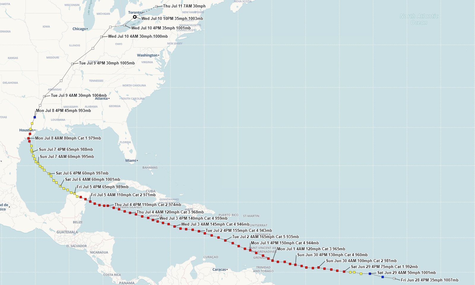
Above: Hurrevac track of Hurricane Beryl from operational National Hurricane Center public advisories.
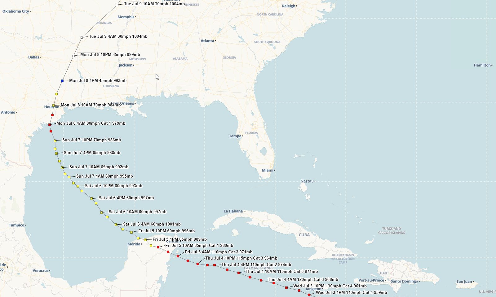
Above: Hurrevac Gulf track of Hurricane Beryl from operational National Hurricane Center public advisories.
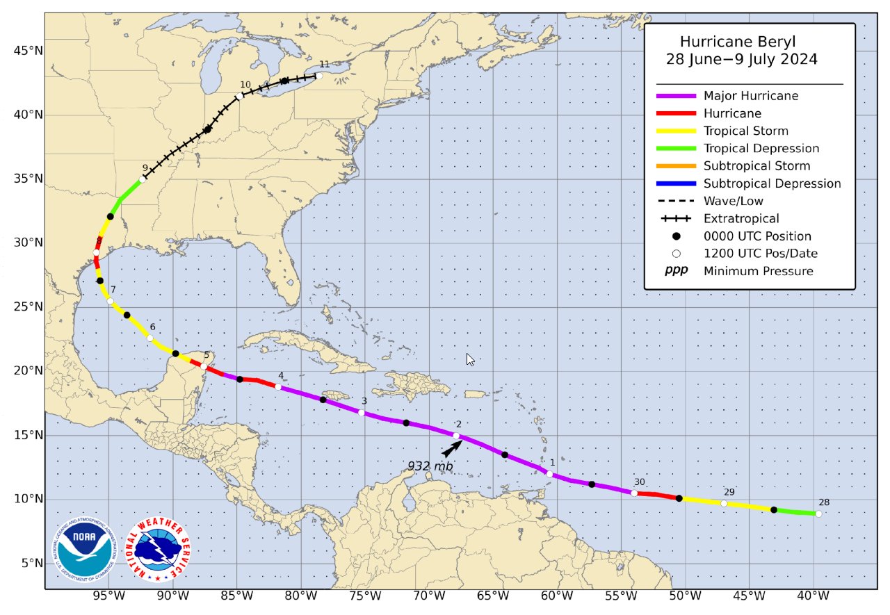
Above: National Hurricane Center best track of Hurricane Beryl.
Webpage design by: Donovan Landreneau
Content by: NWS Lake Charles staff, other sources as noted above.
|

