|
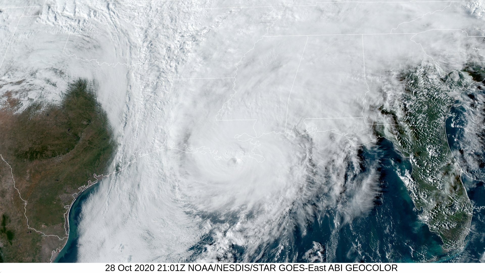
Above: GOES 16 GeoColor Satellite Image of Hurricane Zeta at 4:01 PM CDT on October 28, 2020.
Tropical Depression Twenty-eight formed across the Eastern Caribbean just after daybreak on October 24th and strengthened into Tropical Storm Zeta by that evening. Zeta was upgraded to a minimal hurricane during the early morning hours on October 26th, and later made landfall across the Northeast Yucatán Peninsula later that evening. Zeta weakened to a tropical storm as it crossed the Northeast Yucatán Peninsula, emerging across the Southern Gulf shortly after daybreak on October 27th.
With an approaching upper level low over Texas, Zeta began turning to the north and regained hurricane strength during the early morning hours of October 28th. Zeta continued to intensify as it moved north and then northeast towards the Southeast Louisiana Coast. Zeta made landfall at maximum intensity of 115 mph (100 knots) and pressure of 970 millibars (28.64 inches) at 4 PM CDT October 28th near Cocodrie, Louisiana. Zeta moved directly over New Orleans as a strong category 2 hurricane shortly after landfall and southern Mississippi later that evening.
Most of Zeta’s effects were felt east of the Atchafalaya River across Southeast Louisiana and Southern Mississippi. Minimal tropical storm force gusts were recorded at Patterson, Louisiana, Atchafalaya Bay and the adjacent coastal waters.
Hurricane Zeta was the sixth hurricane and record tenth named tropical cyclone to make landfall across the United States (which was broken again on November 8th with Tropical Storm Eta being the eleventh named storm to make landfall). Hurricane Zeta was also the latest category 3 storm to make landfall in the state of Louisiana, as well the United States.
Hurricane Zeta was the record tying fourth named storm to make landfall in Louisiana in a single season, previously set in 2002. Zeta was also the third hurricane to make either direct (or indirect) landfall in Louisiana, tying the records from 1860, 1985, and 2005.

Above: New Orleans, LA WSR-88D radar image of Hurricane Zeta landfall at 4:05 PM CDT on October 28, 2020.

Above: Hurrevac track of Hurricane Zeta from operational National Hurricane Center public advisories.

Above: National Hurricane Center best track of Hurricane Zeta.
Listed below are post-storm reports and meteorological data gathered. All data is considered preliminary, and is subject to change at any time. Additional information will continue to be added to this page in the future.
Webpage design by: Donovan Landreneau
Content by: NWS Lake Charles staff, other sources as noted above.
|

