|

Above: GOES 16 GeoColor Satellite Image of Hurricane Sally's closest approach to Southeast Louisiana at 4:16 PM CDT on September 15, 2020.
Sally developed from a broad area of low pressure over the Bahamas and became Tropical Depression #19 by the afternoon of September 11th just off the Southeast coast of Florida. While passing over southern Florida the morning of the 12th, Tropical Depression #19 was upgraded to Tropical Storm Sally. Sally turned northwestward with only slow strengthening across the Eastern Gulf.
Sally was upgraded to a hurricane by late morning on September 14th, increasing to category 2 status by that afternoon. By this time, Sally's west northwestward motion slowed considerably. Sally weakened back to a category one hurricane, with its circulation gradually growing in size while south of the Mississippi and Alabama coasts. Sally's closest approach to Southeast Louisiana occurred during the morning and afternoon hours of September 15th, bringing tropical storm force winds to the coastal parishes there. Sally began to turn north and then north northeastward later that evening towards the Alabama coast and began to strengthen once more.
Hurricane Sally made landfall around 4:45 AM CDT September 16th near Gulf Shores, Alabama as a Category 2 hurricane, with maximum sustained winds of 110 mph (95 knots) and a minimum central pressure of 965 milibars (28.50 inches).
Most of the effects of Sally were felt across extreme Southeastern Louisiana, Mississippi, Alabama and the Florida Panhandle. No reports of tropical storm force winds or coastal flooding were reported across South Central Louisiana or adjacent coastal waters.

Above: New Orleans, LA WSR-88D radar image of Hurricane Sally's closest approach to Southeast Louisiana at 2053 UTC (3:53 PM CDT) on September 15, 2020.

Above: Hurrevac track of Hurricane Marco from operational National Hurricane Center public advisories.
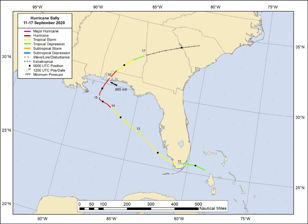
Above: National Hurricane Center best track of Hurricane Sally.
Listed below are post-storm reports and meteorological data gathered. All data is considered preliminary, and is subject to change at any time. Additional information will continue to be added to this page in the future.
Webpage design by: Donovan Landreneau
Content by: NWS Lake Charles staff, other sources as noted above.
|

