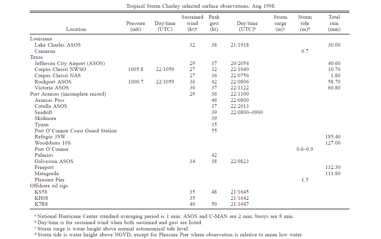
Wind and Pressure Reports
Sources: National Weather Service Post Storm Reports
National Centers for Environmental Information (NECI)
Monthly Weather Review - 1998 Atlantic Hurricane Season |
| Location |
Minimal Sea Level Pressure |
Maximum Sustained Wind (2 Min. Avg.) |
Peak Wind Gust |
Port Arthur, TX
(KBPT) |
1014.4 mb (29.96")
8/20 @ 4:53 PM CDT |
33 mph (29 knots)
8/20 @ 3:54 PM CDT |
43 mph (37 knots)
8/20 @ 3:57 PM CDT |
Sea Rim State Park, TX
(SRST2) |
|
18 mph (16 knots)
8/20 @ 5:10 PM CDT |
32 mph (28 knots)
8/20 @ 6:00 PM CDT |
Lafayette, LA
(KLFT) |
1015.2 mb (29.98")
8/20 @ 4:52 PM CDT |
22 mph (19 knots)
8/22 @ 2:52 PM CDT |
26 mph (23 knots)
8/22 @ 2:52 PM CDT |
Lake Charles, LA
(KLCH) |
1014.8 mb (29.97")
8/20 @ 4:51 PM CDT |
37 mph (32 knots)
8/21 @ 2:18 PM CDT |
44 mph (38 knots)
8/21 @ 2:17 PM CDT |
Alexandria (Esler), LA
(KESF) |
1015.2 mb (29.98")
8/20 @ 4:53 PM CDT |
22 mph (19 knots)
8/20 @ 9:37 PM CDT |
32 mph (28 knots)
8/20 @ 9:37 PM CDT |
Fort Polk, LA
(KPOE) |
1015.2 mb (29.98")
8/20 @ 4:00 PM CDT |
18 mph (16 knots)
8/21 @ 3:08 PM CDT |
36 mph (31 knots)
8/21 @ 3:08 PM CDT |
(E)=Estimated
(I) =Incomplete |