|
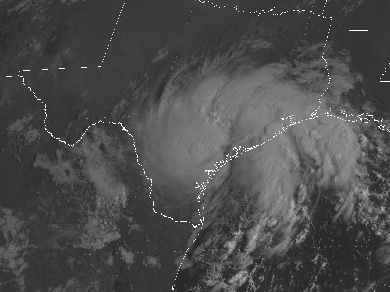
Above: GOES-8 visible satellite image of Tropical Storm Charley just after landfall across the Central Texas coast at 9:02 AM CDT August 22, 1998.
A tropical disturbance across the Central Gulf slowly became better organized on August 19-20th with cyclonic rotation noted on satellite imagery. By daybreak on August 21st, reconnaissance aircraft found a closed circulation, with advisories being initiated on Tropical Depression #3 at this time. Although not initially well organized, thunderstorms increased north of the center later that afternoon, with oil platforms across the Northern Gulf recording tropical storm force winds. The system was upgraded to Tropical Storm Charley around 190 miles southeast of Corpus Christi, Texas.
Tropical Storm Charley began to move northwest as a strong mid to upper-level high pressure system across the Central and Eastern U.S. persisted. Charley increased in organization and intensity that evening and overnight, reaching a peak intensity of 70 mph (60 knots) just after Midnight on August 22nd. Charley weakened some before making landfall near Port Aransas, Texas around 5:00 AM CDT with maximum sustained winds of 45 mph (40 knots) and a minimum central pressure of 1000 millibars (29.53 inches). After landfall, Tropical Storm Charley began to move west northwest and weakened to a tropical depression later that afternoon, and dissipated near the Texas and Mexico border during the evening hours of August 23rd. Click here for an interactive track of Tropical Storm Charley.
WIND & PRESSURE:
No sustained tropical storm force winds were recorded across Southeast Texas or Southern Louisiana. The highest wind gusts recorded were 44 mph (38 knots) at Lake Charles, Louisiana and 43 mph (37 knots) at Port Arthur, Texas. For complete meteorological statistics, see the Wind and Pressure section.
STORM SURGE:
Tide levels of 3 feet MSL were recorded across Coastal Cameron Parish Louisiana and Jefferson County Texas. Minor coastal flooding on Highway 82 near Cameron, Louisiana was noted near high tide during the morning hours of August 21st and 22nd. For other storm surge and high-water marks, see the Storm Surge section.
RAINFALL:
Rainfall of 2 to 3 inches was common across Southeast Texas and Southwest Louisiana along and south of I-10, with the highest total of 3.01 inches recorded in Beaumont, Texas. Further north and east, rainfall varied between a quarter inch to 2 inches. For complete rainfall totals reported across our region, see the Rainfall section.
TORNADOES:
One F0 tornado was recorded in League City, Texas, causing minor damage with no injuries noted. For complete details on this tornado, see the Tornadoes section.
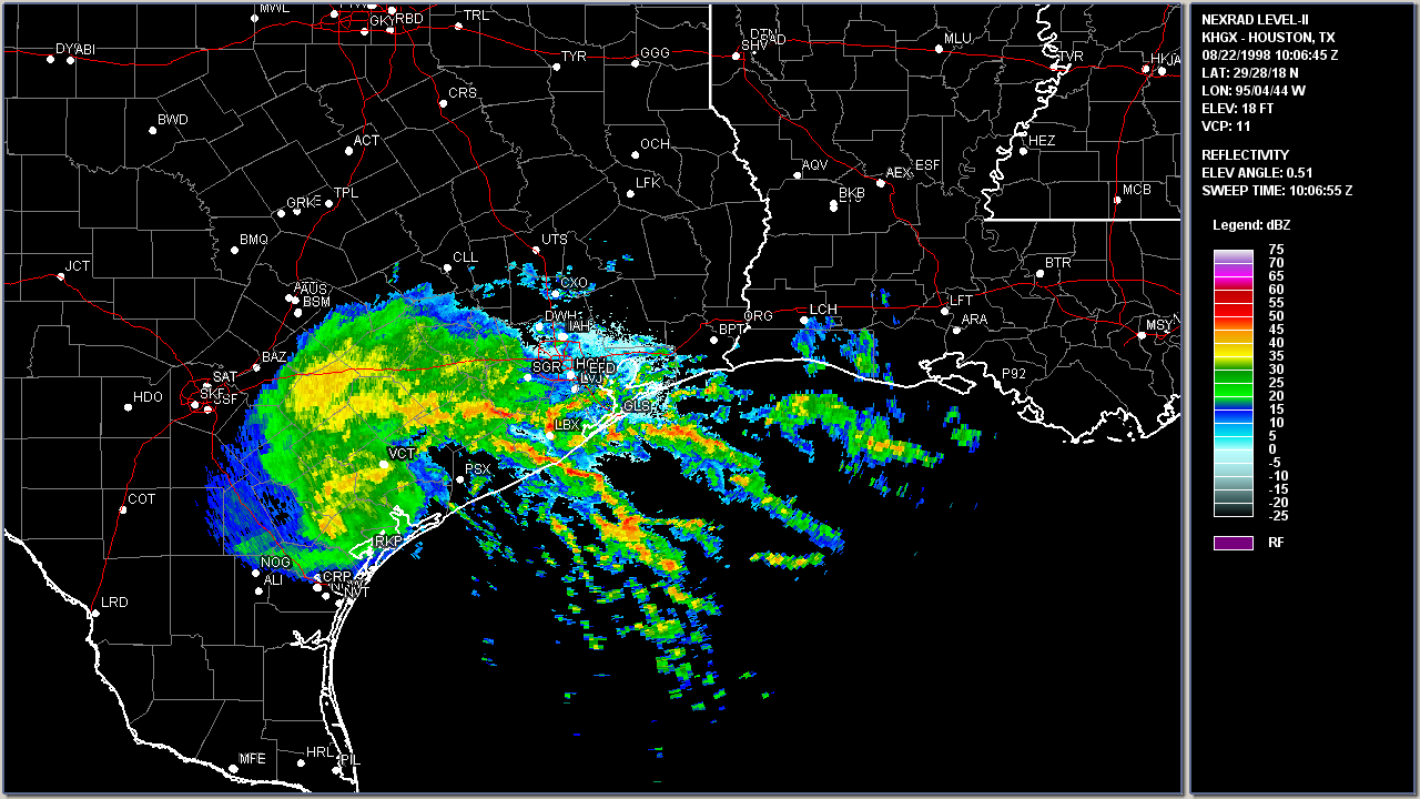
Above: Houston, TX WSR-88D radar image of Tropical Storm Charley making landfall near Port Aransas, Texas at 5:06 AM CDT August 22, 1998.
|


