|
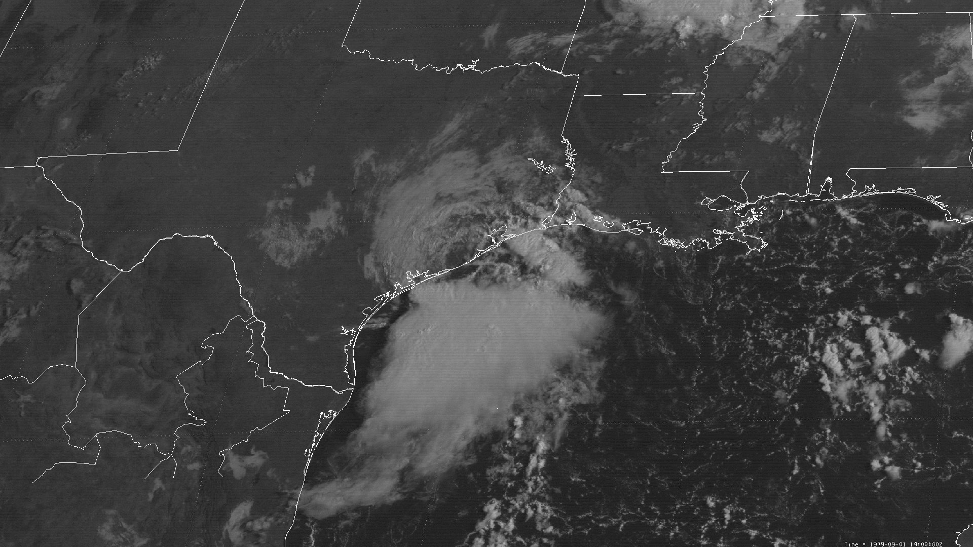
Above: SMS-2 visible satellite image of Tropical Storm Elena at 9:00 AM CDT September 1, 1979, at landfall near Matagorda, TX.
Tropical Storm Elena originated from a tropical wave that emerged from the African coast August 17th. The wave moved across the tropical Atlantic and Caribbean Islands the next several days with little additional organization, crossing Florida on August 27th. The wave moved westward into the Gulf on August 28th, gradually gaining organization. Late in the afternoon on August 29th, an Air Force reconnaissance flight confirmed that Tropical Depression #10 formed about 200 miles south of the mouth of the Mississippi River. A mid to upper level ridge over the Southern United States and Northern Gulf steered the depression on a general west-northwest path south of the Louisiana coast. The depression strengthened to Tropical Storm Elena by the afternoon of August 30th.
Tropical Storm Elena began to move northwest and eventually northward towards the Texas coast on August 31st through September 1st as the mid to upper level trough over the Central United States weakened the ridge over the Northern Gulf. Weak northerly sheer noted in animated satellite imagery likely inhibited development, with Tropical Storm Elena remaining a weak tropical storm. The highest sustained winds of 40 mph (35 knots) continued through landfall at Matagorda, Texas around 9 AM CDT September 1st. Elena weakened back to a depression immediately after landfall, and dissipated later that evening. Click here for an interactive track of Tropical Storm Elena.
WIND & PRESSURE:
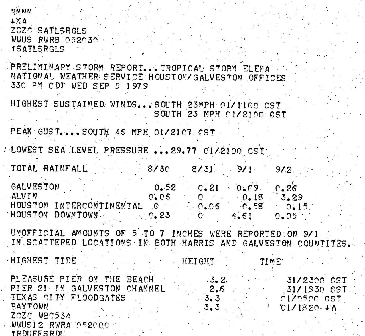
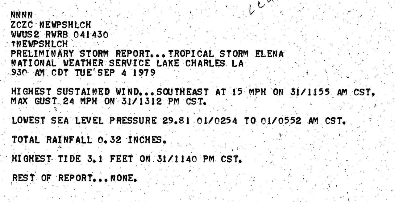
The highest recorded wind was 46 mph (40 knots) at the National Weather Service Galveston, Texas at 4:07 PM CDT September 1st. The highest wind gust across our area of Southeast Texas and Southern Louisiana was 31 mph (27 knots) at the National Weather Service Port Arthur, TX at 9:00 AM CDT September 1st. For complete meteorological statistics, see the Wind and Pressure section.
STORM SURGE:
The highest tides of 3.0 to 3.5 feet MSL occurred across the Upper Texas and Southwest Louisiana Coasts. For other storm surge and high-water marks across our region, see the Storm Surge section.
RAINFALL:
Rainfall of 3 to 5 inches occurred across Southeast Texas and Southwest Louisiana, with lesser amounts of one half to 3 inches occurred across the remainder of Inland Southeast Texas, Central and South-Central Louisiana. The highest rainfall of 5.13 occurred in Hackberry, Louisiana. Further down the Central Texas coast, rainfall totals varied greatly between 3 to 10 inches, with the highest storm total of 10.28 inches recorded at Palacious, Texas. For complete rainfall totals reported across our region, see the Rainfall section.
TORNADOES:
No tornadoes were reported in Louisiana or Southeast Texas.
|

