
Scattered severe thunderstorms capable of damaging wind gusts and some hail are expected this afternoon and evening from the Upper Ohio River Valley into the Northeast, and from the Appalachians into the Mid-Atlantic States. Excessive rainfall from heavy thunderstorms may produce areas of flash flooding from southern New Mexico into the western and northern Gulf Coast into Wednesday. Read More >
| Tropical Storm Claudette | ||||||||||||||||||||||||||||||||||
| July 15-29, 1979 | ||||||||||||||||||||||||||||||||||
|
|
||||||||||||||||||||||||||||||||||
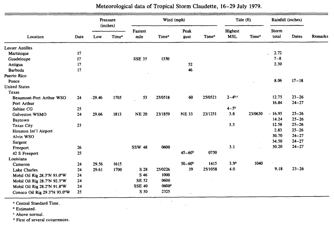
| Post Tropical Cyclone Report Summary from National Weather Service Source: Monthly Weather Review, July 1980 |
||||
 |
||||
|
Hourly Surface Observations for July 22-26, 1979 |
|||||||
| Lafayette, LA (KLFT-WBAN) | 7/22 | 7/23 | 7/24 | 7/25 | 7/26 | ||
| Lake Charles Regional Airport, LA (KLCH-NWS) | 7/22 | 7/23 | 7/24 | 7/25 | 7/26 | ||
| Port Arthur Southeast Texas Regional Airport, TX (KBPT-NWS) | 7/22 | 7/23 | 7/24 | 7/25 | 7/26 | ||
| Alexandria Esler Field, LA (KESF-WBAN) | 7/22 | 7/23 | 7/24 | 7/25 | 7/26 | ||
| Fort Polk, LA (KPOE-Army) | 7/23 | 7/24 | 7/25 | 7/26 | |||

