|
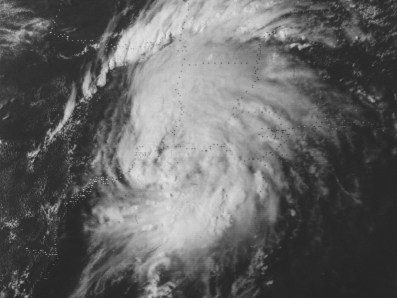
Above: GOES 2 Visible Satellite Image of Tropical Storm Debra at 2101 UTC (4:01 PM CDT) on August 28, 1978, shortly before landfall.
Tropical Storm Debra originated from the interaction of a mid to upper level low that formed over Southern Florida late on August 24th and a tropical wave from the Caribbean Sea. The mid to upper low drifted southwestward across the Yucatán Peninsula as the tropical wave was entering the Gulf on August 25th. Increased showers and thunderstorms occurred near the disturbance, with Tropical Depression #5 forming by daybreak on August 26th. The depression moved westward being steered by and mid to upper level ridge of high pressure over the Southern United States.
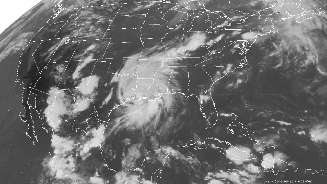
By August 27th, the mid to upper level ridge shifted eastward as an upper level trough moved eastward over the Central United States. This allowed the depression to move northwest and eventually northward towards the Northwest Gulf Coast through August 28th. The depression intensified and was named Tropical Storm Debra by early afternoon. Now heading in a north-northeast direction, Tropical Storm Debra made landfall shortly after 7 PM CDT August 28th near Constance Beach, Louisiana with maximum sustained winds of 60 mph (50 knots) and a minimum central pressure of 1000 millibars (29.53 inches). A GOES 2 infrared satellite image of Tropical Storm Debra at 7:01 PM CDT on August 28th near landfall. Debra weakened to a depression shortly after midnight on August 29th over Western Louisiana and merged with a frontal trough across Central Arkansas by the afternoon. Click here for an interactive track of Tropical Storm Debra.
WIND & PRESSURE:
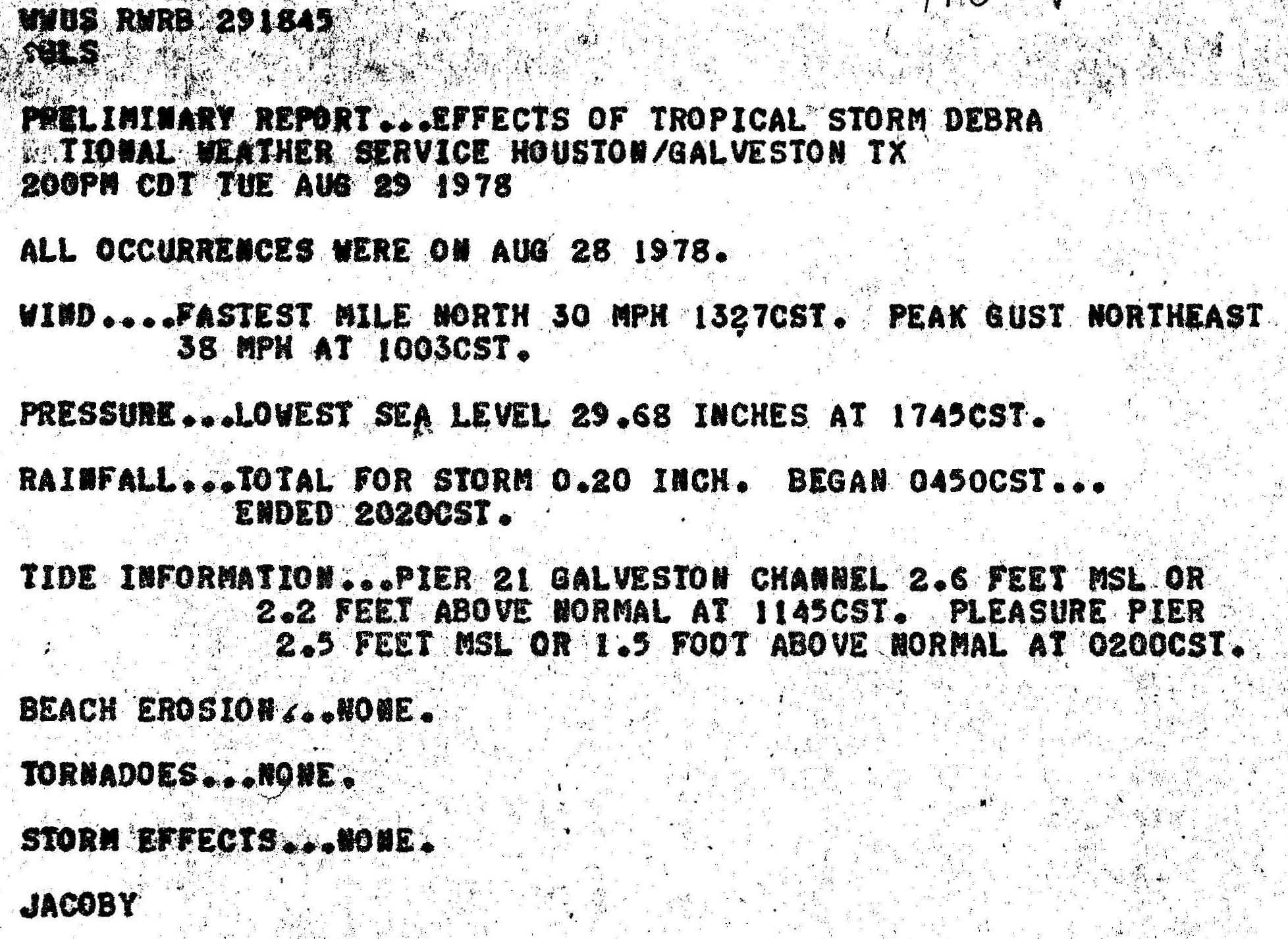
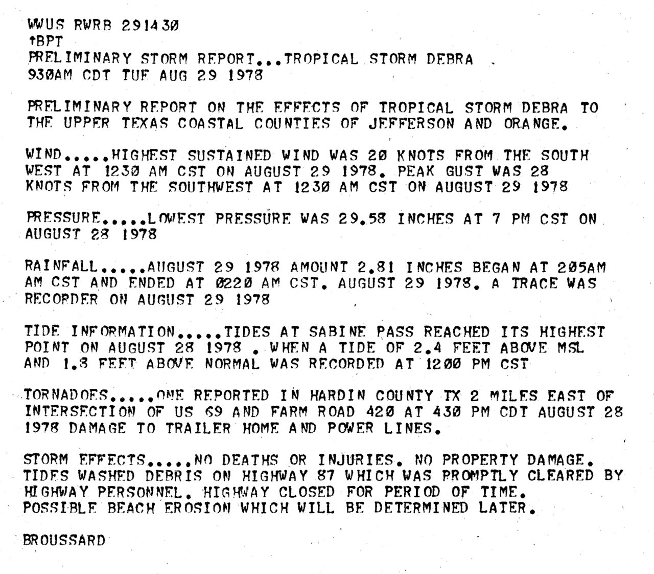
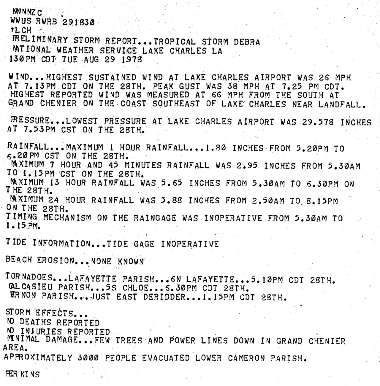
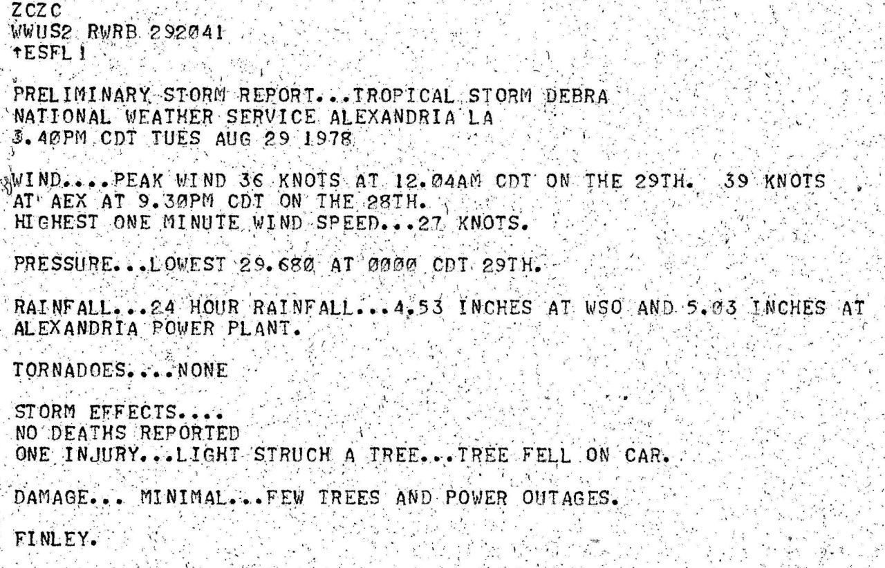
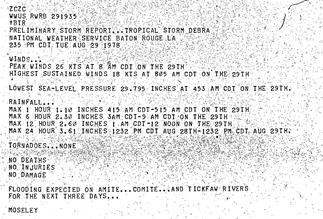
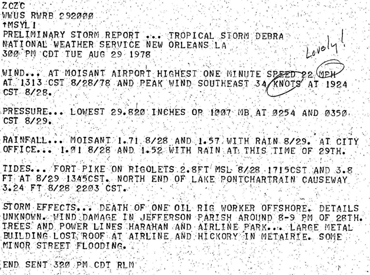
Gusts to tropical storm force occurred at most locations across South and Central Louisiana. The highest reported wind gust was 66 mph (57 knots) at Grand Chenier, Louisiana. For complete meteorological statistics, see the Wind and Pressure section.
STORM SURGE:
Tides of 3 to 5 feet MSL occurred along the Louisiana coast with the highest tide of 5.7 feet MSL across Vermilion Bay near Cypremort Point, Louisiana. Tides of 2 to 3 feet MSL occurred across the Upper Texas Coast. For other storm surge and high-water marks across our region, see the Storm Surge section.
RAINFALL:
Rainfall of 5 to 10 inches occurred across Central and Southern Louisiana, with 3 to 5 inches across Southeast Texas and Western Louisiana. The highest total of 10.81 inches occurred at Freshwater Lock, Louisiana. For complete rainfall totals reported across our region, see the Rainfall section.
TORNADOES:
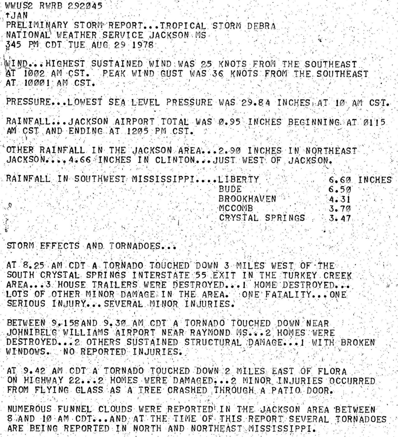
During the afternoon and evening hours of August 28th, confirmed tornadoes occurred at De Ridder in Beauregard Parish Louisiana and near Village Mills in Hardin County Texas. For complete details on all the tornadoes reported across Texas and Louisiana, see the Tornadoes section.
*Unable to make animation due to data integrity issues.
Webpage design and content by: Donovan Landreneau
|

