|
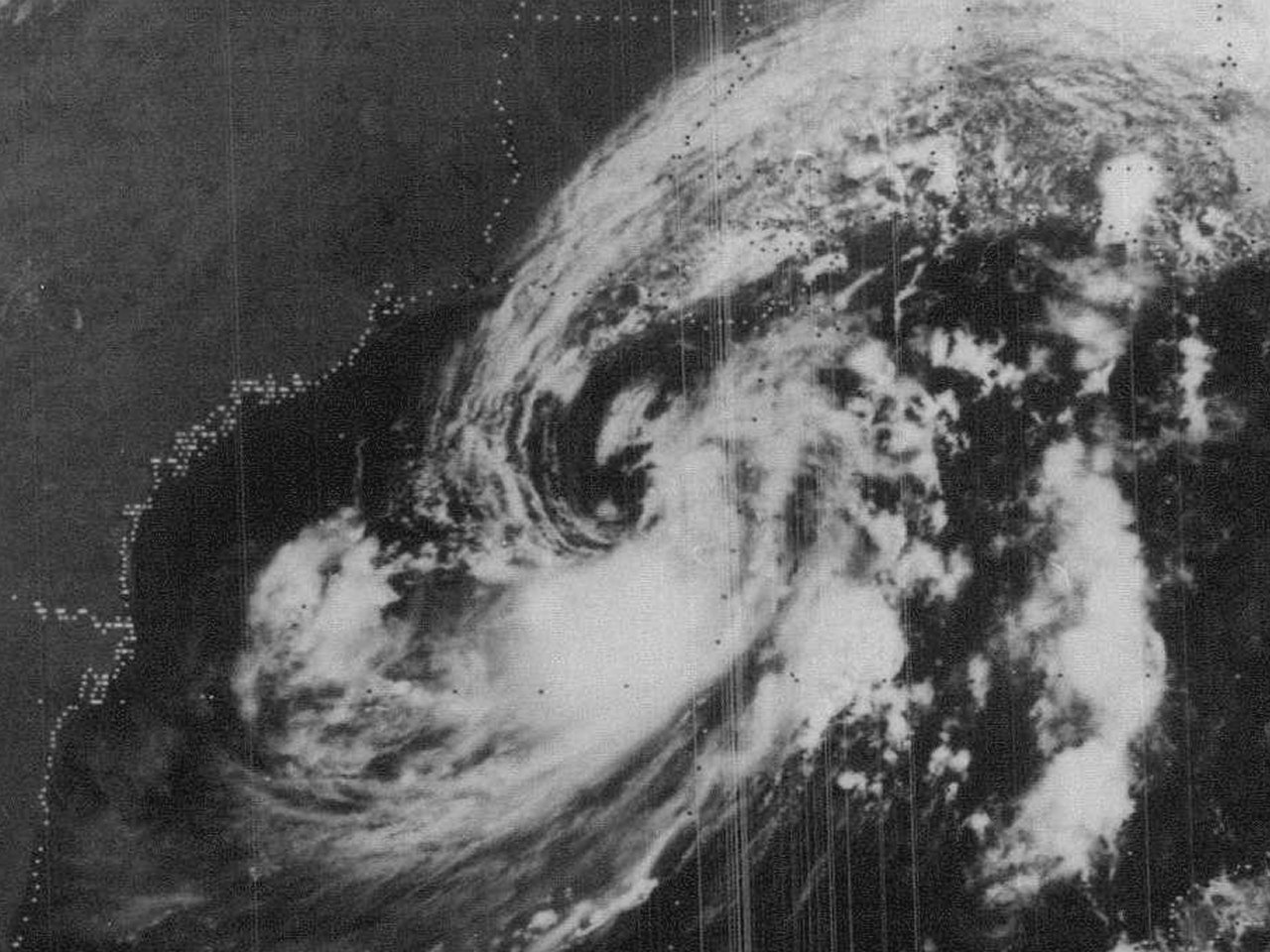
Above: GOES-2 visible satellite image of Hurricane Babe just inland South Central Louisiana at 7:30 AM CDT September 5, 1977.
Hurricane Babe originated as a tropical wave that moved off the African coast on August 23th. For the next several days, the wave moved west across the Atlantic and Caribbean Sea. By September 2nd, the wave interacted with an upper level low across the Northeast Gulf. Early on September 3rd, a surface low had developed and operationally designated as Tropical Depression #9, and upgraded to Tropical Storm Babe later that morning as it moved westward. In the post analysis, it shows that this system was subtropical in nature through the morning of September 4th. In this particular case, Babe was found to be still underneath the upper level low (but exhibited some warm core characteristics associated with tropical cyclones) and the maximum sustained winds and strongest bands were far removed from the center of circulation. Operationally, it was decided on September 3rd to go ahead and name the system Tropical Storm Babe due to the expected transition to tropical cyclone before it made landfall across the northern Gulf Coast.
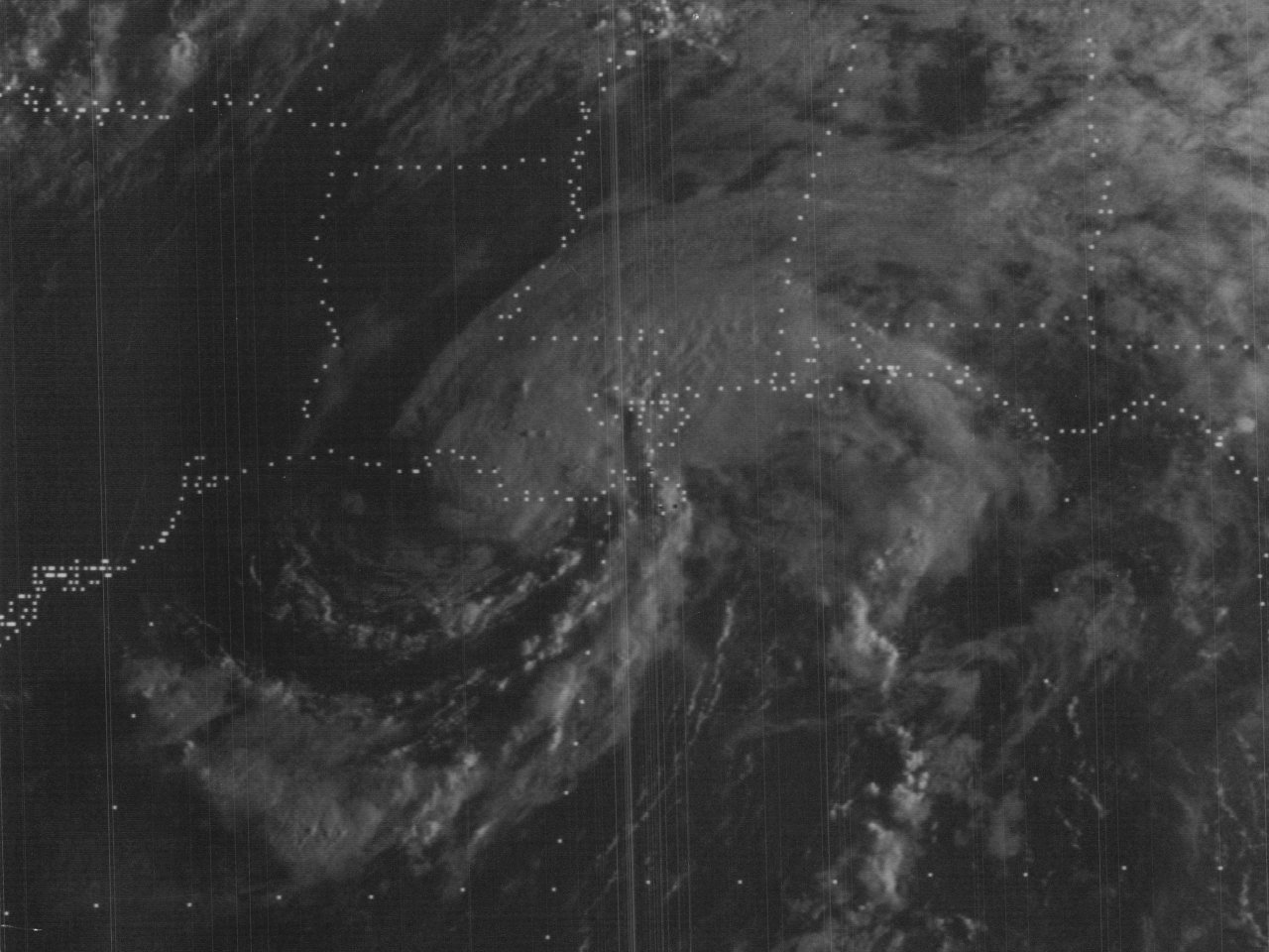
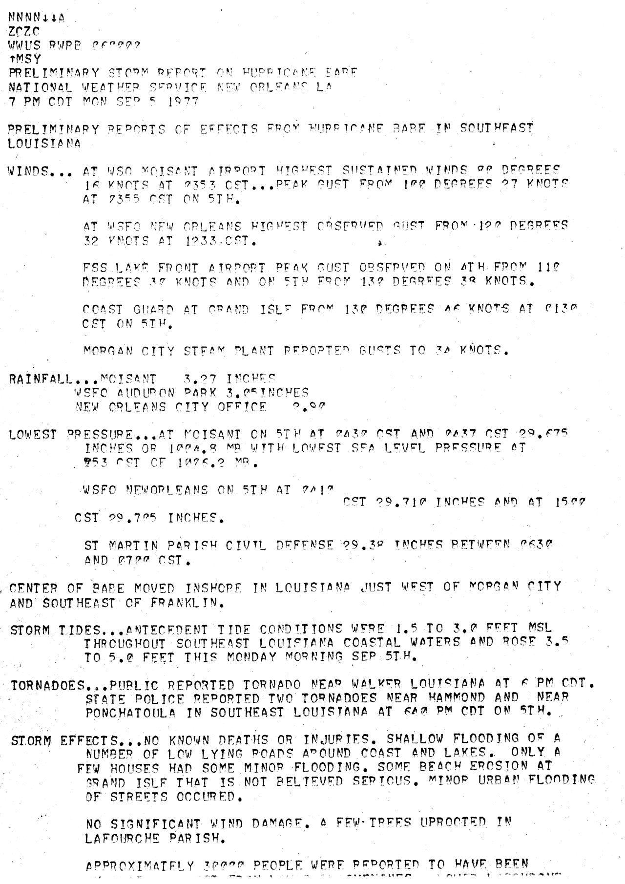
By the late morning hours of September 4th, the storm gradually intensified, acquired full tropical characteristics, and began to move northward as the upper level low gradually filled and a mid to upper level high continued off the Southeast U.S. A GOES-2 visible satellite image of Babe south of the Louisiana coast at 11 AM CDT September 4th. Continuing northward towards the South-Central Louisiana Coast, Babe was upgraded to a hurricane later that evening. Babe made landfall south of Morgan City, Louisiana around 6 AM CDT September 5th with maximum sustained winds of 75 mph (65 knots) and a minimal central pressure of 995 millibars (29.38 inches). A GOES-2 visible satellite image of Hurricane Babe shows the storm just inland South Central-Louisiana at 7:30 AM CDT September 5th.
Babe rapidly weakened to a tropical storm just after landfall, and a depression later that evening as it headed northeast across the remainder of Southeast Louisiana. Tropical Depression Babe continued across Mississippi, Alabama, & Georgia September 6th and 7th, and finally dissipated over South Carolina on September 8th. Click here for an interactive track of Hurricane Babe.
WIND & PRESSURE:
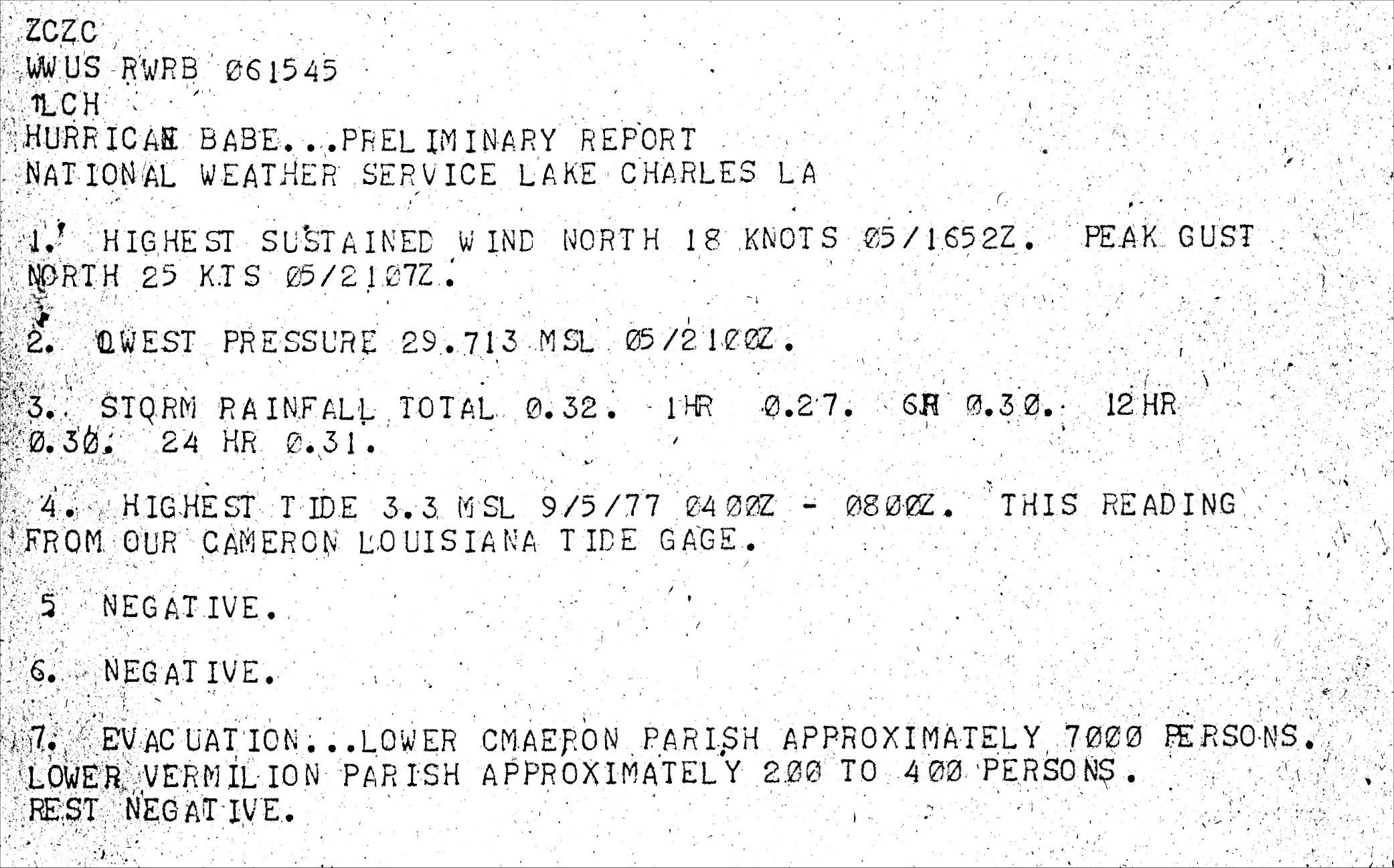
The highest wind gust recorded along the coast was 53 mph (46 knots) at Grand Isle, Louisiana. Lafayette, Louisiana recorded a maximum sustained wind of 28 mph (24 knots) and a peak wind gust of 34 mph (30 knots) just after daybreak on September 5th. The Morgan City Steam Plant recorded a peak gust of 39 mph (34 knots). No hurricane force winds were measured across South Central or Southeast Louisiana. For complete meteorological statistics, see the Wind and Pressure section.
STORM SURGE:
Tides of 2 to 3 feet MSL were common along the Louisiana Coast west of the Atchafalaya River with no significant coastal flooding effects reported. Further eastward, tides of 3 to 5 feet MSL were common across the Southeast Louisiana coast to the Mississippi River. For other storm surge and high-water marks across our region, see the Storm Surge section.
RAINFALL:
Rainfall of 3 to 4 inches occurred across Lower Acadiana with the highest total of 4.78 inches recorded at Morgan City, Louisiana. Much lower rainfall amounts of a quarter inch to two inches occurred across the remainder of Central and Southwestern Louisiana, to no rainfall recorded at all across most of Southeast Texas. Further east across Southeast Louisiana, rainfall ranged from 3 to 10 inches. For complete rainfall totals reported across our region, see the Rainfall section.
TORNADOES:
Several tornadoes were reported during the afternoon and evening after landfall, mainly over Southeast Louisiana. The strongest tornado reported was rated an F2 in Ponchatoula in Tangipahoa Parish around 8:15 PM CDT September 5th, injuring 1 and causing approximately 2.5 million in damage. For complete details on all the tornadoes reported across Louisiana, see the Tornadoes section.
|

