|
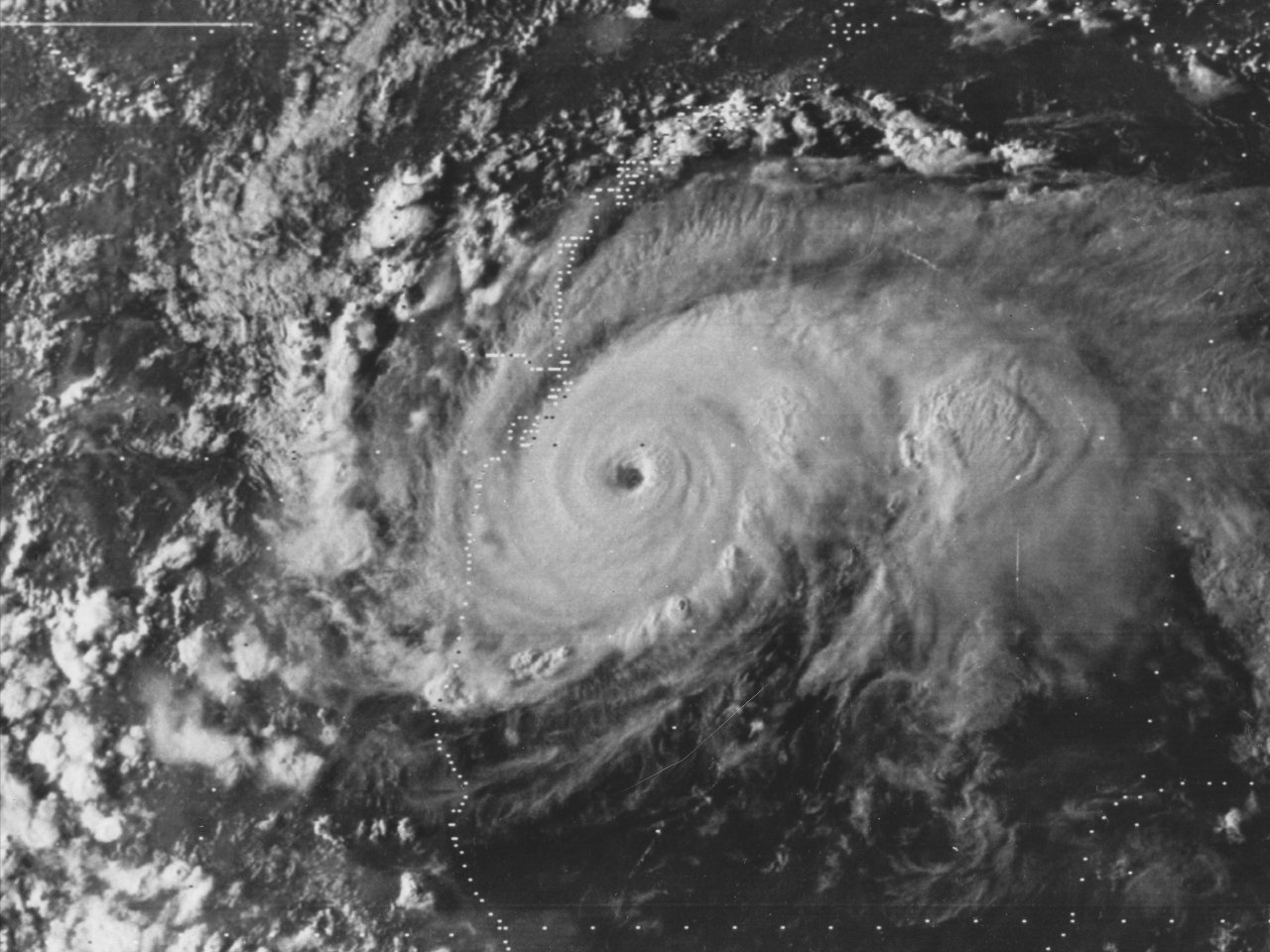
Above: GOES-2 visible satellite image of Hurricane Anita southeast of Brownsville, TX September 1, 1977 at 6:01 PM CDT.
Hurricane Anita originated as a tropical wave that moved off the African coast on August 16th. For the next several days, the wave moved west across the Atlantic and Caribbean Sea. By August 28th, the wave entered the Eastern Gulf where it gradually became better organized. By daybreak on August 29th, Tropical Depression #8 developed approximately 200 miles south of Mobile, Alabama. With a mid to upper level high building across the Eastern U.S. initial track forecasts projected landfall towards the Upper Texas or Southwest Louisiana coast where hurricane watches were issued.
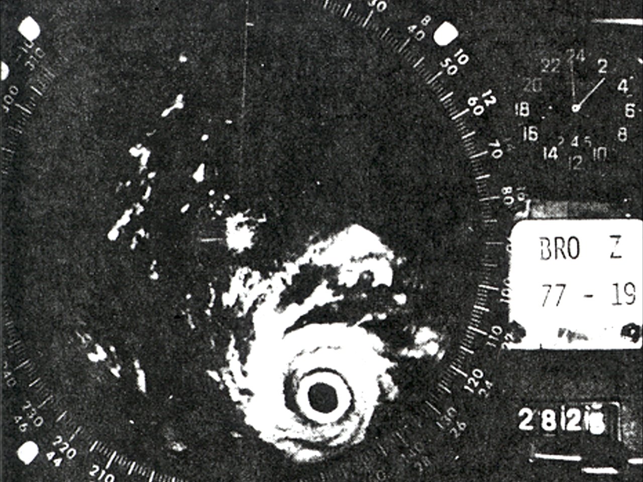
The depression strengthened into Tropical Storm Anita just after midnight on August 30th, and quickly strengthened into a hurricane by that afternoon. Anita began to move more west southwesterly as the mid to upper level ridge strengthened and built southwestward across Louisiana, Texas and the Northern Gulf, shifting the focus toward the lower Texas coast. Slow strengthening continued through August 31st. By September 1st, the mid to upper level high continued to strengthen to the north of Anita, turning the cyclone southwestward towards northern Mexico. With the moist atmosphere, low shear aloft, and warmer than normal water temperatures (as measured by a ship several days before), rapid strengthening commenced. A GOES-2 visible satellite image of Hurricane Anita southeast of Brownsville, TX September 1st at 6:01 PM CDT shows an extremely well-organized hurricane with sustained winds estimated to be around 160 mph (140 knots). Later that evening, the National Weather Service Brownsville, Texas WSR-57 radar recorded this image at 10 PM CDT September 1st showing Anita continuing to strengthen. Anita reached a peak intensity with maximum sustained winds of 175 mph (150 knots) and a minimum central pressure of 926 mb (27.34 inches) around 1 AM CDT September 2nd.
According to the Monthly Weather Review of the 1977 Atlantic Hurricane Season, Anita made landfall as a strong category 4 hurricane over a sparsely populated area about 90 miles north of Tampico, Mexico, or about 165 miles south of Brownsville, Texas around 6 AM CDT September 2nd. Anita continued moving west southwest, rapidly weakening across the higher terrain of Northeast Mexico, eventually dissipating early on September 3rd. Click here for an interactive track of Hurricane Anita.
WIND & PRESSURE:
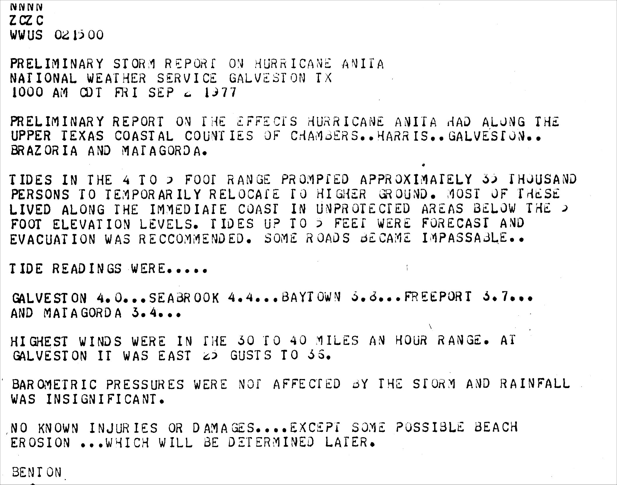
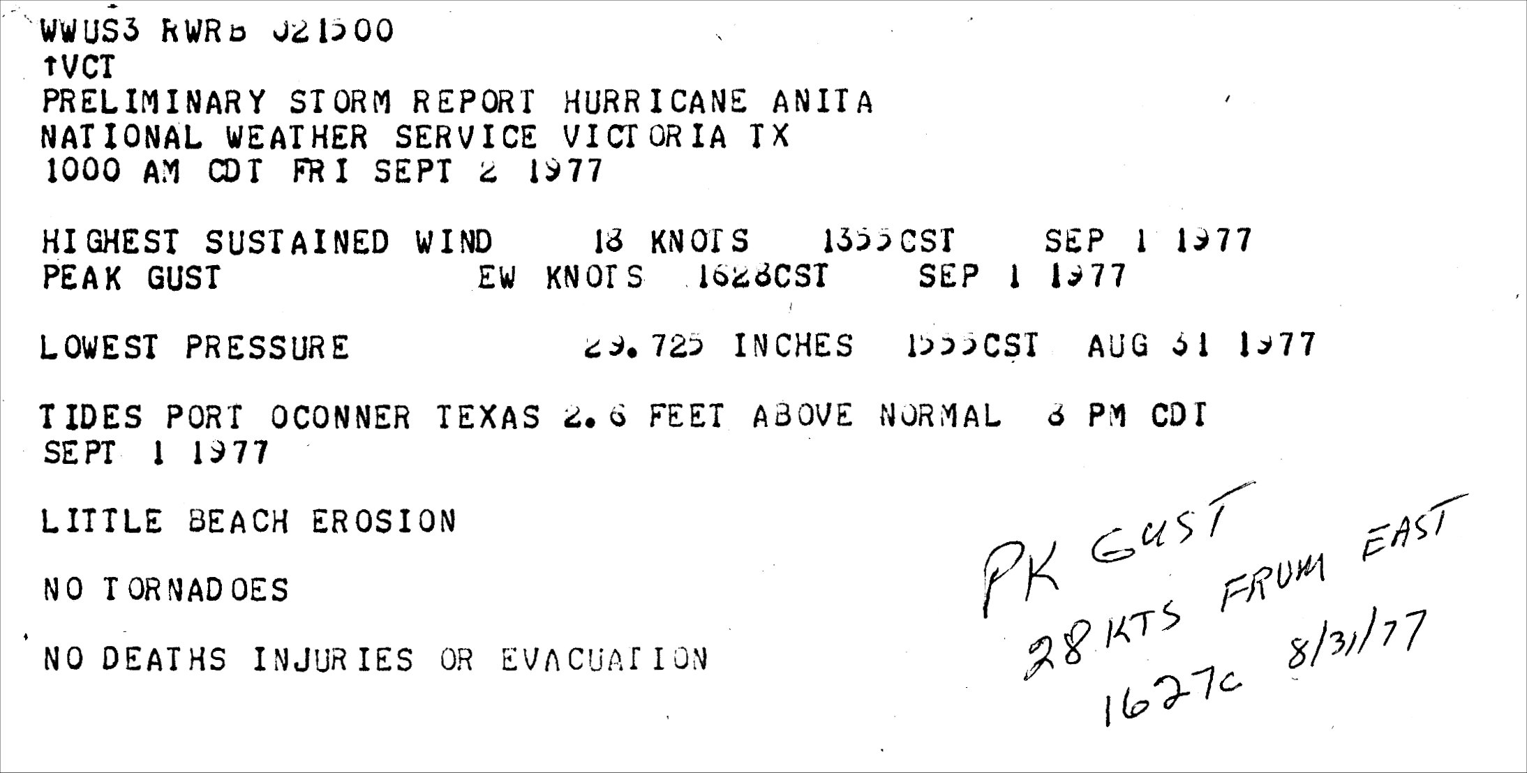
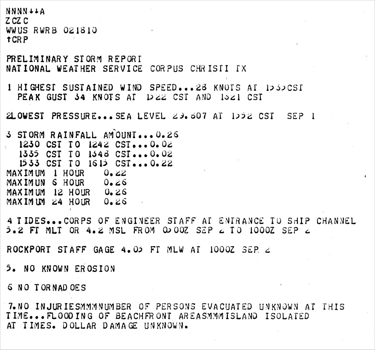
The National Weather Service Lake Charles, Louisiana recorded a maximum sustained wind of 35 mph (30 knots) and a peak wind gust of 44 mph (38 knots), around 2:10 PM CDT August 31st with one of the rain bands to reach the region. Otherwise, no tropical storm force winds were measured across Southern Louisiana or Southeast Texas. For complete meteorological statistics, see the Wind and Pressure section.
STORM SURGE:
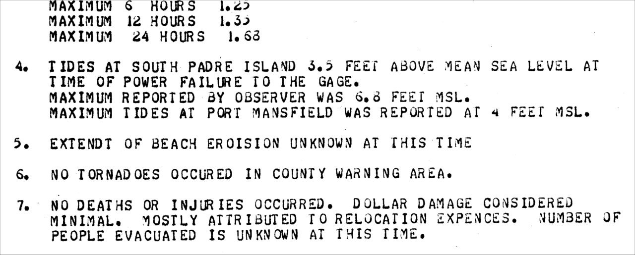
Despite some distance from the hurricane, maximum tide levels of 3 to 4 feet MSL occurred across Southeast Texas and Southwest Louisiana, with a reading of 3.8 feet MSL at Cameron, Louisiana. Tides of 4 to 5 feet MSL occurred across the Middle Texas Coast, with the highest tide of 6.8 feet recorded across South Padre Island, Texas. For other storm surge and high-water marks across our region, see the Storm Surge section.
RAINFALL:
Rainfall ranged from a quarter of an inch to almost two inches in the passing rain bands. The highest rainfall total of 1.76” was recorded at Beaver Fire Tower in Evangeline Parish. For complete rainfall totals reported across our region, see the Rainfall section.
TORNADOES:
No tornadoes were reported.
|

