|

Above: ATS-3 visible satellite image of Tropical Storm Delia just off the Texas Coast September 5, 1973 at 12:00 PM CDT.
A tropical depression formed during the late morning hours of September 1st just off the southeastern coast of the Yucatán Peninsula. The depression moved north northwestward into the Gulf being steered by a mid to upper level high pressure ridge over the Eastern United States. The depression strengthened into Tropical Storm Delia by the evening of September 2nd, now being steered northwestward while strengthening into a strong tropical storm by daybreak on September 3rd with 70 mph (60 knots) sustained winds.
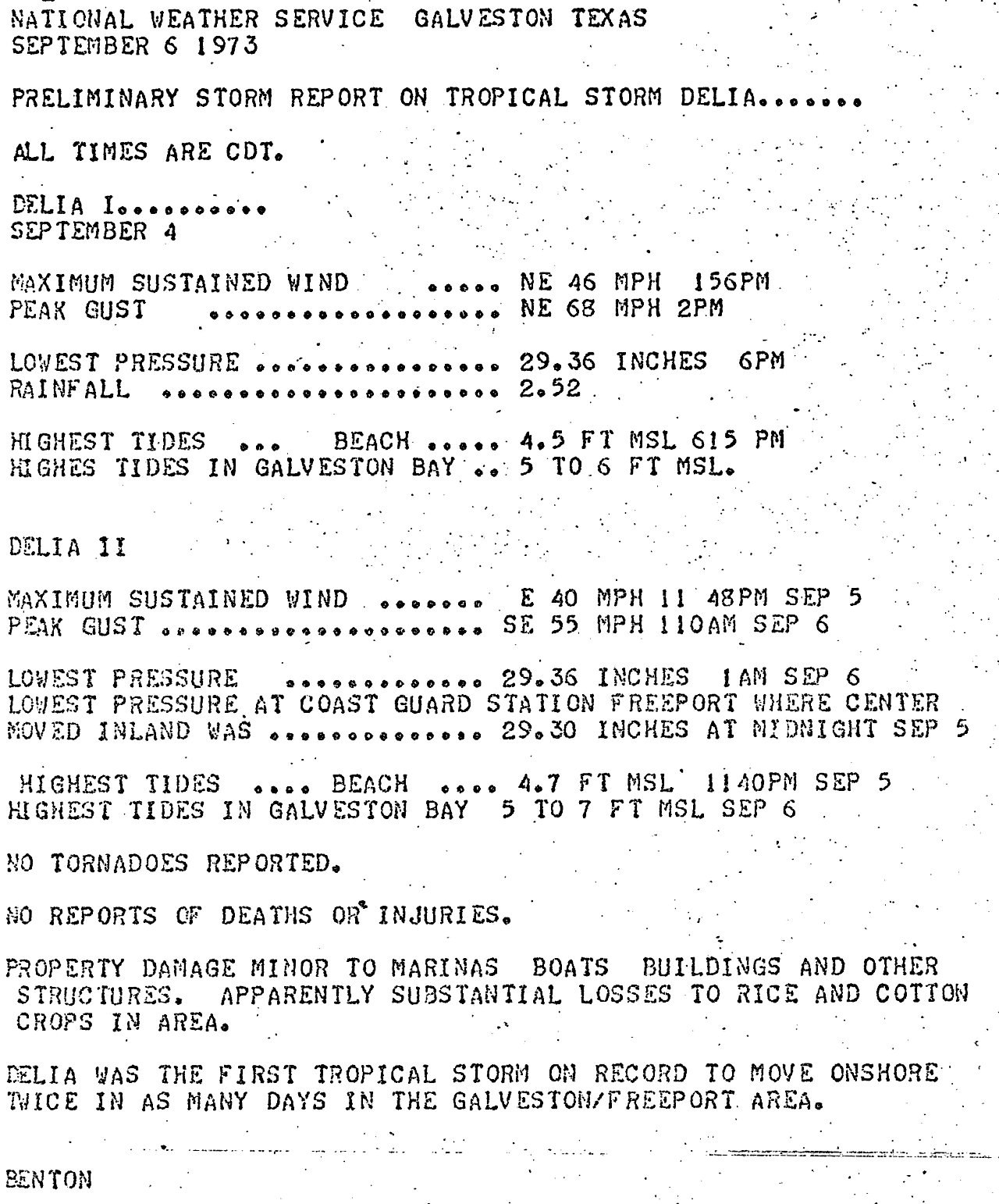
Delia began to move erratically northwest towards the Texas coast on September 3rd to the 4th as the mid to upper level ridge began weakening. While Delia’s strengthening trend ceased, the storm itself was becoming larger across the Gulf. Delia turned west and made landfall around Freeport, Texas around 10 PM CDT with maximum sustained winds around 65 mph (55 knots) and a minimum central pressure of 986 millibars (29.12 inches).
Delia’s initial time inland was short, as the center moved back offshore shortly after midnight on September 5th, evidently in the process of making a counterclockwise loop as steering currents collapsed. The center of a weakening Delia wobbled inland once again in almost the same location just southwest of Freeport, Texas shortly before Midnight. After the second landfall, Delia began to move quicker to the northwest and west on September 6th as a mid to upper level ridge strengthened to the north. Delia weakened to a depression by early afternoon, and dissipating across Northern Mexico early on September 7th. Click here for an interactive track of Tropical Storm Delia.
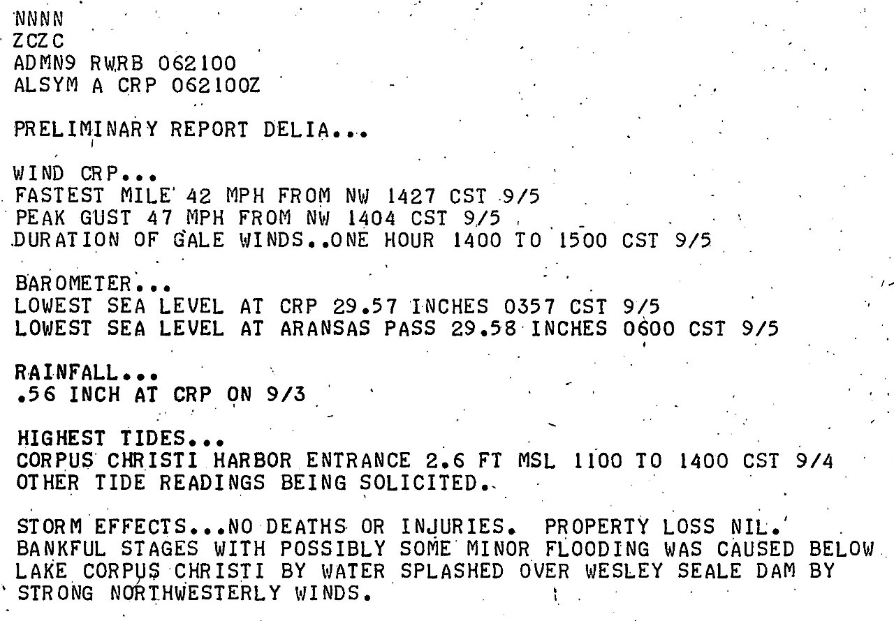
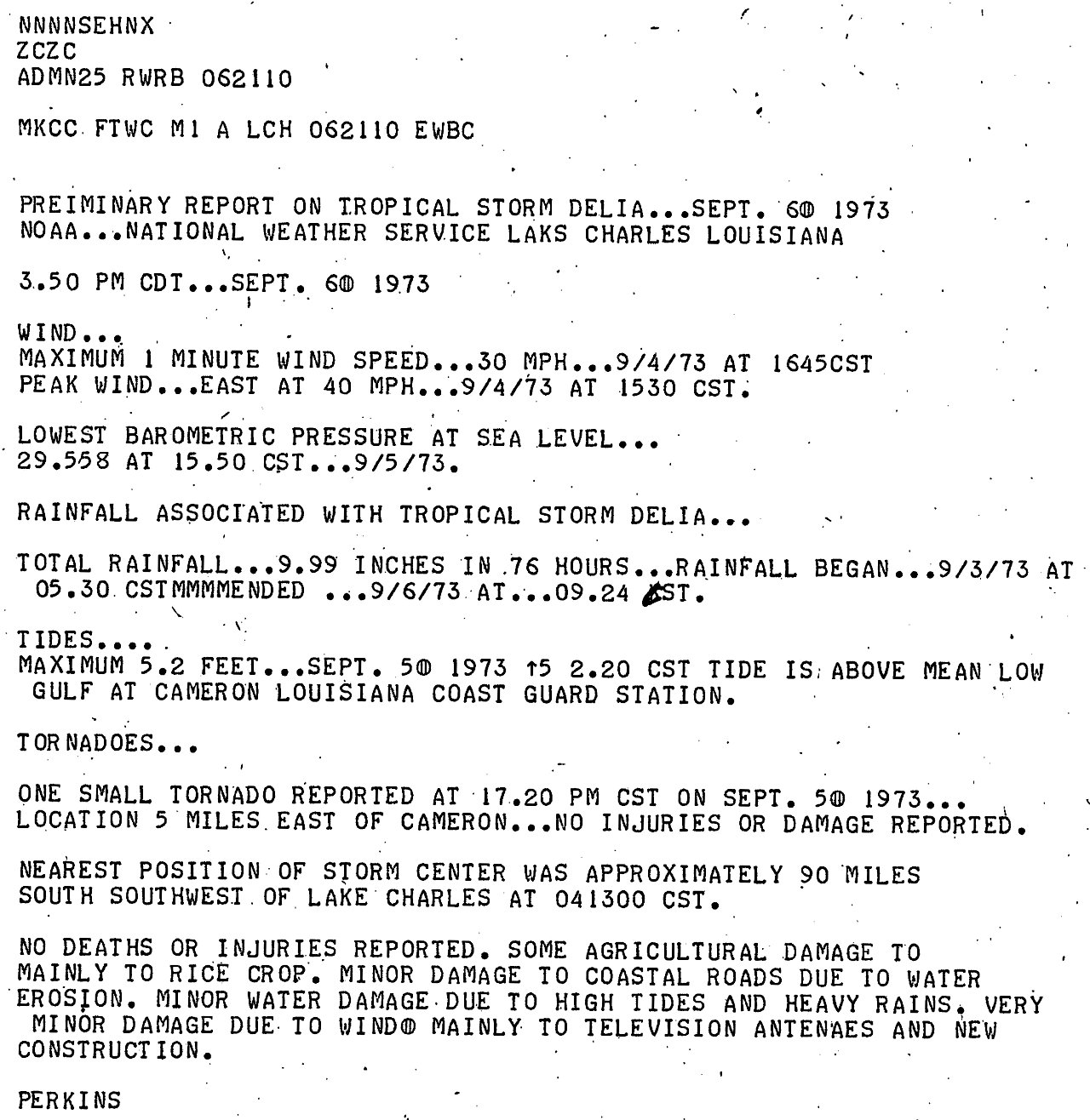
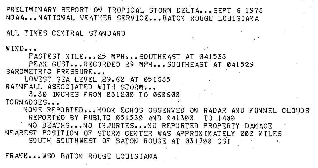
WIND & PRESSURE:
The highest winds associated with Delia occurred across the Upper Texas Coast and coastal Cameron Parish. Sabine Pass, Texas Coast Guard station recorded a highest sustained wind of 52 mph (45 knots) and a peak wind gust of 58 mph (50 knots) at 11 PM CDT September 4th. Further east, Cameron, Louisiana Coast Guard station recorded a highest sustained wind of 35 mph (30 knots) and a peak wind gust of 46 mph (40 knots) at 11 AM CDT September 4th. For complete meteorological statistics, see the Wind and Pressure section.
STORM SURGE:
Storm surge measured and high-water marks ranged from 5 to 7 feet MSL across Galveston Bay, 4 to 5 feet MSL across Jefferson County and Cameron Parish. For other storm surge and high-water marks across our region, see the Storm Surge section.
RAINFALL:
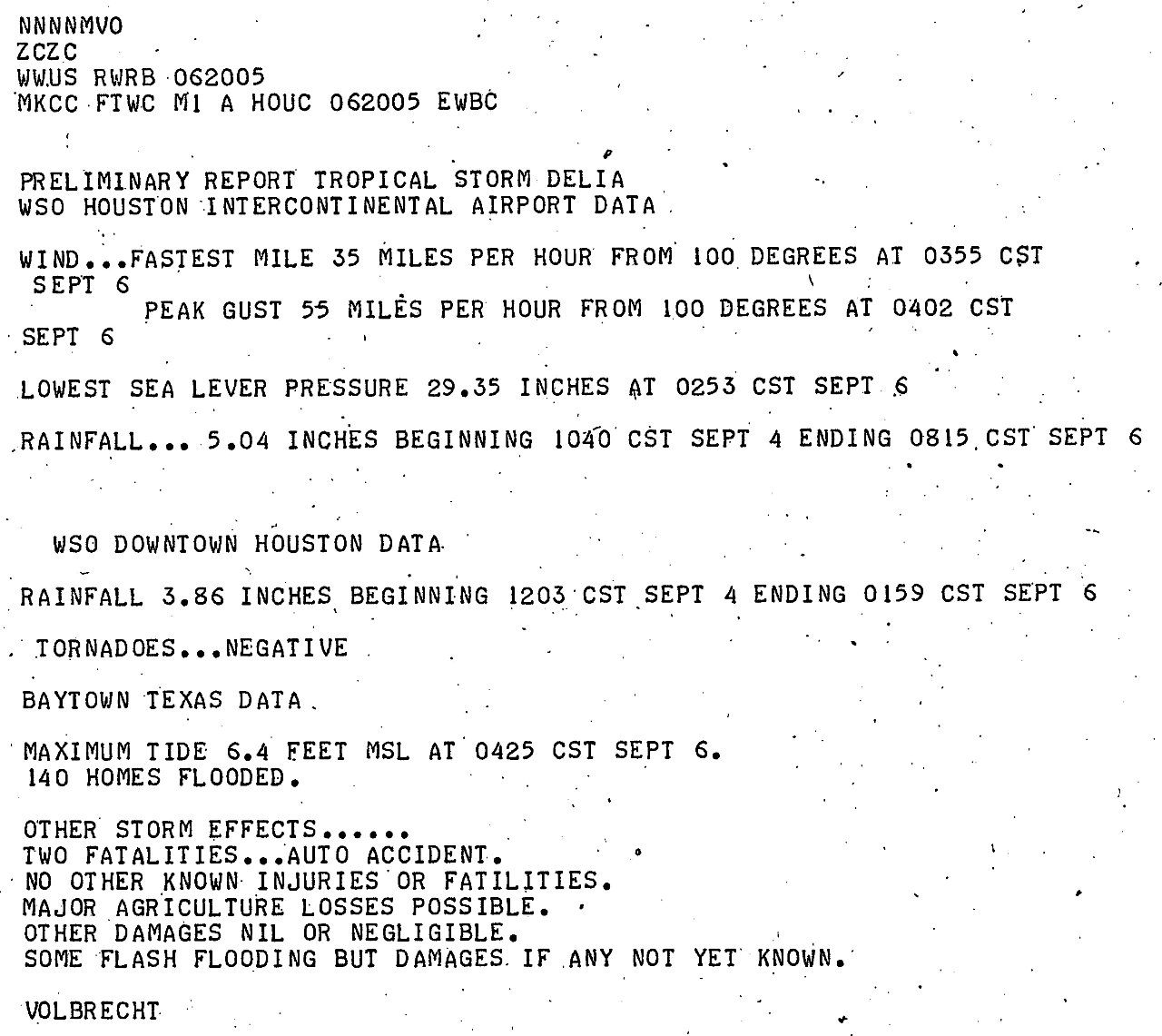
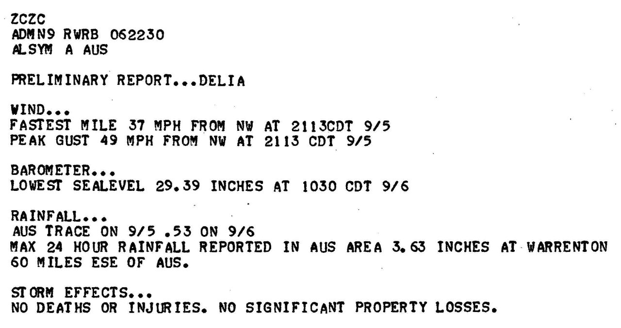
With the large circulation and slow movement of Delia as it approached the upper Texas Coast, rainfall of 8 to 13 inches fell across Southeast Texas and Southern Louisiana along the I-10 corridor to the coast, with 4 to 7 inches further inland. The highest rainfall total across our region was 13.34 inches in New Iberia, Louisiana. For complete rainfall totals reported across our region, see the Rainfall section.
TORNADOES:
Delia’s large circulation produced a few tornadoes ranging from F0 to F2 across North and Northeast Texas, as well as Northeast Louisiana. For complete details on all the tornadoes reported, see the Tornadoes section.
|

