|

Above: ESSA-8 visible satellite image of Tropical Storm Felice south of the Louisiana Coast September 15, 1970 at 10:18 AM CDT.
Felice originated from an upper level low pressure that gradually became a warm core system, and is estimated that the system organized into a tropical depression the evening of September 11th. The depression slowly moved west southwestward across the Florida Keys on September 13th into the Southeastern Gulf early on September 14th with little change in strength.
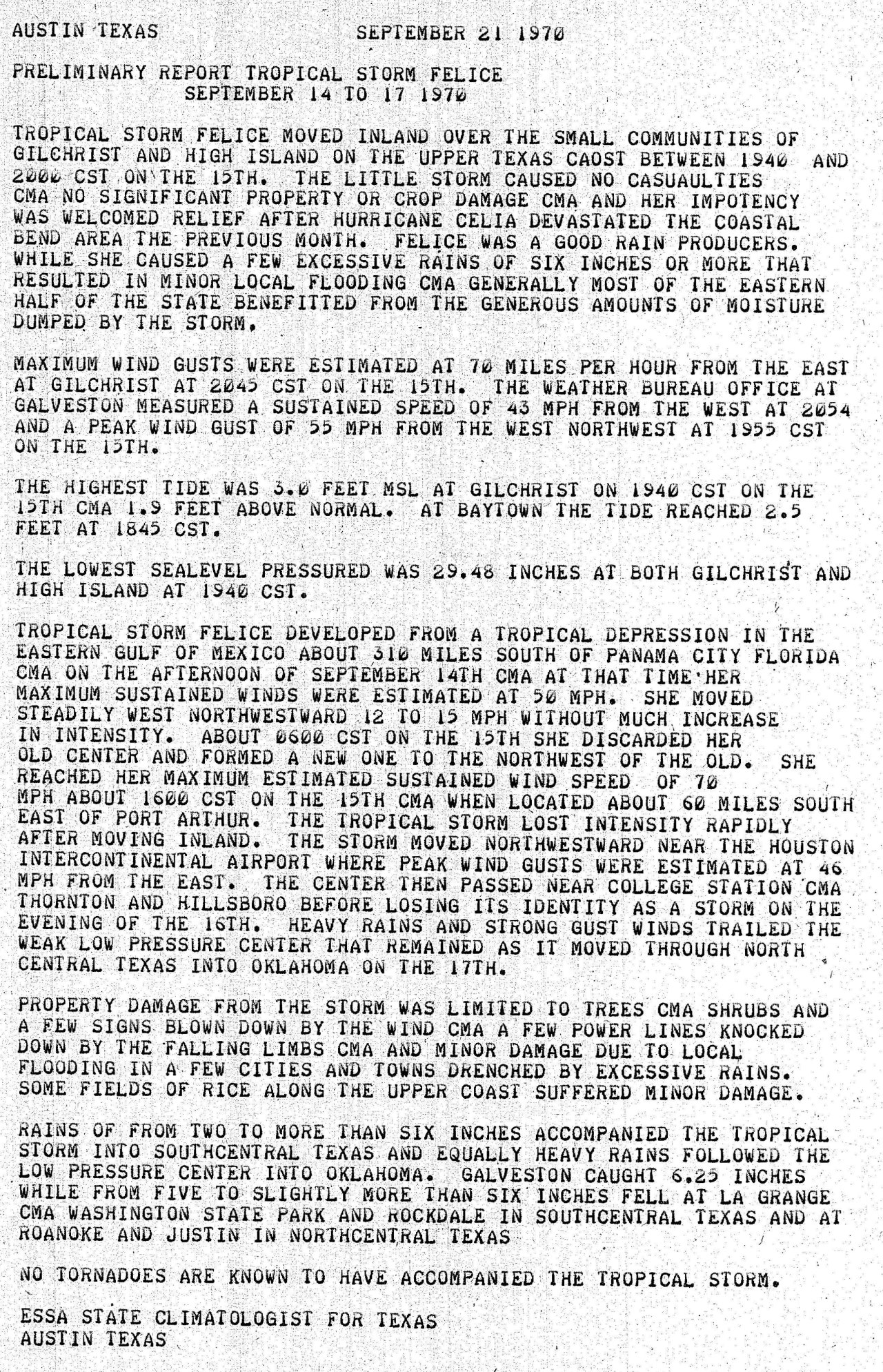
By the afternoon of September 14th, the system was upgraded to Tropical Storm Felice, being steered west northwest by a mid to upper level ridge of high pressure over the Eastern United States. Felice gradually became better organized as it moved south of the Louisiana Coast on September 15th, reaching a peak intensity of 70 mph (60 knots) and a minimum central pressure of 990 millibars (29.23 inches) while located about 100 miles south of Lafayette, Louisiana. With little change in strength, Felice made landfall just northeast of Galveston near Gilchrist, Texas at 9 PM CDT.
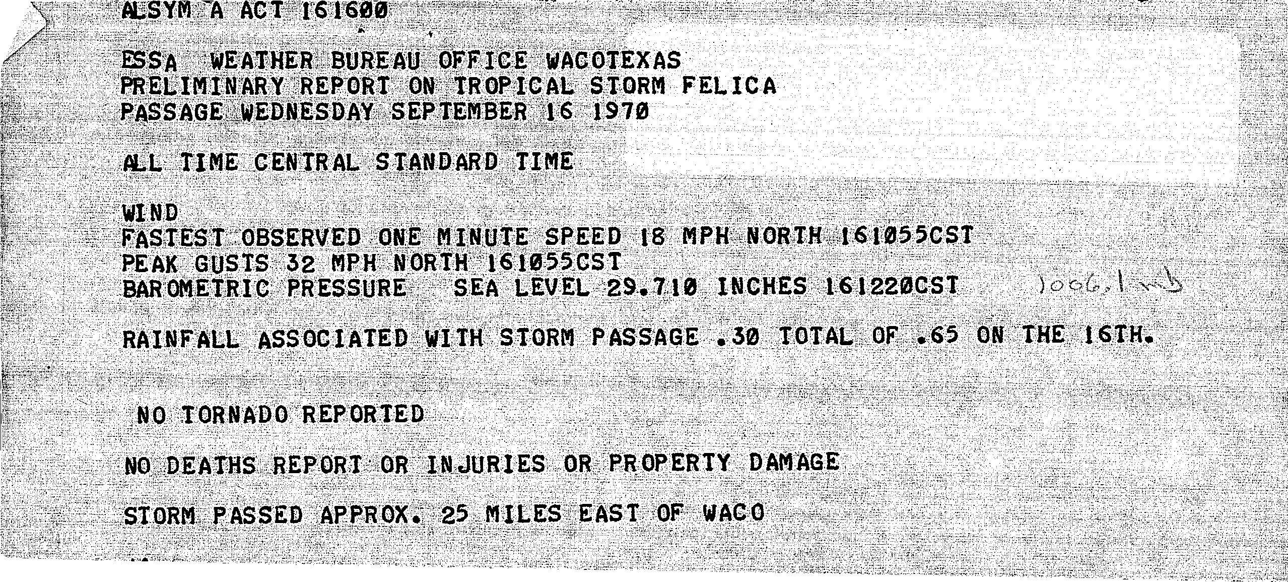
Felice weakened rapidly after landfall as it crossed the Houston Metropolitan area, and was a tropical depression by daybreak September 16th near College Station, Texas. The depression began to turn northward across Fort Worth later that evening, and across Southeast Oklahoma September 17th before becoming post tropical over Arkansas. Click here for an interactive track of Tropical Storm Felice.
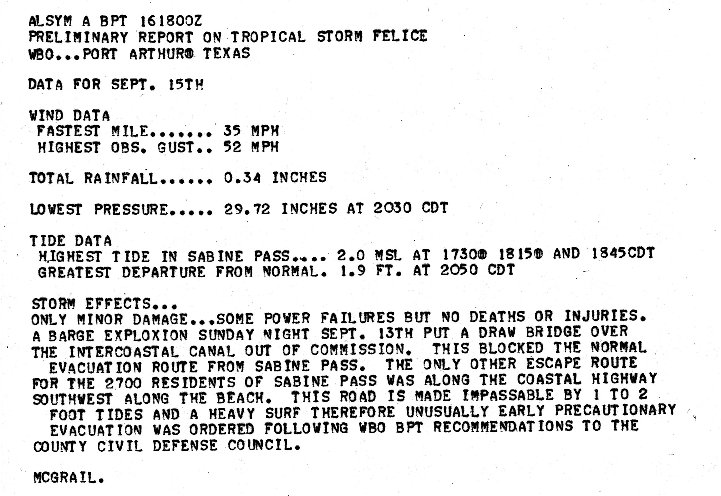
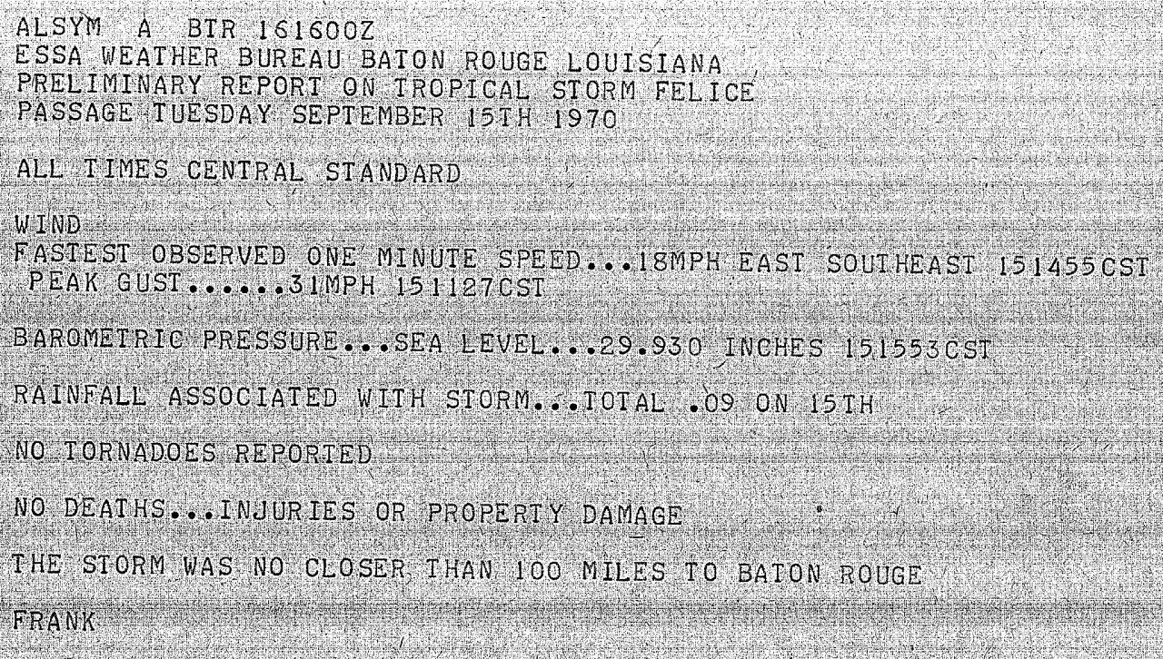
WIND & PRESSURE:
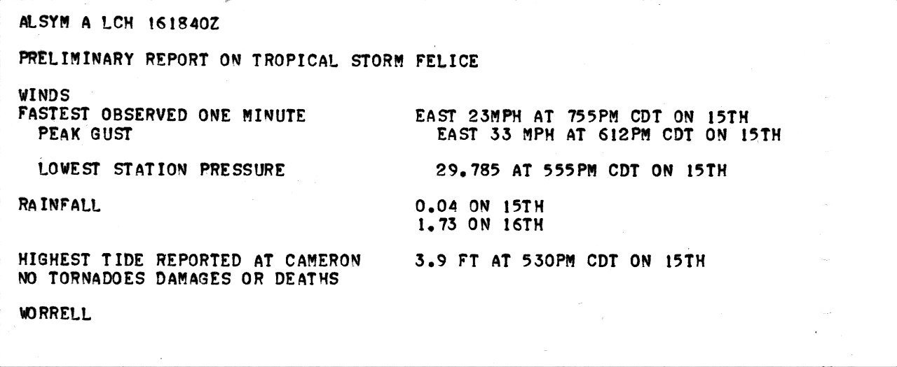
The highest winds were confined to Southeast Texas and coastal Southwest Louisiana. At the U.S. Weather Bureau office in Galveston, Texas the highest sustained winds of 43 mph (37 knots) and a peak wind gust of 55 mph (48 knots) was recorded at 9:54 PM CDT September 15th. At the U.S. Weather Bureau office in Port Arthur, the highest sustained winds of 35 mph (30 knots) and a peak wind gust of 52 mph (45 knots) was recorded at 8:02 PM CDT September 15th. At Rockefeller Wildlife Refuge in Eastern Cameron Parish, the highest sustained winds of 26 mph (23 knots) was recorded at 9:40 PM and a peak wind gust of 42 mph (37 knots) was recorded at 6:12 PM CDT September 15th.
STORM SURGE:
The highest storm surge of 3.9 feet MSL was reported at Cameron, Louisiana. Other readings are as follows (feet MSL): Baytown, 2.5; Galveston, 1.9; Sabine Pass, 2.0; Orange, 2.9. For other storm surge and high-water marks across our region, see the Storm Surge section.
RAINFALL:
Rainfall ranged from around one half to two inches, with a couple of locations recording almost 3 inches in Bunkie and Longville Louisiana. The highest storm total rainfall was 6.73 inches in Galveston, Texas. For complete rainfall totals reported across our region, see the Rainfall section.
TORNADOES:
No tornadoes were reported.
|

