|
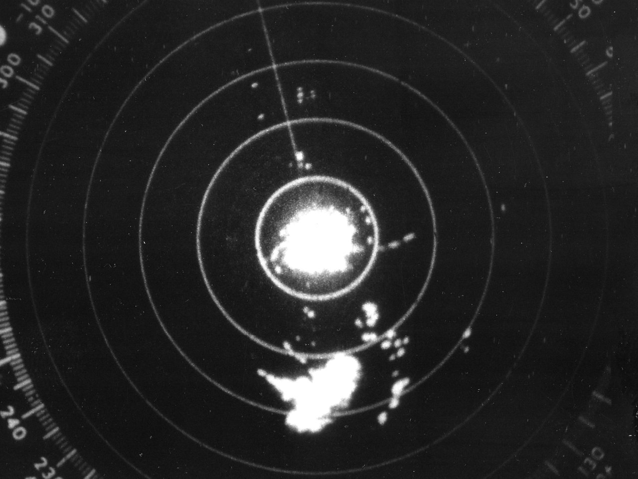
Above: Lake Charles, LA WSR-57 radar image at 10:25 PM CST on August 6, 1964 showing the tropical depression south of the Louisiana coast (which became Tropical Storm Abby the next morning).
Abby had its genesis across the northern Gulf about 200 miles south of Mobile, AL when a tropical depression formed during the afternoon of August 5th. For the next two days, the depression moved due west south of the Louisiana coast, being steered by a large mid to upper level high pressure ridge over the Central U.S. The Lake Charles, LA WSR-57 radar showing the tropical depression south of the Louisiana coast image at 10:25 PM CST on August 6, 1964, and 3:10 AM CST on August 7, 1964.
By daybreak on August 7th the depression strengthened into Tropical Storm Abby located about 60 miles south of Galveston. Abby, a very small system, rapidly strengthened for the remainder of the morning into the early afternoon hours. Abby made landfall at 2 PM CST between Matagorda and Freeport, Texas with maximum sustained winds of 70 mph (60 knots) over a very small area. Abby continued westward over Victoria, Texas later that evening, weakening to a depression by daybreak on August 8th. Tropical depression Abby dissipated just south of San Antonio, Texas later that afternoon. Click here for an interactive track of Tropical Storm Abby.
WIND & PRESSURE:
The Corps of Engineers office in Matagorda, Texas recorded a highest sustained wind of 45 mph (39 knots), a peak wind gust of 65 mph (57 knots), and a minimum central pressure of 1000.0 millibars (29.53 inches). The highest sustained wind of 25 mph (22 knots) was recorded at the U.S. Weather Bureau in Port Arthur, Texas. No tropical storm force winds were recorded across Southeast Texas or Southern Louisiana.
STORM SURGE:
Highest surge of 2 to 4 feet MSL was reported from Matagorda to Freeport, Texas. No significant storm surge was observed across Southeast Texas or Louisiana coasts.
RAINFALL:
Rainfall of 1 to 3 inches was recorded across Southeast Texas, Central and Southern Louisiana. No significant impacts were recorded, other than beneficial rainfall during early August across the area. For complete rainfall totals reported across our region, see the Rainfall section.
TORNADOES:
No tornadoes were reported.
|

