Extreme heat continues across the Southwest as temperatures may top 120 degrees. The heat may expand across the West and south-central U.S. into the middle of the month. Severe thunderstorms capable of severe wind gusts and large hail will be the primary hazards today across the northern Plains into the upper Midwest. Rainfall could be locally heavy across the Eastern U.S. today. Read More >
Overview
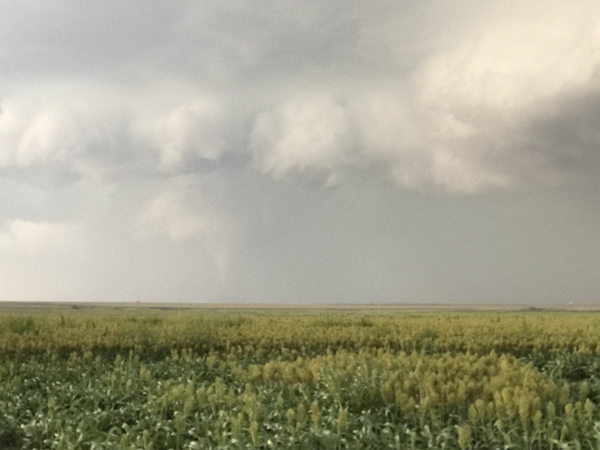
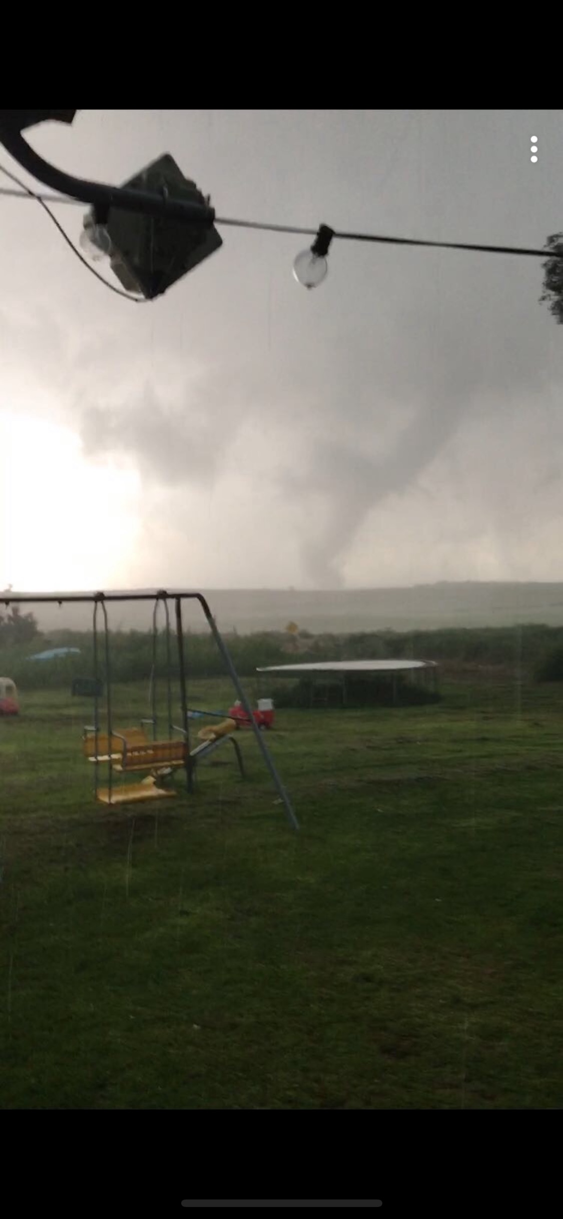
Tornadoes
|
Tornado #1
Track Map 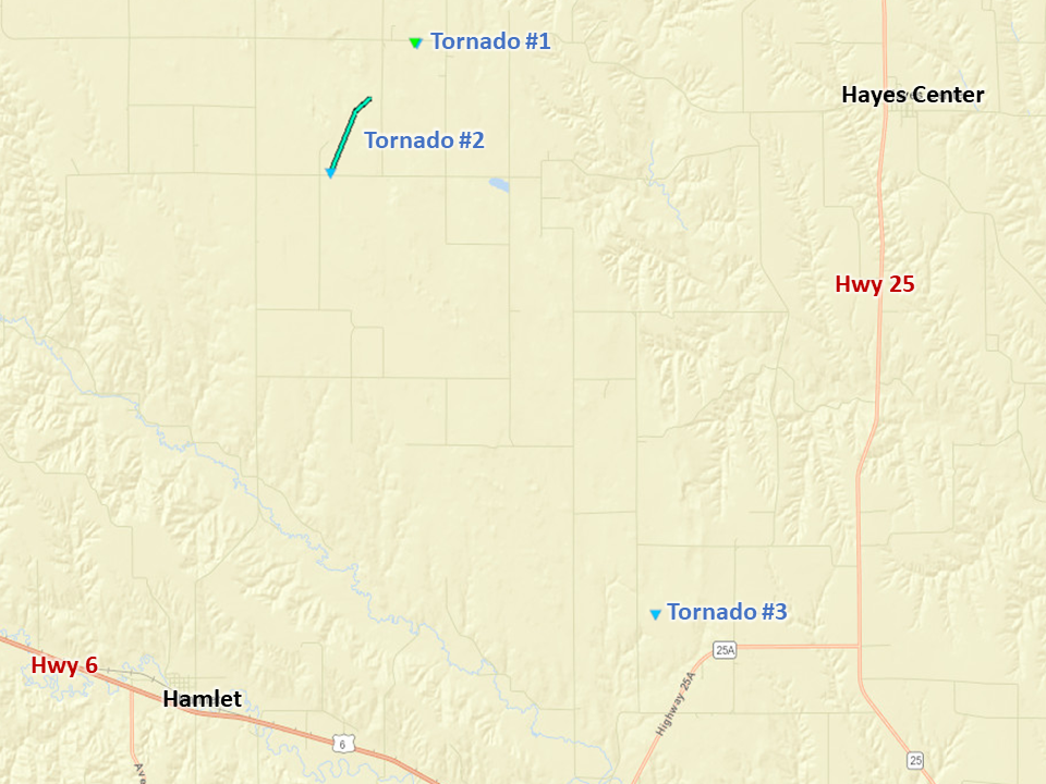 
|
||||||||||||||||
|
||||||||||||||||
|
Tornado #2
Track Map
Downloadable KMZ File |
||||||||||||||||
|
||||||||||||||||
|
Tornado #3
Track Map
Downloadable KMZ File |
||||||||||||||||
|
||||||||||||||||
For more information regarding Dundy, Hitchcock, and Red Willow Counties, visit NWS Goodland at https://www.weather.gov/gld/August29SevereWind
The Enhanced Fujita (EF) Scale classifies tornadoes into the following categories:
| EF0 Weak 65-85 mph |
EF1 Moderate 86-110 mph |
EF2 Significant 111-135 mph |
EF3 Severe 136-165 mph |
EF4 Extreme 166-200 mph |
EF5 Catastrophic 200+ mph |
 |
|||||
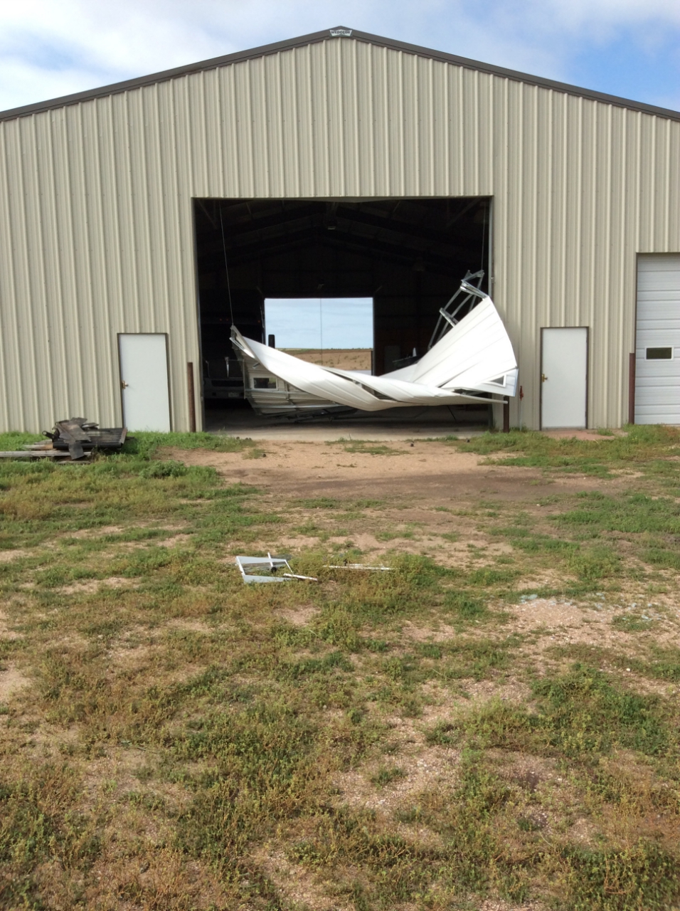
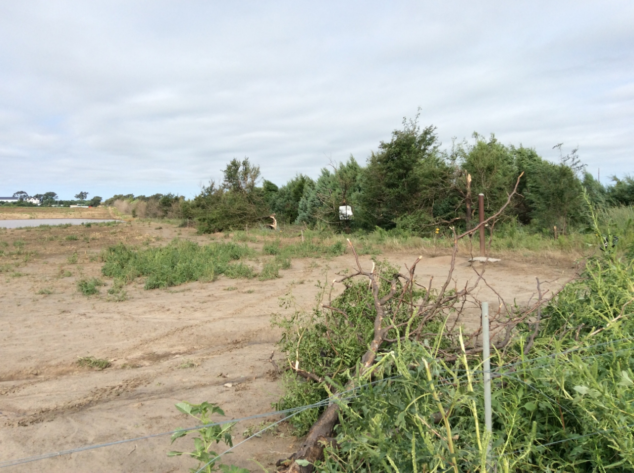
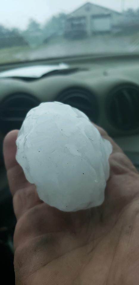
Photos
 |
 |
 |
 |
|
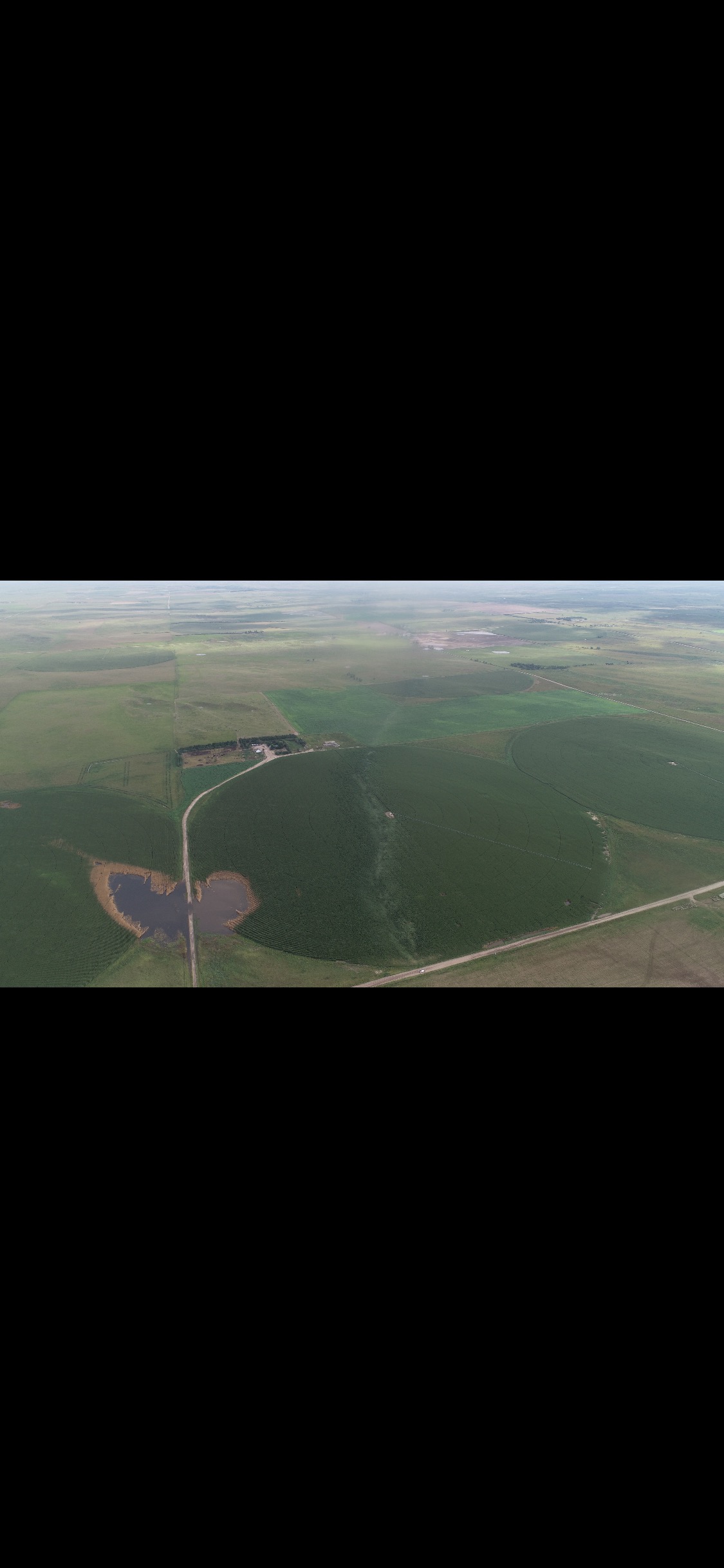
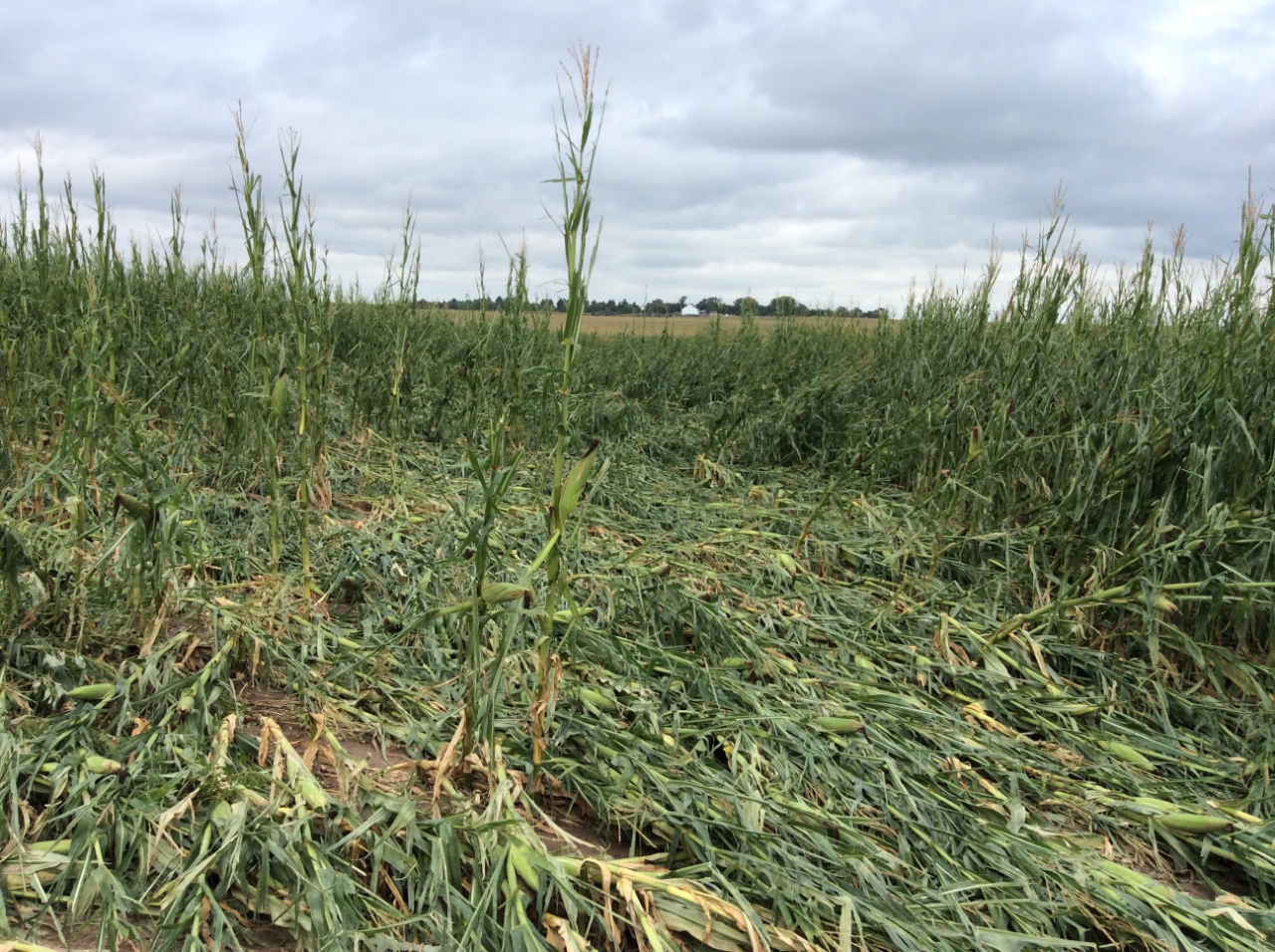
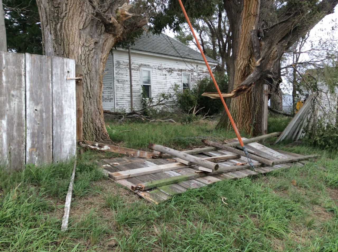
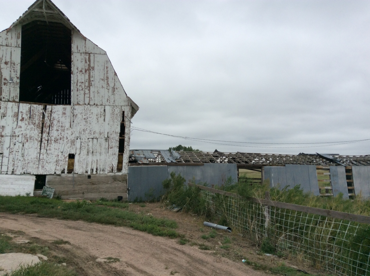
Northwest of Palisade, Hayes Co NWS storm survey |
Northwest of Palisade, Hayes Co NWS storm survey |
Northwest of Palisade, Hayes Co NWS storm survey |
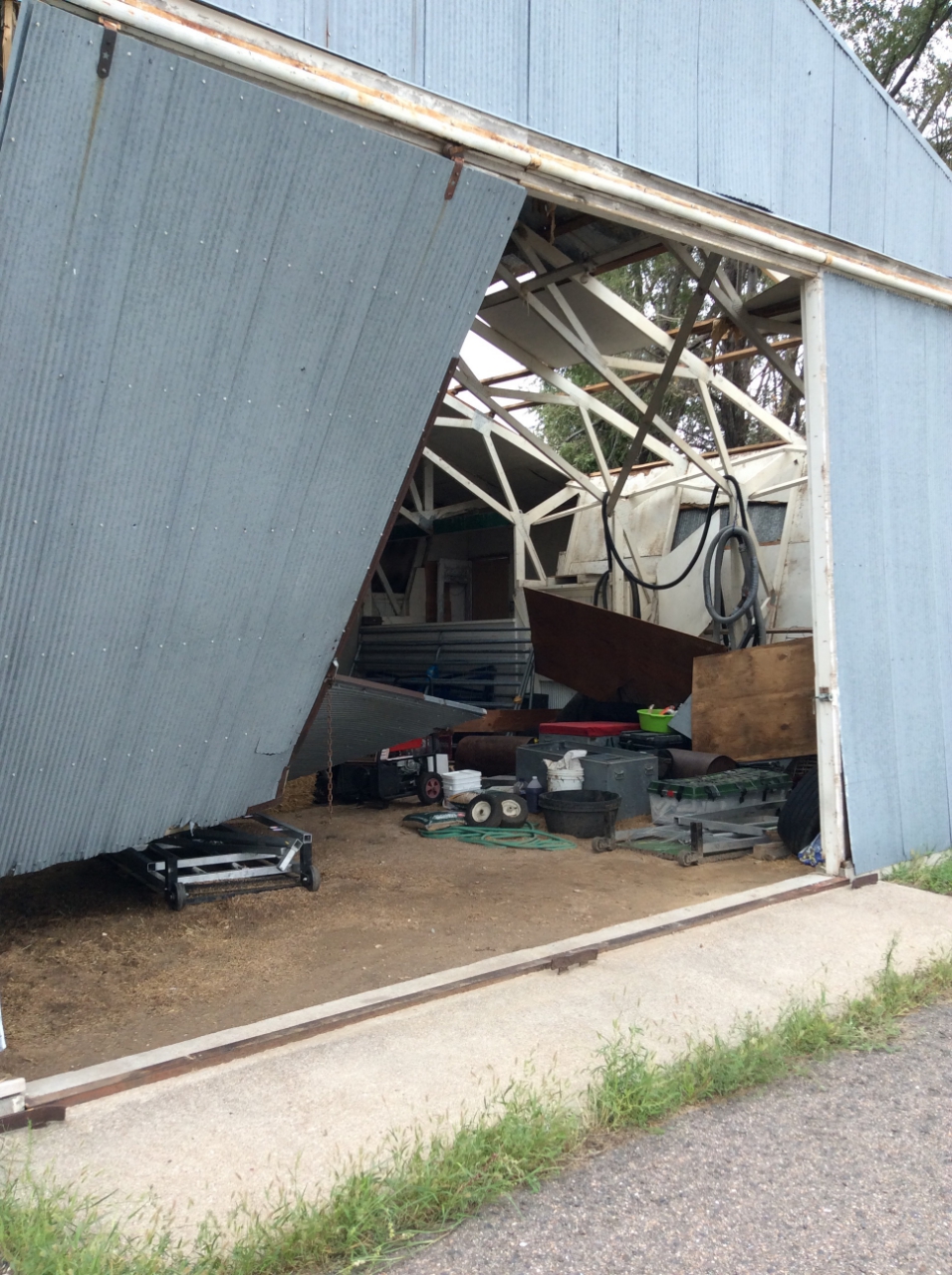
Just north of Hayes / Hitchcock county line NWS storm survey |
 |
 |
|
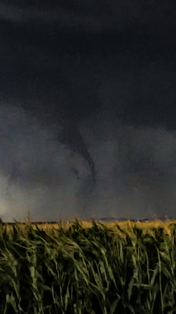
Near Palisade Photo credit: Char Hamilton |
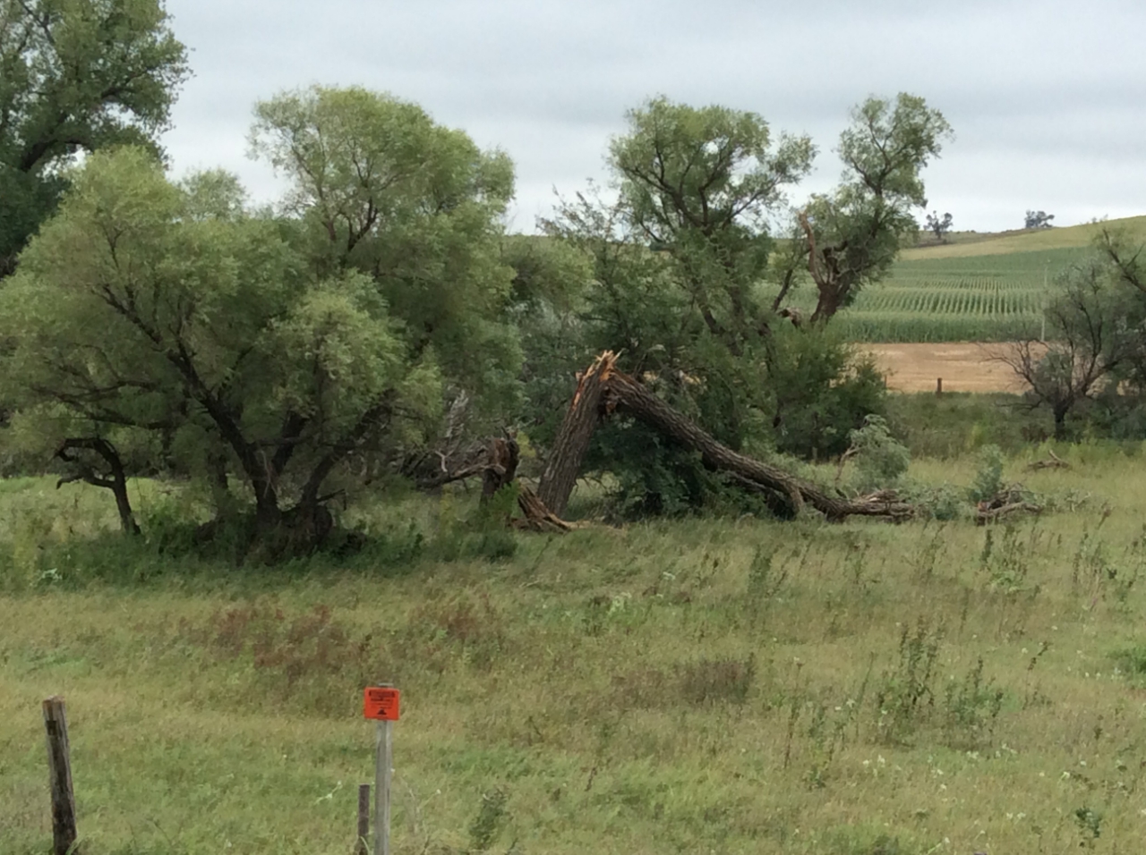
West of Hayes Center Photo credit: Nathan Jurgensen |
Radar
.gif) |
|
Radar loop courtesy of Iowa Environmental Mesonet Yellow box = Severe Thunderstorm Warning, Red box = Tornado Warning, Orange outline = NWS coverage areas |
Storm Reports
..TIME... ...EVENT... ...CITY LOCATION... ...LAT.LON...
..DATE... ....MAG.... ..COUNTY LOCATION..ST.. ...SOURCE....
..REMARKS..
0443 PM HAIL 10 S WALLACE 40.69N 101.16W
08/29/2019 E1.50 INCH HAYES NE TRAINED SPOTTER
0448 PM HAIL 8 S WALLACE 40.72N 101.16W
08/29/2019 E1.00 INCH LINCOLN NE PUBLIC
0452 PM TSTM WND GST 12 S WALLACE 40.66N 101.16W
08/29/2019 E60.00 MPH HAYES NE TRAINED SPOTTER
0452 PM HAIL 12 S WALLACE 40.66N 101.16W
08/29/2019 E1.25 INCH HAYES NE TRAINED SPOTTER
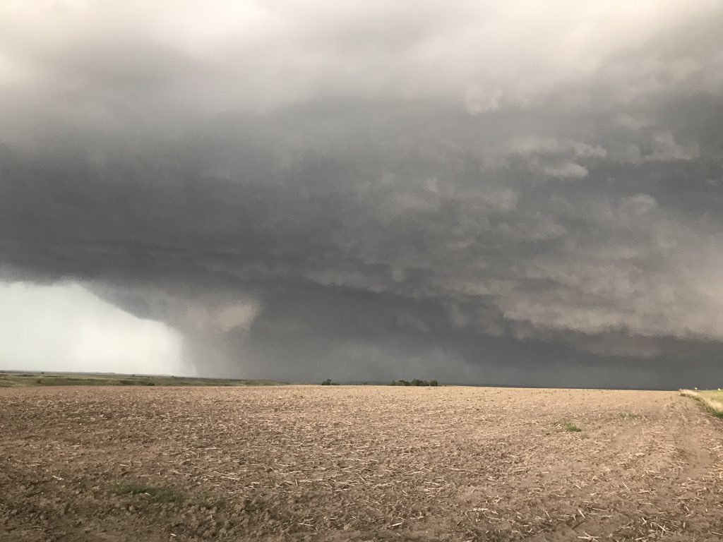
0520 PM FUNNEL CLOUD 6 WSW HAYES CENTER 40.48N 101.13W
08/29/2019 HAYES NE NWS EMPLOYEE
WELL DEFINED FUNNEL CLOUD VIA PHOTO.
0525 PM TSTM WND GST 3 N HAYES CENTER 40.55N 101.02W
08/29/2019 M58.00 MPH HAYES NE MESONET
NE-MESO030
0525 PM HAIL 2 N HAYES CENTER 40.54N 101.02W
08/29/2019 E1.75 INCH HAYES NE EMERGENCY MNGR
0537 PM TORNADO 9 ENE HAMLET 40.43N 101.08W
08/29/2019 HAYES NE TRAINED SPOTTER
BRIEF ROPE TORNADO
0540 PM TORNADO 7 SSW HAYES CENTER 40.42N 101.07W
08/29/2019 HAYES NE NWS EMPLOYEE
0546 PM TORNADO 6 ENE HAMLET 40.42N 101.13W
08/29/2019 HAYES NE FIRE DEPT/RESCUE
0555 PM HAIL 7 E HAMLET 40.38N 101.10W
08/29/2019 E2.00 INCH HAYES NE PUBLIC
WIND DRIVEN HAIL DAMAGED SIDING ON HOUSE. RELAYED VIA
SOCIAL MEDIA. TIME ESTIMATED FROM RADAR
0700 AM HEAVY RAIN HAYES CENTER 40.51N 101.02W
08/30/2019 M1.11 INCH HAYES NE CO-OP OBSERVER
0700 AM HEAVY RAIN 8 E HAMLET 40.38N 101.08W
08/30/2019 M1.21 INCH HAYES NE COCORAHS
0800 AM HEAVY RAIN HAYES CENTER 40.51N 101.02W
08/30/2019 M1.21 INCH HAYES NE COCORAHS
 |
Media use of NWS Web News Stories is encouraged! Please acknowledge the NWS as the source of any news information accessed from this site. |
|