Heavy to excessive rainfall may bring flooding to parts of Arizona, New Mexico, Florida, North Carolina, and Virginia today. Recently burned areas will be particularly vulnerable to flash flooding. Gusty winds and low humidity will bring elevated to critical fire weather conditions to parts of the Northwest U.S. and central Alaska today. Read More >
|
Record Flooding Along South Platte and Platte Rivers
Colorado Rainfall South Platte Basin and Colorado Flooding Nebraska Flooding Hydrographs Nebraska Flooding Pictures
Historical rains fell across the front range of the Colorado Rocky Mountains September 9-15th, 2013. These rains, which totaled over the yearly average across portions of this area fell at rates of over 2 inches per hour at times which caused drastic flash flooding and river flooding. Total values through the seven days amounted up to 17 inches where the heaviest amounts were measured. These extreme amounts were more localized, however a large part of the area received greater than 8 inches in these seven days. See graphics below, courtesy of NWS Boulder.
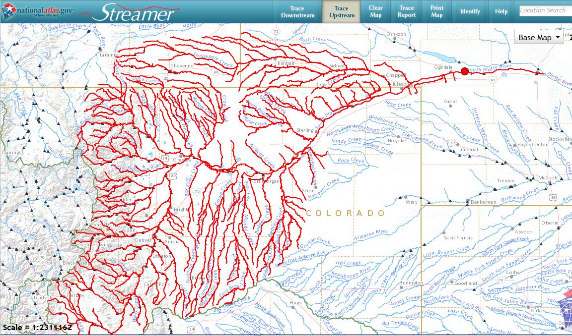
The heavy rains largely fell in the South Platte River Basin (see graphic below), therefore these extreme amounts of water were routed downstream through the South Platte and Platte River systems through the following weeks. Across Colorado, the extreme amounts of water caused historic flooding along the South Platte River and its tributaries. Many towns and lands along the river were inundated with water which caused great amounts of damage to infrastructure, farmland, and personal property.
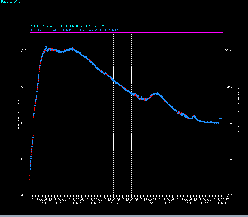
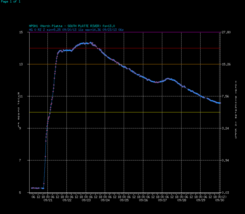
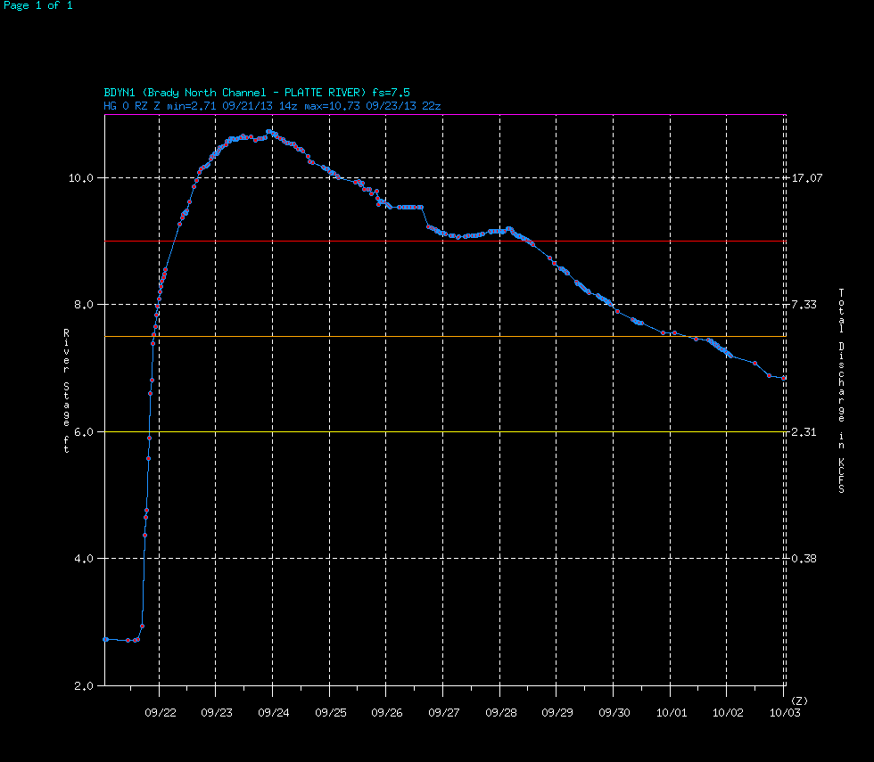
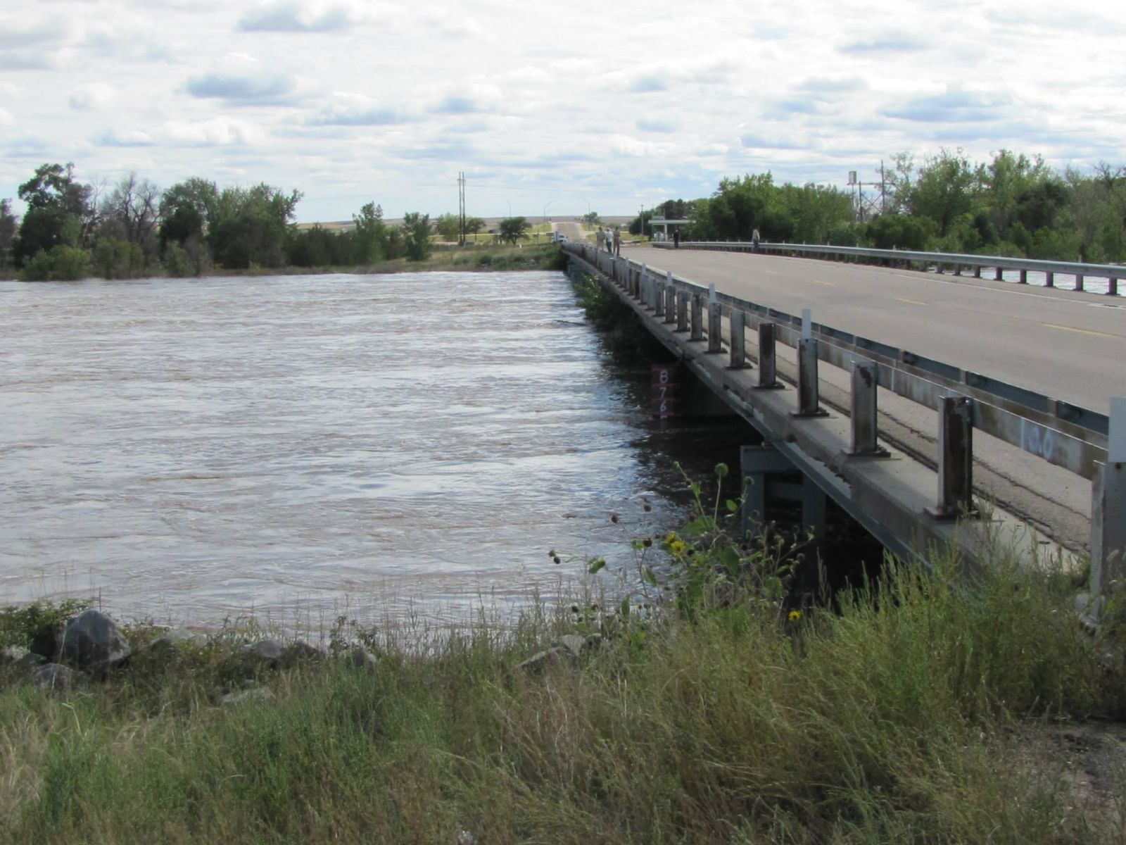
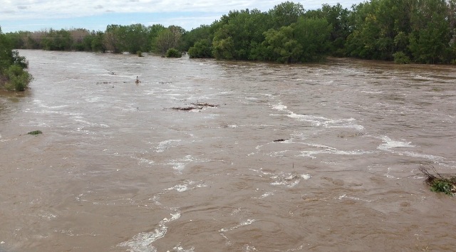
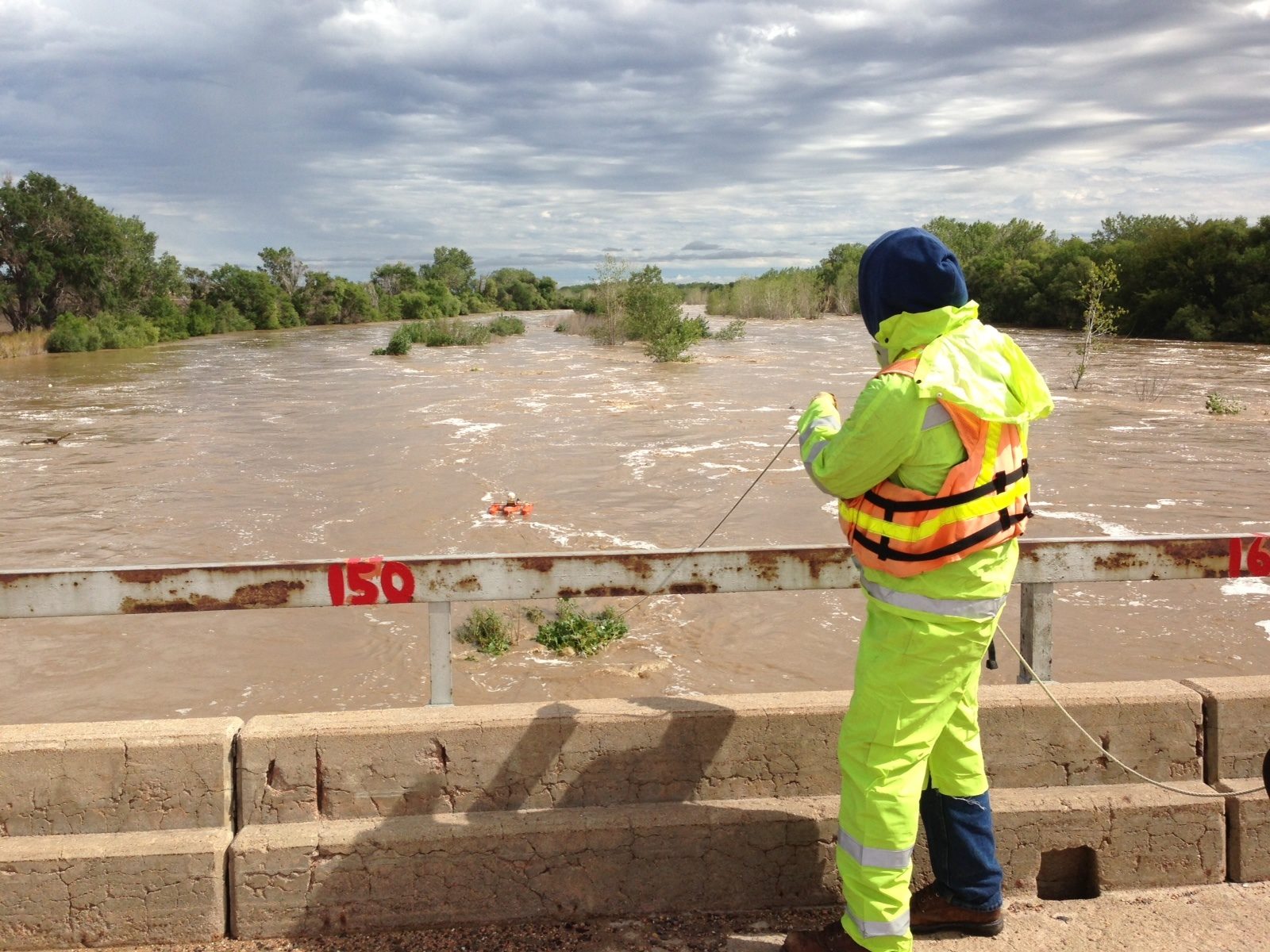
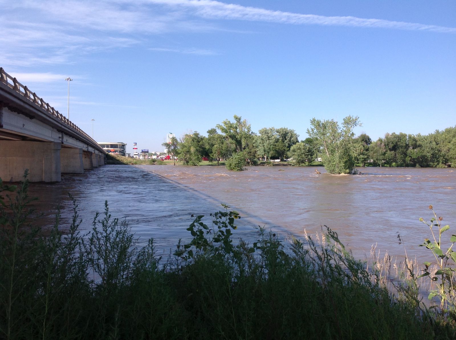
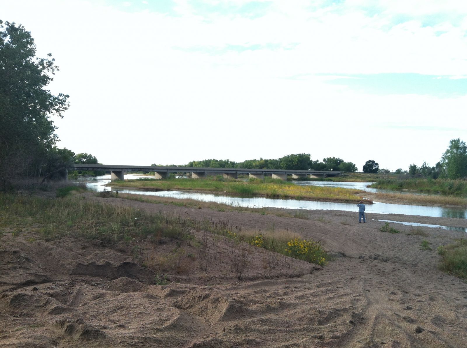
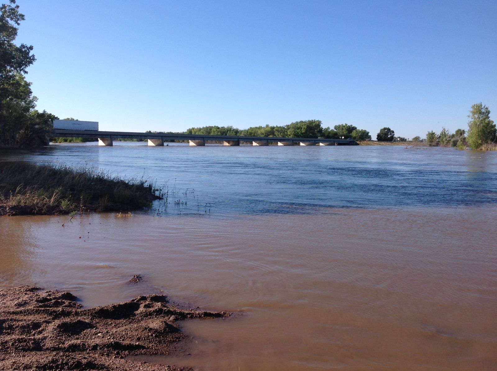
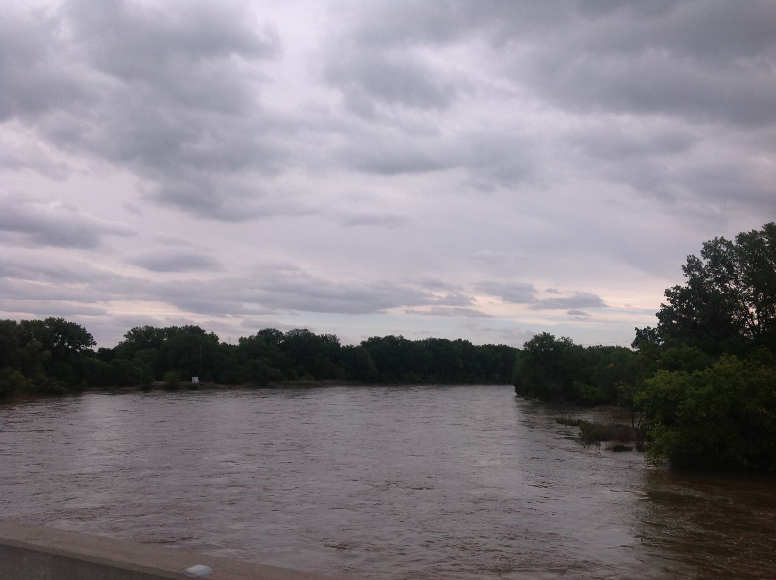
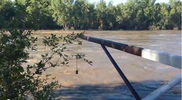
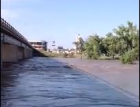
The flood waters began to move through the South Platte River into Nebraska on Tuesday, September 17th, with significant rises beginning across Deuel County on the 18th. Rises continued downstream through the next week, as the river gage at Roscoe, in central Keith County rose above flood stage the 19th and at the river gage at North Platte in the early morning hours of the 21st. The flood waters then entered into the main stem of the Platte river just east of North Platte and continued downstream. Flooding occurred along the Platte River across eastern Lincoln county, with the river gage at Brady rising above flood stage the afternoon of the 21st. Rises of up to a foot an hour were observed as the flood waters moved through the river channel. Flooding continued along all portions of these two rivers for roughly a week, while elevated flows continued through the first part of October due the great amounts of water to move through the river system. In the graphs below, the yellow line is three-quarters bankfull, the orange line is minor flood stage, red is moderate flood stage, and purple is major flood stage.
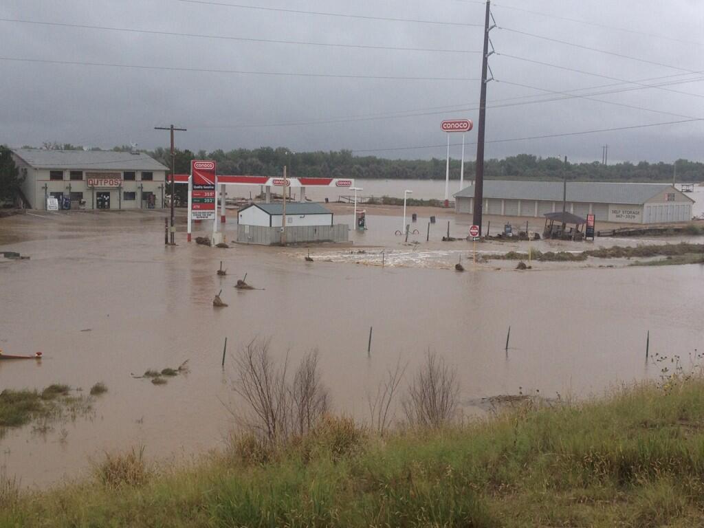
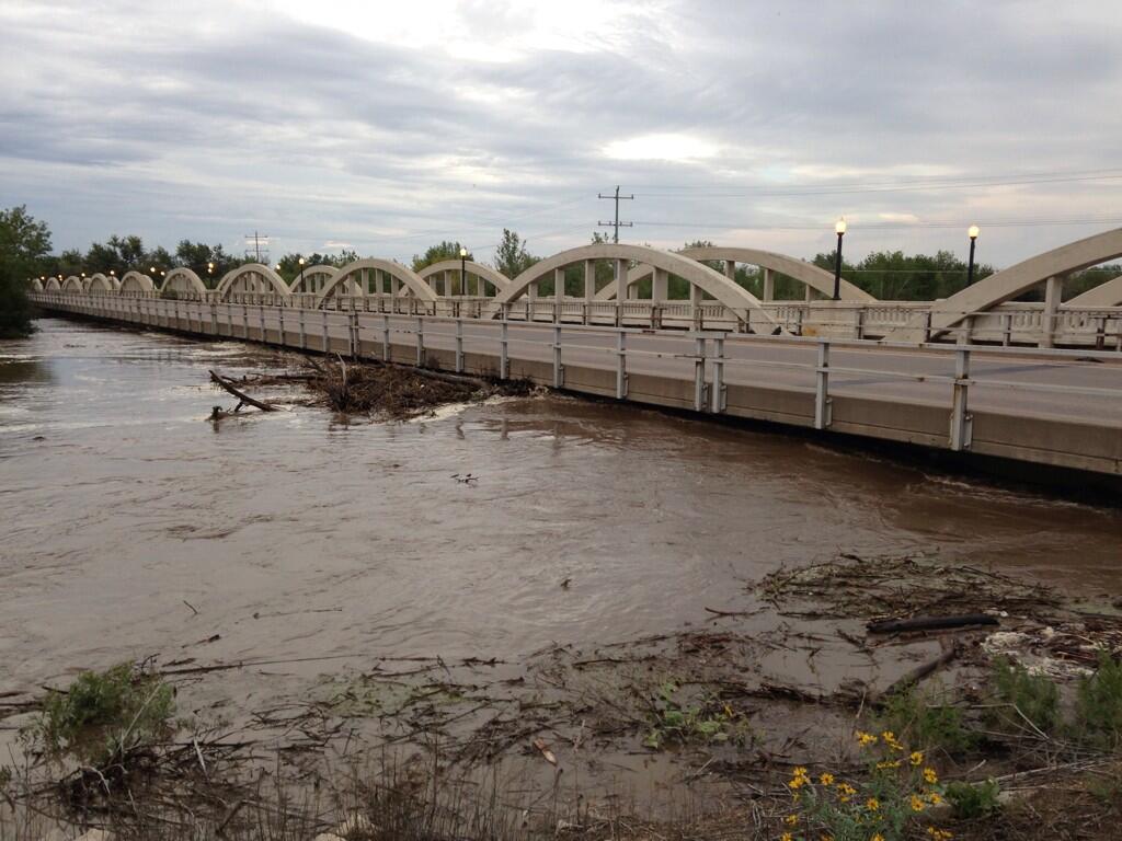
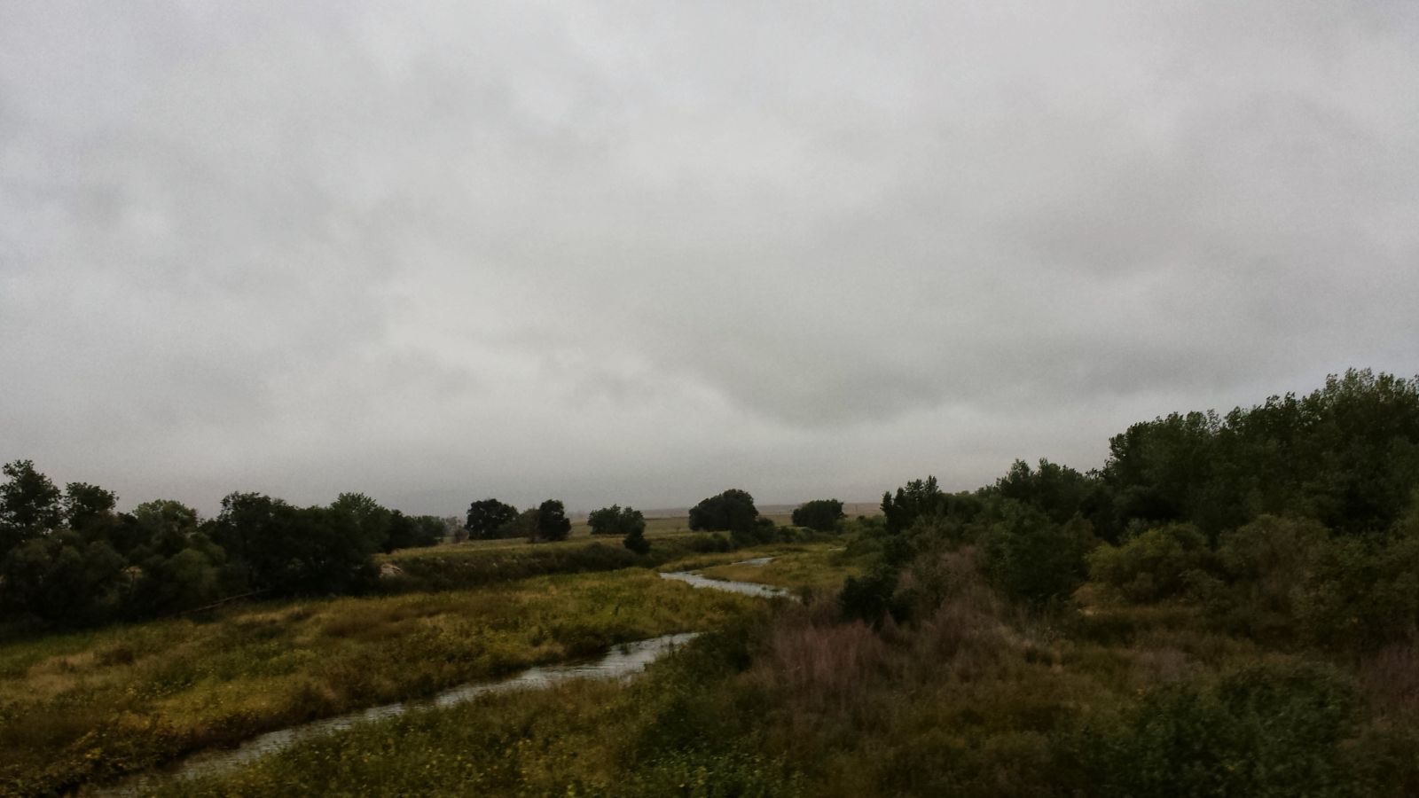
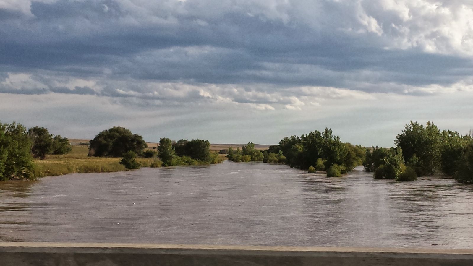
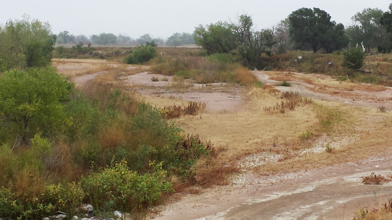
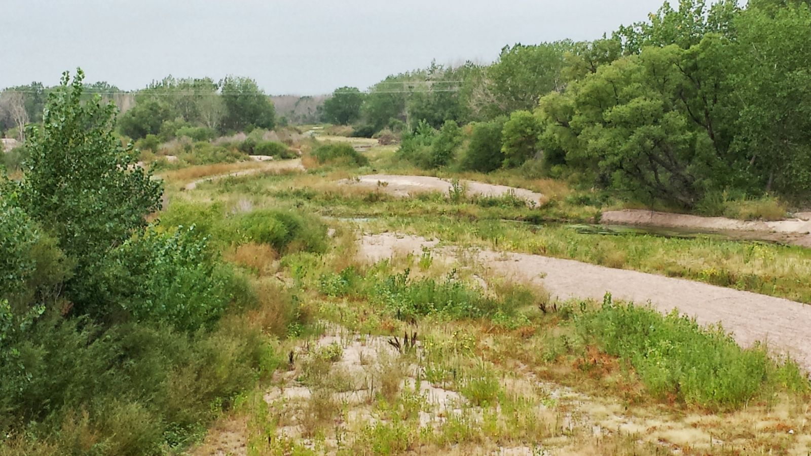
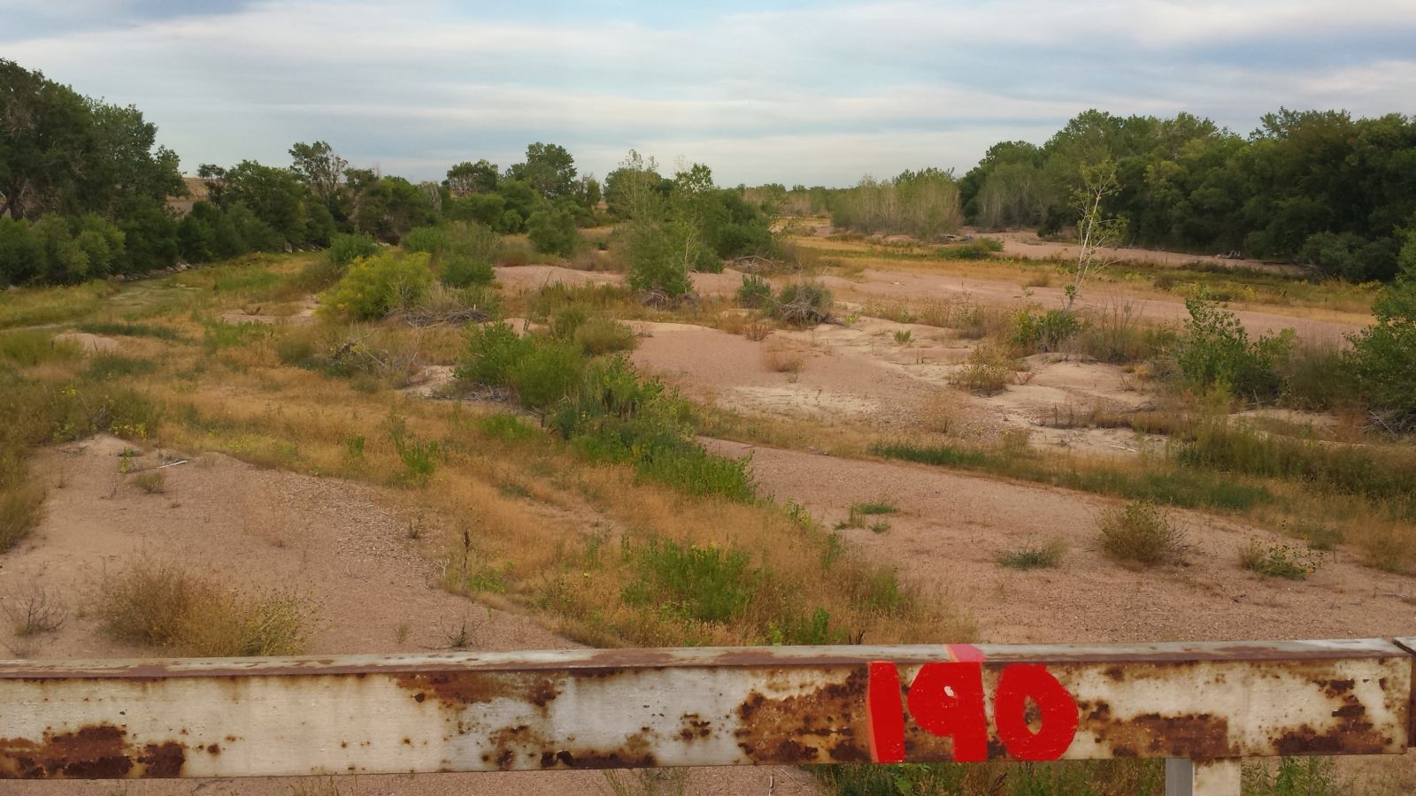
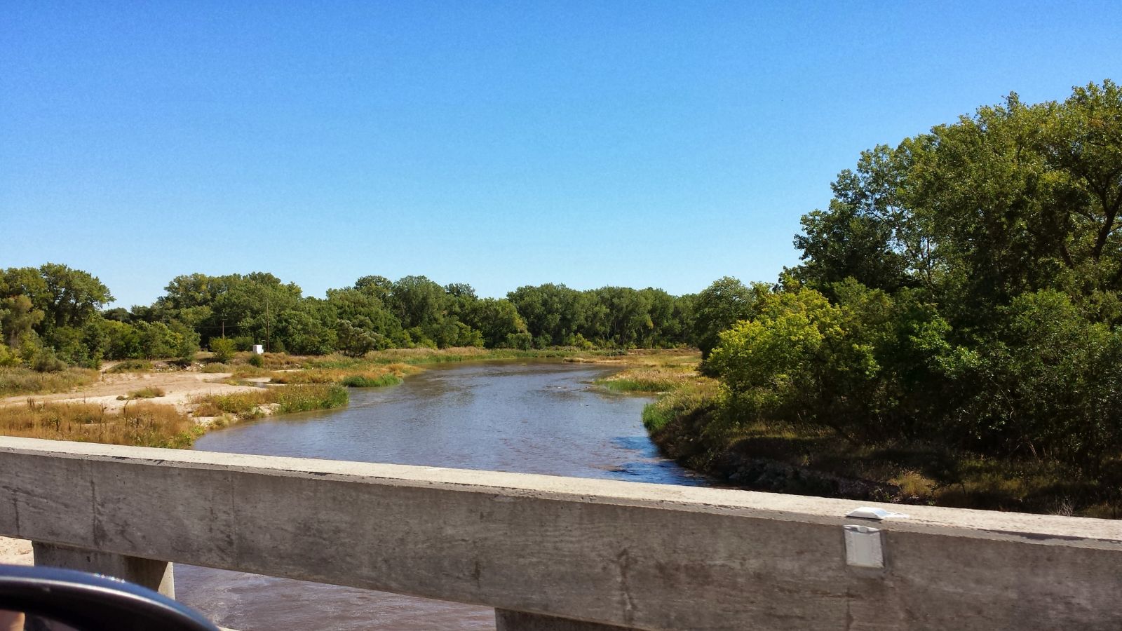
Before and During the Flood
Big Springs 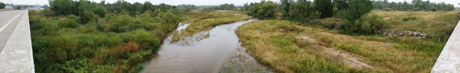 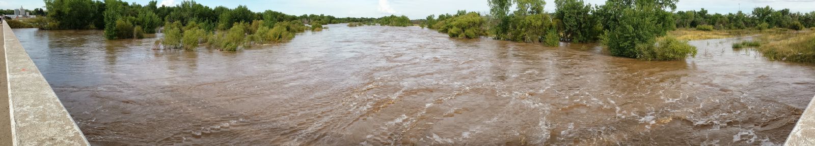
|