| Local Flood Information |
| |
|
|
| Western and North Central Nebraska is fortunate to have only rare occurrences of flooding. However, there remains areas prone to flooding each year. In Western and North Central Nebraska there exists 9 major river basins. The basins include the Elkhorn, Hat Creek, Loup, Niobrara, North Platte, Middle Platte, South Platte and the Republican. Each basin consists of various topography, soils, and vegetation with the potential for flooding in all 26 counties within the county warning area. |
| |
|
|
 |
In winter flooding occurs on rivers, streams, and creeks prone to ice jams. Ice jams have a tendency to occur at selected sites, generally near bridges or dam sites. In the spring flooding can occur as a result of snowmelt or an occasional thunderstorm over ground that can remain frozen. |
| |
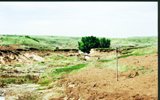
| During the spring, summer, and fall slow moving storm systems and thunderstorms can result copious amounts of rain over an area. This can result in excess water in fields, dry creek beds becoming full, and road and valley washouts. A recent example is a road washout in Hayes county in August of 1999 (right image). |
 |
| |
| Nebraska has hundreds of dams, ranging in size from large water project dams such as Kingsley Dam (Lake McConaughy) to small pool or diversion dams, all of which have the possibility of failing. There is a potential for flash flooding or flooding if these dams would break. In the 26 counties covered by the North Platte Weather Service Office there consists of 248 moderate to large dam sites listed in the Dam Catalog, the largest being Kingsley Dam. |
| |
 |
Flooding occurs due to several factors, but the two primary causes are the duration and intensity of rainfall. The sandhills encompass a vast portion of Western and North Central Nebraska and, because of their makeup (sand), limit flood potential in these areas. However, flooding is still a possibility, especially when a thunderstorm becomes stationary over an area. One such case occurred in the city of Arthur (in Arthur county). In Arthur roads were washed out and several stores had a layer of silt before the storm weakened and moved east. |
| |
| It is important to know your area's flood risk. The risk of flooding can increase in canyons, low vegetation areas, clay soils, and dry creek beds. Creeks in western and north-central Nebraska which are prone to flooding include: |
| |
Southwest Nebraska ---
- Stinking Water Creek that flows through Perkins, Chase and Hayes counties
- Frenchman Creek extends through Chase and Hayes counties
- Sand Creek in Southwest Perkins county flows into Western Chase county
- Blackwood Creek in Central Hayes county
- Medicine Creek in Central Frontier county
- Mitchell Creek in Central Frontier county |
| |
North Central Nebraska ---
- Long Pine Creek in Brown county
- Ponca Creek in Boyd county |
| |
Eastern Nebraska Panhandle ---
- Ash Creek in Southern Garden county
- Lodgepole Creek in western Deuel county |