North Platte, NE
Weather Forecast Office
Overview
|
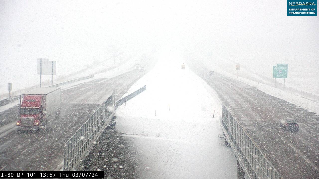
Unlike many past major snowstorms across western and north central Nebraska, a deep upper low was not present in the central United States on March 7, 2024. Instead, a slow moving area of weak upper low pressure pushed eastward across the central Plains through the day. Anomalously high atmospheric moisture was in place for this time of year, along with a narrow corridor of converging winds aloft. This, along with the environment being moderately unstable, led to enhanced lift and a snow band developed in this narrow corridor around 3 PM CST in southwest Nebraska. The band lifted northward through the evening, reaching North Platte and stretching northeastward into Custer County. The band remained nearly stationary for almost 6 hours, with snowfall rates of 2-3" per hour observed. A daily snowfall of 15.3" (with 14.6" falling in the 6 hour period the band was stalled) occurred on March 7th in North Platte, setting a new all time single day snowfall record. A total of 15-18" of snow fell across the North Platte area and points north and east into Custer County, prompting numerous road closures. |
Source: Nebraska 511 |
Photos
 |
 |
 |
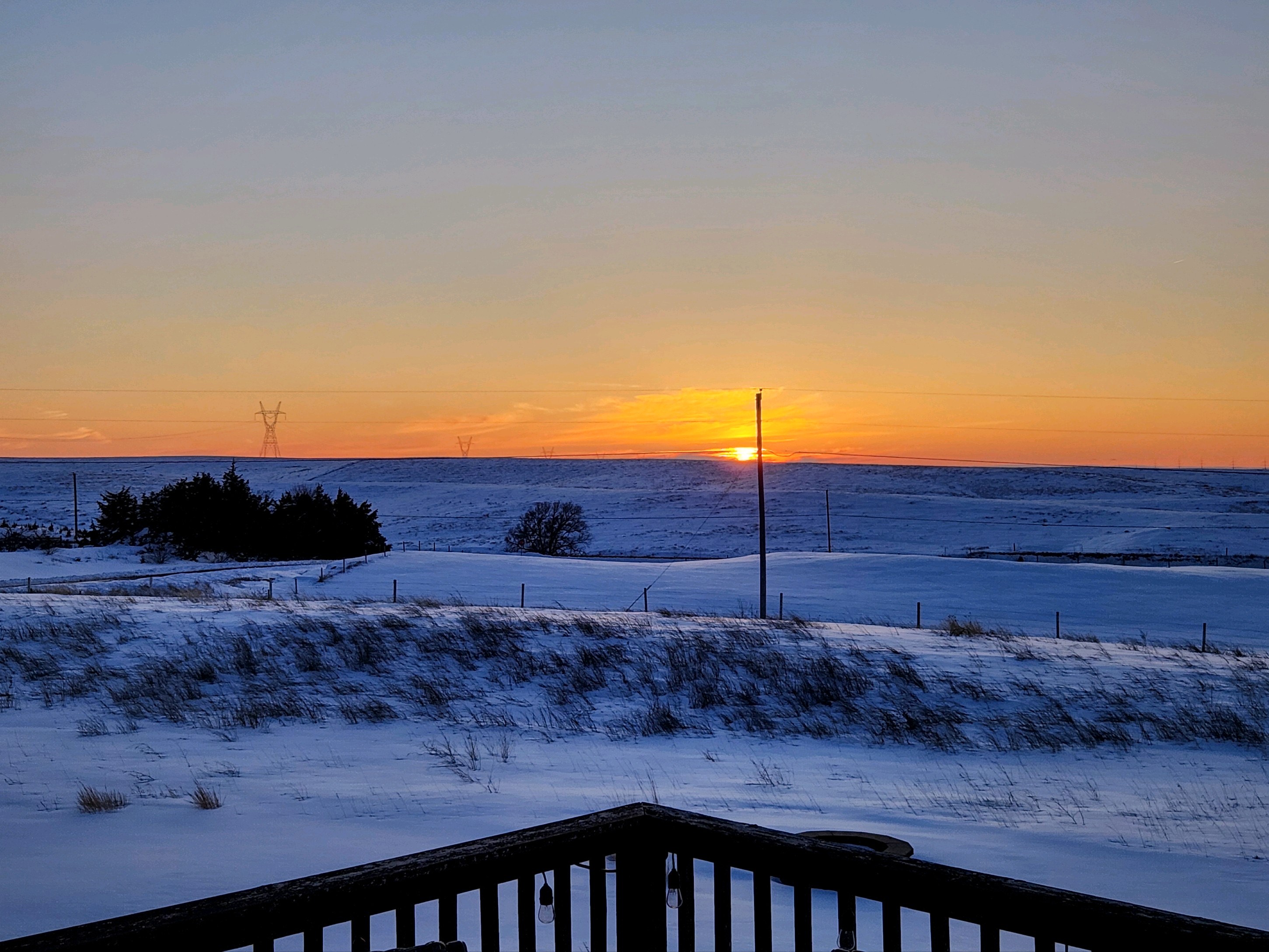 |
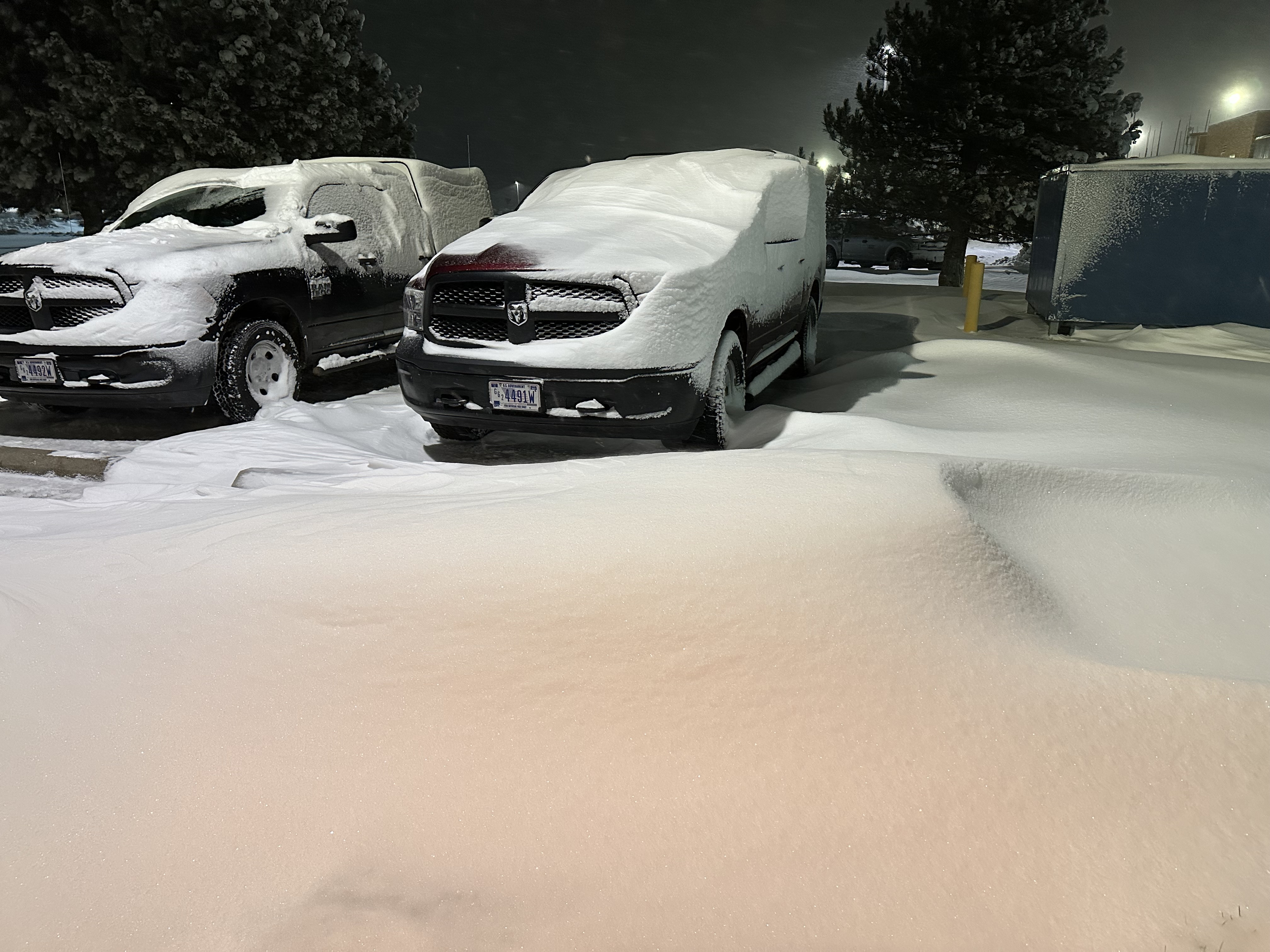
| North Platte Airport source: Caleb Brown |
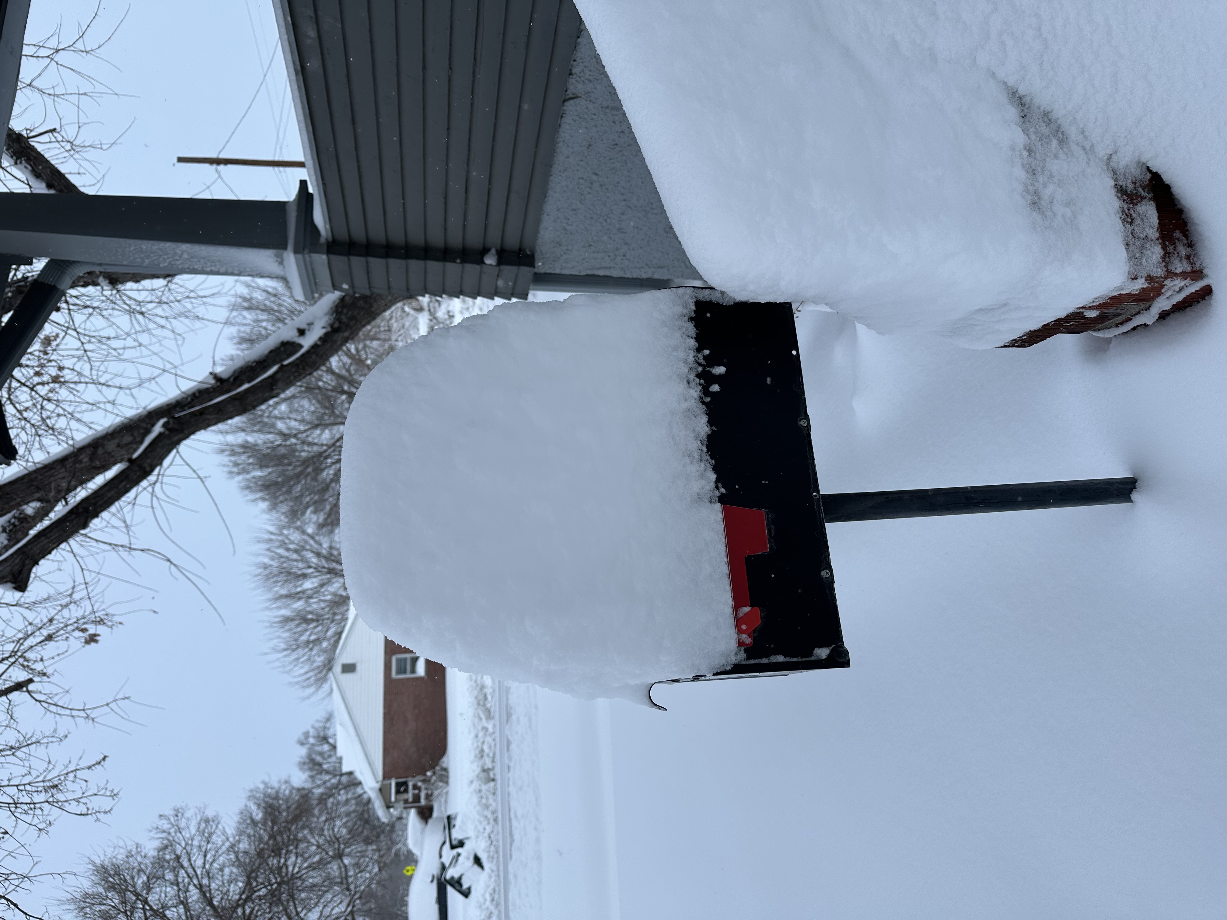
east North Platte source: Caleb Brown |
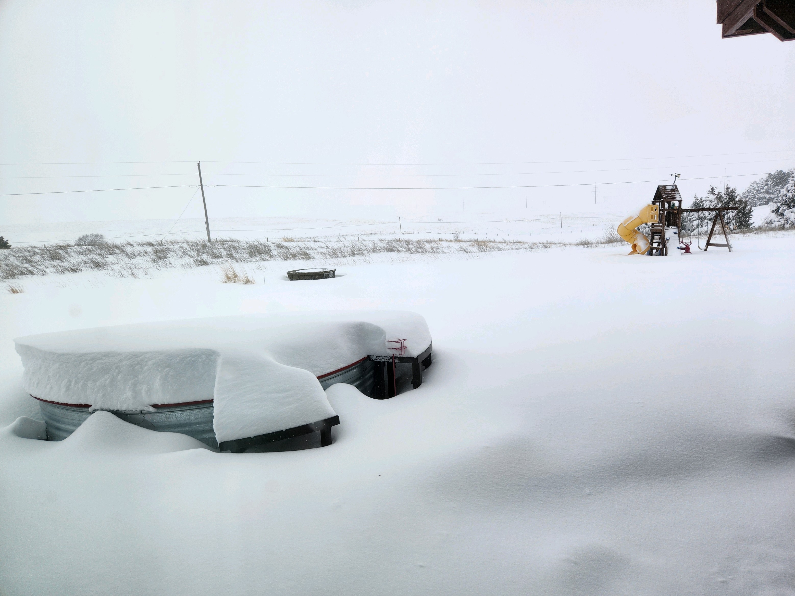
south of North Platte source: Darren Snively |
south of North Platte source: Darren Snively |
Radar
Thursday Evening (3/7) - Friday early morning (3/8)
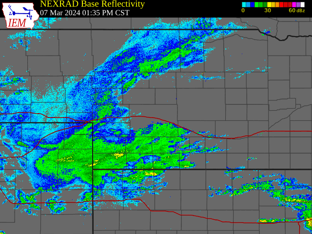 |
| Thu. 4 PM - Fri. 12 AM CST |
Radar loops courtesy of the Iowa Environmental Mesonet.
Snow Map
Storm total snow from March 7th:
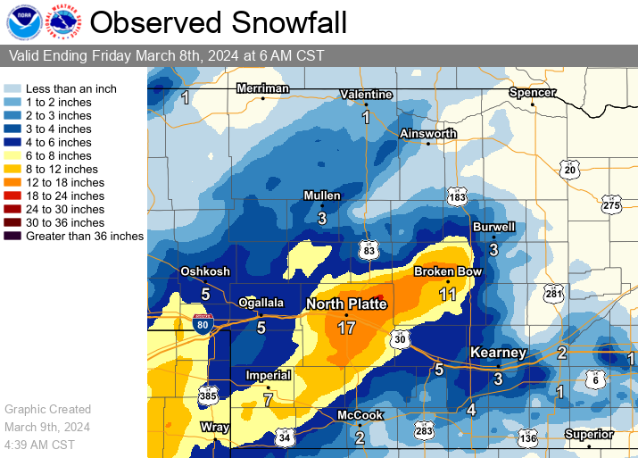
Amounts derived from local storm reports, automated airport gauges, Cooperative Weather Observers, CoCoRaHS.
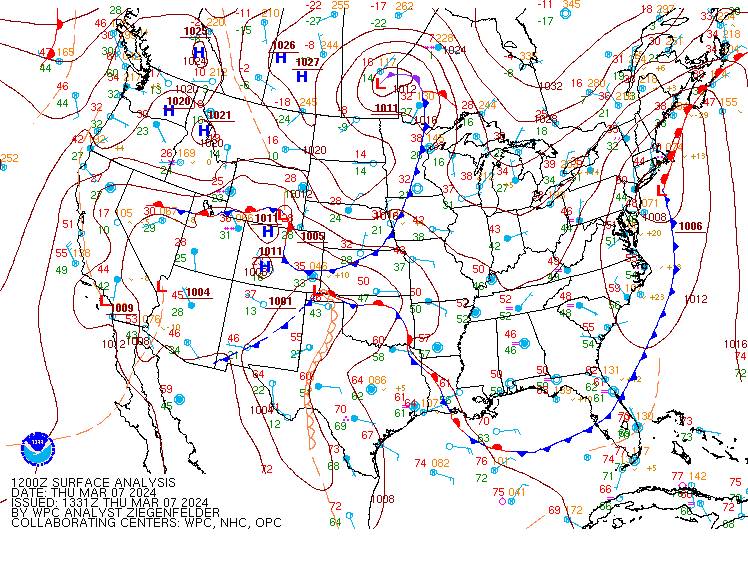
Environment
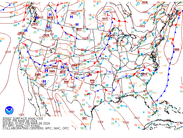
Surface analysis:
 |
 |
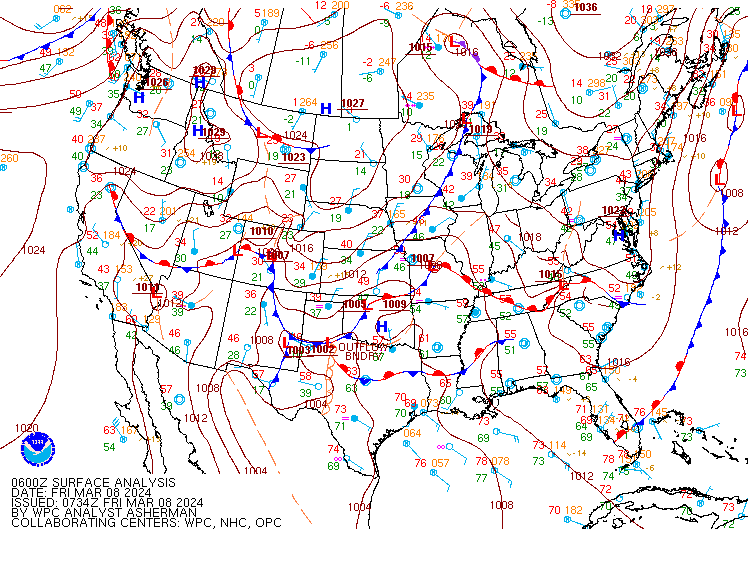 |
| Thursday morning | Thursday Evening | Early Friday Morning |
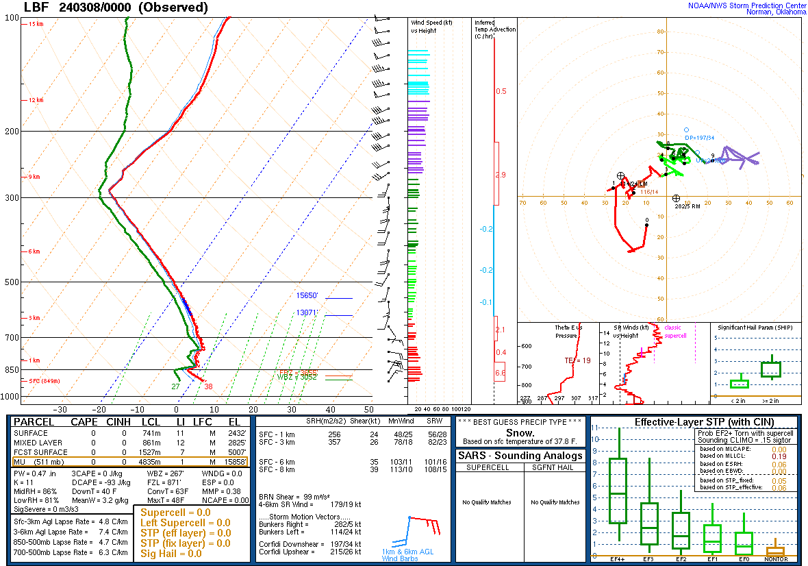
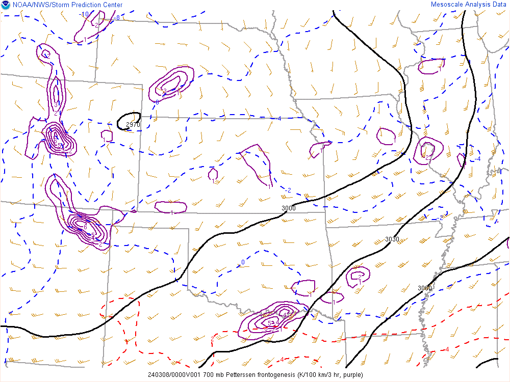
Additional Analysis:
 |
 |
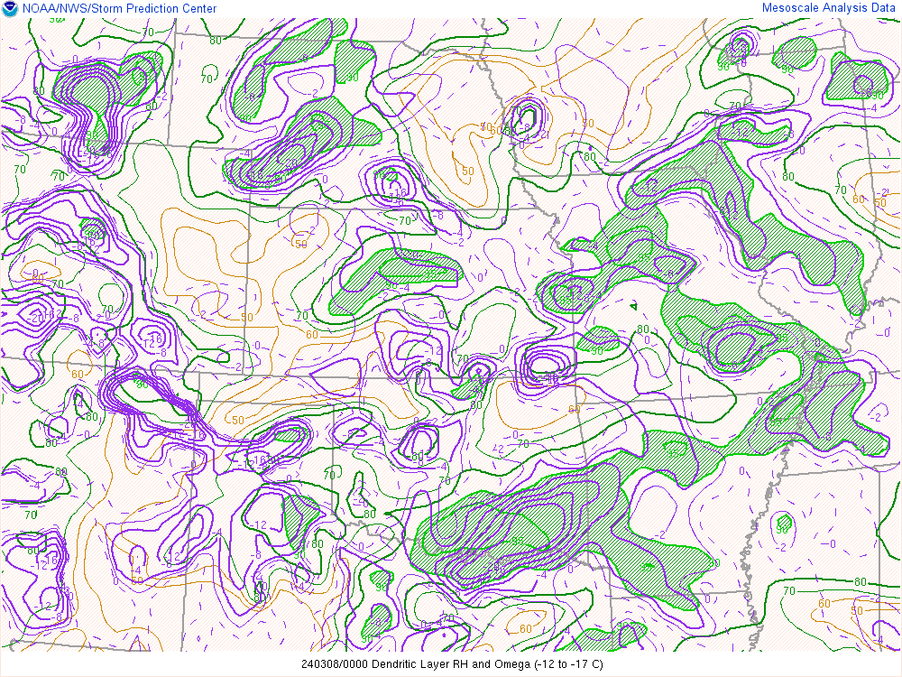 |
| Thursday Evening Sounding Data | 700mb Frontogenesis | Snow Growth Zone RH & Omega |
 |
Media use of NWS Web News Stories is encouraged! Please acknowledge the NWS as the source of any news information accessed from this site. |
|
HAZARDS
Active Alerts
National Radar
National Hurricane Center
Storm Prediction Center
Weather Prediction Center
River Flooding
Decision Support
Submit a Storm Report
Recent Storm Reports
CURRENT CONDITIONS
CoCoRaHS
Enhanced Data Display
Local Radar
National Radar Mosiac
Observations
National Snow Cover
Precipitation Mapped
Regional Links
Satellite
Snowfall Analysis
FORECASTS
Area Forecast Discussion
Aviation Weather Center
Local Aviation Weather
Fire Weather
Recreation Forecast
National Graphical Forecast
Local Graphical Forecast
CLIMATE
Local Climate
National Climate
North Platte - Daily
North Platte - Monthly
Valentine - Daily
Valentine - Monthly
Broken Bow - Daily
Broken Bow - Monthly
Imperial - Daily
Imperial - Monthly
NIDIS Drought
NOAA Climate Science
Local Storm Reports
Local Drought Statement
US Dept of Commerce
National Oceanic and Atmospheric Administration
National Weather Service
North Platte, NE
5250 E. Lee Bird Drive
North Platte, NE 69101-2473
308-532-4936
Comments? Questions? Please Contact Us.