
Severe thunderstorms will continue to impact the center of the Nation through today. Very large hail, strong tornadoes, and damaging winds are expected from the Great Lakes into the central/southern Plains; Flash flooding is possible for portions into the mid-Mississippi Valley. Critical fire weather conditions for the Southwest and central valley of California today. Winter hangs on for Rockies. Read More >
Overview
An isolated supercell developed along a warm front and remained nearly stationary during the early evening hours on Thursday, June 20, 2024. The supercell impacted areas south of Highway 20 from Ainsworth to Long Pine. The supercell produced at least two brief tornadoes.Tornadoes:
|
Tornado - 10.3 Miles S of Ainsworth
Track Map 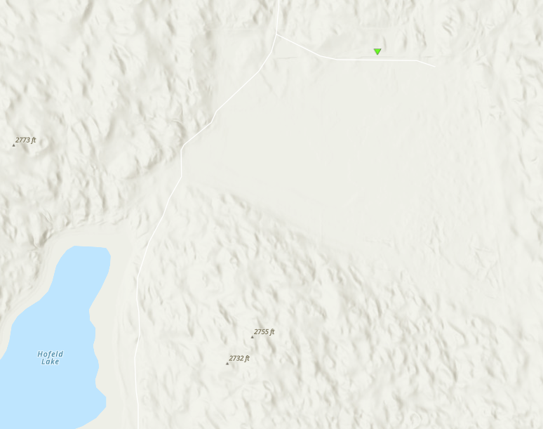 
|
||||||||||||||||
|
Tornado - 7 Miles South of Long Pine
Track Map .png)
|
||||||||||||||||
The Enhanced Fujita (EF) Scale classifies tornadoes into the following categories:
| EF0 Weak 65-85 mph |
EF1 Moderate 86-110 mph |
EF2 Significant 111-135 mph |
EF3 Severe 136-165 mph |
EF4 Extreme 166-200 mph |
EF5 Catastrophic 200+ mph |
 |
|||||
Photo
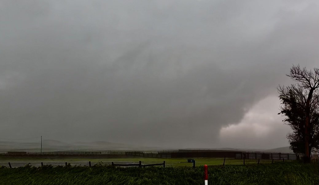 |
| Picture of rain wrapped tornado south of Ainsworth Photo Credit: Connor Croff |
 |
Media use of NWS Web News Stories is encouraged! Please acknowledge the NWS as the source of any news information accessed from this site. |
|

