Critical fire weather is expected Friday across the Northern Plains, Upper Midwest, and southern High Plains due to gusty winds and low humidity. Severe thunderstorms capable of large to very large hail, wind damage and tornadoes will be possible Friday and Saturday across parts of the central Plains. Read More >
Multiple weather hazards were seen Friday April 22nd and Saturday April 23rd, starting first with strong winds and critical fire weather conditions Friday, then severe weather Friday evening into Saturday, and even winter weather across the northwest Sandhills Saturday morning. Strong winds and winter weather continued through the day Saturday.
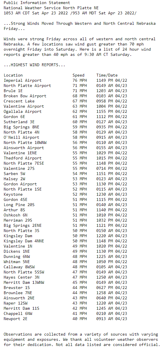
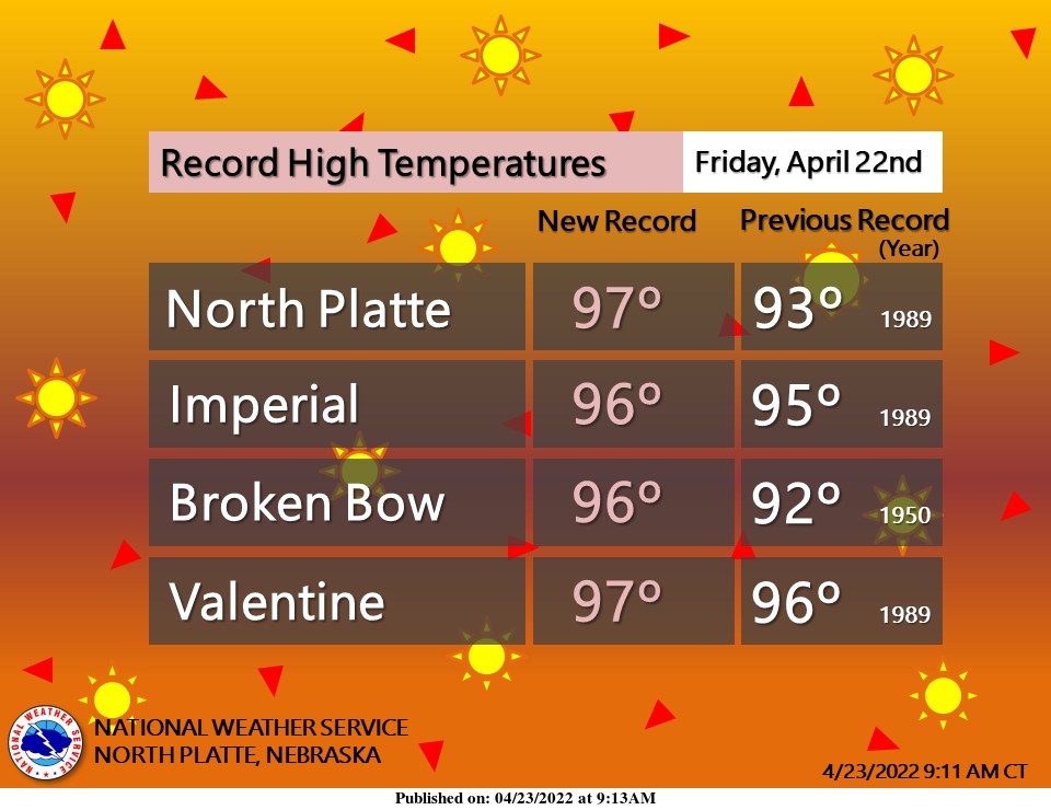
A deepening surface low moved across central Nebraska Friday. Southerly winds increased through the day with the strongest winds Friday afternoon into the overnight hours. A few locations saw winds greater than 70 mph, with the highest wind gust of 76 mph record at the Imperial airport on Friday night. The strong winds also created areas of blowing dust, especially across southwest Nebraska. Temperatures soared into the 90s, with several locations breaking record high temperatures.
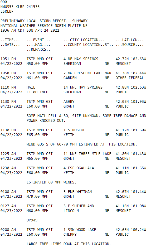
As evening approached isolated thunderstorms developed across parts of north central and southwest Nebraska. Initially the thunderstorms had little precipitation associated with them and lightning strikes caused several wildfires across parts of north central Nebraska and southwest Nebraska. Late Friday night a line of storms developed across western Nebraska and moved eastward overnight. Additional thunderstorms developed early Saturday morning and moved across portions of southwest Nebraska, the Sandhills and into north Central Nebraska. Damaging winds were the main hazard of the severe storms.
Snow developed across the far northwest Sandhills Saturday morning prompting the issuance of a Winter Weather Advisory for Sheridan County. The high winds continued on Saturday with the highest winds across the western Sandhills. Strong winds continued Sunday with gusts around 40 to 45 mph, with a few locations having gust of 50 mph or greater. The slow moving system continued to move northeastward Sunday bringing relief to strong winds Sunday night.
Here are some of the top wind gusts and rainfall amounts from the storm system. For more observations, click on the tabs below for the specific data you wish to locate.
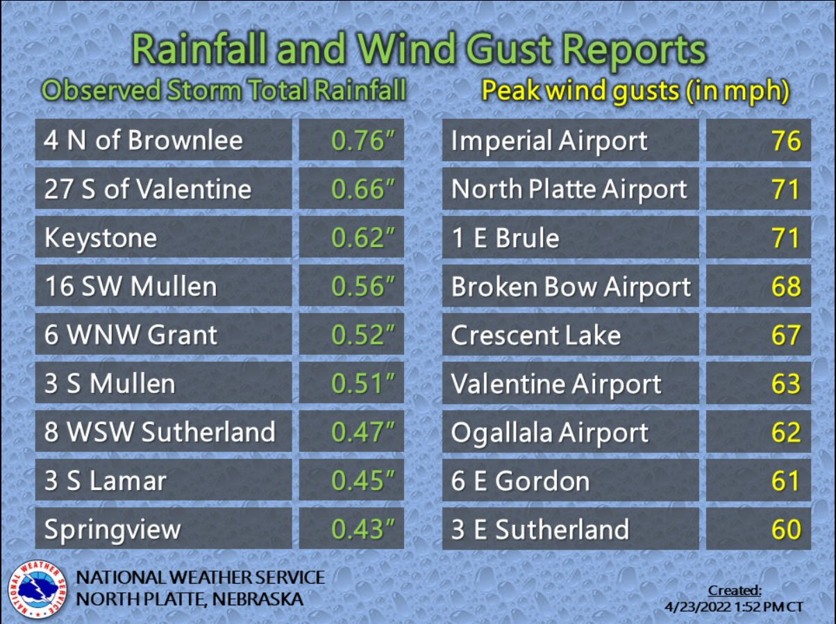
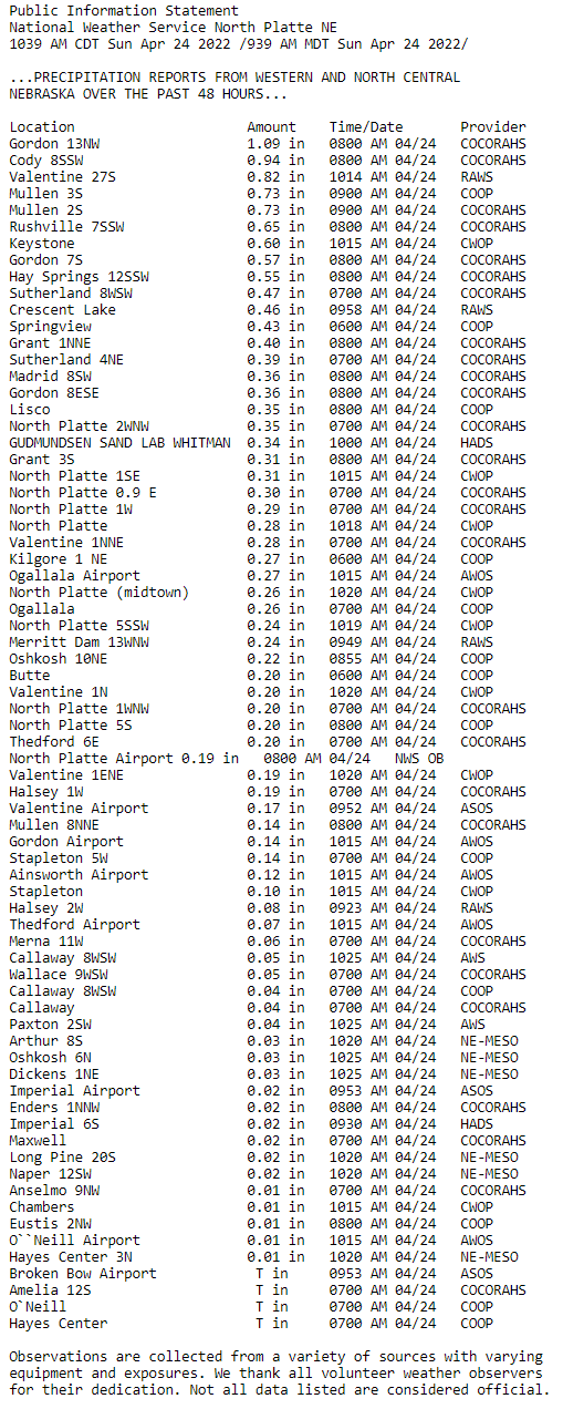
Winds gusted over 70 mph in some locations Friday into Saturday. The strongest winds occurred during the Friday overnight hours. Temperatures reached the 90s on Friday with all 4 of our climate sites breaking records. Severe thunderstorms impacted some locations Friday evening into the overnight hours. The main hazard with the severe storms was strong damaging winds. Much needed rainfall occurred across portions of southwest into north central Nebraska, including the Sandhills. Locations that saw thunderstorms benefited the most and thus had the highest rainfall totals.
High Winds
Record Heat
Local Storm Reports
Rainfall Amounts