
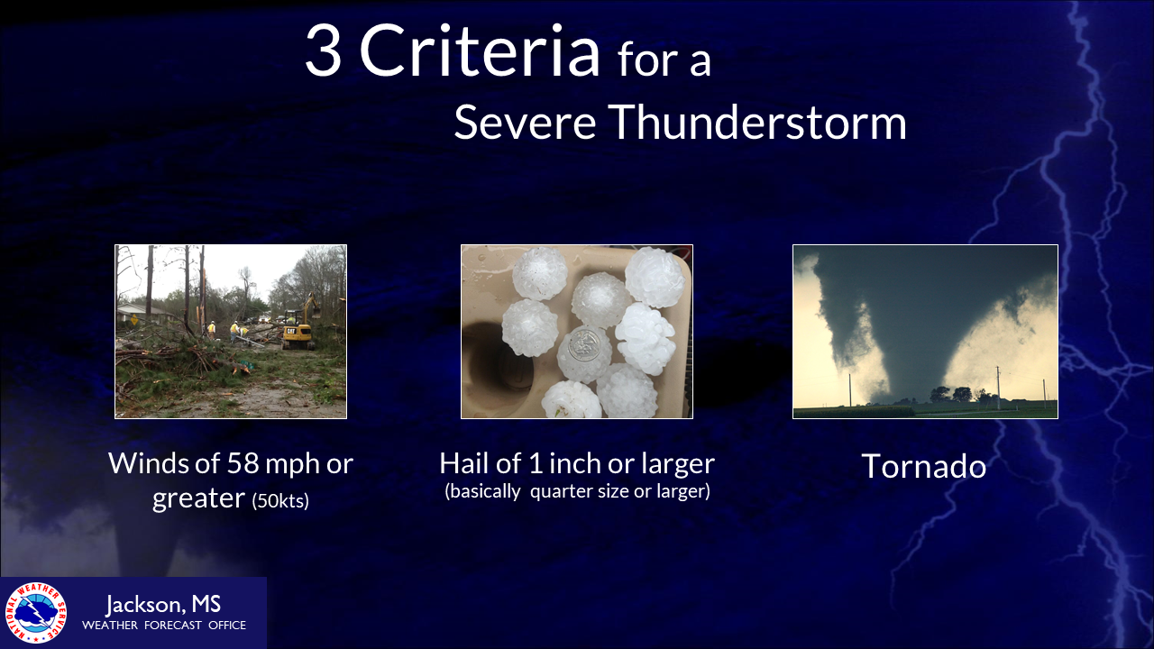
A severe thunderstorm is any storm that contains one or more of the following:
While severe thunderstorms can occur any time of the year, the most common time for occurrence is during the months of March, April and May.

|
Particularly Dangerous Situation (PDS) Watch: |
| Two main kinds: Tornado and Severe Thunderstorm |
| Can be issued for a long period of time(6 hours or longer) |
| Covers many counties |
| Usually is issued before severe weather occurs and exceptionally intense and well organized wind storms are possible. |
| Remain weather aware of rapidly changing conditions |
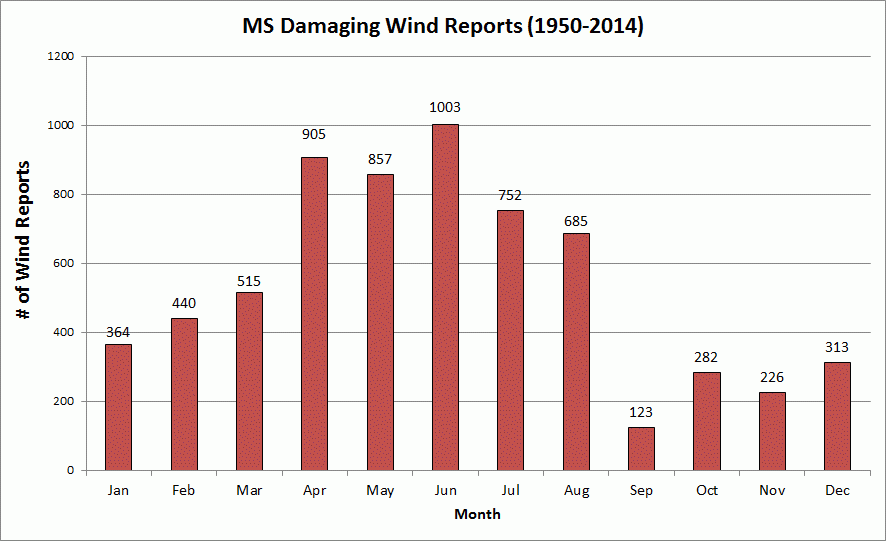
Straight line damaging winds are common across Mississippi any time of the year. Damaging winds (sometimes referred to as straight line winds)can do just as much, if not more, damage than a tornado. These storms can knock down trees and cause damage to structures. While damaging wind reports tend to increase during the spring months and peak during the summer months in Mississippi, they can occur any time of year, including the fall and winter. A straight line wind event occurred in mid October 2012 when 80 to 90 mph wind gusts went through Greenville, knocking down trees and causing building damage. On November 18, 2003, a squall line moved across the region and caused widespread wind damage as well.
 |
 |
Hail is formed when water droplets are drawn into an area of strong upward moving air, known as an updraft, of a storm. Once the water droplets are transported above the freezing level, they combine with tiny airborne particles, such as dirt, salt, etc., and freeze on contact, forming tiny ice particles. These ice particles are light enough that they remain suspended in the cloud, where they undergo processes that allow them to combine with other supercooled water droplets and grow into hailstones. Once the hailstones are heavy enough to overcome the upward force of the updraft, they fall out of the cloud.
Hail can occur throughout the year as long as temperatures aloft are cold enough to support freezing of the hailstone, and won't melt the hail as it falls. The spring months tend to be the time of year that the largest number of severe hail reports occur. In addition, the highest number of large hail( 2 inches or larger) reports also occurs during the spring months. While there are not a lot of hail reports in the fall, they do ramp up more into the winter months.
 |
 |
Large hail can cause significant damage to crops and property. On March 18, 2013, hail to the size of ping pong balls, tennis balls and even softballs fell across several locations in central Mississippi. The largest of the hailstones fell across portions of the Jackson metro area during rush hour. This caused significant damage to thousands of cars and many buildings. Around 550 million dollars in damage was caused by this destructive hailstorm. The softball size hailstone that fell in Clinton, MS was the third largest hailstone to fall in March in Mississippi since 1950 and the seventh largest to fall in the state for any month of the year. The largest hailstone to fall in Mississippi history was 5 inches in diameter, or CD/DVD size. This fell in Lafayette County on April 10, 1962.

