Meridian Area

High Temperature
| Location |
Normal |
Warmest Years |
Coldest Years |
| Meridian |
56.9°F |
80°F (1987)
79°F (2015)
79°F (1964)
78°F (1982)
77°F (2016)
77°F (1942) |
26°F (1983)
31°F (1985)
31°F (1924)
35°F (1998)
38°F (2004/1918) |
Low Temperature
| Location |
Normal |
Warmest Years |
Coldest Years |
| Meridian |
34.3°F |
70°F (1982)
68°F (1987)
65°F (2015)
64°F (1942)
63°F (1904) |
8°F (1983)
13°F (1985)
16°F (1966)
18°F (1989)
20°F (1990) |

| Location |
Wettest Years |
Years With Measurable
Precipitation/Total Years |
| Meridian |
7.99" (1973)
3.34" (2012)
1.77" (1976)
1.75" (1926)
1.69" (1943) |
41/128
(32%) |

- 1973 - Heavy rains caused flooding across portions of central and south Mississippi. In Meridian, around 25 people had to be evacuated due to rising waters.
- 1983 - Extreme cold gripped the Deep South. Four people died in the state of Mississippi as a result of exposure.
- 1989 - A cold wave affected the Deep South, with the coldest air occurring during the days leading up to Christmas. The low temperatures caused water lines to freeze and break across the area.
- 2012 - Strong to severe thunderstorms affected the area. An EF-0 tornado occurred in southern Lauderdale County, tracking 2.3 miles. Elsewhere, trees were downed around Philadelphia and near Enterprise, and flash flooding was reported north of Meridian.
- 2015 - Early evening thunderstorms blew down a tree near Hickory in Newton County.

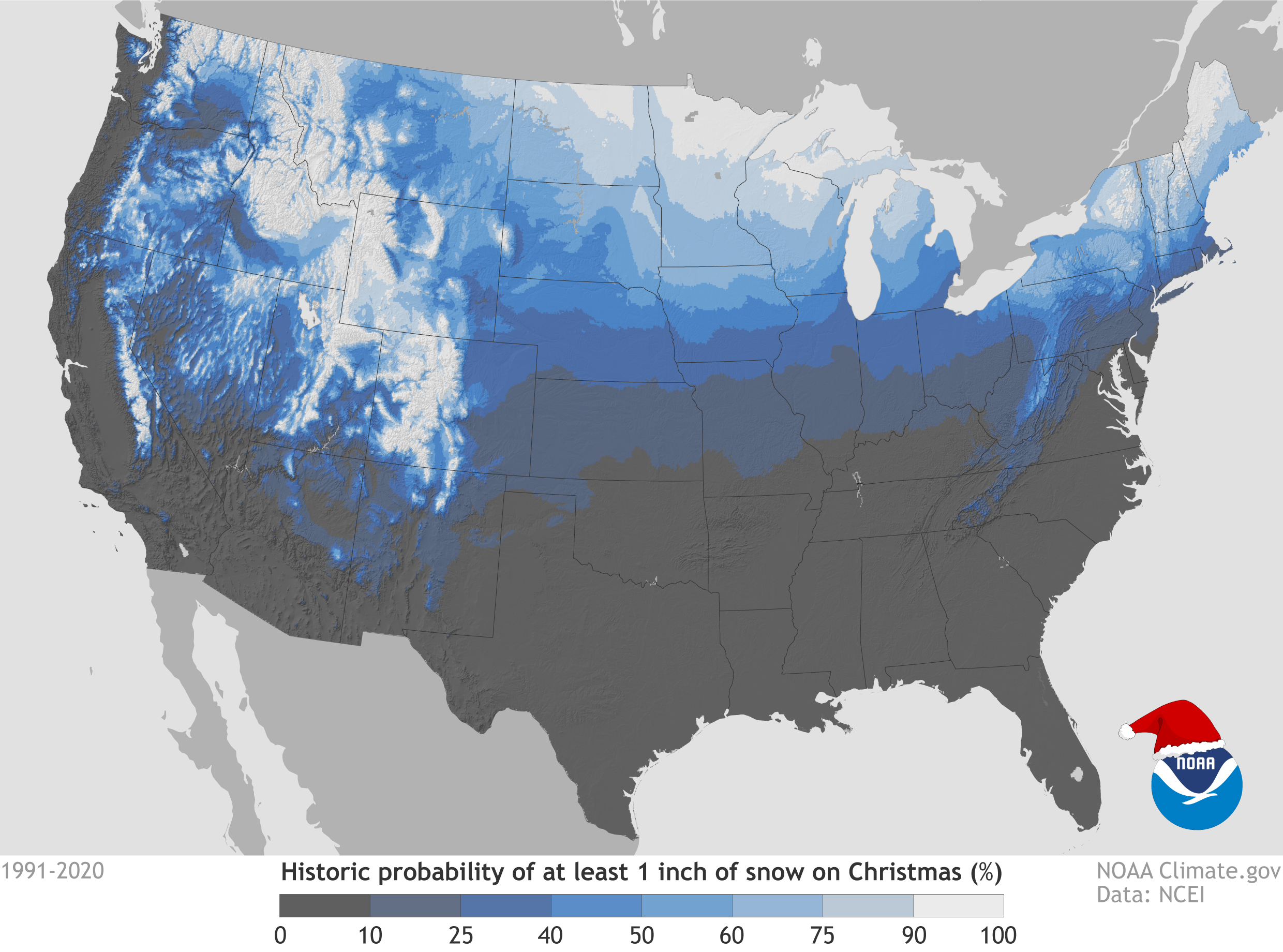
It goes without saying, the probability of experiencing a White Christmas in east central Mississippi is very, very low. However, most locales in the Meridian area have seen at least one White Christmas over the last century, and a few areas have seen more. The map below from the National Climatic Data Center shows the probability of seeing a White Christmas based on past Christmas weather conditions. To qualify as an official White Christmas the snow depth must be at least one inch on Christmas Day. The snowfall does not necessarily need to occur on Christmas Day.
Below is a listing of past White Christmases and a few close calls.
- 1913 - Rain on Christmas Eve night changed over to light snow on Christmas morning in a few locations. Generally, the snow melted on contact, thus it was not an official White Christmas. A trace of snow was reported at Meridian.
- 1929 - Between December 21st and 22nd, a significant winter storm dropped 3 to 9 inches of snow across east central Mississippi, with 7.5" reported at Hickory and 3.8" reported at Shubuta. Temperatures were sufficiently cold over the following days to allow some snow to remain through Christmas Day. In some areas there was still up to an inch of snow, making this a White Christmas for part of East Central Mississippi. At Hickory there was 2.7" on the ground Christmas Eve, then only a dusting Christmas Day.
- 1963 - A significant winter storm affected the entire area between December 20th and 22nd. East central Mississippi was in a transition zone between snowier conditions to the north and an ice storm to the south. Through the event, precipitation types wavered back and forth between freezing rain, sleet, and snow. Accumulation amounts ranged from 4.8" at Russell, 4.5" at Philadelphia, and 4" at Collinsville, where there was more snow, to 1" at Paulding in Jasper County, where there was more ice. The event was followed by record cold conditions, with temperatures in the teens in most locations (below zero temperatures were reported farther north in the state). These cold conditions allowed some of the ice and snow to remain on the ground through Christmas morning, making it an official White Christmas for some areas. Among observing sites that were reporting snow depth, Meridian NAS and Russell both reported a trace.
- 1998 - Though it wasn't a White Christmas in the classical sense, it looked like one over much of the area. An ice storm impacted the region from the evening of December 22nd through early Christmas morning. This primarily affected the counties north of the I-20 corridor, with the biggest accumulations outside of the Meridian area - across northern portions of central Mississippi. Closer to Meridian, Neshoba and Kemper counties saw the most ice, though freezing rain and sleet did occur around Meridian. Power outages were widespread across the area, and holiday travel was significantly impacted.
- 2010 - Off and on rain showers became sleet and snow showers on Christmas morning. Additional light snow continued into December 26th. Though it didn't snow enough for significant accumulations, a few locations received between a dusting and an inch of snow, making it a White Christmas for a few in the Meridian area. De Kalb reported 0.8" of snow. Trace amounts were reported at Meridian, Collinsville, Okatibbee Reservoir, Topton, Dunns Falls, Quitman, Shubuta, and Crandall.
|


